Photo: Wikipedia
Strategic Assessment of Pecos, TX
Workable tactical position. Some exposure to population density or targets, but generally defensible in a crisis.
What does the Strategic Assessment tell us?
Our Strategic Assessment grades tactical survivability of an area. Major population centers, military targets, fallout zones, natural disasters, and border exposure all drive risk — lower exposure means a more defensible position in a crisis.
This is heavily inspired by Joel Skousen's Strategic Relocation book. Highly recommended you checkout the book ($)What does this tell us?
Our Strategic Assessment grades tactical survivability of an area. Major population centers, military targets, fallout zones, natural disasters, and border exposure all drive risk — lower exposure means a more defensible position in a crisis.
This is heavily inspired by Joel Skousen's Strategic Relocation book. Highly recommended you checkout the book ($)Strategic Pillars

Key Distances
Regional Safe Places
Below is our recommended "safe zones" in Texas and the surrounding area based on our strategic heuristics. For most people, it's unrealistic to live in a “safe zone” full-time due to work, family or other personal reasons. They tend to be more rural. However, many of these areas are perfect for second homes and retreat properties that double as a vacation home or even a short-term rental.


Important Note: For informational purposes only. This does not mean nothing bad ever happens in the green zones. Please use common sense. This is based on public data and modeled with AI. We tried to take a conservative approach but mistakes happen. We update this regularly as new information becomes available.
Solar Generator Recommendations
Backup power matters more here than in safer locations. We've picked three solar generators across budgets and capacity tiers — start with the budget unit if you only need a few essentials, or step up if you want to run a fridge and HVAC for days at a time.

Jackery Portable Power Station Explorer 300
Budget OptionPower on the Go: Weighing only 11 lbs, it's convenient to set up and store with book-sized foldable solar panels

BLUETTI Portable Power Station AC180
Designed for both indoor and outdoor scenarios, AC180 is highly capable as it has a robost capacity and continuous output power.

EF ECOFLOW DELTA Pro Ultra Power Station
Upgraded PickEcoFlow DELTA Pro Ultra is a whole-home energy system designed to grow with your family. Integrated with the Smart Home Panel 2, it scales to meet your evolving energy needs — keeping your home powered, intelligent, and secure through every stage of life.
We earn a commission, at no additional cost to you.
Strategic Assessment Analysis
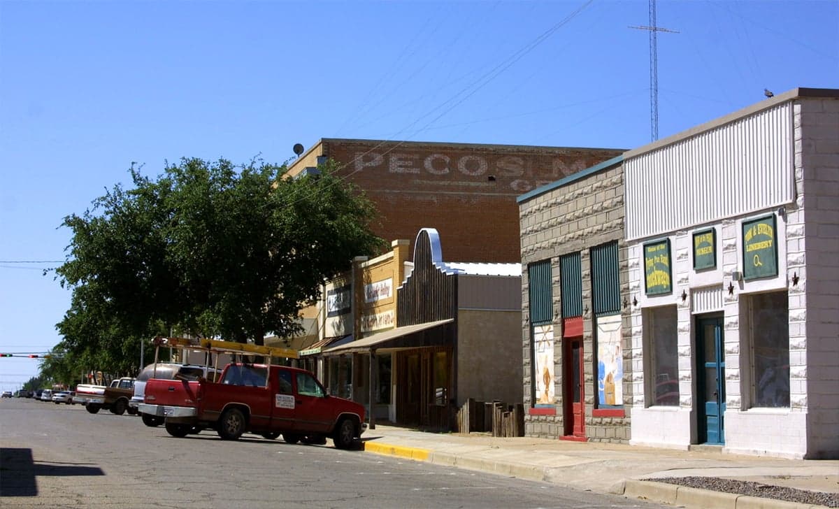
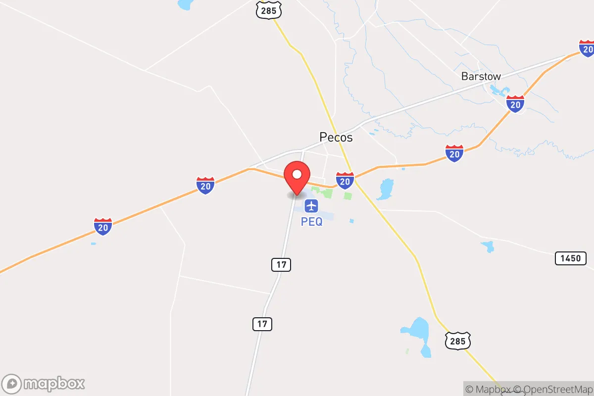
Pecos, Texas, sits in a unique strategic pocket of the American Southwest, offering a combination of geographic isolation, resource independence, and low population density that makes it a serious contender for anyone thinking long-term about resilience. Located in Reeves County, roughly 50 miles from the New Mexico border and 200 miles from El Paso, this town of about 12,000 people is far enough from major metropolitan centers to avoid the immediate fallout of a major disaster, yet close enough to critical infrastructure and trade routes to remain viable. For a relocator with a prepper mindset, Pecos presents a rare balance: it’s not a bunker in the middle of nowhere, but it’s also not a suburb that would be overrun in the first 72 hours of a crisis.
Geographic position and natural advantages for long-term survival
Pecos sits in the Trans-Pecos region, a high desert basin at roughly 2,600 feet elevation, bordered by the Davis Mountains to the south and the Guadalupe Mountains to the north. This positioning gives it several natural advantages. The arid climate means fewer mold, rot, and pest issues compared to humid regions, and the lack of dense tree cover reduces wildfire risk relative to forested areas. The area is also far from major fault lines, so earthquake risk is negligible. The Pecos River runs through town, providing a surface water source that, while not pristine, is a critical asset in a region where water is scarce. The surrounding terrain—open rangeland, mesquite flats, and low hills—offers good visibility and limited cover for anyone approaching, which is a defensive plus. The nearest major population centers—El Paso (200 miles), Midland-Odessa (120 miles), and Albuquerque (300 miles)—are far enough that a sudden collapse in those cities would not immediately spill over into Pecos. The town’s location along Interstate 20 and the Union Pacific rail line means it’s connected to national supply chains, but those same routes could become chokepoints in a crisis. For a relocator, the key takeaway is that Pecos is isolated enough to avoid the initial wave of chaos but connected enough to allow for resupply or evacuation if needed.
Risks, exposures, and proximity to fallout-relevant landmarks
No location is without risk, and Pecos has its share. The most immediate concern is the area’s proximity to the Permian Basin oil and gas fields, which stretch from just east of Pecos through Midland and Odessa. While this energy infrastructure is a resource in normal times, it also makes the region a potential target for sabotage, cyberattack, or even conventional military strikes in a broader conflict. The Permian Basin produces roughly 40% of U.S. crude oil, and any disruption there would have national consequences. Pecos itself is not a primary target, but it lies within the blast radius of a major incident at a nearby refinery or pipeline hub. Additionally, the town is about 150 miles from the Waste Isolation Pilot Plant (WIPP) near Carlsbad, New Mexico, a nuclear waste repository. A catastrophic failure at WIPP—whether from accident or attack—could render large swaths of the region uninhabitable for decades. The prevailing winds in the area blow from the southwest, meaning fallout from WIPP would likely move northeast, away from Pecos, but that’s cold comfort in a worst-case scenario. On the civic unrest front, Pecos’s small population and rural character mean it’s less likely to see the kind of riots or looting that plague larger cities. However, the town’s location on a major east-west corridor means it could see a surge of refugees from El Paso or Midland-Odessa in a collapse scenario. The local law enforcement presence is thin—Reeves County has about 14 deputies for 2,600 square miles—so community self-defense would be a real consideration.
Practical resilience for a relocator: food, water, energy, and defensibility
For someone serious about self-sufficiency, Pecos offers a mixed bag. Water is the biggest challenge. The Pecos River is saline and requires treatment for drinking, but it can be used for irrigation and livestock. The local aquifer, the Capitan Reef, provides decent groundwater, but wells are expensive to drill and maintain. Rainwater harvesting is viable in the region, with an average of 12 inches of annual precipitation, but that’s not enough to rely on alone. A serious prepper would need to invest in a well, storage tanks, and a filtration system. Food production is more feasible. The growing season is long—about 220 days—and the soil, while alkaline, can be amended for vegetables, beans, and grains. The area is already known for cantaloupes and onions, so staple crops are possible with irrigation. Hunting is an option: mule deer, javelina, and quail are common, and the nearby mountains offer elk and pronghorn. Livestock, particularly goats and sheep, do well in the arid conditions. Energy is a strong point. West Texas has some of the best solar and wind resources in the country. A modest solar array with battery storage can easily power a home year-round, and the lack of cloud cover means consistent generation. Natural gas is also abundant and cheap if you can tap into local supplies. For defensibility, Pecos’s layout is a double-edged sword. The town is spread out, with no natural chokepoints, so perimeter defense would be difficult. But the open terrain means any approaching group would be visible from miles away. The local population is largely conservative, rural, and accustomed to firearms, which bodes well for community defense. The nearest military installation is Fort Bliss in El Paso, which could be a stabilizing force or a target, depending on the scenario.
The overall strategic picture for Pecos is one of cautious optimism for a relocator with a prepper mindset. It’s not a perfect hideout—the water situation requires serious planning, and the proximity to oil and gas infrastructure introduces risks that can’t be ignored. But compared to most of the country, Pecos offers a rare combination of isolation, resource access, and a like-minded community. The town’s small size means you can actually know your neighbors, build a mutual aid network, and have a real say in local governance. The cost of living is low—median home prices are around $150,000—so you can invest the savings into solar panels, a well, and supplies. The biggest wildcard is the potential for mass migration from failing cities along I-20, but that’s a risk anywhere outside a true wilderness area. For someone looking to ride out the coming storms—whether economic, political, or environmental—Pecos is a solid bet. It’s not glamorous, and it’s not easy, but it’s real. And in a world that’s getting less stable by the year, real is worth a lot.
* Values derived from national, state, county, city and local statistics and may differ in a specific area. Last updated: 2026-04-22T02:13:51.000Z
Narrative content on this page is AI-generated and may contain mistakes. Verify any details that matter before acting on them.
ReloMaps may earn a commission from affiliate links at no extra cost to you.