
Photo: Wikipedia
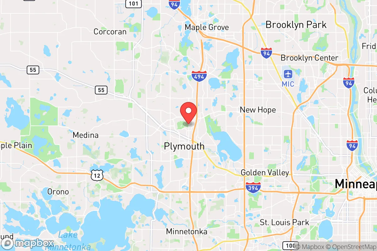
Strategic Assessment of Plymouth, MN
Multiple tactical vulnerabilities. Population density, target proximity, or disaster risk are likely compounding. A retreat property and exit planning is required.
What does the Strategic Assessment tell us?
Our Strategic Assessment grades tactical survivability of an area. Major population centers, military targets, fallout zones, natural disasters, and border exposure all drive risk — lower exposure means a more defensible position in a crisis.
This is heavily inspired by Joel Skousen's Strategic Relocation book. Highly recommended you checkout the book ($)What does this tell us?
Our Strategic Assessment grades tactical survivability of an area. Major population centers, military targets, fallout zones, natural disasters, and border exposure all drive risk — lower exposure means a more defensible position in a crisis.
This is heavily inspired by Joel Skousen's Strategic Relocation book. Highly recommended you checkout the book ($)Strategic Pillars

Key Distances
Regional Safe Places
Below is our recommended "safe zones" in Minnesota and the surrounding area based on our strategic heuristics. For most people, it's unrealistic to live in a “safe zone” full-time due to work, family or other personal reasons. They tend to be more rural. However, many of these areas are perfect for second homes and retreat properties that double as a vacation home or even a short-term rental.


Important Note: For informational purposes only. This does not mean nothing bad ever happens in the green zones. Please use common sense. This is based on public data and modeled with AI. We tried to take a conservative approach but mistakes happen. We update this regularly as new information becomes available.
Solar Generator Recommendations
Backup power matters more here than in safer locations. We've picked three solar generators across budgets and capacity tiers — start with the budget unit if you only need a few essentials, or step up if you want to run a fridge and HVAC for days at a time.

Jackery Portable Power Station Explorer 300
Budget OptionPower on the Go: Weighing only 11 lbs, it's convenient to set up and store with book-sized foldable solar panels

BLUETTI Portable Power Station AC180
Designed for both indoor and outdoor scenarios, AC180 is highly capable as it has a robost capacity and continuous output power.

EF ECOFLOW DELTA Pro Ultra Power Station
Upgraded PickEcoFlow DELTA Pro Ultra is a whole-home energy system designed to grow with your family. Integrated with the Smart Home Panel 2, it scales to meet your evolving energy needs — keeping your home powered, intelligent, and secure through every stage of life.
We earn a commission, at no additional cost to you.
Strategic Assessment Analysis
Plymouth, Minnesota, offers a strategic paradox for the conservative prepper: it’s a well-resourced, economically resilient suburb that sits uncomfortably close to a major metropolitan target. While its robust infrastructure and community stability provide a solid baseline for long-term survival, its proximity to Minneapolis and key logistical corridors introduces significant risk during civil unrest or a mass casualty event. For the relocator prioritizing self-sufficiency and security, Plymouth is a strong base camp, not a final redoubt—a place to build resources and networks before a potential retreat to more defensible terrain.
Geographic position and natural advantages for long-term security
Plymouth’s location in the western Twin Cities metro gives it a distinct edge over inner-ring suburbs. It sits at the junction of major highways 494 and 55, providing quick egress routes north toward St. Cloud or west toward the rural expanses of Wright and McLeod counties. This is critical for a bug-out scenario: you’re not trapped in a single choke point. The city is also bordered by the Medicine Lake chain and numerous smaller lakes, offering a natural water source that many suburban areas lack. The Plymouth Creek and Bassett Creek watersheds provide additional surface water, though treatment would be necessary. The area’s rolling terrain and scattered woodlots offer limited but useful cover for a rural retreat within the city limits, though true defensibility requires moving farther out. For the prepper, the key advantage is the 30-minute drive to agricultural land in places like Delano or Watertown, where barter networks and food production become viable. The city’s own Plymouth Municipal Airport is a potential asset for private aviation evacuation, but it’s also a likely target in a crisis—so treat it as a one-time-use option.
Risks, exposures, and proximity to fallout-relevant landmarks
The single biggest vulnerability for Plymouth is its proximity to Minneapolis, just 15 miles east. In a scenario involving civil unrest, mass casualty events, or a coordinated attack, the metro area becomes a high-risk zone. Plymouth sits directly in the path of any east-to-west exodus from the city, meaning highway 55 and I-494 could become impassable within hours of a major event. The city is also within the fallout shadow of several potential targets: the Minneapolis-St. Paul International Airport (MSP), the Fort Snelling military installation, and the Xcel Energy grid infrastructure in the metro. While Plymouth itself is not a primary target, prevailing winds from the east could carry fallout from a dirty bomb or industrial accident at the St. Paul Park Refinery or the Monticello Nuclear Generating Plant (30 miles northwest). The Monticello plant is a particular concern—a major incident there would put Plymouth in a moderate fallout zone, requiring shelter-in-place for days. Additionally, the city’s reliance on the Mississippi River water supply (via Minneapolis) is a single point of failure; a contamination event upstream would force reliance on local wells and lakes.
Practical resilience for a relocator: food, water, energy, and defensibility
For a relocator looking to establish a semi-self-sufficient household, Plymouth offers a mixed bag. Water is the strongest suit: the city’s groundwater is generally clean, and many homes have private wells, though newer developments rely on municipal supply. A hand pump or deep-well bucket system is a wise investment. Food security is moderate—the city has several community gardens and farmers’ markets (e.g., the Plymouth Farmers Market at the Plymouth Creek Center), but the growing season is short (May to September). Stockpiling is essential, and the Costco and Cub Foods on Highway 55 are high-traffic locations that will be stripped within hours of a crisis. For long-term food production, the soil is decent but rocky; raised beds and greenhouses are recommended. Energy resilience is a weak point. Xcel Energy dominates, and the grid is aging. Solar is viable (average 4.5 peak sun hours), but HOA restrictions in many Plymouth neighborhoods can limit panel installation. A generator and a 100-gallon propane tank are non-negotiable for winter survival—Plymouth averages 50 inches of snow annually, and a grid-down scenario in January is life-threatening. Defensibility is poor within the city—it’s a standard suburban grid with cul-de-sacs and open parks. The best approach is to choose a home on a dead-end street near a wooded buffer (e.g., near French Regional Park or the Luce Line Trail) to limit approach vectors. The Plymouth Police Department is well-funded and responsive, but in a widespread event, they will be overwhelmed. Your security plan must assume no outside help for at least 72 hours.
The overall strategic picture for Plymouth is that of a high-potential staging ground, not a final destination. It offers the economic stability, infrastructure, and community resources to build a solid prepper foundation—good schools, a strong tax base, and access to medical care (including the Hennepin Healthcare’s Plymouth Clinic). But its location within the metro’s blast radius and its dependence on fragile supply chains mean that long-term survival requires a secondary plan. For the conservative relocator, the smart move is to use Plymouth as a base to accumulate resources, establish a network of like-minded individuals, and identify a rural retreat within 60 miles—places like Litchfield, Hutchinson, or even the St. Croix River valley. If you’re willing to invest in a well, solar, and a solid stockpile, and you have a bug-out location ready, Plymouth can work as a primary residence. But if you’re looking for a single location that can weather a decade of instability, you’ll want to look farther west. Plymouth is a good horse, but it’s not the only horse in the stable.
* Values derived from national, state, county, city and local statistics and may differ in a specific area. Last updated: 2026-04-30T00:29:22.000Z
Narrative content on this page is AI-generated and may contain mistakes. Verify any details that matter before acting on them.
ReloMaps may earn a commission from affiliate links at no extra cost to you.