Photo: Wikipedia
Strategic Assessment of Port Huron, MI
Meaningful friction. Expect exposure to either population pressure, blast zones, or natural disaster risk. Consider buying a retreat property.
What does the Strategic Assessment tell us?
Our Strategic Assessment grades tactical survivability of an area. Major population centers, military targets, fallout zones, natural disasters, and border exposure all drive risk — lower exposure means a more defensible position in a crisis.
This is heavily inspired by Joel Skousen's Strategic Relocation book. Highly recommended you checkout the book ($)What does this tell us?
Our Strategic Assessment grades tactical survivability of an area. Major population centers, military targets, fallout zones, natural disasters, and border exposure all drive risk — lower exposure means a more defensible position in a crisis.
This is heavily inspired by Joel Skousen's Strategic Relocation book. Highly recommended you checkout the book ($)Strategic Pillars

Key Distances
Regional Safe Places
Below is our recommended "safe zones" in Michigan and the surrounding area based on our strategic heuristics. For most people, it's unrealistic to live in a “safe zone” full-time due to work, family or other personal reasons. They tend to be more rural. However, many of these areas are perfect for second homes and retreat properties that double as a vacation home or even a short-term rental.


Important Note: For informational purposes only. This does not mean nothing bad ever happens in the green zones. Please use common sense. This is based on public data and modeled with AI. We tried to take a conservative approach but mistakes happen. We update this regularly as new information becomes available.
Solar Generator Recommendations
Backup power matters more here than in safer locations. We've picked three solar generators across budgets and capacity tiers — start with the budget unit if you only need a few essentials, or step up if you want to run a fridge and HVAC for days at a time.

Jackery Portable Power Station Explorer 300
Budget OptionPower on the Go: Weighing only 11 lbs, it's convenient to set up and store with book-sized foldable solar panels

BLUETTI Portable Power Station AC180
Designed for both indoor and outdoor scenarios, AC180 is highly capable as it has a robost capacity and continuous output power.

EF ECOFLOW DELTA Pro Ultra Power Station
Upgraded PickEcoFlow DELTA Pro Ultra is a whole-home energy system designed to grow with your family. Integrated with the Smart Home Panel 2, it scales to meet your evolving energy needs — keeping your home powered, intelligent, and secure through every stage of life.
We earn a commission, at no additional cost to you.
Strategic Assessment Analysis
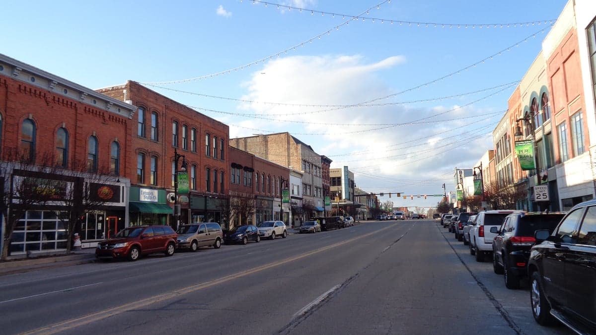
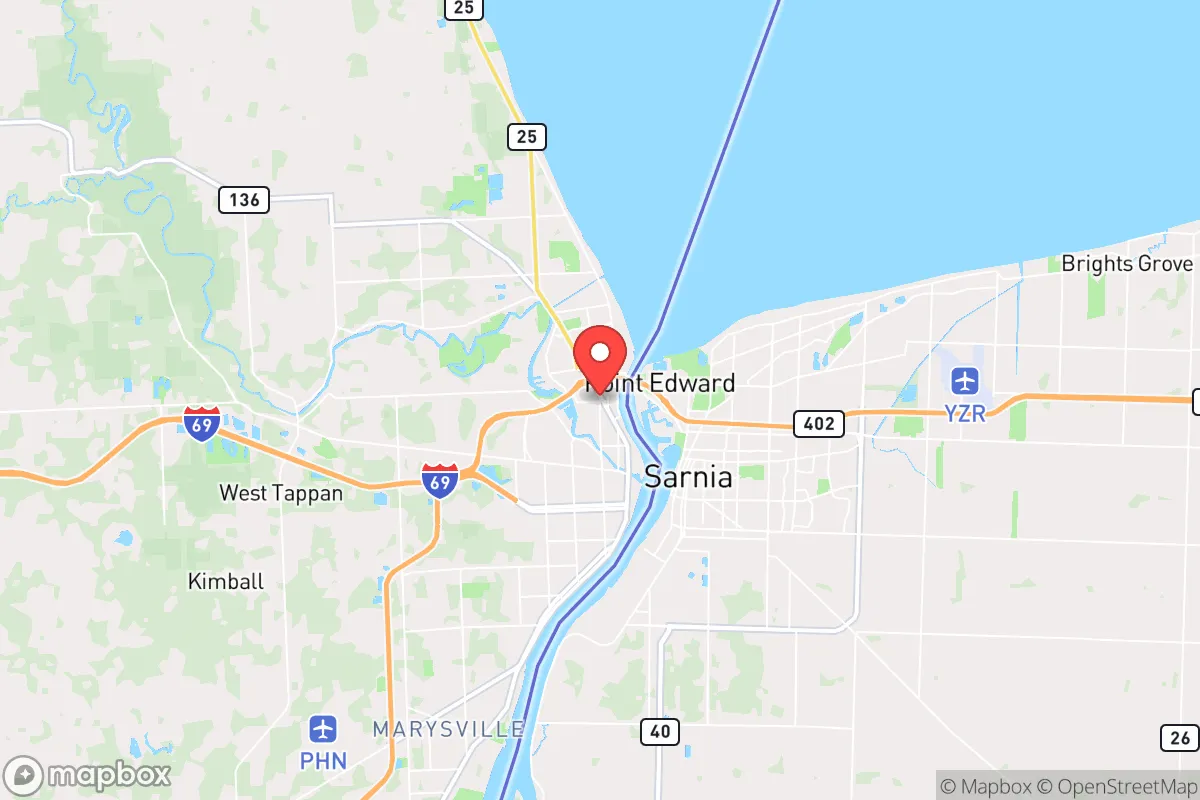
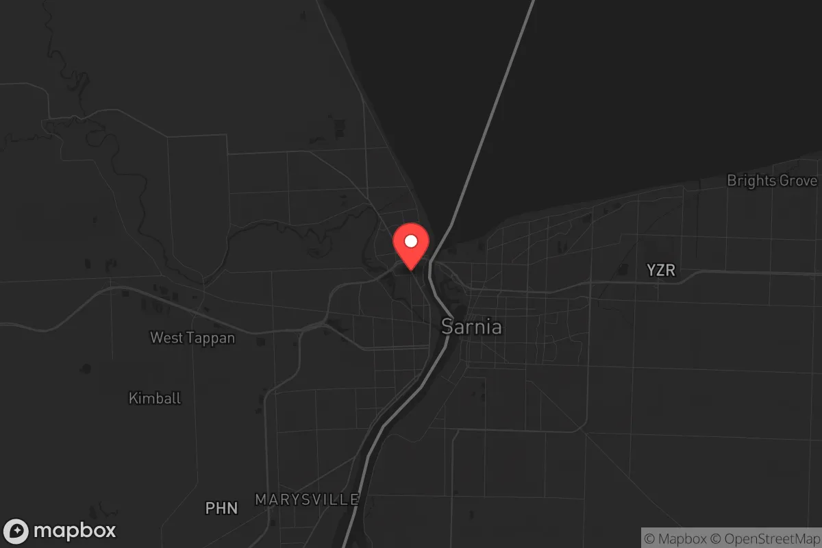
Port Huron, Michigan, sits at a strategic chokepoint where the St. Clair River meets Lake Huron, offering a blend of geographic insulation and critical infrastructure access that deserves a hard look from anyone serious about long-term preparedness. This city of roughly 28,000 people is the county seat of St. Clair County, and its position on the U.S.-Canada border—directly across from Sarnia, Ontario—gives it a unique resilience profile that most inland towns simply cannot match. For a relocator thinking about civic unrest, supply chain disruptions, or mass casualty events, Port Huron’s location is both a shield and a sword: it’s far enough from Detroit’s urban core (about 60 miles northeast) to avoid the worst fallout, yet close enough to leverage the Blue Water Bridge and international trade routes if things go sideways.
Geographic position and natural advantages for long-term security
Port Huron’s primary strategic asset is its control over the southern terminus of the Lake Huron waterway, which feeds into the St. Clair River and ultimately the Great Lakes system. This isn’t just scenic—it’s a logistical lifeline. In a scenario where ground transport is compromised, the lake and river provide a navigable corridor for moving people, supplies, or equipment. The city sits on a natural bluff overlooking the water, offering elevated sightlines and defensible terrain compared to floodplain communities. The surrounding St. Clair County is predominantly agricultural, with over 60% of the land in active farming, meaning local food production is not a theoretical exercise but a daily reality. The area’s moderate climate—cold winters but manageable summers—reduces the risk of extreme weather events like hurricanes or wildfires that plague other regions. For a prepper, the ability to grow food, access fresh water, and maintain a low profile in a semi-rural environment is a significant advantage over dense suburban sprawl.
Risks, exposures, and proximity to fallout-relevant landmarks
No location is without vulnerabilities, and Port Huron has a few that demand attention. The most obvious is its proximity to the Blue Water Bridge, a critical international crossing that connects I-94 and Highway 402. In a mass casualty event or civil unrest scenario, that bridge becomes a chokepoint and a target—both for those trying to flee Canada and for anyone looking to disrupt cross-border movement. The city also sits within 60 miles of Detroit, which, while not immediate, is close enough that fallout from a major urban disaster—whether a terrorist attack, pandemic surge, or economic collapse—could ripple outward. The nearby St. Clair River is a major shipping channel for hazardous materials, including petroleum and chemicals, which introduces a non-zero risk of industrial accidents or intentional sabotage. Additionally, Port Huron is within 100 miles of the Fermi 2 nuclear power plant in Monroe County, Michigan, and the Bruce Nuclear Generating Station in Ontario is roughly 90 miles across the lake. While both are operational and regulated, a nuclear incident—whether accident or attack—would put this area in a potential plume zone, depending on wind direction. For a conservative-minded relocator, these are not dealbreakers but factors that demand a solid plan for evacuation or shelter-in-place.
Practical resilience for a relocator: food, water, energy, and defensibility
When you strip away the politics and look at raw survival metrics, Port Huron holds up well. Fresh water is abundant—Lake Huron and the St. Clair River provide an essentially limitless supply, though treatment infrastructure could be compromised in a grid-down scenario. The city’s water treatment plant draws from the lake, so a gravity-fed or hand-pump backup system is feasible for those with property near the shoreline. Food security is strong: St. Clair County has over 200 farms within a 20-mile radius, many of which sell directly to locals through farmers’ markets and CSAs. The area also has a history of hunting and fishing, with deer, waterfowl, and walleye readily available. Energy resilience is mixed—the local grid is tied to DTE Energy, which has faced reliability issues in recent years, but natural gas is widely available, and the region has decent solar potential despite cloudy winters. Defensibility is where Port Huron shines: the city’s layout, with the river to the east and farmland to the west, creates natural buffers. The downtown area is compact, but the surrounding townships (like Fort Gratiot and Port Huron Township) offer rural acreage where a family can establish a low-visibility homestead. Property taxes in St. Clair County average about 1.5% of assessed value, which is reasonable compared to downstate Michigan, and land prices are still affordable for those looking to buy acreage outright.
The overall strategic picture for Port Huron is one of cautious optimism for the prepared relocator. It’s not a fortress—no place is—but it offers a rare combination of water access, agricultural hinterland, and relative isolation from the worst urban chaos. The proximity to Canada and the Great Lakes shipping lanes is a double-edged sword: it provides escape routes and trade options, but also attracts attention in a crisis. For a single individual or a family willing to invest in off-grid capabilities—solar panels, a well, a root cellar, and some basic firearms training—Port Huron provides a solid foundation. The conservative lean of the area is reflected in local politics (St. Clair County voted +18 for Trump in 2020), which means a like-minded community exists for mutual aid and networking. The key is to treat this as a base, not a bunker: stay aware of the risks from the bridge, the plants, and the urban spillover, but recognize that few places in the Midwest offer this much strategic depth for the price. If you’re looking to ride out the coming storms with your values and your family intact, Port Huron deserves a spot on your short list.
* Values derived from national, state, county, city and local statistics and may differ in a specific area. Last updated: 2026-04-30T05:02:37.000Z
Narrative content on this page is AI-generated and may contain mistakes. Verify any details that matter before acting on them.
ReloMaps may earn a commission from affiliate links at no extra cost to you.