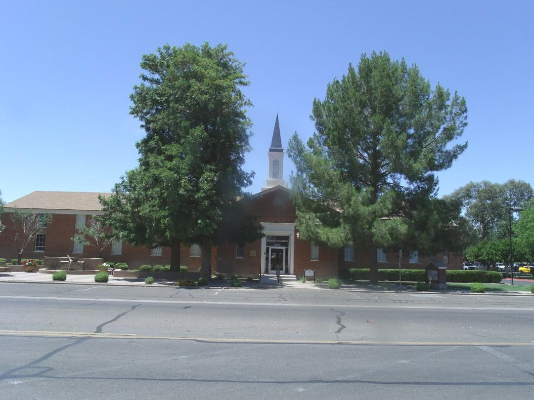
Photo: Wikipedia
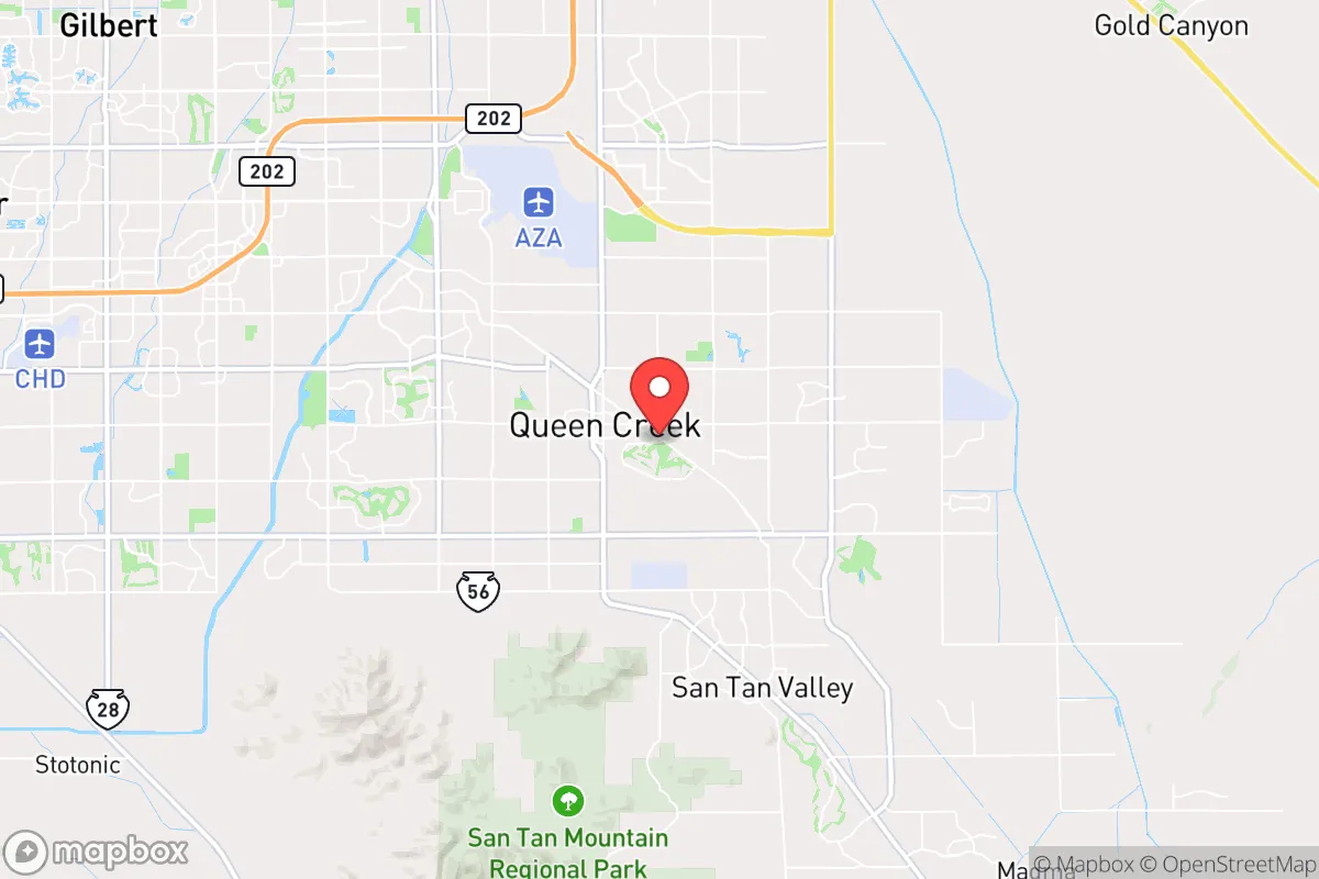
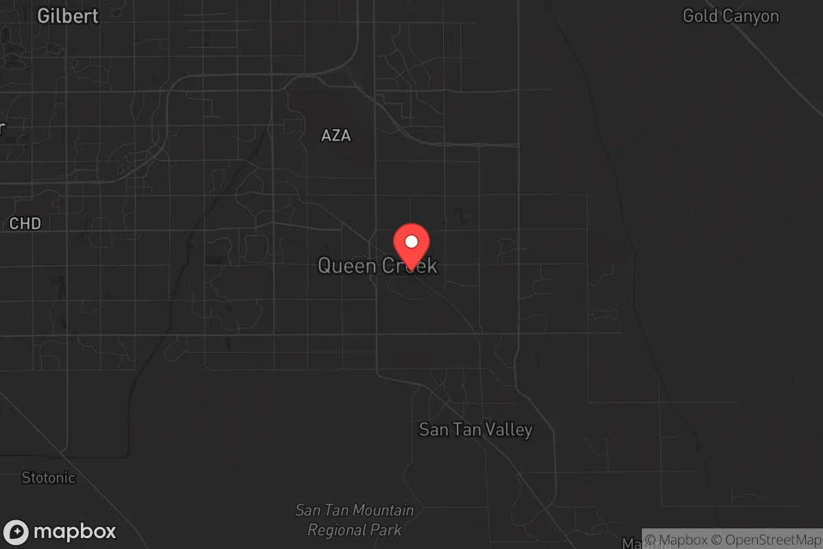
Strategic Assessment of Queen Creek, AZ
Multiple tactical vulnerabilities. Population density, target proximity, or disaster risk are likely compounding. A retreat property and exit planning is required.
What does the Strategic Assessment tell us?
Our Strategic Assessment grades tactical survivability of an area. Major population centers, military targets, fallout zones, natural disasters, and border exposure all drive risk — lower exposure means a more defensible position in a crisis.
This is heavily inspired by Joel Skousen's Strategic Relocation book. Highly recommended you checkout the book ($)What does this tell us?
Our Strategic Assessment grades tactical survivability of an area. Major population centers, military targets, fallout zones, natural disasters, and border exposure all drive risk — lower exposure means a more defensible position in a crisis.
This is heavily inspired by Joel Skousen's Strategic Relocation book. Highly recommended you checkout the book ($)Strategic Pillars

Key Distances
Regional Safe Places
Below is our recommended "safe zones" in Arizona and the surrounding area based on our strategic heuristics. For most people, it's unrealistic to live in a “safe zone” full-time due to work, family or other personal reasons. They tend to be more rural. However, many of these areas are perfect for second homes and retreat properties that double as a vacation home or even a short-term rental.
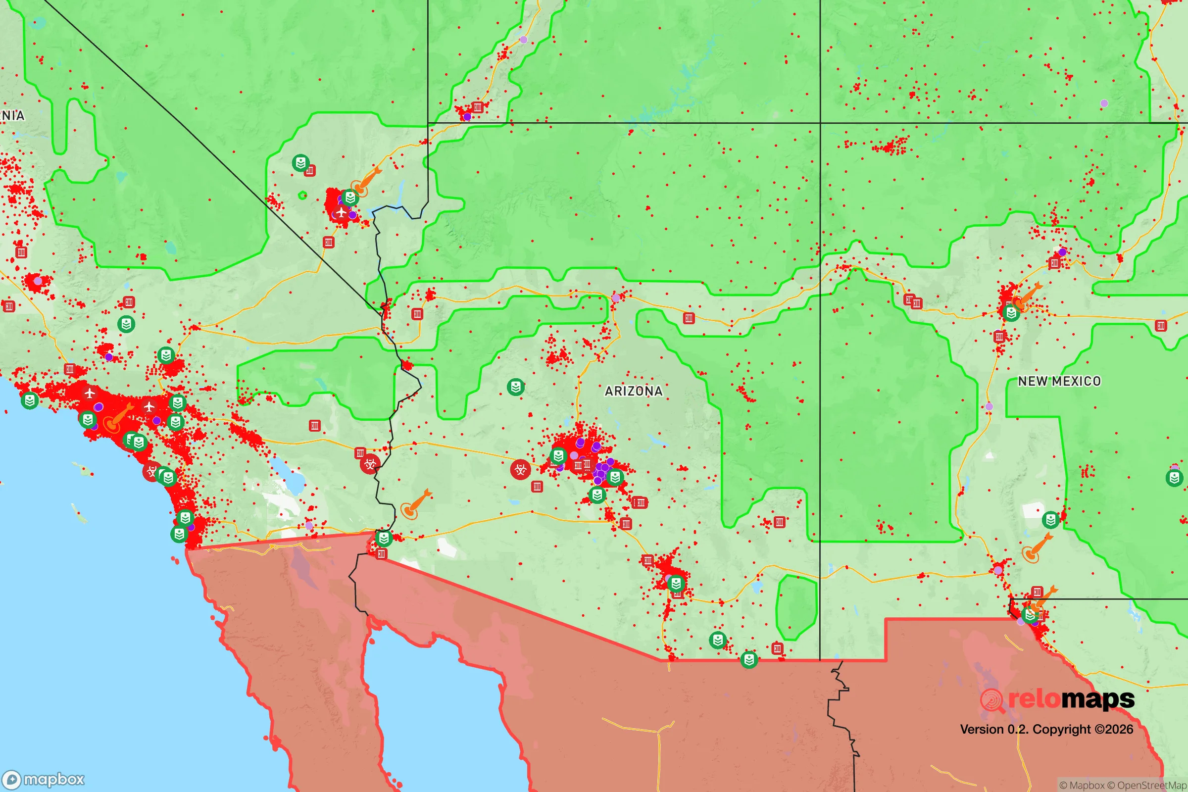
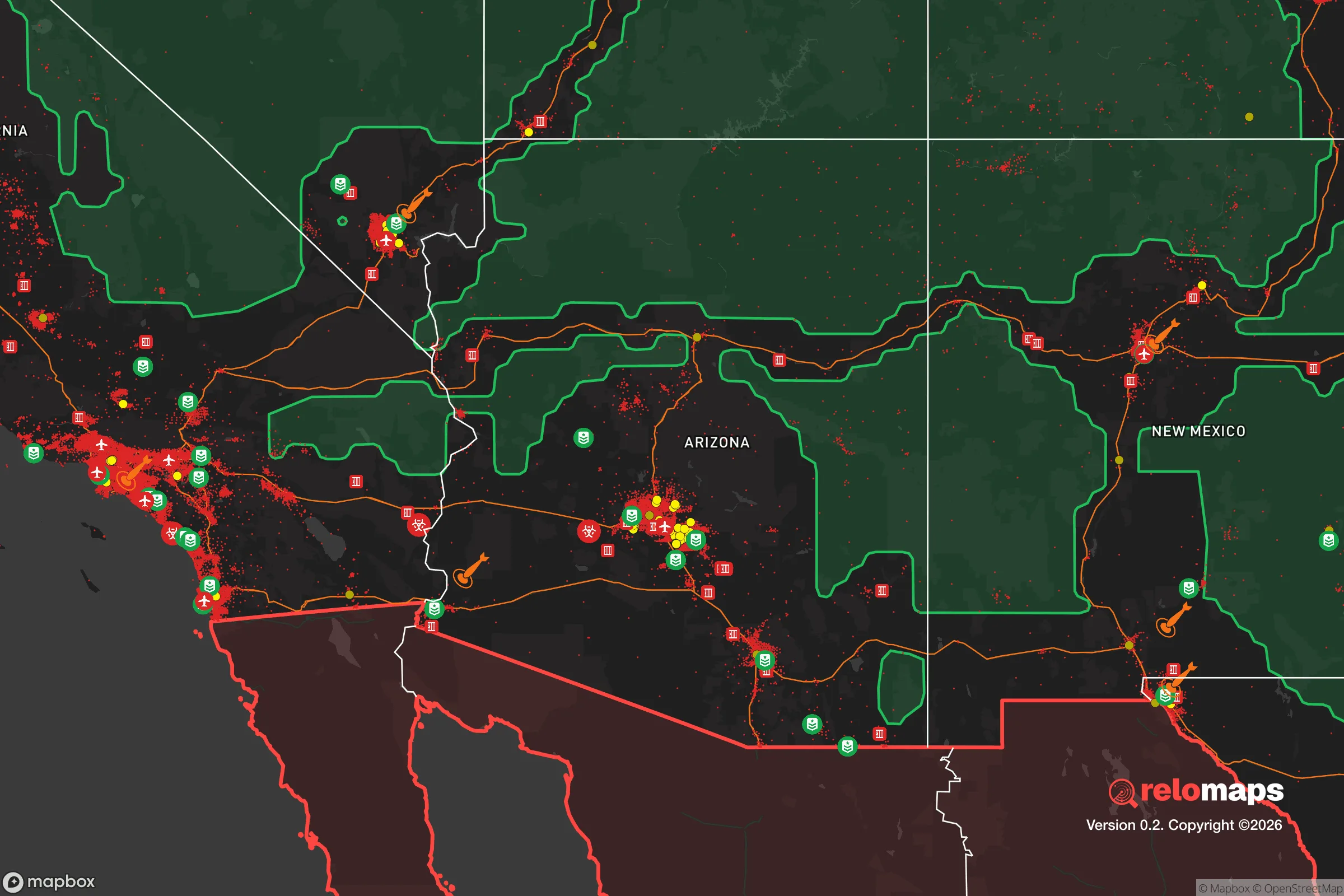
Important Note: For informational purposes only. This does not mean nothing bad ever happens in the green zones. Please use common sense. This is based on public data and modeled with AI. We tried to take a conservative approach but mistakes happen. We update this regularly as new information becomes available.
Solar Generator Recommendations
Backup power matters more here than in safer locations. We've picked three solar generators across budgets and capacity tiers — start with the budget unit if you only need a few essentials, or step up if you want to run a fridge and HVAC for days at a time.

Jackery Portable Power Station Explorer 300
Budget OptionPower on the Go: Weighing only 11 lbs, it's convenient to set up and store with book-sized foldable solar panels

BLUETTI Portable Power Station AC180
Designed for both indoor and outdoor scenarios, AC180 is highly capable as it has a robost capacity and continuous output power.

EF ECOFLOW DELTA Pro Ultra Power Station
Upgraded PickEcoFlow DELTA Pro Ultra is a whole-home energy system designed to grow with your family. Integrated with the Smart Home Panel 2, it scales to meet your evolving energy needs — keeping your home powered, intelligent, and secure through every stage of life.
We earn a commission, at no additional cost to you.
Strategic Assessment Analysis
Queen Creek, Arizona, offers a compelling strategic position for those prioritizing resilience, sitting far enough from Phoenix’s urban core to avoid the worst fallout of a major disruption, yet close enough to access critical supplies and infrastructure when things are stable. Its location in the southeastern Phoenix metro area, roughly 40 miles from downtown, places it on the edge of the sprawling Sun Corridor, a region that has seen explosive growth but also faces significant water and heat challenges. For a relocator with a prepper mindset, Queen Creek’s real advantage is its semi-rural character—large lots, agricultural roots, and a community that still values self-reliance—combined with a political climate that leans heavily conservative, which often translates into lower regulatory friction for things like water storage, solar panels, and firearms ownership.
Geographic position and natural advantages for long-term security
Queen Creek sits in the Sonoran Desert at roughly 1,400 feet elevation, which gives it a slightly cooler microclimate than Phoenix proper but still subjects it to extreme summer heat. The area’s natural advantages are limited but real: the nearby San Tan Mountains provide some topographic diversity, and the region’s geology is stable—no significant earthquake risk, no hurricane threat, and only occasional flash flooding in washes. The town’s position on the eastern edge of the metro area means it’s farther from the major interstate corridors (I-10 and I-17) that would become choke points during an evacuation or supply disruption. This distance is a double-edged sword: it reduces exposure to mass casualty events tied to highway accidents or terrorist targets on those routes, but it also means that if you need to bug out, your primary route east (US 60) or south (AZ 347) can become clogged quickly. The surrounding area is mostly open desert and state trust land, which offers some buffer from urban sprawl, but development is creeping in fast—new master-planned communities are eating up the open space that once made Queen Creek feel remote. For a survivalist, the key takeaway is that Queen Creek’s geographic position is decent for a suburban prepper, but it’s not a remote retreat; you’re still within a 30-minute drive of Chandler and Gilbert, which means you’re in the blast radius of any major event affecting the Phoenix metro.
Risks, exposures, and proximity to fallout-relevant landmarks
The biggest strategic risk for Queen Creek is its proximity to Phoenix’s critical infrastructure. Luke Air Force Base, about 50 miles west, is a primary target in any conflict scenario, and while Queen Creek is far enough to avoid the immediate blast zone, fallout patterns in the desert are unpredictable and could drift east depending on wind. Closer to home, the Palo Verde Nuclear Generating Station, about 60 miles west, is another high-value target; a meltdown or strike there would render large swaths of the metro area uninhabitable for years. Queen Creek’s position southeast of both Luke and Palo Verde offers some protection from prevailing westerly winds, but it’s not a guarantee. On the civic unrest front, Queen Creek’s relative isolation from Phoenix’s denser, more politically volatile areas is a plus. The town’s population is around 60,000, with a low crime rate and a strong police presence, which reduces the likelihood of localized chaos during a national emergency. However, the town’s growth has brought in more people from California and other blue states, diluting the original conservative culture slightly—something to watch if you value community cohesion during a crisis. The nearby San Tan Mountains could serve as a natural barrier for foot traffic from the west, but they’re not impassable. The real exposure is economic: Queen Creek’s housing market is tied to Phoenix’s boom-and-bust cycle, and a major disaster could trigger a real estate collapse that strands homeowners with underwater mortgages.
Practical resilience for a relocator: food, water, energy, and defensibility
Water is the single biggest concern for any prepper in Queen Creek. The town relies entirely on groundwater and the Central Arizona Project canal, which brings Colorado River water—a resource that is increasingly contested and likely to face cuts in the coming decades. Many homes in Queen Creek have large lots (half-acre to acre-plus), which is a huge advantage for installing rainwater catchment systems, but annual rainfall is only about 9 inches, so you can’t rely on that alone. Drilling a private well is possible in some areas, but permits are getting harder to obtain as the aquifer drops. For food resilience, the agricultural history of Queen Creek is a plus: the area still has working farms and a strong farmers’ market culture, and many homeowners have space for gardens and small livestock. Chickens, goats, and even a few fruit trees are common in the older neighborhoods, and the town’s zoning is generally friendly to these uses. Energy is less of a worry—Arizona gets 300+ sunny days a year, and solar panels are a no-brainer here. The local utility, Salt River Project, is reliable but has faced strain during heat waves; a grid-down scenario in July would be deadly without backup power. Defensibility is moderate: Queen Creek’s layout is mostly suburban sprawl with cul-de-sacs and gated communities, which can be secured but also create chokepoints. The town’s low population density means you’re not packed in like sardines, but it also means law enforcement response times could be slow in a widespread event. Firearm ownership is common and culturally accepted here, and there are several gun ranges and training facilities nearby, which is a practical advantage for those serious about self-defense.
The overall strategic picture for Queen Creek is that it’s a solid B+ option for a conservative-leaning prepper who wants to stay within striking distance of Phoenix’s jobs and amenities but doesn’t want to be in the middle of the chaos when things go sideways. It’s not a bug-out location—you’d want to be farther north in the mountains or east in New Mexico for that—but it’s a defensible home base with enough space and community culture to ride out most disruptions. The water issue is the ticking clock; if you move here, invest in storage and conservation immediately. The growth pressure is real, and the window for buying a large lot at a reasonable price is closing. For a single individual or a family willing to put in the work on self-sufficiency, Queen Creek offers a rare combination of proximity to urban resources and a semi-rural lifestyle that’s increasingly hard to find in the Southwest. Just don’t mistake it for a fortress—it’s a suburb with prepper potential, not a survivalist compound.
* Values derived from national, state, county, city and local statistics and may differ in a specific area. Last updated: 2026-04-21T19:42:00.000Z
Narrative content on this page is AI-generated and may contain mistakes. Verify any details that matter before acting on them.
ReloMaps may earn a commission from affiliate links at no extra cost to you.