

Photo: Wikipedia
Strategic Assessment of Rahway, NJ
High tactical risk. This location is likely close to major population centers, strategic targets, or sits in a high-disaster corridor. A retreat property and careful exit planning is required.
What does the Strategic Assessment tell us?
Our Strategic Assessment grades tactical survivability of an area. Major population centers, military targets, fallout zones, natural disasters, and border exposure all drive risk — lower exposure means a more defensible position in a crisis.
This is heavily inspired by Joel Skousen's Strategic Relocation book. Highly recommended you checkout the book ($)What does this tell us?
Our Strategic Assessment grades tactical survivability of an area. Major population centers, military targets, fallout zones, natural disasters, and border exposure all drive risk — lower exposure means a more defensible position in a crisis.
This is heavily inspired by Joel Skousen's Strategic Relocation book. Highly recommended you checkout the book ($)Strategic Pillars

Key Distances
Regional Safe Places
Below is our recommended "safe zones" in New Jersey and the surrounding area based on our strategic heuristics. For most people, it's unrealistic to live in a “safe zone” full-time due to work, family or other personal reasons. They tend to be more rural. However, many of these areas are perfect for second homes and retreat properties that double as a vacation home or even a short-term rental.


Important Note: For informational purposes only. This does not mean nothing bad ever happens in the green zones. Please use common sense. This is based on public data and modeled with AI. We tried to take a conservative approach but mistakes happen. We update this regularly as new information becomes available.
Solar Generator Recommendations
Backup power matters more here than in safer locations. We've picked three solar generators across budgets and capacity tiers — start with the budget unit if you only need a few essentials, or step up if you want to run a fridge and HVAC for days at a time.

Jackery Portable Power Station Explorer 300
Budget OptionPower on the Go: Weighing only 11 lbs, it's convenient to set up and store with book-sized foldable solar panels

BLUETTI Portable Power Station AC180
Designed for both indoor and outdoor scenarios, AC180 is highly capable as it has a robost capacity and continuous output power.

EF ECOFLOW DELTA Pro Ultra Power Station
Upgraded PickEcoFlow DELTA Pro Ultra is a whole-home energy system designed to grow with your family. Integrated with the Smart Home Panel 2, it scales to meet your evolving energy needs — keeping your home powered, intelligent, and secure through every stage of life.
We earn a commission, at no additional cost to you.
Strategic Assessment Analysis
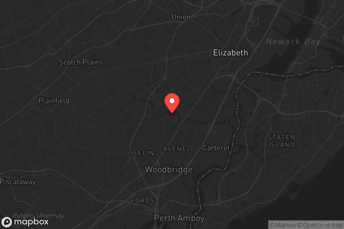
Rahway, New Jersey, sits in a precarious strategic position that demands a clear-eyed assessment for anyone prioritizing resilience and self-reliance. While its location offers some logistical advantages, the city's proximity to major population centers, critical infrastructure, and potential fallout targets makes it a high-risk area for those preparing for civic unrest, mass casualty events, or large-scale disasters. For a conservative-leaning relocator—whether a single individual or a parent—the calculus here is less about natural advantages and more about understanding the vulnerabilities baked into the geography and regional dependencies.
Geographic position and natural advantages: a mixed bag for survival
Rahway is situated in Union County, roughly 20 miles southwest of Manhattan and 10 miles from Newark. This places it within the dense, interconnected corridor of the Northeast Megalopolis. The city itself sits on the Rahway River, which feeds into the Arthur Kill and ultimately the Atlantic Ocean. For a prepper, the river offers a potential water source, but it's heavily industrialized and polluted in stretches—requiring advanced filtration or boiling before any use. The terrain is mostly flat and suburban, with limited natural cover or defensible high ground. The area's moderate climate means fewer extreme weather events compared to the Midwest or Gulf Coast, but nor'easters and occasional hurricanes (like Sandy in 2012) can knock out power for days. The soil is decent for small-scale gardening, but most residential lots are small, and community gardens are scarce. In short, the natural advantages here are minimal; you're not getting remote wilderness or abundant game. What you get is proximity to resources—but also to threats.
Risks, exposures, and proximity to fallout-relevant landmarks
The biggest strategic liability for Rahway is its location within the New York City metropolitan area. In a scenario involving a nuclear detonation, dirty bomb, or large-scale terrorist attack on Manhattan, Rahway would be within the fallout plume zone depending on wind direction. The city is also within 10 miles of Newark Liberty International Airport, a major transportation hub that could be a target for disruption or attack. Additionally, the nearby Port Newark-Elizabeth Marine Terminal—one of the busiest ports in the country—is a high-value target for both state and non-state actors. Rahway itself has a small rail yard and industrial zones, but the real risk is the cascading effect: if the region's power grid, water supply, or fuel distribution is compromised, Rahway will feel it immediately. The city's population density (about 30,000 people in 4 square miles) means that any evacuation would be chaotic, with limited routes out—mainly the Garden State Parkway and Route 1/9, both notorious for gridlock. For a parent, this raises serious questions about school pickup zones, emergency reunification plans, and the ability to bug out with children in a panic scenario. Civil unrest in nearby Newark or Elizabeth could also spill over, as Rahway is connected by rail and road to those hotspots.
Practical resilience for a relocator: food, water, energy, and defensibility
For a single individual or family looking to hunker down, Rahway presents significant challenges. Water security is the first concern: the municipal supply comes from the Elizabethtown Water Company, which draws from the Raritan River and the Spruce Run Reservoir. A prolonged power outage or contamination event would cut off this supply, and the Rahway River is not a reliable backup without heavy treatment. Food storage is feasible if you have a basement or garage, but most homes lack deep pantries or root cellars. Local grocery stores (ShopRite, Stop & Shop) are within a few miles, but they'd be stripped bare within hours of a crisis. Gardening space is limited; community plots exist but are oversubscribed. Energy resilience is poor: the grid is old and prone to outages, and solar panel installation is possible but often restricted by homeowners' associations or local ordinances. Natural gas is common for heating, but a grid-down scenario means no gas pumps for vehicles. Defensibility is the weakest point. Rahway is a dense, walkable city with row houses, apartments, and narrow streets. There's no rural buffer, no natural chokepoints, and no community of like-minded preppers to form a neighborhood watch. The police department is professional but small (about 80 officers), and in a widespread crisis, they'd be overwhelmed. For a relocator, the best strategy here is not to fortify in place but to have a pre-planned bug-out location—ideally 50+ miles inland, away from the I-95 corridor. If you must stay, focus on building a deep pantry, installing a rainwater catchment system, and forming alliances with neighbors who share your mindset. But honestly, Rahway is a location you'd pass through, not dig into.
The overall strategic picture for Rahway is one of high risk with limited reward for a survivalist or prepper. Its location within the New York City orbit means it's exposed to the worst-case scenarios—nuclear fallout, infrastructure collapse, civil unrest—while offering few natural defenses or escape routes. The city's strengths—proximity to jobs, transportation, and services—are exactly the things that become liabilities in a crisis. For a conservative-leaning individual or parent who values self-reliance and security, Rahway is a place to evaluate carefully, not a destination to commit to without a robust contingency plan. If you're already here, your best move is to network with local gun clubs, stockpile supplies, and identify a secondary location outside the metro area. If you're considering relocating here, ask yourself: is the convenience worth the vulnerability? For most preppers, the answer will be no.
* Values derived from national, state, county, city and local statistics and may differ in a specific area. Last updated: 2026-05-03T09:54:53.000Z
Narrative content on this page is AI-generated and may contain mistakes. Verify any details that matter before acting on them.
ReloMaps may earn a commission from affiliate links at no extra cost to you.