Photo: Wikipedia
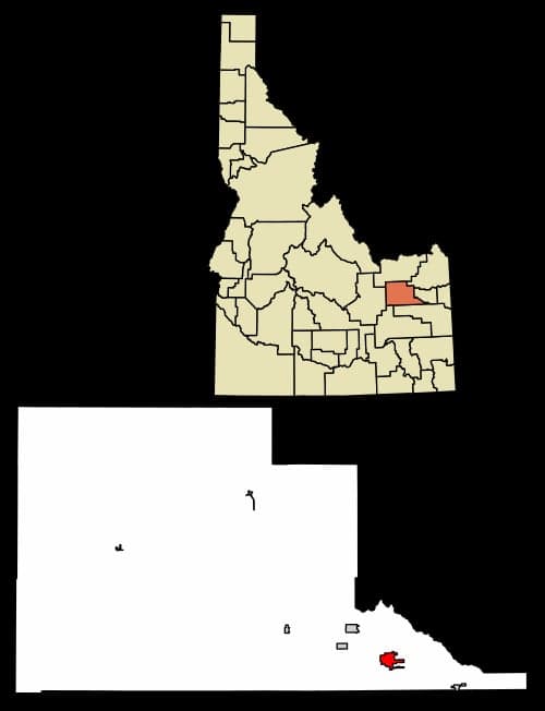
Strategic Assessment of Rigby, ID
Strong survivability profile. Good buffer from population centers, with manageable environmental and tactical risks.
What does the Strategic Assessment tell us?
Our Strategic Assessment grades tactical survivability of an area. Major population centers, military targets, fallout zones, natural disasters, and border exposure all drive risk — lower exposure means a more defensible position in a crisis.
This is heavily inspired by Joel Skousen's Strategic Relocation book. Highly recommended you checkout the book ($)What does this tell us?
Our Strategic Assessment grades tactical survivability of an area. Major population centers, military targets, fallout zones, natural disasters, and border exposure all drive risk — lower exposure means a more defensible position in a crisis.
This is heavily inspired by Joel Skousen's Strategic Relocation book. Highly recommended you checkout the book ($)Strategic Pillars

Key Distances
Regional Safe Places
Below is our recommended "safe zones" in Idaho and the surrounding area based on our strategic heuristics. For most people, it's unrealistic to live in a “safe zone” full-time due to work, family or other personal reasons. They tend to be more rural. However, many of these areas are perfect for second homes and retreat properties that double as a vacation home or even a short-term rental.


Important Note: For informational purposes only. This does not mean nothing bad ever happens in the green zones. Please use common sense. This is based on public data and modeled with AI. We tried to take a conservative approach but mistakes happen. We update this regularly as new information becomes available.
Solar Generator Recommendations
Backup power matters more here than in safer locations. We've picked three solar generators across budgets and capacity tiers — start with the budget unit if you only need a few essentials, or step up if you want to run a fridge and HVAC for days at a time.

Jackery Portable Power Station Explorer 300
Budget OptionPower on the Go: Weighing only 11 lbs, it's convenient to set up and store with book-sized foldable solar panels

BLUETTI Portable Power Station AC180
Designed for both indoor and outdoor scenarios, AC180 is highly capable as it has a robost capacity and continuous output power.

EF ECOFLOW DELTA Pro Ultra Power Station
Upgraded PickEcoFlow DELTA Pro Ultra is a whole-home energy system designed to grow with your family. Integrated with the Smart Home Panel 2, it scales to meet your evolving energy needs — keeping your home powered, intelligent, and secure through every stage of life.
We earn a commission, at no additional cost to you.
Strategic Assessment Analysis
Rigby, Idaho, offers a compelling strategic position for those prioritizing long-term resilience, sitting at the intersection of the Snake River Plain and the Continental Divide’s eastern foothills. Its location provides a buffer from the immediate fallout zones of major metropolitan areas while maintaining access to critical infrastructure and natural resources. For a relocator with a prepper mindset, Rigby’s combination of agricultural self-sufficiency, low population density, and distance from primary target zones makes it a serious contender for a sustainable retreat, though it is not without its own exposure risks.
Geographic position and natural advantages for long-term survival
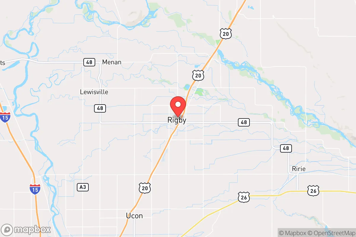
Rigby sits in Jefferson County, roughly 20 miles north of Idaho Falls and 50 miles southwest of the Montana border, placing it in a region that benefits from both isolation and logistical access. The area is part of the Upper Snake River Valley, one of the most productive agricultural regions in the Intermountain West, with over 200,000 acres of irrigated farmland within a 30-mile radius. This means local food production is not a theoretical exercise—it is the dominant economic activity. The Snake River itself, along with the Henrys Fork and Teton River systems, provides abundant surface water, and the Eastern Snake River Plain Aquifer sits beneath the region, offering deep groundwater reserves that are less vulnerable to surface contamination than many other Western locations.
The surrounding topography is a strategic asset. To the east, the Teton Range and Caribou-Targhee National Forest create a natural barrier, while the Snake River Plain to the west offers open terrain that is difficult to approach covertly. Elevation here averages 4,800 feet, which moderates summer heat and reduces wildfire risk compared to lower-elevation Western communities. The region’s low seismic risk—the nearest major fault line is the Teton Fault, which has not produced a significant earthquake in recorded history—adds another layer of stability. For a relocator, this geography means defensible positions, reliable water, and a climate that supports year-round food storage without the extreme cold of northern Montana or the arid constraints of the Great Basin.
Risks, exposures, and proximity to fallout-relevant landmarks
No location is a fortress, and Rigby has specific vulnerabilities that a strategic relocator must weigh. The most immediate concern is the Idaho National Laboratory (INL), located roughly 30 miles west of Rigby. INL is a 890-square-mile Department of Energy complex that houses nuclear research reactors, spent fuel storage, and radioactive waste facilities. While the site has a strong safety record, it is a high-value target in any large-scale conflict or terrorist scenario. A direct strike or major accident at INL could produce a fallout plume that, depending on wind patterns, could affect Jefferson County within hours. The prevailing winds in this region are from the southwest, which means Rigby is generally upwind of INL, but seasonal shifts and specific weather events could change that calculus.
Proximity to Idaho Falls (population 65,000) is a double-edged sword. While the city provides medical infrastructure, supply chains, and a regional airport, it also concentrates population and risk. In a civil unrest scenario, Idaho Falls could become a chokepoint for refugees moving north along US-20, the primary highway connecting Rigby to the rest of the region. The highway itself is a vulnerability—it is the only major east-west route through the area, and a single bridge failure or blockade could isolate Rigby from critical supplies. Additionally, the Mountain Home Air Force Base, 150 miles southwest, is a strategic asset that could become a target, though its distance reduces direct fallout risk to Rigby. The region’s low tornado risk and moderate winter storm exposure are manageable, but heavy snow years can disrupt road access for days at a time, which is a factor for anyone relying on just-in-time supply chains.
Practical resilience for a relocator: food, water, energy, and defensibility
Rigby’s practical resilience is anchored in its agricultural base. The area is a major producer of potatoes, wheat, barley, and sugar beets, and local farmers’ markets and co-ops are well-established. For a relocator, this means direct access to bulk food supplies without relying on national distribution networks. The Jefferson County Cooperative Extension and local seed libraries support home gardening, and the growing season—roughly 120 frost-free days—is sufficient for cold-hardy crops like kale, carrots, and peas. Water rights are a critical consideration: most residential wells in the area tap into the Snake River Aquifer at depths of 100-300 feet, and the region has no history of groundwater depletion like the Central Valley or the Ogallala Aquifer. However, new well permits can take months, so any relocator should prioritize a property with an existing, tested well.
Energy resilience is mixed. The region is served by Idaho Power, which generates roughly 60% of its electricity from hydroelectric dams on the Snake River. This is a double-edged sword: hydro is reliable and low-carbon, but a coordinated attack on the dams—such as the American Falls or Palisades dams—could disrupt power for weeks. Solar potential is good, with the area averaging 5.2 peak sun hours per day, and many rural properties already have backup generators. Natural gas is available in town, but propane is the standard for rural heating, and bulk propane delivery is reliable. For defensibility, Rigby’s rural character is an asset. The county has a population density of just 12 people per square mile, and most homes are set back from main roads with clear sightlines. The local sheriff’s office is well-regarded, but response times in remote areas can exceed 30 minutes, making personal security and community networks essential. The Jefferson County Preparedness Group and local church-based mutual aid networks are active, offering a social infrastructure that is rare in more transient regions.
The overall strategic picture for Rigby is one of high potential with specific, manageable risks. Its agricultural abundance, water security, and low population density make it a strong candidate for a long-term relocation, particularly for those who value self-sufficiency and community cohesion. The primary trade-offs are the proximity to the Idaho National Laboratory and the reliance on a single highway corridor, both of which require contingency planning. For a relocator willing to invest in well water, solar backup, and local networks, Rigby offers a defensible position in a region that is politically and culturally aligned with self-reliance. It is not a fortress, but it is a solid foundation—and in the current climate, that is more than most locations can claim.
* Values derived from national, state, county, city and local statistics and may differ in a specific area. Last updated: 2026-05-01T00:54:54.000Z
Narrative content on this page is AI-generated and may contain mistakes. Verify any details that matter before acting on them.
ReloMaps may earn a commission from affiliate links at no extra cost to you.