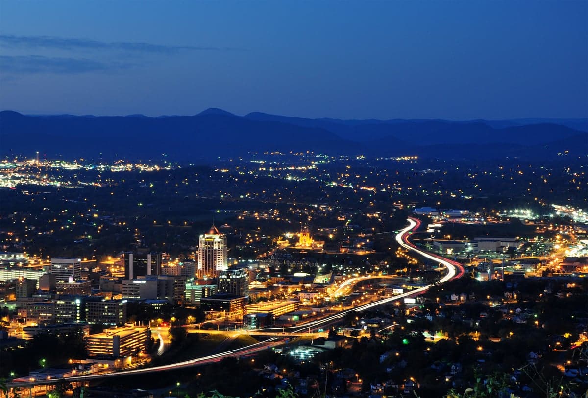
Photo: Wikipedia
Strategic Assessment of Roanoke, VA
Meaningful friction. Expect exposure to either population pressure, blast zones, or natural disaster risk. Consider buying a retreat property.
What does the Strategic Assessment tell us?
Our Strategic Assessment grades tactical survivability of an area. Major population centers, military targets, fallout zones, natural disasters, and border exposure all drive risk — lower exposure means a more defensible position in a crisis.
This is heavily inspired by Joel Skousen's Strategic Relocation book. Highly recommended you checkout the book ($)What does this tell us?
Our Strategic Assessment grades tactical survivability of an area. Major population centers, military targets, fallout zones, natural disasters, and border exposure all drive risk — lower exposure means a more defensible position in a crisis.
This is heavily inspired by Joel Skousen's Strategic Relocation book. Highly recommended you checkout the book ($)Strategic Pillars

Key Distances
Regional Safe Places
Below is our recommended "safe zones" in Virginia and the surrounding area based on our strategic heuristics. For most people, it's unrealistic to live in a “safe zone” full-time due to work, family or other personal reasons. They tend to be more rural. However, many of these areas are perfect for second homes and retreat properties that double as a vacation home or even a short-term rental.


Important Note: For informational purposes only. This does not mean nothing bad ever happens in the green zones. Please use common sense. This is based on public data and modeled with AI. We tried to take a conservative approach but mistakes happen. We update this regularly as new information becomes available.
Solar Generator Recommendations
Backup power matters more here than in safer locations. We've picked three solar generators across budgets and capacity tiers — start with the budget unit if you only need a few essentials, or step up if you want to run a fridge and HVAC for days at a time.

Jackery Portable Power Station Explorer 300
Budget OptionPower on the Go: Weighing only 11 lbs, it's convenient to set up and store with book-sized foldable solar panels

BLUETTI Portable Power Station AC180
Designed for both indoor and outdoor scenarios, AC180 is highly capable as it has a robost capacity and continuous output power.

EF ECOFLOW DELTA Pro Ultra Power Station
Upgraded PickEcoFlow DELTA Pro Ultra is a whole-home energy system designed to grow with your family. Integrated with the Smart Home Panel 2, it scales to meet your evolving energy needs — keeping your home powered, intelligent, and secure through every stage of life.
We earn a commission, at no additional cost to you.
Strategic Assessment Analysis
Roanoke, Virginia, sits in a geographic sweet spot that makes it one of the more strategically interesting relocation options for those thinking long-term about resilience. Nestled in the Blue Ridge Mountains at the intersection of Interstates 81 and 581, it offers a rare combination of natural barriers, moderate climate, and access to critical infrastructure without being chained to a major metropolitan hub. For a conservative-leaning audience concerned with civic stability, supply chain disruptions, or mass casualty events, Roanoke presents a defensible position that balances isolation with practicality—provided you understand its real exposures.
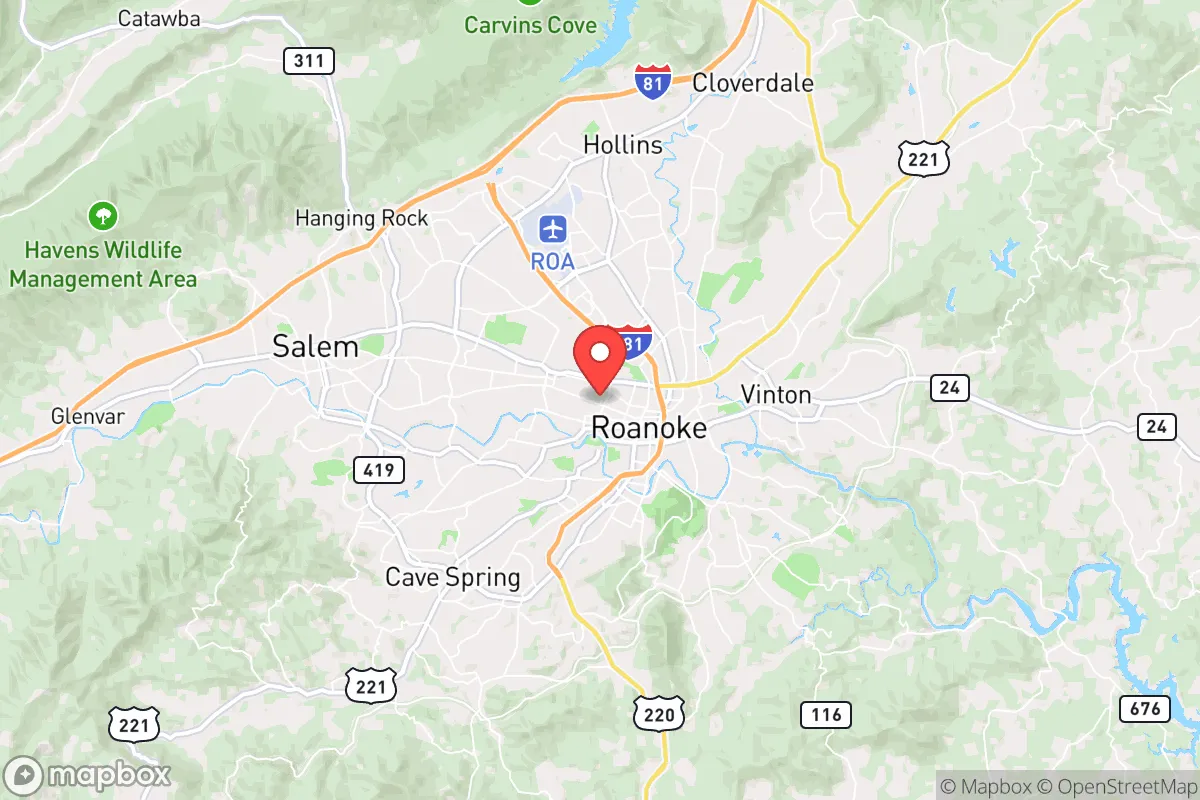
Geographic position and natural advantages for long-term security
Roanoke’s primary strategic asset is its location in the Roanoke Valley, surrounded by the Blue Ridge Parkway and the Appalachian Trail corridor. This topography creates natural chokepoints and defensible terrain—any approach from the east, north, or south funnels through narrow mountain passes, which could be monitored or controlled in a crisis. The city itself sits at roughly 1,000 feet elevation, with surrounding peaks reaching 3,000–4,000 feet, offering both vantage points and microclimate advantages. The region is far enough from the East Coast’s major population centers—Roanoke is roughly 180 miles from Richmond, 200 miles from Washington D.C., and 150 miles from Charlotte—to avoid the immediate fallout of a coastal disaster or civil unrest, yet close enough to access those markets if needed. The area also sits atop the Roanoke River, a reliable water source, and benefits from a temperate climate that supports year-round agriculture without the extremes of the Deep South or Northeast. For a relocator, this means you’re not betting on a desert or a frozen tundra; you’re betting on a place where food can be grown, water flows, and the weather won’t kill you outright.
Risks, exposures, and proximity to fallout-relevant landmarks
No place is a fortress, and Roanoke has its share of vulnerabilities that a prepper needs to weigh. The most obvious risk is its position along I-81, a major north-south trucking corridor that runs from Tennessee to New York. In a crisis, this highway could become a chokepoint for refugees fleeing the Northeast, or a target for supply chain disruptions. Roanoke is also within 50 miles of the Radford Army Ammunition Plant, a major Department of Defense facility that produces propellants and explosives—a potential target in a conflict scenario. Additionally, the city is roughly 90 miles from the Blue Ridge and Smith Mountain Lake dams, which, while not immediate threats, could pose flooding risks if compromised. On the nuclear front, Roanoke is about 120 miles from the North Anna Nuclear Generating Station in Virginia, and 150 miles from the McGuire Nuclear Station in North Carolina—far enough to avoid a direct blast zone, but within the range of fallout patterns depending on wind direction. The region also sees occasional seismic activity from the Central Virginia Seismic Zone, though major quakes are rare. For the conservative relocator, the key takeaway is that Roanoke isn’t a bunker—it’s a position that requires awareness of its proximity to military and industrial targets, and a plan for managing the I-81 corridor if things go sideways.
Practical resilience for a relocator: food, water, energy, and defensibility
When you strip away the maps and look at daily survival logistics, Roanoke holds up well. The Roanoke River and its tributaries provide surface water that can be filtered or treated, and the region’s average annual rainfall of 40–45 inches means you’re not dependent on a single reservoir. The valley’s soil is fertile enough for small-scale farming, and there’s a strong local farming community—the Roanoke Valley Farmers Market is one of the oldest in Virginia, and you’ll find neighbors who know how to can, preserve, and raise livestock. Energy-wise, Appalachian Power serves the area with a mix of coal, natural gas, and hydroelectric, but the mountains also offer potential for micro-hydro or solar if you’re off-grid inclined. Roanoke’s defensibility comes from its geography: the city is a bowl surrounded by ridges, meaning you can see threats coming from miles away, and the limited road access (primarily I-81, US-220, and US-460) means you can control movement in and out. For a single individual or family, the practical question is whether you can secure a property on the outskirts—say, in Botetourt County to the north or Franklin County to the south—where you’d have more land, fewer neighbors, and better lines of sight. Inside the city limits, you’re trading convenience for vulnerability; outside, you’re trading convenience for security. The local gun culture is strong—Virginia is a shall-issue state for concealed carry, and Roanoke County has a history of Second Amendment support—so you won’t be the odd one out for being armed.
The overall strategic picture for Roanoke is one of calculated risk. It’s not a remote survivalist compound in Montana, nor is it a coastal city that will be gridlocked in a crisis. It’s a mid-sized mountain city with real assets—water, terrain, climate, and a conservative-leaning population that values self-reliance—but also real liabilities in the form of a major highway, military-industrial targets, and proximity to nuclear infrastructure. For the relocator who wants to be prepared without disappearing into the wilderness, Roanoke offers a middle path: you can live a normal life, work a remote job, and still have a plan for when the world gets ugly. The key is to buy outside the city core, stock up on supplies, and make friends with the locals who’ve been farming this valley for generations. If you’re looking for a place that’s not on everyone’s radar but checks most of the boxes for long-term resilience, Roanoke deserves a serious look.
* Values derived from national, state, county, city and local statistics and may differ in a specific area. Last updated: 2026-05-02T05:03:55.000Z
Narrative content on this page is AI-generated and may contain mistakes. Verify any details that matter before acting on them.
ReloMaps may earn a commission from affiliate links at no extra cost to you.