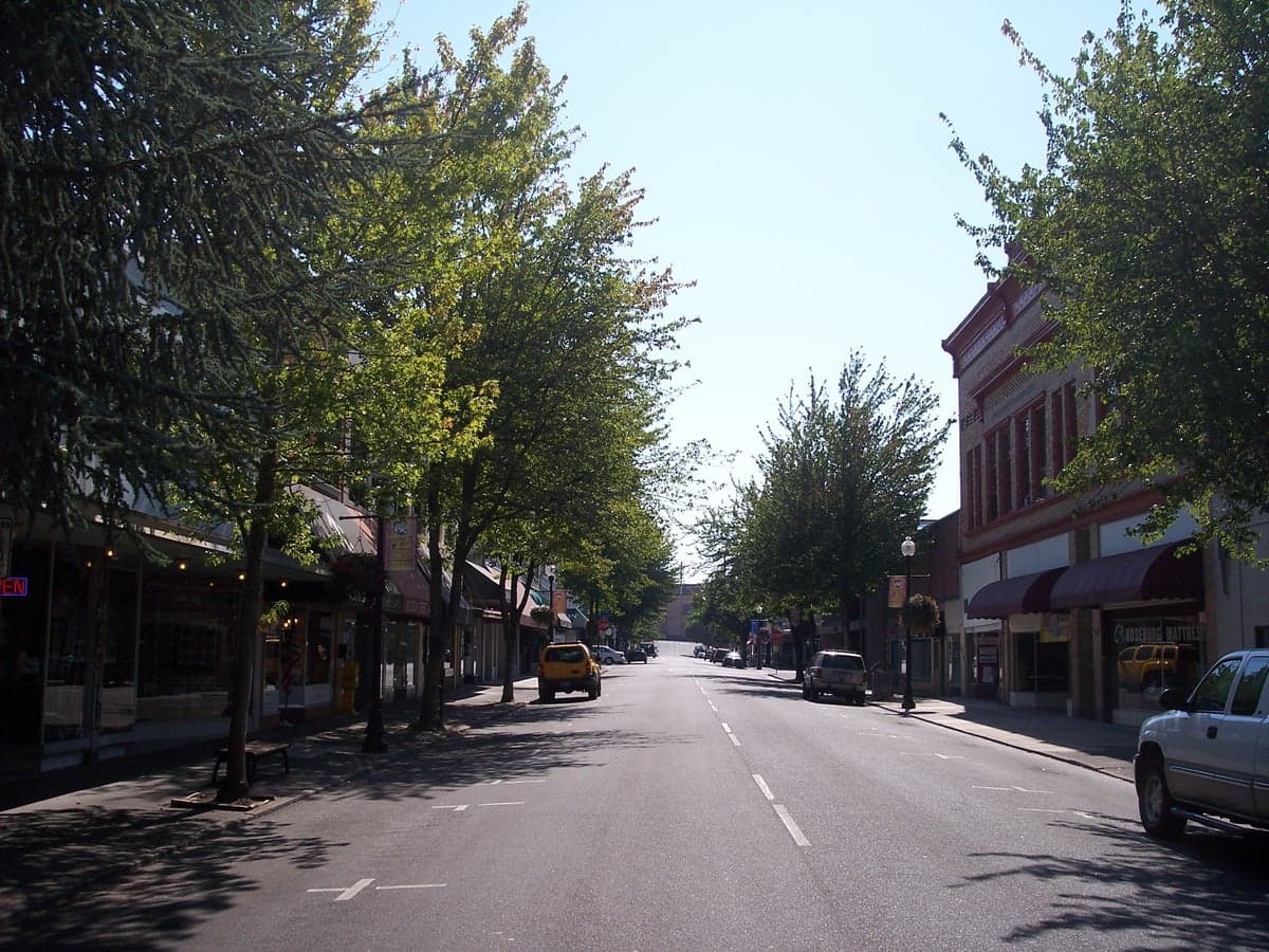
Photo: Wikipedia
Strategic Assessment of Roseburg, OR
Workable tactical position. Some exposure to population density or targets, but generally defensible in a crisis.
What does the Strategic Assessment tell us?
Our Strategic Assessment grades tactical survivability of an area. Major population centers, military targets, fallout zones, natural disasters, and border exposure all drive risk — lower exposure means a more defensible position in a crisis.
This is heavily inspired by Joel Skousen's Strategic Relocation book. Highly recommended you checkout the book ($)What does this tell us?
Our Strategic Assessment grades tactical survivability of an area. Major population centers, military targets, fallout zones, natural disasters, and border exposure all drive risk — lower exposure means a more defensible position in a crisis.
This is heavily inspired by Joel Skousen's Strategic Relocation book. Highly recommended you checkout the book ($)Strategic Pillars

Key Distances
Regional Safe Places
Below is our recommended "safe zones" in Oregon and the surrounding area based on our strategic heuristics. For most people, it's unrealistic to live in a “safe zone” full-time due to work, family or other personal reasons. They tend to be more rural. However, many of these areas are perfect for second homes and retreat properties that double as a vacation home or even a short-term rental.


Important Note: For informational purposes only. This does not mean nothing bad ever happens in the green zones. Please use common sense. This is based on public data and modeled with AI. We tried to take a conservative approach but mistakes happen. We update this regularly as new information becomes available.
Solar Generator Recommendations
Backup power matters more here than in safer locations. We've picked three solar generators across budgets and capacity tiers — start with the budget unit if you only need a few essentials, or step up if you want to run a fridge and HVAC for days at a time.

Jackery Portable Power Station Explorer 300
Budget OptionPower on the Go: Weighing only 11 lbs, it's convenient to set up and store with book-sized foldable solar panels

BLUETTI Portable Power Station AC180
Designed for both indoor and outdoor scenarios, AC180 is highly capable as it has a robost capacity and continuous output power.

EF ECOFLOW DELTA Pro Ultra Power Station
Upgraded PickEcoFlow DELTA Pro Ultra is a whole-home energy system designed to grow with your family. Integrated with the Smart Home Panel 2, it scales to meet your evolving energy needs — keeping your home powered, intelligent, and secure through every stage of life.
We earn a commission, at no additional cost to you.
Strategic Assessment Analysis
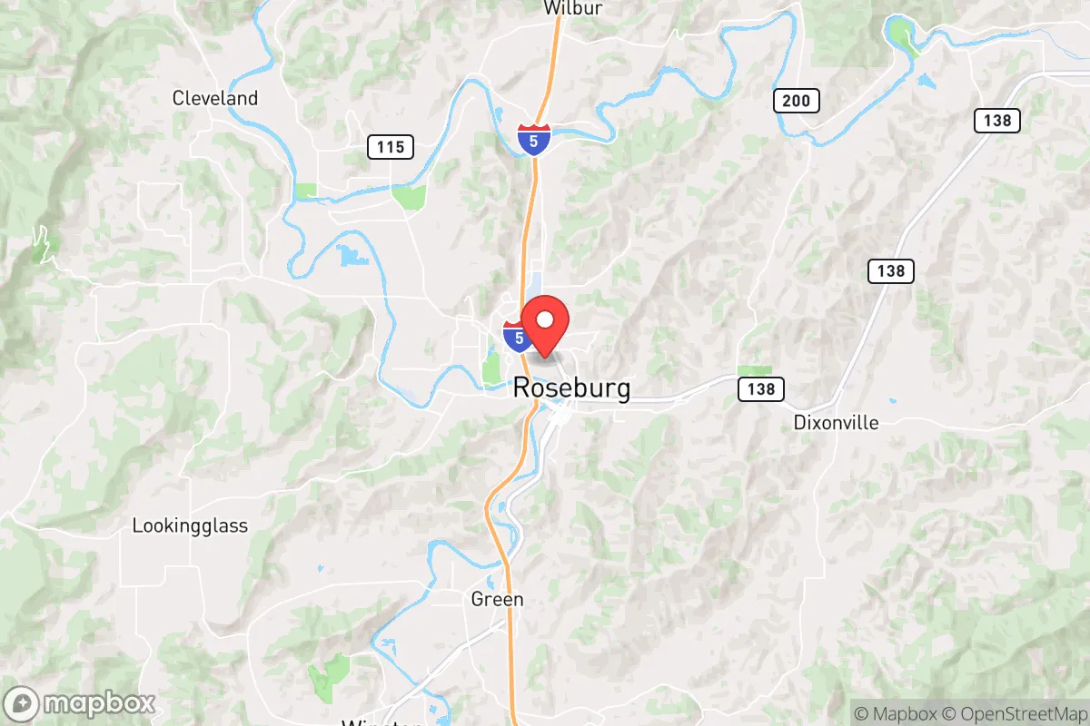
Roseburg, Oregon, sits in a sweet spot that few people outside the Pacific Northwest have on their radar: far enough from the I-5 corridor’s major population centers to avoid the worst of a cascading collapse, yet close enough to access critical supply routes and medical infrastructure if things hold together. The Umpqua Valley’s natural barriers—the Coast Range to the west, the Cascades to the east—create a defensible pocket that’s been historically self-sufficient, with a local economy still rooted in timber, agriculture, and small-scale manufacturing rather than tech or tourism. For a relocator thinking in terms of decades, not just the next election cycle, Roseburg offers a rare combination of geographic isolation, resource abundance, and community cohesion that most of the West Coast has already lost.
Geographic position and natural advantages for long-term security
Roseburg’s location at the confluence of the North and South Umpqua rivers gives it a reliable freshwater supply that most of the drought-prone West would envy. The Umpqua Basin receives 40–50 inches of rain annually, which means even in a multi-year dry spell, the rivers rarely drop to crisis levels. The surrounding Coast Range and Cascade foothills provide natural chokepoints: only two major highways—I-5 and OR-138—serve the area, and both can be monitored or blocked with minimal effort if civil order degrades. The valley floor is wide enough for productive agriculture but narrow enough that a small community can physically secure its perimeter. Elevation ranges from 400 to 1,200 feet, keeping the area above the worst of the valley fog and below the snow line that would complicate winter travel. For a prepper, this is terrain that works with you, not against you.
Risks, exposures, and proximity to fallout-relevant landmarks
No location is perfect, and Roseburg has real vulnerabilities that a serious relocator needs to weigh. The biggest is I-5 itself: the highway runs right through town, and in a mass evacuation event from Portland or Eugene, Roseburg would become a chokepoint for desperate people heading south. Eugene is 75 miles north, Portland 180 miles—close enough that a major earthquake on the Cascadia subduction zone could send tens of thousands of refugees funneling through the Umpqua Valley within 48 hours. The Cascadia fault’s projected 9.0+ megathrust earthquake would also directly impact Roseburg with severe shaking (MMI VIII–IX), liquefaction risks in the river bottomlands, and likely landslides on the surrounding mountain roads that could isolate the area for weeks. On the fallout side, there are no nuclear power plants within 150 miles, but the Portland metro area and the Hanford Site (280 miles east) are both plausible targets in a conflict scenario. Prevailing winds blow west-to-east, so fallout from a Portland strike would largely miss Roseburg, but a Hanford strike could send contamination across the Cascades depending on weather. The local VA hospital and the county’s only trauma center (Mercy Medical Center) are both in the downtown floodplain—a single-point failure that should concern anyone planning for long-term medical resilience.
Practical resilience for a relocator: food, water, energy, and defensibility
This is where Roseburg shines compared to 90% of similarly sized towns in the West. The Umpqua Valley is one of Oregon’s most productive agricultural regions, with over 200 farms within a 20-mile radius growing everything from grass-fed beef and pastured pork to hazelnuts, wine grapes, and Christmas trees. The growing season runs 180–200 days, and the soil is volcanic loam that doesn’t require heavy irrigation—a critical advantage if the grid goes down and electric pumps stop. Water is abundant: the North Umpqua River alone has a mean annual flow of 3,500 cubic feet per second, enough to supply a small city even in drought years. Most rural properties in the county have their own wells, and the water table is shallow enough that hand pumps are a realistic backup. Energy is more of a mixed bag. Roseburg’s municipal utility gets about 60% of its power from hydroelectric dams on the North Umpqua, which means grid power is relatively stable but vulnerable to earthquake damage to the dams. Solar potential is moderate—the valley gets about 200 sunny days per year, less than the high desert east of the Cascades—but the mild climate means heating demand is low, and wood heat is widely available from the surrounding national forests. Defensibility is strong: the valley is a natural funnel with limited entry points, and the local culture is heavily armed and self-reliant. Douglas County has one of the highest per-capita firearm ownership rates in Oregon, and the sheriff’s office has a stated policy of not enforcing federal gun laws they consider unconstitutional. For a relocator concerned about civil unrest, that’s a meaningful force multiplier.
The overall strategic picture for Roseburg is one of high potential with manageable risk, provided you plan for the specific threats rather than generic disaster scenarios. The Cascadia earthquake is the single biggest wildcard—it will happen eventually, and when it does, Roseburg will be cut off from outside help for weeks or months. But the same isolation that makes that scenario dangerous also makes the area resilient in every other crisis: food, water, fuel, and community are all local, and the geography gives you options that coastal or urban locations simply don’t. If you’re looking for a place that can ride out the next 20 years without depending on a fragile supply chain or a federal government that may not show up, Roseburg deserves a serious look. Just don’t buy in the floodplain, stockpile enough ammo and medical supplies to cover your neighbors as well as yourself, and make peace with the fact that you’ll be raking pine needles off your roof for the rest of your life. That’s the trade-off for living in one of the last genuinely defensible valleys on the West Coast.
* Values derived from national, state, county, city and local statistics and may differ in a specific area. Last updated: 2026-04-24T14:55:59.000Z
Narrative content on this page is AI-generated and may contain mistakes. Verify any details that matter before acting on them.
ReloMaps may earn a commission from affiliate links at no extra cost to you.