Photo: Wikipedia
Strategic Assessment of Roseville, MI
Multiple tactical vulnerabilities. Population density, target proximity, or disaster risk are likely compounding. A retreat property and exit planning is required.
What does the Strategic Assessment tell us?
Our Strategic Assessment grades tactical survivability of an area. Major population centers, military targets, fallout zones, natural disasters, and border exposure all drive risk — lower exposure means a more defensible position in a crisis.
This is heavily inspired by Joel Skousen's Strategic Relocation book. Highly recommended you checkout the book ($)What does this tell us?
Our Strategic Assessment grades tactical survivability of an area. Major population centers, military targets, fallout zones, natural disasters, and border exposure all drive risk — lower exposure means a more defensible position in a crisis.
This is heavily inspired by Joel Skousen's Strategic Relocation book. Highly recommended you checkout the book ($)Strategic Pillars

Key Distances
Regional Safe Places
Below is our recommended "safe zones" in Michigan and the surrounding area based on our strategic heuristics. For most people, it's unrealistic to live in a “safe zone” full-time due to work, family or other personal reasons. They tend to be more rural. However, many of these areas are perfect for second homes and retreat properties that double as a vacation home or even a short-term rental.


Important Note: For informational purposes only. This does not mean nothing bad ever happens in the green zones. Please use common sense. This is based on public data and modeled with AI. We tried to take a conservative approach but mistakes happen. We update this regularly as new information becomes available.
Solar Generator Recommendations
Backup power matters more here than in safer locations. We've picked three solar generators across budgets and capacity tiers — start with the budget unit if you only need a few essentials, or step up if you want to run a fridge and HVAC for days at a time.

Jackery Portable Power Station Explorer 300
Budget OptionPower on the Go: Weighing only 11 lbs, it's convenient to set up and store with book-sized foldable solar panels

BLUETTI Portable Power Station AC180
Designed for both indoor and outdoor scenarios, AC180 is highly capable as it has a robost capacity and continuous output power.

EF ECOFLOW DELTA Pro Ultra Power Station
Upgraded PickEcoFlow DELTA Pro Ultra is a whole-home energy system designed to grow with your family. Integrated with the Smart Home Panel 2, it scales to meet your evolving energy needs — keeping your home powered, intelligent, and secure through every stage of life.
We earn a commission, at no additional cost to you.
Strategic Assessment Analysis
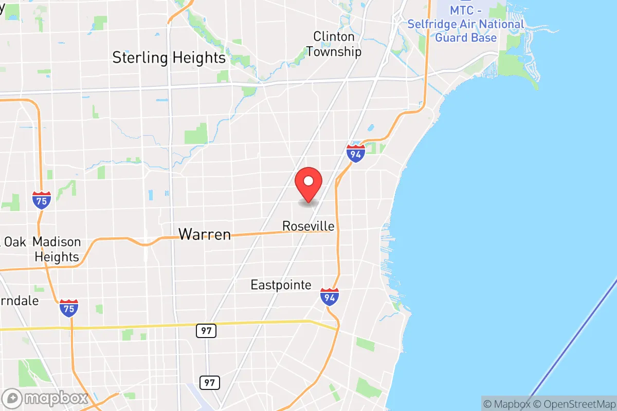
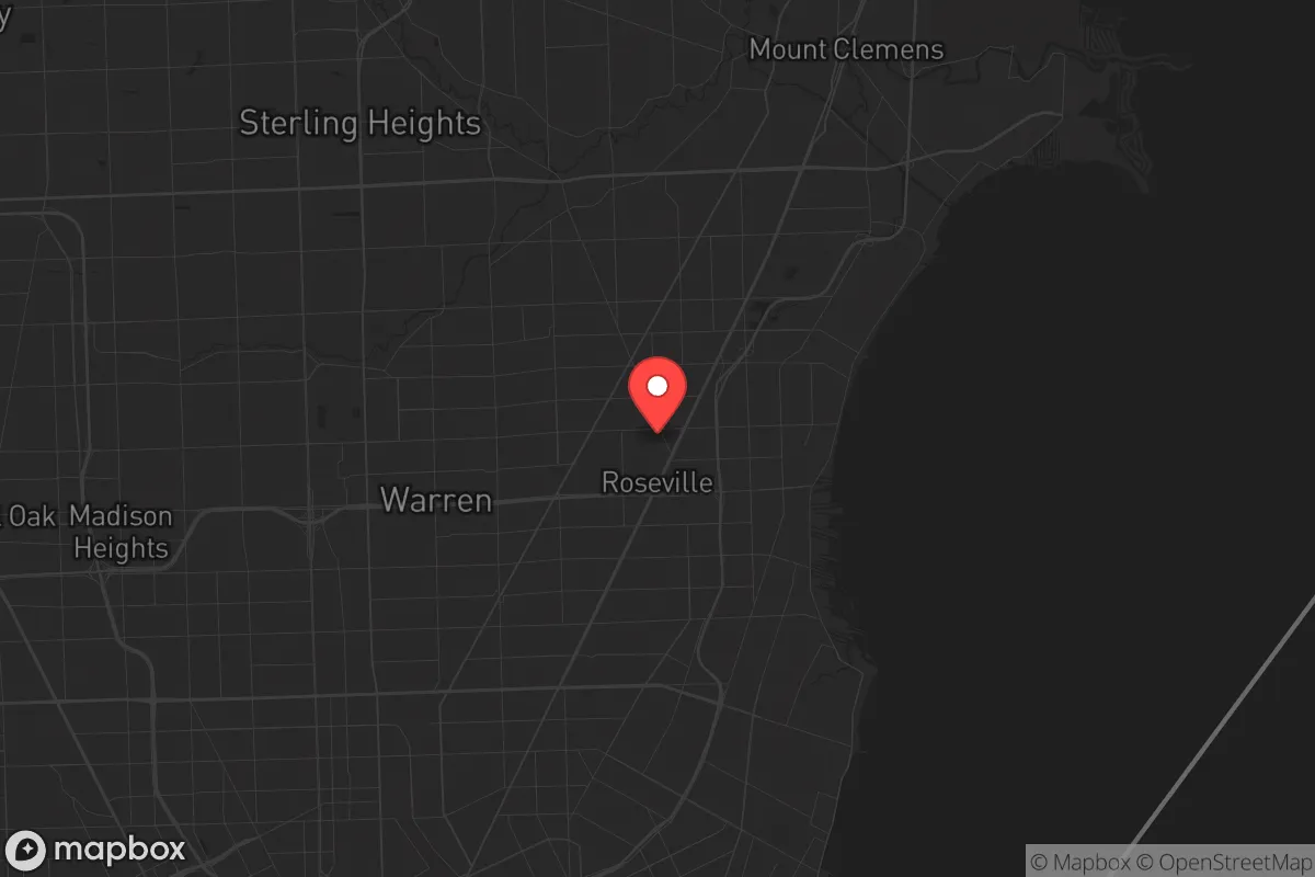
Roseville, Michigan, presents a mixed bag for the strategic relocator. Its position as a dense, inner-ring suburb of Detroit offers immediate access to resources, but that same proximity is the primary liability in a crisis scenario. For a conservative-minded prepper, the calculus here is less about long-term self-sufficiency and more about leveraging a high-density staging area with strong infrastructure resilience—provided you have a clear exit plan. The city’s grid layout and industrial backbone offer some tactical advantages, but the surrounding urban decay and potential for civil unrest in the metro area demand a sober, defensive posture.
Geographic position and natural advantages in a crisis
Roseville sits about 12 miles north of downtown Detroit, nestled between I-94 and I-696, two major arterial freeways that form a critical logistics triangle. This location gives you rapid access to both the urban core and the northern suburbs, but it also means you are squarely in the path of any evacuation or unrest radiating from Detroit. The natural terrain is flat, post-glacial lake plain—no hills, no forests, no natural choke points. Defensively, this is a liability: there are few places to hide or establish a natural perimeter. However, the area’s proximity to Lake St. Clair (roughly 4 miles east) provides a massive freshwater resource and a potential waterborne escape route. The lake’s shoreline is heavily developed, but marinas and public access points at places like Memorial Park offer a fallback for fishing, water collection, or evacuation by boat if roads become impassable. The region’s four-season climate means you must contend with lake-effect snow and occasional ice storms, which can disrupt power and travel for days—a factor that favors those with backup heating and winterized vehicles.
Risks, exposures, and proximity to fallout-relevant landmarks
The single greatest strategic weakness of Roseville is its location within the Detroit metropolitan statistical area. In a mass casualty event, civil unrest, or grid-down scenario, the city is within the immediate fallout zone of Detroit’s potential chaos. The urban core’s history of civil disturbances (e.g., the 1967 riots, 2020 protests) shows that unrest can spread rapidly along the I-94 corridor. Roseville itself is a working-class suburb with a significant industrial base, including the massive General Motors Technical Center in nearby Warren and the Stellantis (formerly Chrysler) assembly plants. These are potential targets for sabotage, labor unrest, or supply chain disruption. Additionally, the city is within 20 miles of the Detroit Metropolitan Airport (DTW), a major international hub that could become a focal point for disease spread, refugee influx, or military staging. The presence of the Selfridge Air National Guard Base in neighboring Harrison Township (about 8 miles east) is a double-edged sword: it provides a potential security buffer but also makes the area a target for any adversary seeking to disrupt military airlift capability. For the prepper, the risk of being caught in a mass evacuation of the Detroit metro—with 4.3 million people trying to flee north or west—is the single most dangerous scenario. Roseville’s grid streets offer multiple egress routes, but they will clog rapidly.
Practical resilience for a relocator: food, water, energy, and defensibility
For day-to-day resilience, Roseville has some surprising strengths. The city is served by the Great Lakes Water Authority, drawing from Lake Huron via the Detroit River system. This means water supply is robust even during regional power outages, provided the treatment plants remain operational. However, a prolonged grid failure would still require stored water or a personal filtration system (e.g., Berkey or Sawyer). Food access is decent: there are multiple grocery chains (Kroger, Meijer, Aldi) within a 10-minute drive, but these will be stripped bare within hours of a declared emergency. The city’s dense residential fabric means most homes are on small lots (typically 0.1–0.2 acres), making gardening for self-sufficiency impractical. You will rely on stored supplies. Energy-wise, DTE Electric’s grid is aging and prone to outages during storms; a whole-house generator or solar-plus-battery system is a wise investment. Natural gas is widely available for heating, which is a plus for winter resilience. Defensibility is poor: the city’s street grid is open, with few cul-de-sacs or natural barriers. Your best bet is a home with a basement (common here) that can serve as a safe room, and a neighborhood with good sight lines and a strong community watch. The local police department is responsive, but in a widespread crisis, response times will stretch to hours or days. The city’s zoning is mostly single-family residential with some light industrial, meaning you are not surrounded by high-value targets, but you are also not in a rural redoubt.
Overall, Roseville is a viable option only for the prepper who understands it as a temporary staging ground, not a final retreat. Its infrastructure resilience is real—reliable water, natural gas, and multiple freeway connections—but its density and proximity to Detroit’s potential flashpoints make it a high-risk location for long-term survival. If you are a single individual or a family with a well-stocked vehicle and a plan to bug out to northern Michigan or the Upper Peninsula within the first 48 hours of a major event, Roseville can serve as a functional base for last-minute supply runs and information gathering. But if you are looking for a place to dig in and ride out a decade of instability, look farther north. The strategic picture here is one of calculated risk: you gain convenience and resource access in exchange for vulnerability to urban contagion. For the conservative relocator who values preparedness over comfort, Roseville is a place to pass through, not to settle.
* Values derived from national, state, county, city and local statistics and may differ in a specific area. Last updated: 2026-04-30T03:37:46.000Z
Narrative content on this page is AI-generated and may contain mistakes. Verify any details that matter before acting on them.
ReloMaps may earn a commission from affiliate links at no extra cost to you.