
Photo: Wikipedia
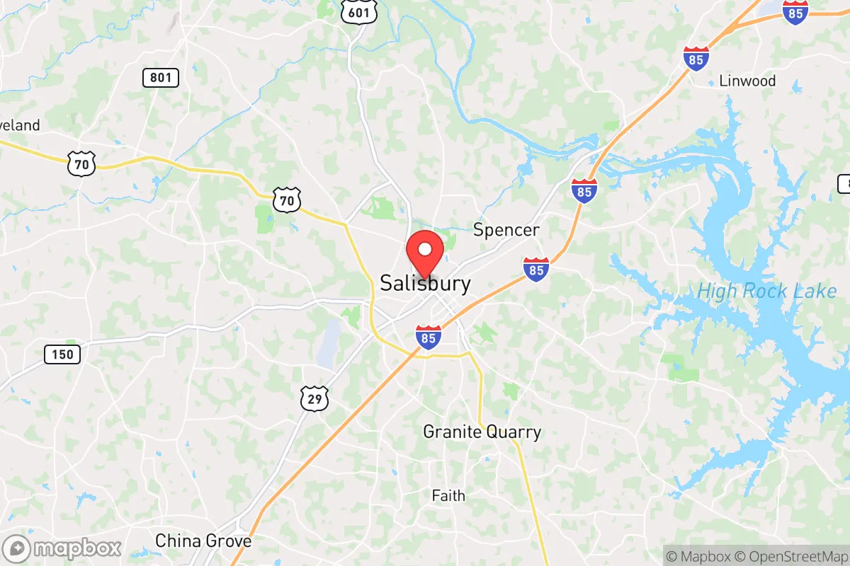
Strategic Assessment of Salisbury, NC
Meaningful friction. Expect exposure to either population pressure, blast zones, or natural disaster risk. Consider buying a retreat property.
What does the Strategic Assessment tell us?
Our Strategic Assessment grades tactical survivability of an area. Major population centers, military targets, fallout zones, natural disasters, and border exposure all drive risk — lower exposure means a more defensible position in a crisis.
This is heavily inspired by Joel Skousen's Strategic Relocation book. Highly recommended you checkout the book ($)What does this tell us?
Our Strategic Assessment grades tactical survivability of an area. Major population centers, military targets, fallout zones, natural disasters, and border exposure all drive risk — lower exposure means a more defensible position in a crisis.
This is heavily inspired by Joel Skousen's Strategic Relocation book. Highly recommended you checkout the book ($)Strategic Pillars

Key Distances
Regional Safe Places
Below is our recommended "safe zones" in North Carolina and the surrounding area based on our strategic heuristics. For most people, it's unrealistic to live in a “safe zone” full-time due to work, family or other personal reasons. They tend to be more rural. However, many of these areas are perfect for second homes and retreat properties that double as a vacation home or even a short-term rental.


Important Note: For informational purposes only. This does not mean nothing bad ever happens in the green zones. Please use common sense. This is based on public data and modeled with AI. We tried to take a conservative approach but mistakes happen. We update this regularly as new information becomes available.
Solar Generator Recommendations
Backup power matters more here than in safer locations. We've picked three solar generators across budgets and capacity tiers — start with the budget unit if you only need a few essentials, or step up if you want to run a fridge and HVAC for days at a time.

Jackery Portable Power Station Explorer 300
Budget OptionPower on the Go: Weighing only 11 lbs, it's convenient to set up and store with book-sized foldable solar panels

BLUETTI Portable Power Station AC180
Designed for both indoor and outdoor scenarios, AC180 is highly capable as it has a robost capacity and continuous output power.

EF ECOFLOW DELTA Pro Ultra Power Station
Upgraded PickEcoFlow DELTA Pro Ultra is a whole-home energy system designed to grow with your family. Integrated with the Smart Home Panel 2, it scales to meet your evolving energy needs — keeping your home powered, intelligent, and secure through every stage of life.
We earn a commission, at no additional cost to you.
Strategic Assessment Analysis
Salisbury, North Carolina, offers a strategic balance of resilience and access that makes it a serious contender for those preparing for civic instability or large-scale disruptions. Located in Rowan County, this city of roughly 35,000 sits at the crossroads of I-85 and US-70, placing it within a 45-minute drive of Charlotte and an hour from Greensboro, yet its character remains distinctly small-town and self-contained. For the prepper or survivalist, Salisbury’s key advantage is its position as a secondary hub—close enough to major resources and medical centers (like Novant Health Rowan Medical Center) but far enough from the immediate blast radius of a high-value target. The area’s historical resilience, rooted in its role as a Confederate supply depot and later a textile manufacturing center, suggests a community accustomed to pulling together when the outside world falters.
Geographic position and natural advantages for long-term security
Salisbury’s geography is a mixed blessing that leans favorable for those thinking in terms of decades, not just next year. The city lies in the Piedmont region, a rolling landscape of hardwood forests and clay soils that offers natural cover and defensible terrain—no flat plains where an approaching threat can be seen from miles away, but also no steep mountains that isolate you from supply routes. The Yadkin River runs just west of town, providing a reliable freshwater source, and the Uwharrie National Forest is a 50-minute drive east, offering a bug-out option with 50,000 acres of public land. The climate is temperate, with four distinct seasons, meaning you can grow food (average 200 frost-free days) but won’t face the extreme heat or cold that stresses off-grid systems. Critically, Salisbury sits outside the major hurricane surge zones of the coast and the earthquake-prone areas of the western mountains, reducing natural disaster risk. The area’s elevation—around 700 feet—keeps it above most floodplains, though low-lying spots near the river can flood during heavy rains. For a relocator, the natural advantages are solid: water, timber, moderate climate, and enough topography to make a perimeter defensible without being impassable.
Risks, exposures, and proximity to fallout-relevant landmarks
No strategic assessment is honest without confronting the downsides, and Salisbury has several that demand attention. The most glaring risk is its proximity to Charlotte, a major financial hub and transportation nexus that would be a high-priority target in any conflict involving infrastructure strikes or EMP attacks. Charlotte Douglas International Airport, a major hub for American Airlines, and the city’s concentration of banking data centers make it a likely first-wave target. Salisbury is 40 miles from Charlotte’s urban core—close enough that a ground burst or high-altitude EMP could disrupt electronics and communications across the region. Additionally, I-85 runs directly through Salisbury, which is a double-edged sword: it’s a supply route but also a funnel for refugees fleeing Charlotte in a crisis. The city itself has no obvious high-value military or government installations, but the nearby Spencer Mountain and the old Salisbury National Guard Armory could become secondary targets. There’s also the issue of the Yadkin River’s water quality—upstream industrial activity and agricultural runoff mean you’ll want a filtration system beyond a basic Berkey. For the prepper, the biggest exposure is human: Rowan County’s population is around 150,000, and in a collapse scenario, the flow of people from Charlotte (metro population 2.7 million) could overwhelm local resources within days. The city’s location on a major interstate is a vulnerability that requires a solid plan for roadblocks or alternative routes.
Practical resilience for a relocator: food, water, energy, and defensibility
For someone serious about self-sufficiency, Salisbury offers a workable foundation but requires deliberate investment. The local food system is robust: Rowan County has over 1,200 farms, with a strong presence of livestock (poultry and cattle) and row crops like soybeans and corn. The Salisbury Farmers Market operates year-round, and there are multiple u-pick orchards within a 20-minute drive (Patterson Farm is a notable one). For water, the Yadkin River is the primary source, but the city’s municipal supply is treated and vulnerable to contamination or shutdown. A well is the gold standard here—the water table is generally high in the Piedmont, and many rural properties already have wells. If you’re buying land, look for parcels with existing well permits or at least 100 feet of depth potential. Energy resilience is middling: Duke Energy provides the grid, which is reliable day-to-day but susceptible to ice storms and the aforementioned EMP risk. Solar is viable—the region gets about 4.5 peak sun hours per day—but you’ll need battery storage for winter months when cloud cover can stretch for days. Natural gas is available in town but not in rural areas; propane tanks are common for backup. Defensibility varies by exact location. In-town properties near the historic district offer walkability but limited perimeter control. The best bets are the rural fringes—south toward Rockwell or west toward Cleveland—where acreage with tree lines and long driveways provide natural chokepoints. The local gun culture is strong (Rowan County is a Second Amendment sanctuary), and the sheriff’s office is generally pro-owner, which matters for community defense. For daily life, the city has a Walmart, a Lowe’s, and several hardware stores, but for serious prepping supplies (bulk grains, ammunition, medical gear), you’ll need to drive to Charlotte or order online. The biggest practical gap is medical: the local hospital is adequate for routine care, but trauma or complex surgery means a 45-minute ambulance ride to Charlotte. Stock your own trauma kit and consider training with a local CERT team.
The overall strategic picture for Salisbury is one of calculated risk. It is not a remote bunker location—it sits on a major corridor near a primary target city, which is a genuine liability in a full-scale collapse. But for the relocator who wants to stay connected to infrastructure while building a self-sufficient base, it offers a rare combination: affordable land (median home price around $275,000, well below national average), a conservative community that values preparedness, and natural resources that can sustain a small group indefinitely. The key is to treat Salisbury as a forward operating base, not a final redoubt. Have a bug-out vehicle prepped for the Uwharrie or the mountains, maintain a low profile in town, and build relationships with neighbors who share your mindset. The city’s history of weathering economic shifts—from the decline of textiles to the rise of logistics—suggests a population that adapts rather than panics. That cultural resilience, more than any single geographic feature, is what makes Salisbury worth a serious look for anyone planning for an uncertain future.
* Values derived from national, state, county, city and local statistics and may differ in a specific area. Last updated: 2026-05-03T20:27:02.000Z
Narrative content on this page is AI-generated and may contain mistakes. Verify any details that matter before acting on them.
ReloMaps may earn a commission from affiliate links at no extra cost to you.