Photo: Wikipedia
Strategic Assessment of Sand Springs, OK
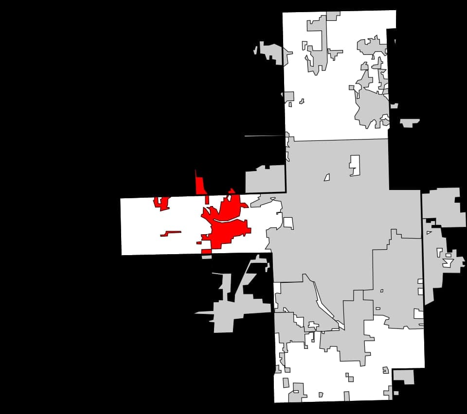
Multiple tactical vulnerabilities. Population density, target proximity, or disaster risk are likely compounding. A retreat property and exit planning is required.
What does the Strategic Assessment tell us?
Our Strategic Assessment grades tactical survivability of an area. Major population centers, military targets, fallout zones, natural disasters, and border exposure all drive risk — lower exposure means a more defensible position in a crisis.
This is heavily inspired by Joel Skousen's Strategic Relocation book. Highly recommended you checkout the book ($)What does this tell us?
Our Strategic Assessment grades tactical survivability of an area. Major population centers, military targets, fallout zones, natural disasters, and border exposure all drive risk — lower exposure means a more defensible position in a crisis.
This is heavily inspired by Joel Skousen's Strategic Relocation book. Highly recommended you checkout the book ($)Strategic Pillars

Key Distances
Regional Safe Places
Below is our recommended "safe zones" in Oklahoma and the surrounding area based on our strategic heuristics. For most people, it's unrealistic to live in a “safe zone” full-time due to work, family or other personal reasons. They tend to be more rural. However, many of these areas are perfect for second homes and retreat properties that double as a vacation home or even a short-term rental.
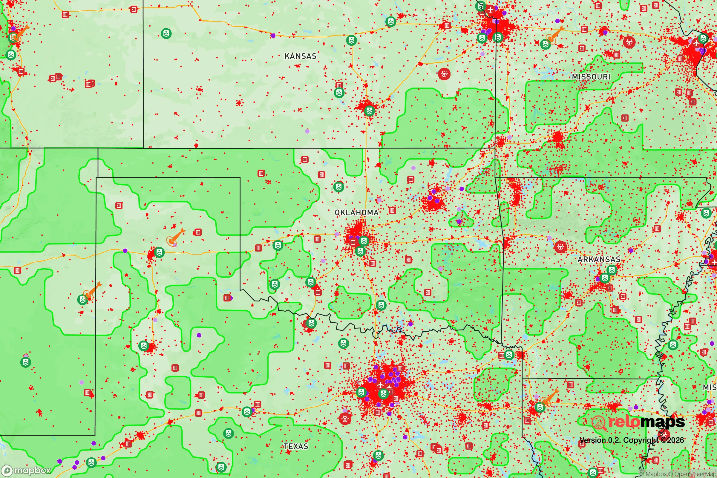
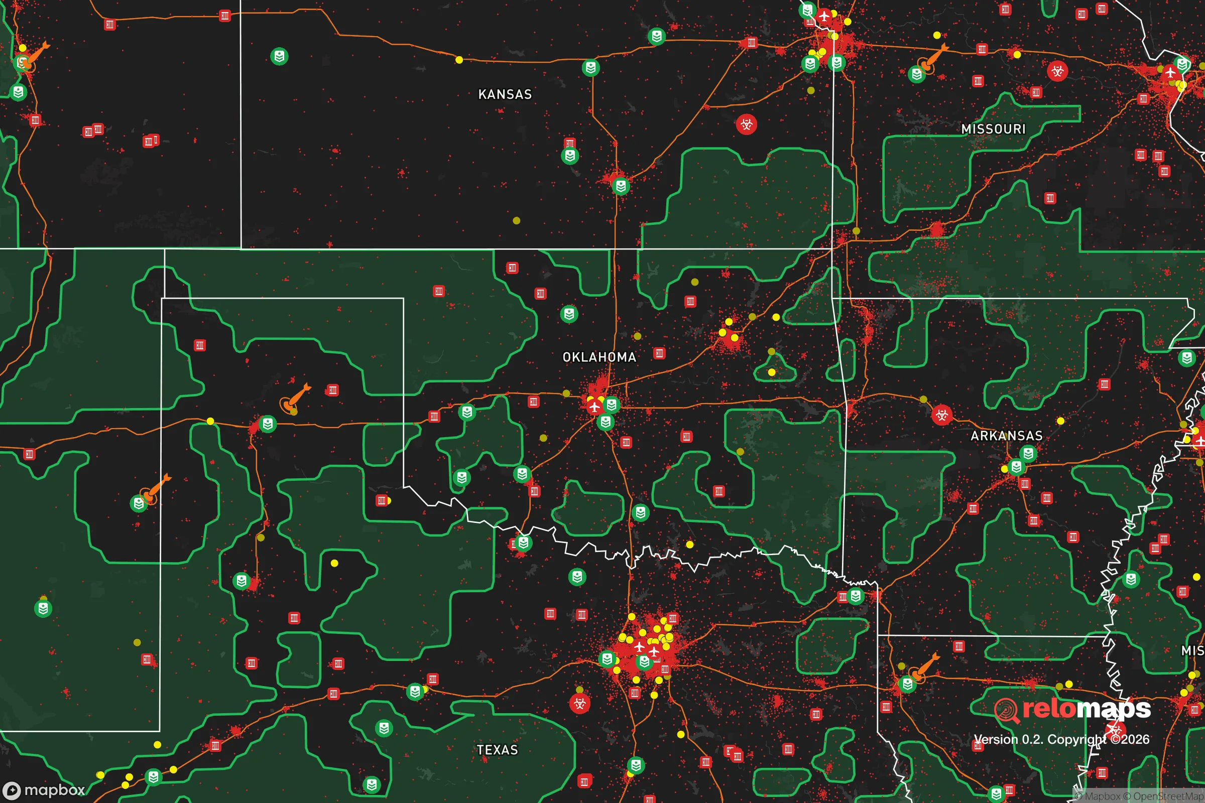
Important Note: For informational purposes only. This does not mean nothing bad ever happens in the green zones. Please use common sense. This is based on public data and modeled with AI. We tried to take a conservative approach but mistakes happen. We update this regularly as new information becomes available.
Solar Generator Recommendations
Backup power matters more here than in safer locations. We've picked three solar generators across budgets and capacity tiers — start with the budget unit if you only need a few essentials, or step up if you want to run a fridge and HVAC for days at a time.

Jackery Portable Power Station Explorer 300
Budget OptionPower on the Go: Weighing only 11 lbs, it's convenient to set up and store with book-sized foldable solar panels

BLUETTI Portable Power Station AC180
Designed for both indoor and outdoor scenarios, AC180 is highly capable as it has a robost capacity and continuous output power.

EF ECOFLOW DELTA Pro Ultra Power Station
Upgraded PickEcoFlow DELTA Pro Ultra is a whole-home energy system designed to grow with your family. Integrated with the Smart Home Panel 2, it scales to meet your evolving energy needs — keeping your home powered, intelligent, and secure through every stage of life.
We earn a commission, at no additional cost to you.
Strategic Assessment Analysis
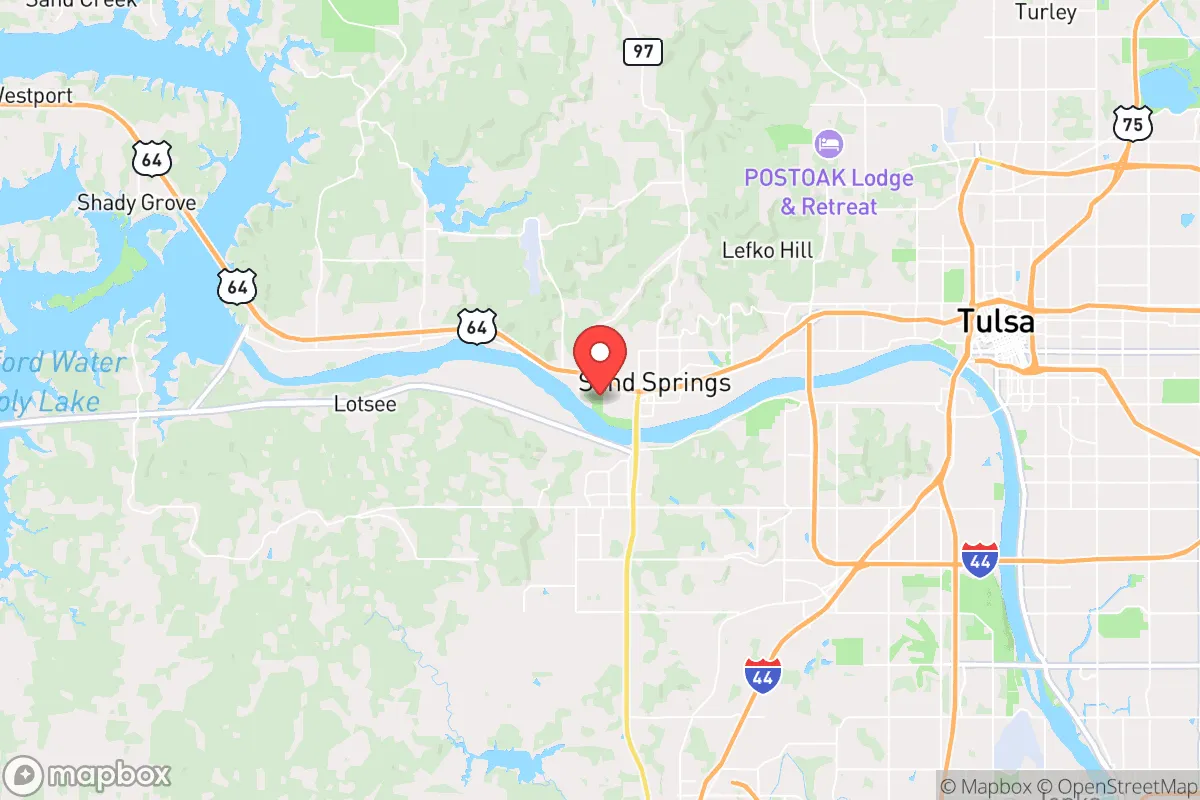
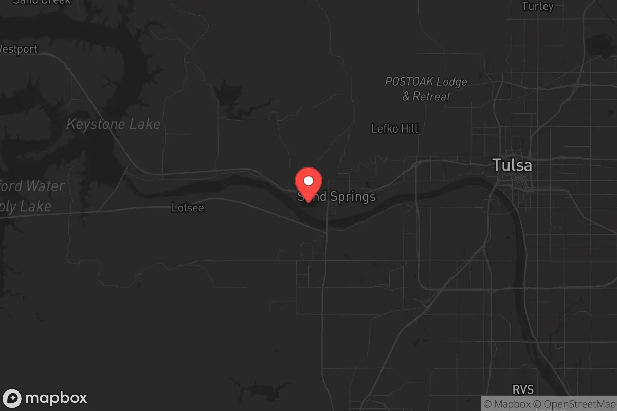
Sand Springs, Oklahoma, sits in a strategic pocket that offers genuine resilience advantages for those thinking long-term about security and self-sufficiency. Positioned just west of Tulsa along the Arkansas River, this community of roughly 20,000 provides a buffer from the immediate chaos of a major metro area while still allowing access to its resources when needed. The key here is that Sand Springs isn't isolated in a way that cuts you off from supply chains or medical care, but it's far enough removed that you're not living in the blast radius of a high-value target. For a relocator with a prepper mindset, the balance between proximity and separation is the first thing to get right, and Sand Springs delivers on that front.
Geographic position and natural advantages for long-term security
Sand Springs occupies a position along the Arkansas River floodplain, with the Keystone Ancient Forest and the surrounding Osage Hills providing natural barriers to the east and north. This isn't flat, exposed prairie — the terrain offers folds, tree cover, and elevation changes that create natural defensibility and concealment. The river itself is a double-edged asset: it provides a reliable water source and a potential transportation corridor, but it also means flood risk in low-lying areas. The real advantage is the Keystone Lake system just upstream, which not only regulates water flow but also serves as a massive freshwater reservoir. For anyone serious about water security, having a major lake within 15 minutes that's fed by the Arkansas River and controlled by the Tulsa District of the US Army Corps of Engineers is a significant plus. The area sits in Tornado Alley, which is a genuine hazard, but the geography also means you're not in a seismic zone, not near active fault lines, and not in a coastal hurricane path. The natural risk profile is manageable with proper construction and planning — unlike the Gulf Coast or California, where the threats are baked into the landscape.
Risks, exposures, and proximity to fallout-relevant landmarks
Let's be direct: Sand Springs is not a fallout-free zone. The primary concern is its proximity to Tulsa, which is a regional transportation and energy hub. Tulsa International Airport, the Port of Catoosa (a major inland port connected to the Mississippi River system), and several oil refineries and chemical plants along the Arkansas River corridor are all within 20-30 miles. In a major conflict or terrorist scenario, these are high-probability targets. The HollyFrontier Tulsa Refinery in West Tulsa is roughly 10 miles east of Sand Springs, and the Phillips 66 refinery in nearby Ponca City is about 60 miles north. A strike on either would create a significant plume depending on wind direction. Additionally, the Interstate 44 corridor runs through Sand Springs, connecting Tulsa to Oklahoma City — this is a major logistical artery that would be a chokepoint in any evacuation or supply disruption scenario. The Keystone Dam upstream is a potential target for sabotage or attack; a breach would inundate large portions of Sand Springs and Tulsa. On the positive side, there are no nuclear power plants within 100 miles, no major military bases in the immediate vicinity (Tinker Air Force Base is 100 miles southwest), and no known underground missile silos in the area. The risk profile is moderate — not ideal, but far better than living in the suburbs of Washington D.C., New York, or Los Angeles.
Practical resilience for a relocator: food, water, energy, and defensibility
For someone looking to set up a resilient homestead or retreat, Sand Springs offers a workable foundation. Water is the first priority, and the Arkansas River and Keystone Lake provide abundant surface water. However, the river is subject to industrial runoff and agricultural pollution, so any direct use requires filtration or treatment. The municipal water supply comes from Lake Keystone and is treated, but in a grid-down scenario, you'll want a well or a rainwater catchment system. The water table in the area is generally accessible at 50-100 feet, so drilling a well is feasible on most rural properties. Food production is viable: the growing season runs from April to October, with hot summers and mild winters. The soil is a mix of sandy loam and clay, which requires amendment but can support gardens, orchards, and small livestock. The Osage Hills to the north offer hunting opportunities for deer, turkey, and small game. Energy is a mixed bag. Oklahoma is a wind energy leader, but that doesn't help you in a grid-down scenario. Solar is viable — the area gets about 230 sunny days per year, which is above the national average. However, the frequent severe storms and hail mean any solar installation needs to be robust and protected. Wood heating is practical given the forested areas, but you'll need to secure a reliable source of firewood. Defensibility is where Sand Springs shines relative to urban areas. The terrain provides natural chokepoints and observation points. The community is small enough that you can know your neighbors and build a mutual aid network. The local law enforcement presence is adequate, but in a prolonged crisis, you'll be relying on yourself and your immediate community. The Sand Springs Police Department and Tulsa County Sheriff's Office are professional, but they're not a substitute for personal preparedness.
The overall strategic picture for Sand Springs is one of calculated trade-offs. You're not getting a remote mountain redoubt or a self-sufficient island. What you are getting is a defensible, resource-rich location that's close enough to a major city to access its hospitals, supply chains, and transportation links, but far enough away to avoid the worst of urban collapse. The risks from industrial targets and tornadoes are real but manageable with proper planning. For a conservative-leaning relocator who values community, self-reliance, and a lower cost of living, Sand Springs offers a solid base of operations. The key is to treat it as a starting point — secure your water source, harden your home against storms, build relationships with like-minded neighbors, and keep a low profile. In a world where the threats are multiplying, Sand Springs gives you a fighting chance without requiring you to go completely off-grid. It's not a perfect solution, but in the current strategic environment, perfect doesn't exist. This is a place where you can build a sustainable, resilient life if you're willing to put in the work.
* Values derived from national, state, county, city and local statistics and may differ in a specific area. Last updated: 2026-04-25T13:53:20.000Z
Narrative content on this page is AI-generated and may contain mistakes. Verify any details that matter before acting on them.
ReloMaps may earn a commission from affiliate links at no extra cost to you.