Strategic Assessment of Seabrook Island, SC
Meaningful friction. Expect exposure to either population pressure, blast zones, or natural disaster risk. Consider buying a retreat property.
What does the Strategic Assessment tell us?
Our Strategic Assessment grades tactical survivability of an area. Major population centers, military targets, fallout zones, natural disasters, and border exposure all drive risk — lower exposure means a more defensible position in a crisis.
This is heavily inspired by Joel Skousen's Strategic Relocation book. Highly recommended you checkout the book ($)What does this tell us?
Our Strategic Assessment grades tactical survivability of an area. Major population centers, military targets, fallout zones, natural disasters, and border exposure all drive risk — lower exposure means a more defensible position in a crisis.
This is heavily inspired by Joel Skousen's Strategic Relocation book. Highly recommended you checkout the book ($)Strategic Pillars

Key Distances
Regional Safe Places
Below is our recommended "safe zones" in South Carolina and the surrounding area based on our strategic heuristics. For most people, it's unrealistic to live in a “safe zone” full-time due to work, family or other personal reasons. They tend to be more rural. However, many of these areas are perfect for second homes and retreat properties that double as a vacation home or even a short-term rental.


Important Note: For informational purposes only. This does not mean nothing bad ever happens in the green zones. Please use common sense. This is based on public data and modeled with AI. We tried to take a conservative approach but mistakes happen. We update this regularly as new information becomes available.
Solar Generator Recommendations
Backup power matters more here than in safer locations. We've picked three solar generators across budgets and capacity tiers — start with the budget unit if you only need a few essentials, or step up if you want to run a fridge and HVAC for days at a time.

Jackery Portable Power Station Explorer 300
Budget OptionPower on the Go: Weighing only 11 lbs, it's convenient to set up and store with book-sized foldable solar panels

BLUETTI Portable Power Station AC180
Designed for both indoor and outdoor scenarios, AC180 is highly capable as it has a robost capacity and continuous output power.

EF ECOFLOW DELTA Pro Ultra Power Station
Upgraded PickEcoFlow DELTA Pro Ultra is a whole-home energy system designed to grow with your family. Integrated with the Smart Home Panel 2, it scales to meet your evolving energy needs — keeping your home powered, intelligent, and secure through every stage of life.
We earn a commission, at no additional cost to you.
Strategic Assessment Analysis
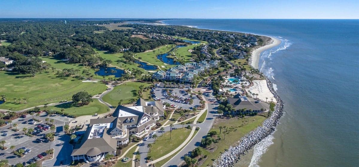
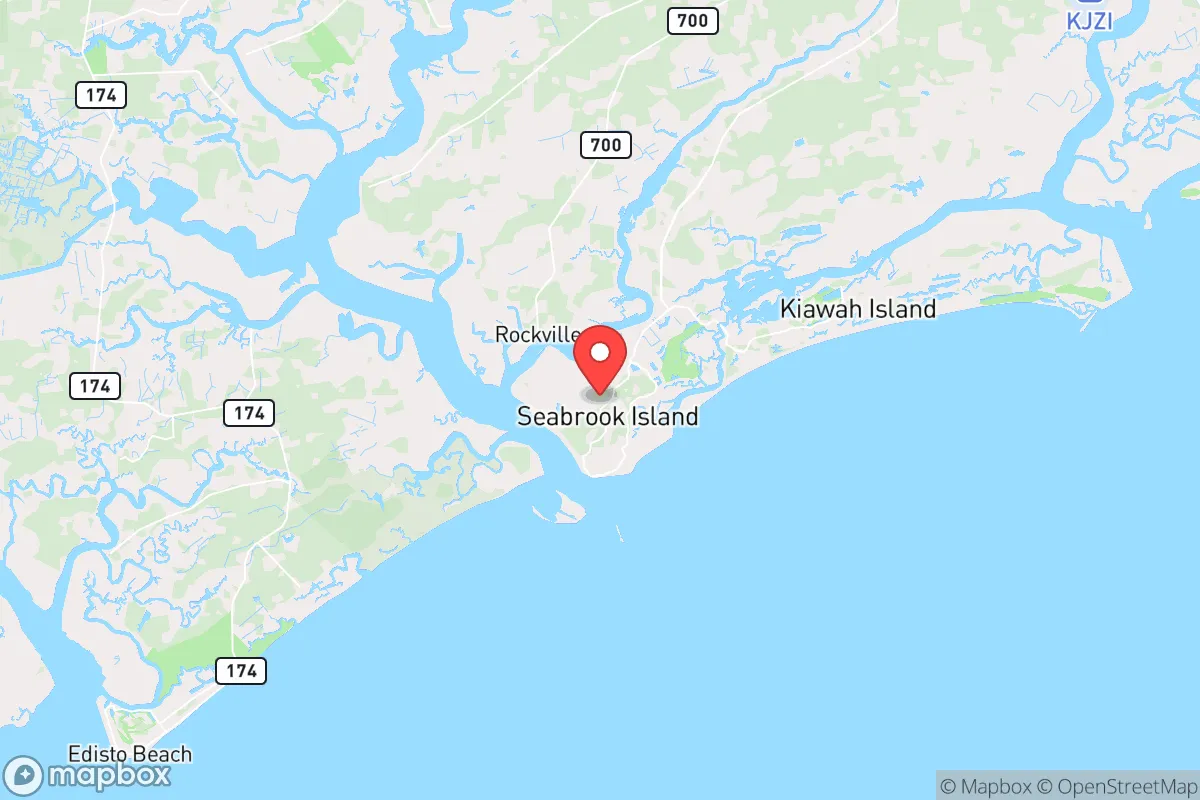
Seabrook Island, South Carolina, offers a strategic relocation option for those prioritizing physical separation from urban centers while maintaining access to critical infrastructure. Located roughly 25 miles southwest of Charleston, this barrier island community provides a natural buffer against the social and logistical pressures that accompany major metropolitan areas. Its position along the Atlantic coast, combined with limited access points and a low population density, creates a defensible environment that appeals to individuals and families planning for long-term resilience in an uncertain national landscape.
Geographic position and natural advantages for long-term security
Seabrook Island sits on a 2,200-acre barrier island accessible only via a single bridge from Johns Island, which itself is connected to the mainland by two bridges. This chokepoint geography is a double-edged sword but leans heavily in favor of those seeking isolation. In a scenario involving civil unrest or mass displacement from Charleston, the limited egress routes can be monitored and controlled more easily than a sprawling suburban grid. The island’s interior is dominated by maritime forests, salt marshes, and tidal creeks, providing natural cover and resources for those with basic bushcraft skills. The surrounding ACE Basin—one of the largest undeveloped estuaries on the East Coast—offers a rich ecosystem for fishing, crabbing, and foraging, reducing reliance on external supply chains. The subtropical climate supports year-round growing seasons for vegetables and herbs, and the average annual rainfall of 48 inches ensures freshwater availability through wells and rainwater catchment. For a relocator, these factors translate into a lower dependency on grid-tied systems compared to inland suburbs or urban cores.
Risks, exposures, and proximity to fallout-relevant landmarks
No location is without vulnerabilities, and Seabrook Island’s coastal position introduces specific threats that must be weighed. The most immediate is hurricane exposure: the island lies in the direct path of Atlantic storm tracks, with the 2023 hurricane season producing near-misses that tested evacuation protocols. Storm surge risk is significant, particularly for properties below 15 feet elevation, and the single road out can become gridlocked during mandatory evacuations—a scenario that played out during Hurricane Matthew in 2016. Beyond weather, the proximity to Charleston (population ~150,000 city proper, ~800,000 metro) introduces a different class of risk. Charleston is home to the Port of Charleston, a major military logistics hub (Joint Base Charleston), and the Naval Weapons Station Charleston, which stores conventional munitions and supports nuclear submarine operations. In a national crisis—whether economic collapse, pandemic resurgence, or geopolitical conflict—these assets become potential targets for sabotage or civil unrest. The 2021 Colonial Pipeline cyberattack demonstrated how infrastructure disruptions cascade; a similar event affecting Charleston’s port or rail lines would directly impact Seabrook’s supply of fuel, food, and medical goods. Additionally, the island’s reliance on the Stono River and Kiawah River for freshwater drainage means contamination from upstream industrial sites (including the former Naval base) could compromise local water sources in a prolonged event.
Practical resilience for a relocator: food, water, energy, and defensibility
For a prepper-minded individual or family, Seabrook Island’s practical resilience hinges on three pillars: self-sufficiency, community cohesion, and logistical independence. Food security is strong due to the marine environment—oysters, shrimp, and fish are abundant in the surrounding creeks and offshore waters, and the island’s homeowners’ association allows limited gardening on private lots. However, the soil is sandy and nutrient-poor, requiring raised beds or imported topsoil for serious vegetable production. Water is the more critical concern: the island relies on a municipal water system sourced from the Edisto River aquifer, which is vulnerable to saltwater intrusion during droughts or storm surges. Installing a private well (depths of 200-400 feet are typical) and a rainwater catchment system with first-flush diverters is a wise investment. Energy independence is achievable but requires upfront capital: solar panels paired with battery storage (e.g., Tesla Powerwall or Generac systems) are common among year-round residents, and the island’s average of 215 sunny days per year makes solar viable. Propane backup generators are also widespread, with local suppliers like Blossman Gas offering delivery. Defensibility is the island’s strongest card: the single bridge across the Kiawah River creates a natural checkpoint, and the 24/7 security patrols by the Seabrook Island Property Owners’ Association provide a layer of deterrence against casual trespassers. In a worst-case scenario, the marshland to the north and east forms a moat-like barrier, while the ocean to the south limits approach vectors. That said, the island’s 2,500 permanent residents (swelling to 5,000+ in season) mean that community cooperation is essential—stockpiling supplies and establishing mutual-aid networks with neighbors is not optional but necessary.
The overall strategic picture for Seabrook Island is one of calculated trade-offs. It offers genuine advantages for those prioritizing isolation, natural resources, and a small, tight-knit community—qualities that become invaluable during societal disruptions. The hurricane risk is real but manageable with proper construction (elevated homes, impact-resistant windows) and a pre-planned evacuation route inland to family or friends in Columbia or Greenville. The proximity to Charleston’s critical infrastructure is a double-edged sword: it provides access to medical care and supplies in normal times but becomes a liability during a crisis. For a conservative-leaning relocator who values self-reliance, low crime rates (Seabrook’s violent crime rate is roughly 0.2 per 1,000 residents, compared to the national average of 4.0), and a community that largely shares similar values, this island represents a viable long-term base. The key is to treat it as a retreat, not a fortress—invest in redundancy, build local relationships, and always have a secondary plan for the hurricane season. In a world where urban centers are increasingly fragile, Seabrook Island’s quiet separation is its greatest asset.
* Values derived from national, state, county, city and local statistics and may differ in a specific area. Last updated: 2026-04-23T03:28:37.000Z
Narrative content on this page is AI-generated and may contain mistakes. Verify any details that matter before acting on them.
ReloMaps may earn a commission from affiliate links at no extra cost to you.