Photo: Wikipedia
Strategic Assessment of Sedalia, MO
Workable tactical position. Some exposure to population density or targets, but generally defensible in a crisis.
What does the Strategic Assessment tell us?
Our Strategic Assessment grades tactical survivability of an area. Major population centers, military targets, fallout zones, natural disasters, and border exposure all drive risk — lower exposure means a more defensible position in a crisis.
This is heavily inspired by Joel Skousen's Strategic Relocation book. Highly recommended you checkout the book ($)What does this tell us?
Our Strategic Assessment grades tactical survivability of an area. Major population centers, military targets, fallout zones, natural disasters, and border exposure all drive risk — lower exposure means a more defensible position in a crisis.
This is heavily inspired by Joel Skousen's Strategic Relocation book. Highly recommended you checkout the book ($)Strategic Pillars

Key Distances
Regional Safe Places
Below is our recommended "safe zones" in Missouri and the surrounding area based on our strategic heuristics. For most people, it's unrealistic to live in a “safe zone” full-time due to work, family or other personal reasons. They tend to be more rural. However, many of these areas are perfect for second homes and retreat properties that double as a vacation home or even a short-term rental.


Important Note: For informational purposes only. This does not mean nothing bad ever happens in the green zones. Please use common sense. This is based on public data and modeled with AI. We tried to take a conservative approach but mistakes happen. We update this regularly as new information becomes available.
Solar Generator Recommendations
Backup power matters more here than in safer locations. We've picked three solar generators across budgets and capacity tiers — start with the budget unit if you only need a few essentials, or step up if you want to run a fridge and HVAC for days at a time.

Jackery Portable Power Station Explorer 300
Budget OptionPower on the Go: Weighing only 11 lbs, it's convenient to set up and store with book-sized foldable solar panels

BLUETTI Portable Power Station AC180
Designed for both indoor and outdoor scenarios, AC180 is highly capable as it has a robost capacity and continuous output power.

EF ECOFLOW DELTA Pro Ultra Power Station
Upgraded PickEcoFlow DELTA Pro Ultra is a whole-home energy system designed to grow with your family. Integrated with the Smart Home Panel 2, it scales to meet your evolving energy needs — keeping your home powered, intelligent, and secure through every stage of life.
We earn a commission, at no additional cost to you.
Strategic Assessment Analysis
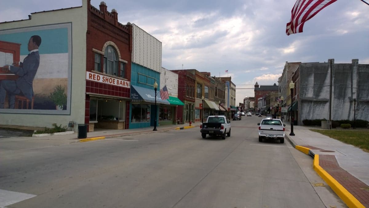
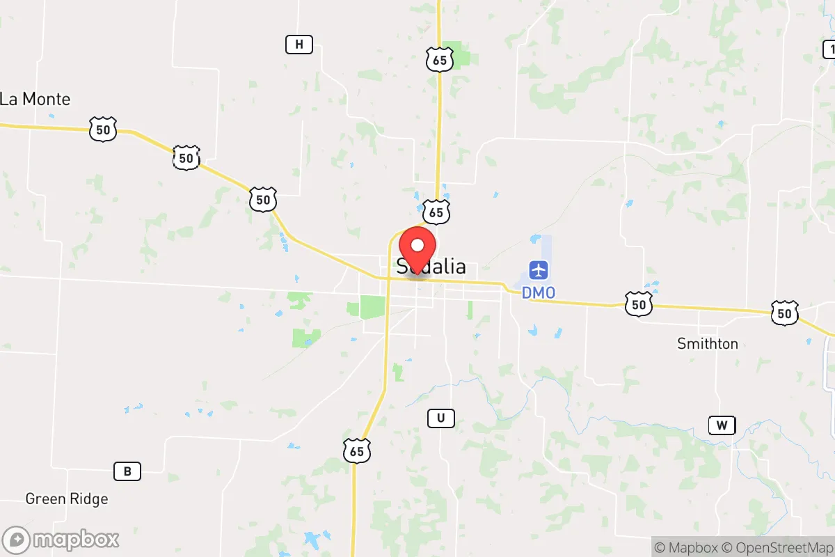
Sedalia, Missouri, sits in a strategic sweet spot that resilience-minded relocators should take seriously: far enough from major population centers to avoid the worst of cascading collapse scenarios, yet close enough to access critical supplies and medical infrastructure when things are stable. With a population hovering around 22,000 and Pettis County trending conservative, this is the kind of place where community ties still mean something and local governance hasn't been completely hollowed out by distant bureaucrats. The town's history as a railroad hub and its position along U.S. Highway 65 and Interstate 70 give it a logistical backbone that matters when supply chains fracture, and the surrounding agricultural land offers a buffer that suburban sprawl hasn't yet consumed.
Geographic position and natural advantages for long-term stability
Sedalia's location in west-central Missouri places it roughly 90 miles southeast of Kansas City and 170 miles west of St. Louis — close enough to reach those cities for specialized medical care or major supply runs in normal times, but far enough that you won't be caught in the immediate blast radius of a major event or the secondary chaos of a panicked urban exodus. The area sits on the northern edge of the Ozark Plateau, which means rolling hills, decent drainage, and fewer floodplain risks than communities along the Missouri River. The climate is continental, with hot summers and cold winters, but the growing season runs about 190 days — long enough for serious food production. The surrounding Pettis County is dominated by row crops (corn, soybeans, wheat) and livestock operations, which means local food sources aren't theoretical; they're already in production. Water availability is a genuine advantage here: the Lamine River runs just east of town, and the groundwater table in the region is reliable for wells, unlike parts of the High Plains where the Ogallala Aquifer is in terminal decline. For a relocator thinking about long-term sustainability, Sedalia offers a natural resource base that doesn't require heroic engineering to access.
Risks, exposures, and proximity to fallout-relevant landmarks
No location is risk-free, and Sedalia has exposures that a serious prepper needs to account for. The most obvious concern is Whiteman Air Force Base, home to the B-2 Spirit stealth bomber fleet, located just 25 miles southwest near Knob Noster. In a major conflict scenario, Whiteman is a high-value target — and while Sedalia is outside the likely ground-zero blast zone for a nuclear strike, fallout patterns depend entirely on wind direction. A southwesterly wind would carry contamination directly over Pettis County. That's not a dealbreaker, but it means you need a fallout shelter plan, not just a basement. Additionally, Interstate 70 runs just north of town, and while that's an advantage for logistics, it's also a liability: in a crisis, I-70 becomes a choke point for refugees fleeing Kansas City or St. Louis. Sedalia could see a surge of transient populations during a collapse event, which strains local resources and raises the risk of civil unrest. The town itself has a modest but present crime rate — property crime is higher than the national average, and while violent crime is lower than in major metros, it's not negligible. For a relocator, this means defensibility planning isn't optional; it's part of the package.
Practical resilience for a relocator: food, water, energy, and defensibility
For someone serious about self-sufficiency, Sedalia offers a workable baseline. The agricultural surrounding means you can source seeds, livestock, and equipment locally — the Pettis County Extension office and local farm co-ops are functional resources, not theoretical ones. Water is the critical variable, and the region's groundwater is generally good, though you'll want to test for agricultural runoff (nitrates from fertilizer are a real concern). Drilling a well in Pettis County typically runs $5,000–$10,000 depending on depth, and most residential lots can support one. Energy resilience is mixed: the local grid is served by Ameren Missouri, which has average reliability for the region, but ice storms in winter and thunderstorms in summer cause periodic outages. Solar is viable — the area gets about 200 sunny days per year — but you'll want battery storage and a backup generator for the cloudy stretches. Natural gas is available in town, but rural properties often rely on propane. Defensibility is where Sedalia shines compared to suburban sprawl: the town has a clear perimeter, with open agricultural land providing visibility and natural chokepoints on the roads leading in. A well-chosen property on the outskirts gives you standoff distance and multiple egress routes. The local law enforcement presence is adequate for normal times, but in a prolonged crisis, you're largely on your own — which is exactly the mindset you should bring.
The overall strategic picture for a conservative relocator
Sedalia isn't a bug-out location for the short-term collapse crowd; it's a long-term repositioning play for someone who sees the writing on the wall and wants to be somewhere that can absorb shocks without breaking. The conservative lean of Pettis County — Trump won it by 38 points in 2020 — means local institutions (schools, sheriff's office, county commission) are less likely to adopt the kind of top-down mandates that caused so much friction in blue areas during recent crises. The cost of living is roughly 20% below the national average, and housing is still affordable: a decent three-bedroom home on a few acres can be found for under $250,000. The trade-offs are real: you're not near world-class medical care, cultural amenities are limited, and the job market outside of manufacturing (Tyson Foods, Maxima, and a few industrial plants) is thin. But if your priority is strategic resilience — a place where you can grow food, access clean water, maintain a low profile, and ride out the turbulence that's coming — Sedalia deserves a serious look. It's not a fortress, but it's a foundation. And in the world we're heading into, that might be the best you can ask for.
* Values derived from national, state, county, city and local statistics and may differ in a specific area. Last updated: 2026-04-29T19:18:09.000Z
Narrative content on this page is AI-generated and may contain mistakes. Verify any details that matter before acting on them.
ReloMaps may earn a commission from affiliate links at no extra cost to you.