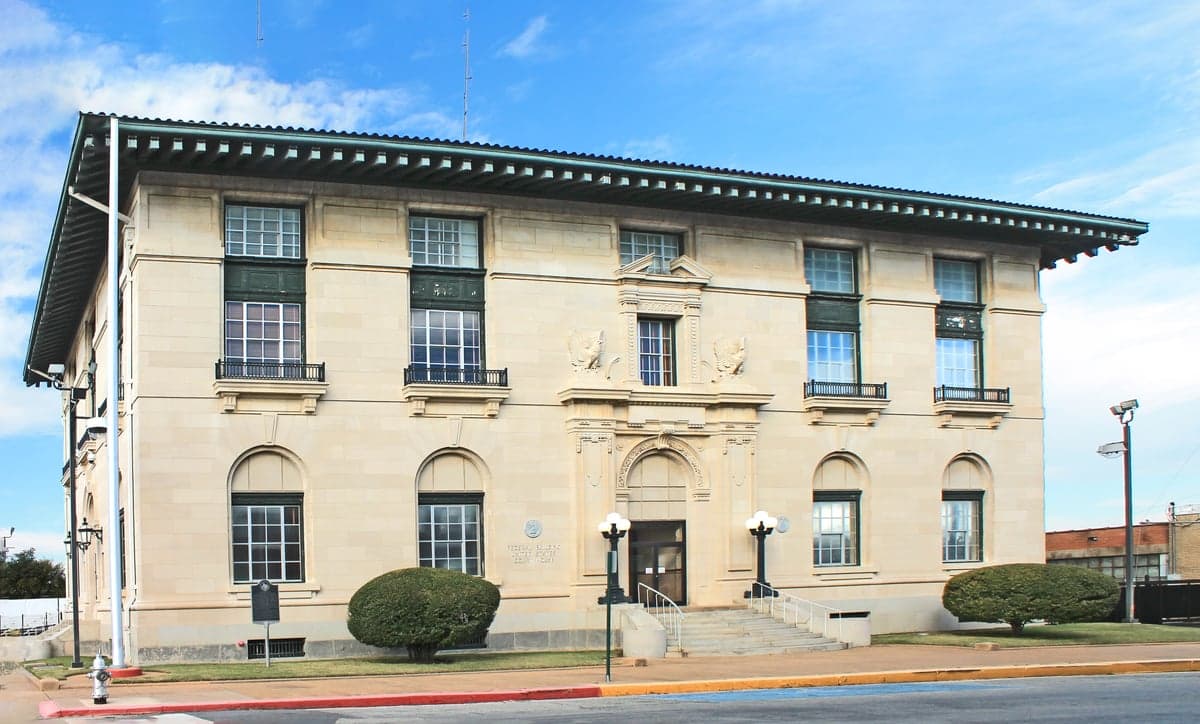
Photo: Wikipedia
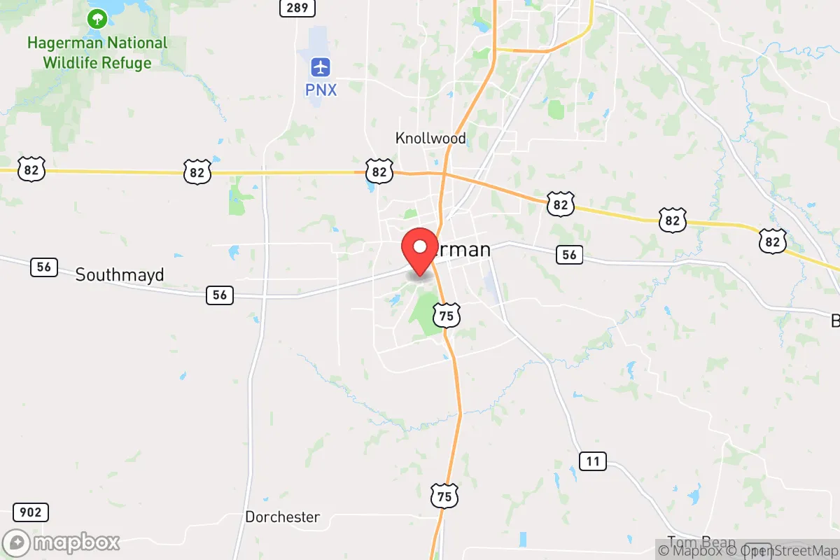
Strategic Assessment of Sherman, TX
Meaningful friction. Expect exposure to either population pressure, blast zones, or natural disaster risk. Consider buying a retreat property.
What does the Strategic Assessment tell us?
Our Strategic Assessment grades tactical survivability of an area. Major population centers, military targets, fallout zones, natural disasters, and border exposure all drive risk — lower exposure means a more defensible position in a crisis.
This is heavily inspired by Joel Skousen's Strategic Relocation book. Highly recommended you checkout the book ($)What does this tell us?
Our Strategic Assessment grades tactical survivability of an area. Major population centers, military targets, fallout zones, natural disasters, and border exposure all drive risk — lower exposure means a more defensible position in a crisis.
This is heavily inspired by Joel Skousen's Strategic Relocation book. Highly recommended you checkout the book ($)Strategic Pillars

Key Distances
Regional Safe Places
Below is our recommended "safe zones" in Texas and the surrounding area based on our strategic heuristics. For most people, it's unrealistic to live in a “safe zone” full-time due to work, family or other personal reasons. They tend to be more rural. However, many of these areas are perfect for second homes and retreat properties that double as a vacation home or even a short-term rental.


Important Note: For informational purposes only. This does not mean nothing bad ever happens in the green zones. Please use common sense. This is based on public data and modeled with AI. We tried to take a conservative approach but mistakes happen. We update this regularly as new information becomes available.
Solar Generator Recommendations
Backup power matters more here than in safer locations. We've picked three solar generators across budgets and capacity tiers — start with the budget unit if you only need a few essentials, or step up if you want to run a fridge and HVAC for days at a time.

Jackery Portable Power Station Explorer 300
Budget OptionPower on the Go: Weighing only 11 lbs, it's convenient to set up and store with book-sized foldable solar panels

BLUETTI Portable Power Station AC180
Designed for both indoor and outdoor scenarios, AC180 is highly capable as it has a robost capacity and continuous output power.

EF ECOFLOW DELTA Pro Ultra Power Station
Upgraded PickEcoFlow DELTA Pro Ultra is a whole-home energy system designed to grow with your family. Integrated with the Smart Home Panel 2, it scales to meet your evolving energy needs — keeping your home powered, intelligent, and secure through every stage of life.
We earn a commission, at no additional cost to you.
Strategic Assessment Analysis
Sherman, Texas, sits in a position that demands serious attention from anyone thinking about long-term strategic relocation. It’s not a bunker, but it’s not a bullseye either—and that’s the point. Located roughly 60 miles north of Dallas and 10 miles south of the Oklahoma border, Sherman offers a blend of industrial resilience and rural buffer that makes it a credible option for those who want to be prepared without going off-grid entirely. The area has seen steady population growth and infrastructure investment, but it still retains enough distance from major metropolitan chaos to matter in a crisis.
Geographic position and natural advantages for long-term security
Sherman’s location is its strongest card. It sits on the Blackland Prairie, a region with deep, fertile soil that supports agriculture—a critical asset if supply chains falter. The city is part of Grayson County, which is bisected by the Red River to the north, providing a natural geographic boundary that could slow movement from the north in a collapse scenario. To the south and east, the land opens into the rolling hills and woodlands of the Cross Timbers region, offering cover and resources for those who know how to use them. The area is not prone to hurricanes, earthquakes, or wildfires in the way coastal or mountain regions are. Tornadoes are a real threat—Grayson County sits in the heart of Tornado Alley—but that risk is manageable with a proper storm shelter and situational awareness. The climate is temperate, with four distinct seasons, which means you can grow food, store water, and maintain equipment without extreme weather destroying your plans. The elevation is modest, around 750 feet, so flooding is limited to low-lying areas near creeks and the Red River. For a relocator, the natural advantages here are about sustainability, not spectacle.
Risks, exposures, and proximity to fallout-relevant landmarks
No strategic assessment is honest without naming the threats. Sherman’s biggest vulnerability is its proximity to the Dallas-Fort Worth metroplex, a population center of over 7 million people. In a mass casualty event, civil unrest, or supply chain collapse, that density becomes a liability. Refugees from the city would likely flow north along US-75 and TX-289, both of which run directly through Sherman. The city itself has a population of about 45,000, but the county is over 130,000—enough people to create competition for resources but not so many that you’re invisible. There are also industrial targets within a 50-mile radius: the Sherman-Denison area has a concentration of manufacturing, including a large Texas Instruments semiconductor plant, a Tyson Foods processing facility, and multiple chemical storage sites along the rail lines. A major accident or targeted disruption at any of these could create localized contamination or supply shocks. On the military side, the nearest major installation is Fort Sill in Oklahoma, about 90 miles northwest, and the Red River Army Depot is about 40 miles east near Texarkana. Neither is a primary nuclear target, but both are strategic assets that could draw attention in a conflict. Sherman itself is not a primary target for a first strike, but it sits within the fallout shadow of potential strikes on Dallas or the DFW airport. Prevailing winds from the south would carry fallout northward, putting Sherman in a moderate-risk zone. For a prepper, this means having a plan for shelter-in-place with HEPA filtration and at least two weeks of supplies is non-negotiable.
Practical resilience for a relocator: food, water, energy, and defensibility
For someone serious about self-reliance, Sherman offers a workable baseline. Water is the first concern: the city draws from Lake Texoma, a massive reservoir on the Red River that also supplies water to Dallas and Oklahoma. In a prolonged drought or contamination event, that shared dependency could become a problem. However, the lake is large enough (89,000 acres) that it would take a major event to drain it. Private wells are common in the rural areas outside city limits, and the water table in Grayson County is generally reliable at depths of 100-300 feet. Rainwater catchment is also viable, with annual precipitation around 40 inches. Food production is realistic: the growing season runs from April to October, and the soil supports corn, beans, squash, and livestock forage. Local farmers’ markets and co-ops exist, but they’re not robust enough to replace supply chains in a crisis—you’d need your own garden and seed stock. Energy is a mixed bag. Sherman is served by the Electric Reliability Council of Texas (ERCOT), which has a well-documented history of grid failures during winter storms (2021’s Uri being the prime example). Natural gas and propane are available, but reliance on the grid is a vulnerability. Solar is viable, with the region averaging 220 sunny days per year, but you’ll need battery storage to handle winter cloud cover. Defensibility is where Sherman gets interesting. The city itself is spread out, with a mix of older neighborhoods, newer subdivisions, and rural acreage. The terrain is mostly flat to gently rolling, which means line-of-sight is long—good for observation, bad for cover. The best defensive setups are on the outskirts, where you can have a few acres with a well, a garden, and a clear view of approach routes. The local law enforcement presence is adequate for day-to-day, but in a breakdown, you’re on your own. The county has a strong tradition of gun ownership and hunting, which means the local population is not helpless, but it also means you’re not the only one armed. Community cohesion is moderate—Sherman is not a tight-knit rural enclave, but it’s not an anonymous suburb either. If you’re willing to build relationships with neighbors and participate in local events, you can establish a mutual-aid network that would be invaluable in a crisis.
The overall strategic picture for Sherman is one of calculated trade-offs. It’s not a remote survivalist retreat, and it’s not a fortified compound. What it offers is a middle ground: enough distance from major population centers to avoid the immediate chaos of a collapse, but close enough to access resources, medical care, and economic opportunity during stable times. The risks from fallout, industrial accidents, and refugee flows are real but manageable with preparation. The water, food, and energy potential are solid for a family or small group willing to invest in infrastructure. For a conservative-leaning relocator who wants to be ready for the worst while still living a normal life, Sherman is a viable option—provided you go in with eyes open, a plan in hand, and a willingness to adapt. It’s not the end of the world, but it’s a place where you could survive it.
* Values derived from national, state, county, city and local statistics and may differ in a specific area. Last updated: 2026-05-11T13:39:36.000Z
Narrative content on this page is AI-generated and may contain mistakes. Verify any details that matter before acting on them.
ReloMaps may earn a commission from affiliate links at no extra cost to you.