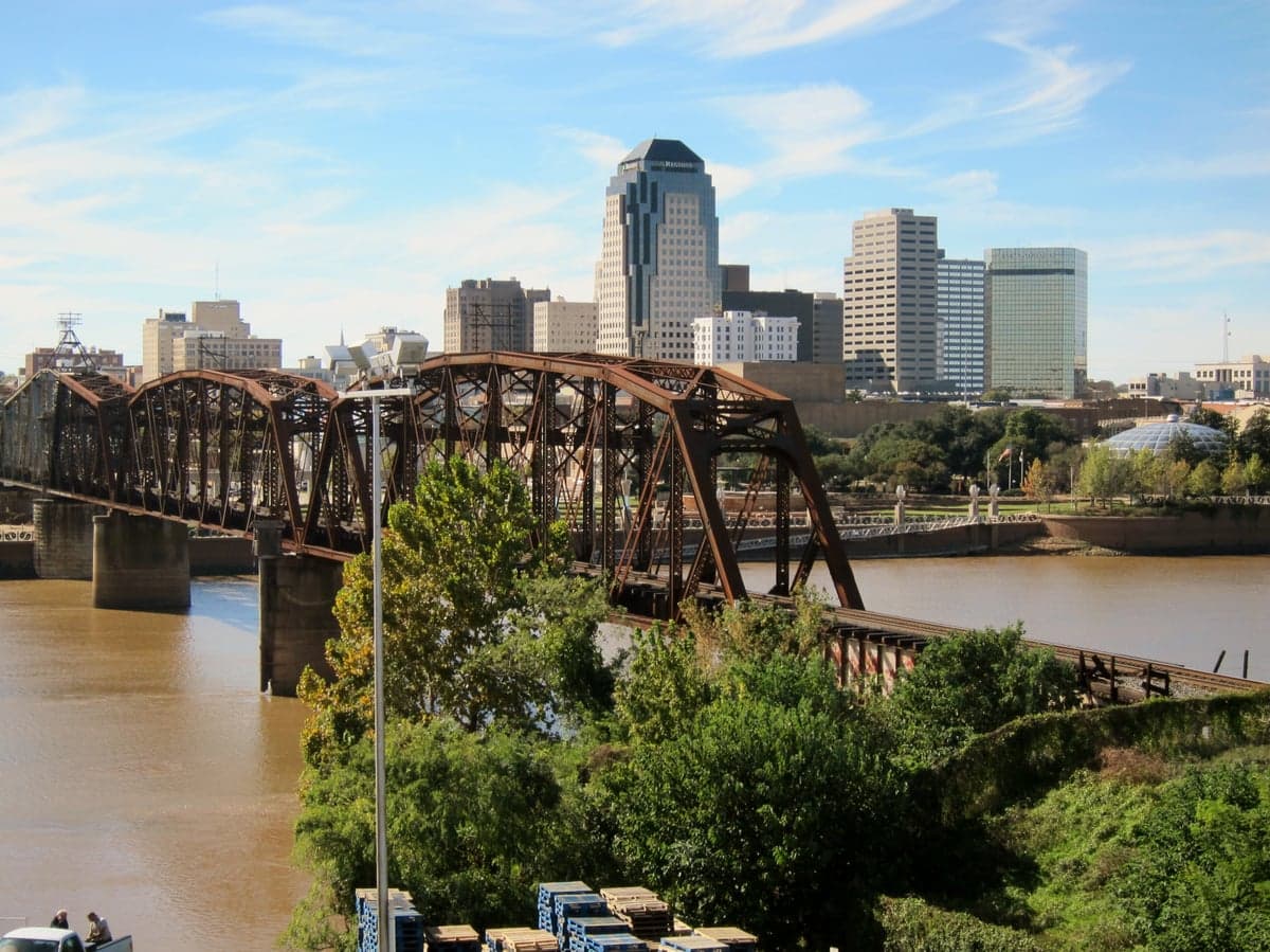
Photo: Wikipedia
Strategic Assessment of Shreveport, LA
Meaningful friction. Expect exposure to either population pressure, blast zones, or natural disaster risk. Consider buying a retreat property.
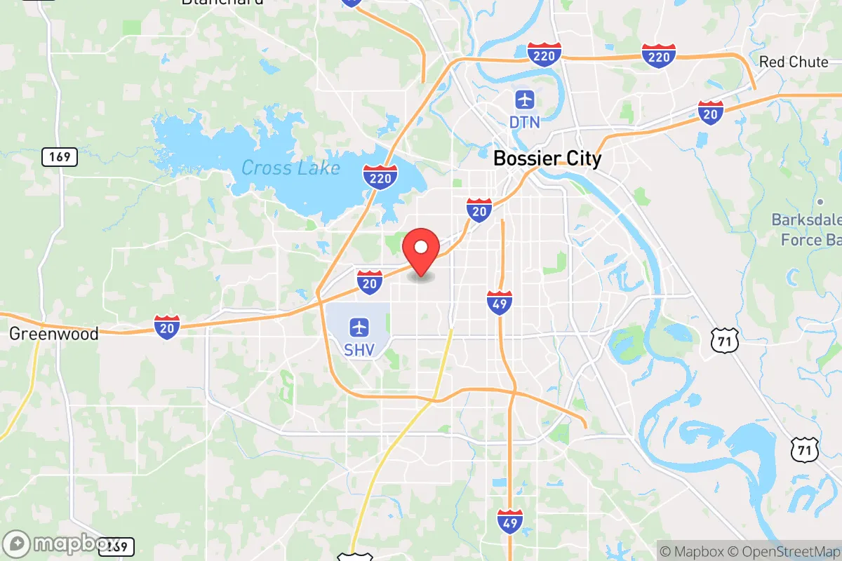
What does the Strategic Assessment tell us?
Our Strategic Assessment grades tactical survivability of an area. Major population centers, military targets, fallout zones, natural disasters, and border exposure all drive risk — lower exposure means a more defensible position in a crisis.
This is heavily inspired by Joel Skousen's Strategic Relocation book. Highly recommended you checkout the book ($)What does this tell us?
Our Strategic Assessment grades tactical survivability of an area. Major population centers, military targets, fallout zones, natural disasters, and border exposure all drive risk — lower exposure means a more defensible position in a crisis.
This is heavily inspired by Joel Skousen's Strategic Relocation book. Highly recommended you checkout the book ($)Strategic Pillars

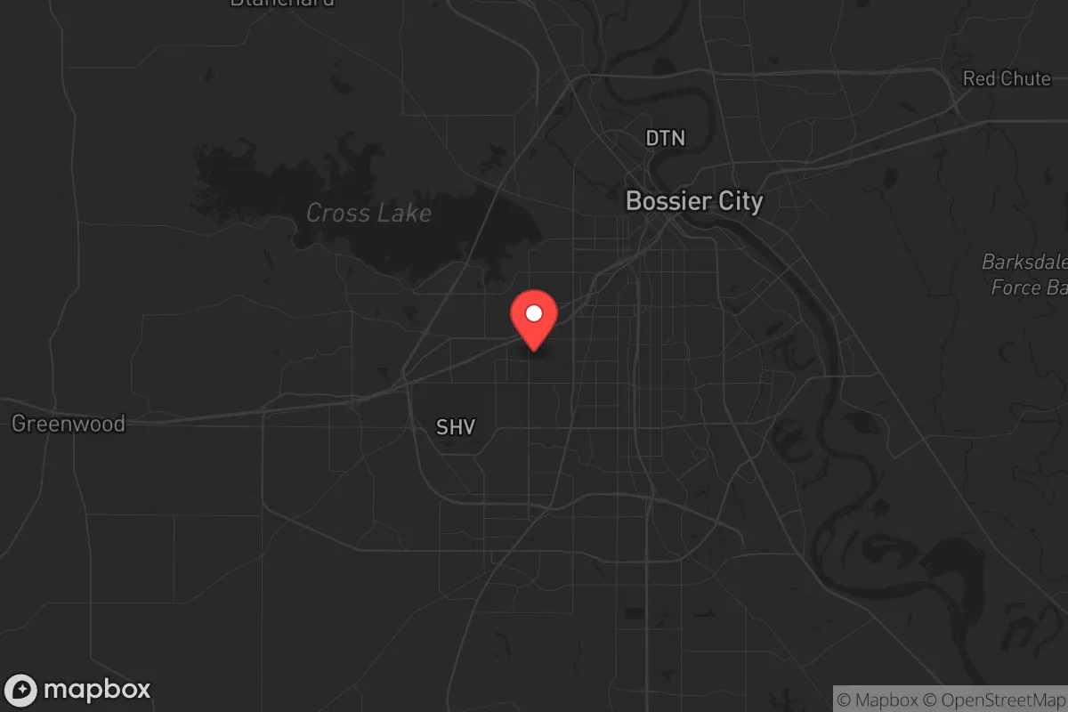
Key Distances
Regional Safe Places
Below is our recommended "safe zones" in Louisiana and the surrounding area based on our strategic heuristics. For most people, it's unrealistic to live in a “safe zone” full-time due to work, family or other personal reasons. They tend to be more rural. However, many of these areas are perfect for second homes and retreat properties that double as a vacation home or even a short-term rental.

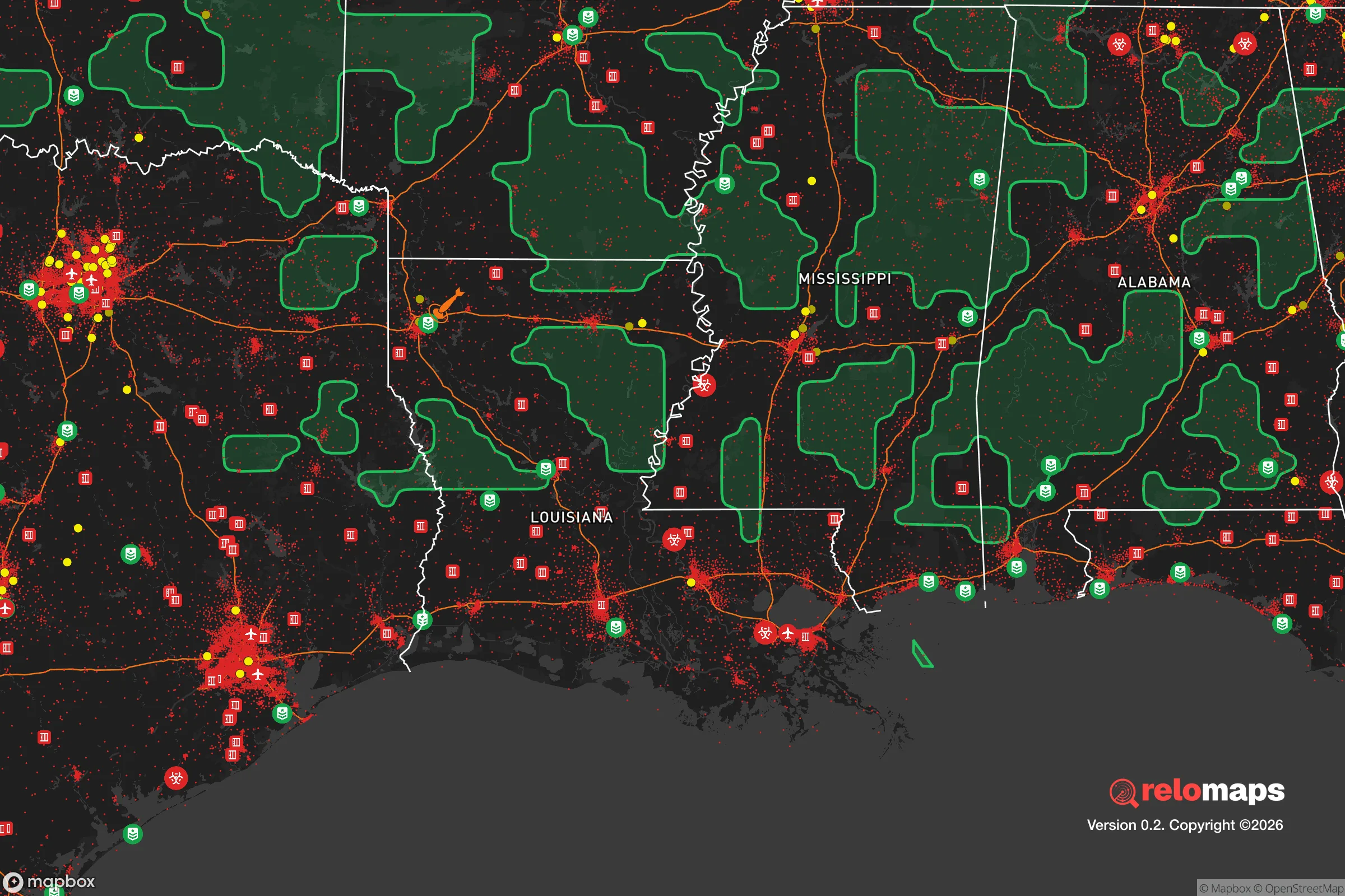
Important Note: For informational purposes only. This does not mean nothing bad ever happens in the green zones. Please use common sense. This is based on public data and modeled with AI. We tried to take a conservative approach but mistakes happen. We update this regularly as new information becomes available.
Solar Generator Recommendations
Backup power matters more here than in safer locations. We've picked three solar generators across budgets and capacity tiers — start with the budget unit if you only need a few essentials, or step up if you want to run a fridge and HVAC for days at a time.

Jackery Portable Power Station Explorer 300
Budget OptionPower on the Go: Weighing only 11 lbs, it's convenient to set up and store with book-sized foldable solar panels

BLUETTI Portable Power Station AC180
Designed for both indoor and outdoor scenarios, AC180 is highly capable as it has a robost capacity and continuous output power.

EF ECOFLOW DELTA Pro Ultra Power Station
Upgraded PickEcoFlow DELTA Pro Ultra is a whole-home energy system designed to grow with your family. Integrated with the Smart Home Panel 2, it scales to meet your evolving energy needs — keeping your home powered, intelligent, and secure through every stage of life.
We earn a commission, at no additional cost to you.
Strategic Assessment Analysis
Shreveport, Louisiana, occupies a strategic position in the Ark-La-Tex region that offers a mix of resilience and exposure for those serious about preparedness. Its location at the intersection of I-20 and I-49, straddling the Red River, provides both logistical access and a natural buffer from the densest population centers of the Gulf Coast and the Dallas-Fort Worth metroplex. While not a remote bunker, Shreveport’s moderate size—roughly 180,000 residents in the city proper, with about 400,000 in the metro area—means it avoids the worst of urban collapse scenarios while still offering infrastructure and supply chains that smaller towns lack. For a relocator weighing civic unrest, mass casualty events, and long-term stability, this city demands a clear-eyed look at its advantages and vulnerabilities.
Geographic position and natural advantages for long-term survival
Shreveport’s geography is a double-edged sword, but the positives are worth noting for preppers. The city sits on the western edge of Louisiana’s piney woods, with the Red River providing a reliable water source—critical for filtration and irrigation if municipal systems fail. The surrounding terrain is gently rolling, with ample hardwood forests that offer cover, fuel, and game for hunting. The climate is humid subtropical, meaning year-round growing seasons for food production, though you’ll contend with heat, humidity, and mosquito-borne diseases. The area is far enough from the Gulf Coast (about 200 miles) to avoid the worst of hurricane storm surges, but it still gets residual effects from major storms—think heavy rain and wind, not catastrophic flooding. Shreveport’s elevation averages around 200 feet above sea level, which reduces flood risk compared to southern Louisiana, though low-lying areas near the river can still flood during prolonged rains. For a survivalist, the key advantage is the region’s relative isolation from the major fault lines and nuclear targets of the East and West Coasts, while still being within a day’s drive of multiple biomes for bug-out options.
Risks, exposures, and proximity to fallout-relevant landmarks
Here’s where the analysis gets sobering. Shreveport is not a fallout-free zone. Barksdale Air Force Base, home to the 2nd Bomb Wing and B-52H Stratofortresses, sits just east of the city—a high-value military target in any major conflict. A nuclear strike on Barksdale would render much of Shreveport uninhabitable for generations due to fallout patterns, especially with prevailing winds blowing west to east. Additionally, the city is roughly 180 miles from the Dallas-Fort Worth metroplex (7.8 million people), a prime target for both nuclear and conventional attacks. In a mass casualty event or grid-down scenario, Shreveport would likely see a surge of refugees from DFW, straining resources and security. The I-20 corridor is a natural evacuation route, meaning your bug-out plan must account for choked highways and potential roadblocks. On the natural disaster front, the area is prone to tornadoes (part of Dixie Alley), ice storms, and occasional flooding. The 2021 winter storm (Uri) knocked out power for days across the region, exposing the fragility of the local grid. For a prepper, these risks mean you need hardened infrastructure—backup power, water storage, and a plan to defend your property from desperate transients.
Practical resilience for a relocator: food, water, energy, and defensibility
Shreveport offers a mixed bag for practical self-sufficiency. Water is abundant from the Red River, but it requires treatment—boiling, filtration, or chemical purification—due to agricultural runoff and industrial pollution upstream. The city’s municipal water system is aging, with frequent boil advisories after heavy rains. For food, the region has strong agricultural potential: the growing season lasts from March to November, allowing for multiple crop cycles of corn, beans, squash, and greens. Local farmers’ markets and feed stores (e.g., Tractor Supply, local co-ops) provide seeds and livestock supplies, but land prices have risen in recent years—expect $3,000–$5,000 per acre for rural parcels within 30 minutes of the city. Energy is a weak point: the grid relies on natural gas and coal, with limited solar adoption. Many preppers in the area install off-grid solar with battery backup, as the region gets about 210 sunny days per year—adequate but not ideal compared to the Southwest. Defensibility is moderate: the flat terrain offers few natural chokepoints, but the dense pine forests provide concealment for a rural homestead. Urban areas like the Highland neighborhood or Broadmoor are less defensible due to density and proximity to main roads. For a relocator, the sweet spot is a property 15–30 miles outside the city, near small towns like Blanchard or Oil City, where you can establish a retreat with good water access and limited foot traffic.
The overall strategic picture for Shreveport is one of calculated risk. It’s not a survivalist paradise—the military target risk is real, and the refugee flow from DFW in a crisis is a serious concern. But for a conservative-leaning relocator who wants a balance of infrastructure, natural resources, and distance from the most volatile urban centers, it’s a viable option. The key is to avoid the city core and Barksdale’s fallout zone, instead focusing on rural parcels north or west of town. If you can secure your own water, power, and food production, Shreveport’s location offers a strategic foothold in the South that’s close enough to supply lines but far enough from the worst of the chaos. Just don’t expect to ride out a major conflict within city limits—plan for a bug-out to the surrounding woods, and you’ll have a fighting chance.
* Values derived from national, state, county, city and local statistics and may differ in a specific area. Last updated: 2026-05-01T18:08:32.000Z
Narrative content on this page is AI-generated and may contain mistakes. Verify any details that matter before acting on them.
ReloMaps may earn a commission from affiliate links at no extra cost to you.