Photo: Wikipedia
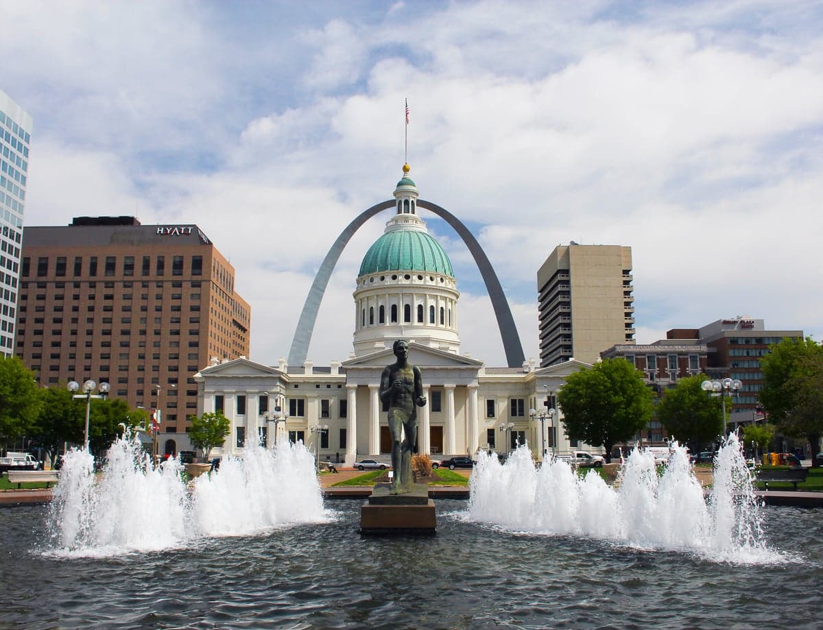
Strategic Assessment of St. Louis, MO
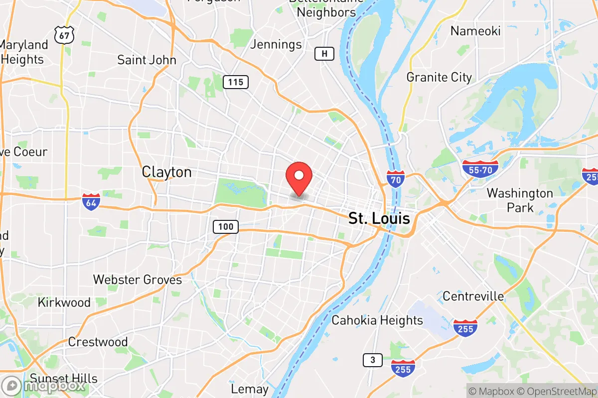
Multiple tactical vulnerabilities. Population density, target proximity, or disaster risk are likely compounding. A retreat property and exit planning is required.
What does the Strategic Assessment tell us?
Our Strategic Assessment grades tactical survivability of an area. Major population centers, military targets, fallout zones, natural disasters, and border exposure all drive risk — lower exposure means a more defensible position in a crisis.
This is heavily inspired by Joel Skousen's Strategic Relocation book. Highly recommended you checkout the book ($)What does this tell us?
Our Strategic Assessment grades tactical survivability of an area. Major population centers, military targets, fallout zones, natural disasters, and border exposure all drive risk — lower exposure means a more defensible position in a crisis.
This is heavily inspired by Joel Skousen's Strategic Relocation book. Highly recommended you checkout the book ($)Strategic Pillars

Key Distances
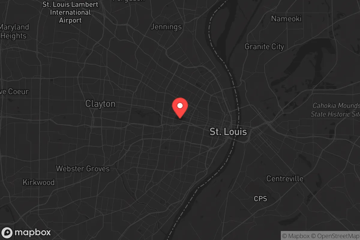
Regional Safe Places
Below is our recommended "safe zones" in Missouri and the surrounding area based on our strategic heuristics. For most people, it's unrealistic to live in a “safe zone” full-time due to work, family or other personal reasons. They tend to be more rural. However, many of these areas are perfect for second homes and retreat properties that double as a vacation home or even a short-term rental.


Important Note: For informational purposes only. This does not mean nothing bad ever happens in the green zones. Please use common sense. This is based on public data and modeled with AI. We tried to take a conservative approach but mistakes happen. We update this regularly as new information becomes available.
Solar Generator Recommendations
Backup power matters more here than in safer locations. We've picked three solar generators across budgets and capacity tiers — start with the budget unit if you only need a few essentials, or step up if you want to run a fridge and HVAC for days at a time.

Jackery Portable Power Station Explorer 300
Budget OptionPower on the Go: Weighing only 11 lbs, it's convenient to set up and store with book-sized foldable solar panels

BLUETTI Portable Power Station AC180
Designed for both indoor and outdoor scenarios, AC180 is highly capable as it has a robost capacity and continuous output power.

EF ECOFLOW DELTA Pro Ultra Power Station
Upgraded PickEcoFlow DELTA Pro Ultra is a whole-home energy system designed to grow with your family. Integrated with the Smart Home Panel 2, it scales to meet your evolving energy needs — keeping your home powered, intelligent, and secure through every stage of life.
We earn a commission, at no additional cost to you.
Strategic Assessment Analysis
St. Louis occupies a strategic position that is both a blessing and a curse for the survival-minded relocator. Situated on the western bank of the Mississippi River and near the confluence of the Missouri and Illinois Rivers, the city sits at a historic crossroads of American commerce and transportation. For those assessing long-term resilience, this location offers abundant freshwater access and a central position within the continental interior, but it also places you within the shadow of a major urban center that carries significant fallout risks. The region's industrial and logistical infrastructure, while economically advantageous, creates a complex web of vulnerabilities that demand careful evaluation before committing to a move.
Geographic position and natural advantages for long-term sustainability
The St. Louis metro area benefits from one of the most significant freshwater resources in the country: the Mississippi River, which carries an average flow of over 600,000 cubic feet per second. This is not a trivial advantage in a scenario where municipal water systems fail or become contaminated. The surrounding Missouri River and numerous smaller tributaries provide additional redundancy. The region sits atop the Ozark Plateau to the south and the Missouri River Valley to the north, offering varied terrain that includes forested hills, limestone bluffs, and fertile floodplains. The climate is continental, with four distinct seasons, which supports subsistence agriculture—corn, soybeans, wheat, and livestock are all viable within a 50-mile radius. The growing season averages around 200 days, long enough for most staple crops. For the prepper, this means the land itself can sustain you if you secure acreage outside the urban core. The area is also relatively flat and open compared to the Appalachians or Rockies, which aids in mobility and line-of-sight security but reduces natural defensibility against organized threats.
Risks, exposures, and proximity to fallout-relevant landmarks
The most glaring vulnerability for St. Louis is its proximity to multiple high-value targets that could attract state-level or non-state actors in a crisis. Lambert-St. Louis International Airport is a major civilian and military logistics hub, and Scott Air Force Base lies just 20 miles east in Illinois, housing the U.S. Transportation Command and the 375th Air Mobility Wing. In a conflict or major terrorist event, these are primary targets for airstrikes, cyberattacks, or ground incursions. The city itself is home to the St. Louis Federal Reserve Bank, the Anheuser-Busch brewery (a critical food and beverage production site), and the McDonnell Douglas/Boeing defense manufacturing complex. Any of these could become focal points for civil unrest, looting, or targeted attacks. The Mississippi River bridges—the Poplar Street Bridge, the Eads Bridge, and the Martin Luther King Bridge—are chokepoints that would be contested in a grid-down scenario, potentially trapping residents on either side. Additionally, the city's aging infrastructure, including the combined sewer system and the 100-year-old Chain of Rocks water intake, is vulnerable to failure during floods or earthquakes. The New Madrid Seismic Zone, located about 150 miles south, poses a real earthquake risk that could collapse bridges and disrupt the entire regional grid for weeks.
Practical resilience for a relocator: food, water, energy, and defensibility
For the individual or family looking to establish a resilient foothold, St. Louis offers a mixed bag. Water is abundant but must be treated—the Mississippi carries industrial runoff, agricultural chemicals, and biological contaminants. A high-quality gravity-fed or pump-based filtration system (e.g., Berkey or a sand filter) is non-negotiable if you rely on surface water. The region's groundwater is generally good, but well drilling in the city limits is restricted; you'll need to look at St. Charles County or Jefferson County for rural properties with private wells. Food production is feasible: the Missouri Extension Service provides soil testing and crop guides, and local farmers' markets (like the Soulard Market) offer seeds and livestock. However, the urban heat island effect and poor soil quality in the city core make gardening difficult without raised beds. Energy resilience is a challenge—Ameren Missouri's grid is aging and prone to outages during storms. Solar is viable but requires battery storage due to frequent cloud cover; a propane or diesel generator with a 500-gallon tank is a more reliable backup. Defensibility is the weakest link. The city's layout is a grid of streets with limited natural barriers, making it hard to secure a perimeter. Suburban neighborhoods in West County (e.g., Chesterfield, Wildwood) offer more space and tree cover but are still within a 30-minute drive of the urban core. For true defensibility, you'd need to push 50+ miles out into the Ozarks or the Missouri River bluffs, where terrain and distance provide a buffer. The St. Louis metro area's population density of roughly 2,000 people per square mile in the city means that in a collapse scenario, you'd be competing with hundreds of thousands for the same resources.
The overall strategic picture for St. Louis is one of high potential but equally high risk. The freshwater access and central location make it a viable hub for a regional survival network, but the concentration of critical infrastructure and the proximity to military and industrial targets create a target-rich environment that no prepper should ignore. If you're considering relocation here, the smart play is to secure a rural property in the surrounding counties—St. Charles, Franklin, or Jefferson—where you can leverage the city's resources (medical facilities, hardware stores, trade networks) while maintaining a buffer of at least 20 miles from the urban core. The city itself is not a defensible position, but the region as a whole offers the raw materials for a resilient lifestyle if you're willing to put in the work and accept the trade-offs. In a world where the next crisis could be a pandemic, a cyberattack, or a civil conflict, St. Louis sits at the intersection of opportunity and exposure—and your survival depends on which side of that intersection you choose to live on.
* Values derived from national, state, county, city and local statistics and may differ in a specific area. Last updated: 2026-04-22T01:27:35.000Z
Narrative content on this page is AI-generated and may contain mistakes. Verify any details that matter before acting on them.
ReloMaps may earn a commission from affiliate links at no extra cost to you.