Photo: Wikipedia
Strategic Assessment of Tacoma, WA
Multiple tactical vulnerabilities. Population density, target proximity, or disaster risk are likely compounding. A retreat property and exit planning is required.
What does the Strategic Assessment tell us?
Our Strategic Assessment grades tactical survivability of an area. Major population centers, military targets, fallout zones, natural disasters, and border exposure all drive risk — lower exposure means a more defensible position in a crisis.
This is heavily inspired by Joel Skousen's Strategic Relocation book. Highly recommended you checkout the book ($)What does this tell us?
Our Strategic Assessment grades tactical survivability of an area. Major population centers, military targets, fallout zones, natural disasters, and border exposure all drive risk — lower exposure means a more defensible position in a crisis.
This is heavily inspired by Joel Skousen's Strategic Relocation book. Highly recommended you checkout the book ($)Strategic Pillars

Key Distances
Regional Safe Places
Below is our recommended "safe zones" in Washington and the surrounding area based on our strategic heuristics. For most people, it's unrealistic to live in a “safe zone” full-time due to work, family or other personal reasons. They tend to be more rural. However, many of these areas are perfect for second homes and retreat properties that double as a vacation home or even a short-term rental.


Important Note: For informational purposes only. This does not mean nothing bad ever happens in the green zones. Please use common sense. This is based on public data and modeled with AI. We tried to take a conservative approach but mistakes happen. We update this regularly as new information becomes available.
Solar Generator Recommendations
Backup power matters more here than in safer locations. We've picked three solar generators across budgets and capacity tiers — start with the budget unit if you only need a few essentials, or step up if you want to run a fridge and HVAC for days at a time.

Jackery Portable Power Station Explorer 300
Budget OptionPower on the Go: Weighing only 11 lbs, it's convenient to set up and store with book-sized foldable solar panels

BLUETTI Portable Power Station AC180
Designed for both indoor and outdoor scenarios, AC180 is highly capable as it has a robost capacity and continuous output power.

EF ECOFLOW DELTA Pro Ultra Power Station
Upgraded PickEcoFlow DELTA Pro Ultra is a whole-home energy system designed to grow with your family. Integrated with the Smart Home Panel 2, it scales to meet your evolving energy needs — keeping your home powered, intelligent, and secure through every stage of life.
We earn a commission, at no additional cost to you.
Strategic Assessment Analysis
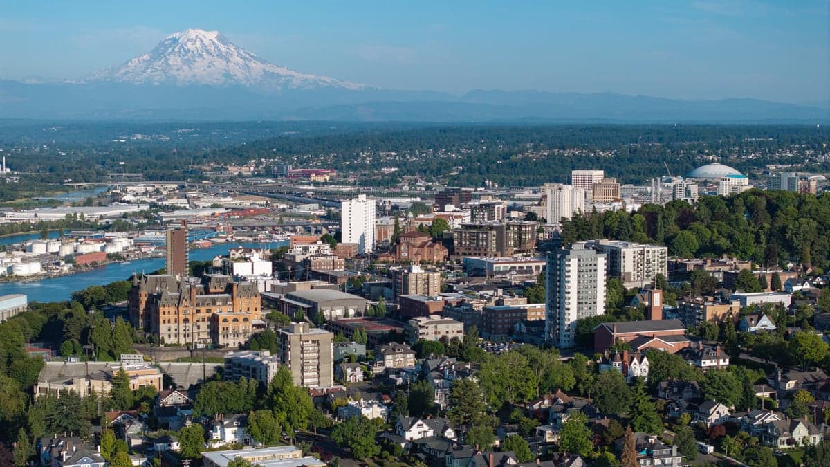
Tacoma, Washington, occupies a strategic position that offers both genuine resilience advantages and significant exposure risks for those prioritizing preparedness. Situated on the southern end of Puget Sound, roughly 30 miles south of Seattle, the city benefits from a robust industrial base, deep-water port access, and a climate that supports year-round food production. However, its proximity to major urban centers, military installations, and critical infrastructure also makes it a potential target or chokepoint during widespread disruption. For the conservative prepper or survivalist, Tacoma presents a mixed picture: it is not a remote retreat, but it is a logistics hub with real defensive and resource potential if you understand the terrain.
Geographic position and natural advantages for long-term survival
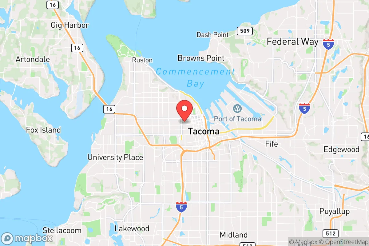
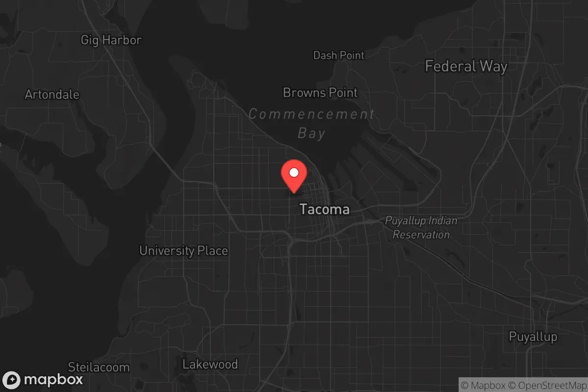
Tacoma’s location at the nexus of the Puget Sound, the Puyallup River valley, and the Cascade foothills provides a rare combination of maritime access, fertile soil, and defensible high ground. The city sits on a series of hills—including the North End, South End, and the Fern Hill area—that offer natural observation points and potential fallback zones if lower-lying areas become compromised. The Puyallup River valley, stretching east toward Mount Rainier, is some of the most productive agricultural land in the Pacific Northwest, capable of supporting substantial local food production even without industrial supply chains. The deep-water Port of Tacoma, while a strategic asset for trade, also means the city is a natural funnel for goods and people, which could become a liability during civil unrest. The surrounding topography—the Olympic Mountains to the west, the Cascades to the east, and the Sound to the north—creates a natural basin that can be isolated if major transportation corridors are cut. For a relocator, the key advantage is that Tacoma is not a coastal floodplain like much of Seattle; the hills provide elevation and drainage, reducing vulnerability to tsunami or storm surge from a Cascadia subduction zone event.
Risks, exposures, and proximity to fallout-relevant landmarks
The most significant strategic drawback of Tacoma is its proximity to high-value targets and population-dense areas. Joint Base Lewis-McChord (JBLM), one of the largest military installations on the West Coast, lies just 15 miles south of downtown. In a major conflict or domestic crisis, JBLM is a primary target for any adversary, and the fallout zone from a conventional or nuclear strike would likely encompass much of Tacoma. Additionally, the Port of Tacoma and the nearby Commencement Bay industrial complex—including refineries, chemical storage, and shipping terminals—are critical infrastructure that would be targeted or could become sources of secondary hazards like chemical spills or fires. The city’s location along Interstate 5, the primary north-south artery on the West Coast, means that any disruption in Seattle or Portland will funnel displaced populations through Tacoma. During a pandemic, economic collapse, or civil unrest, the city could become a chokepoint for refugees and looters. The presence of the Tacoma Dome and the Tacoma Mall as potential FEMA staging areas or refugee collection points is another concern—these sites could become magnets for government control or civil disorder. For the prepper, the lesson is clear: Tacoma is not a bug-out location; it is a location that requires a layered security plan and a willingness to move to higher ground or more rural areas if the situation deteriorates.
Practical resilience for a relocator: food, water, energy, and defensibility
For a relocator willing to invest in preparation, Tacoma offers several practical advantages. The city’s water supply comes primarily from the Green River watershed and the Howard Hanson Dam, which are relatively secure but vulnerable to seismic events. A well-maintained rainwater catchment system or a property with a private well in the South End or Eastside can provide a reliable backup. The climate—cool, wet winters and mild, dry summers—supports year-round gardening, and the soil in the Puyallup Valley is rich volcanic loam. Community gardens and local farms are abundant, and the city has a strong network of farmers’ markets and food co-ops that could be leveraged in a slow-collapse scenario. Energy resilience is mixed: Tacoma Power, a municipal utility, has a relatively reliable grid, but the region is prone to winter storms and wind events that can knock out power for days. Solar panels are viable, though less efficient than in sunnier regions, and a backup generator with a propane or natural gas hookup is a wise investment. Defensibility is the hardest factor. Tacoma’s urban core is dense and difficult to secure, but the hilltop neighborhoods—particularly the North End, Proctor District, and the area around Point Defiance Park—offer natural chokepoints and limited access points. A group of like-minded families could secure a block or a cul-de-sac, but this requires coordination and a willingness to establish mutual aid agreements. The city’s extensive park system, including Point Defiance Park and the Puyallup River Trail, provides both resources (wood, water, game) and potential escape routes to the south or east.
The overall strategic picture for Tacoma is one of calculated risk. It is not a survivalist’s paradise—the proximity to Seattle, JBLM, and critical infrastructure means that a major event could turn the city into a hazard zone. But for the relocator who values access to a deep-water port, fertile agricultural land, and a climate that supports self-sufficiency, Tacoma offers a base of operations that is more resilient than most West Coast cities. The key is to avoid the urban core and focus on the hilltop neighborhoods or the rural fringe to the east and south. A conservative prepper should view Tacoma as a logistics hub and a potential fallback position, not a final destination. If the country continues its trajectory toward instability, the ability to move quickly to the Olympic Peninsula or the Cascade foothills—while leveraging Tacoma’s resources for resupply—will be the difference between thriving and merely surviving. The city’s strategic value lies in its position, not its permanence. Plan accordingly.
* Values derived from national, state, county, city and local statistics and may differ in a specific area. Last updated: 2026-04-21T11:00:53.000Z
Narrative content on this page is AI-generated and may contain mistakes. Verify any details that matter before acting on them.
ReloMaps may earn a commission from affiliate links at no extra cost to you.