
Photo: Wikipedia
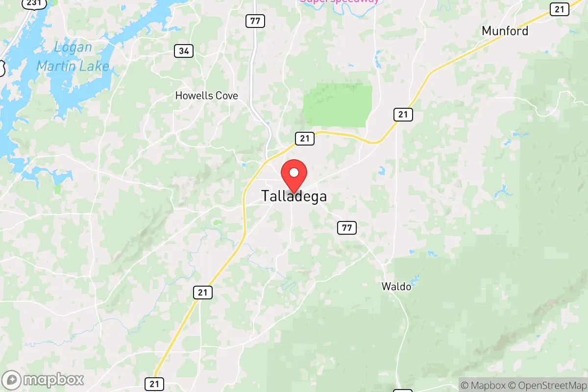
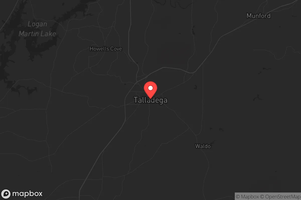
Strategic Assessment of Talladega, AL
Workable tactical position. Some exposure to population density or targets, but generally defensible in a crisis.
What does the Strategic Assessment tell us?
Our Strategic Assessment grades tactical survivability of an area. Major population centers, military targets, fallout zones, natural disasters, and border exposure all drive risk — lower exposure means a more defensible position in a crisis.
This is heavily inspired by Joel Skousen's Strategic Relocation book. Highly recommended you checkout the book ($)What does this tell us?
Our Strategic Assessment grades tactical survivability of an area. Major population centers, military targets, fallout zones, natural disasters, and border exposure all drive risk — lower exposure means a more defensible position in a crisis.
This is heavily inspired by Joel Skousen's Strategic Relocation book. Highly recommended you checkout the book ($)Strategic Pillars

Key Distances
Regional Safe Places
Below is our recommended "safe zones" in Alabama and the surrounding area based on our strategic heuristics. For most people, it's unrealistic to live in a “safe zone” full-time due to work, family or other personal reasons. They tend to be more rural. However, many of these areas are perfect for second homes and retreat properties that double as a vacation home or even a short-term rental.
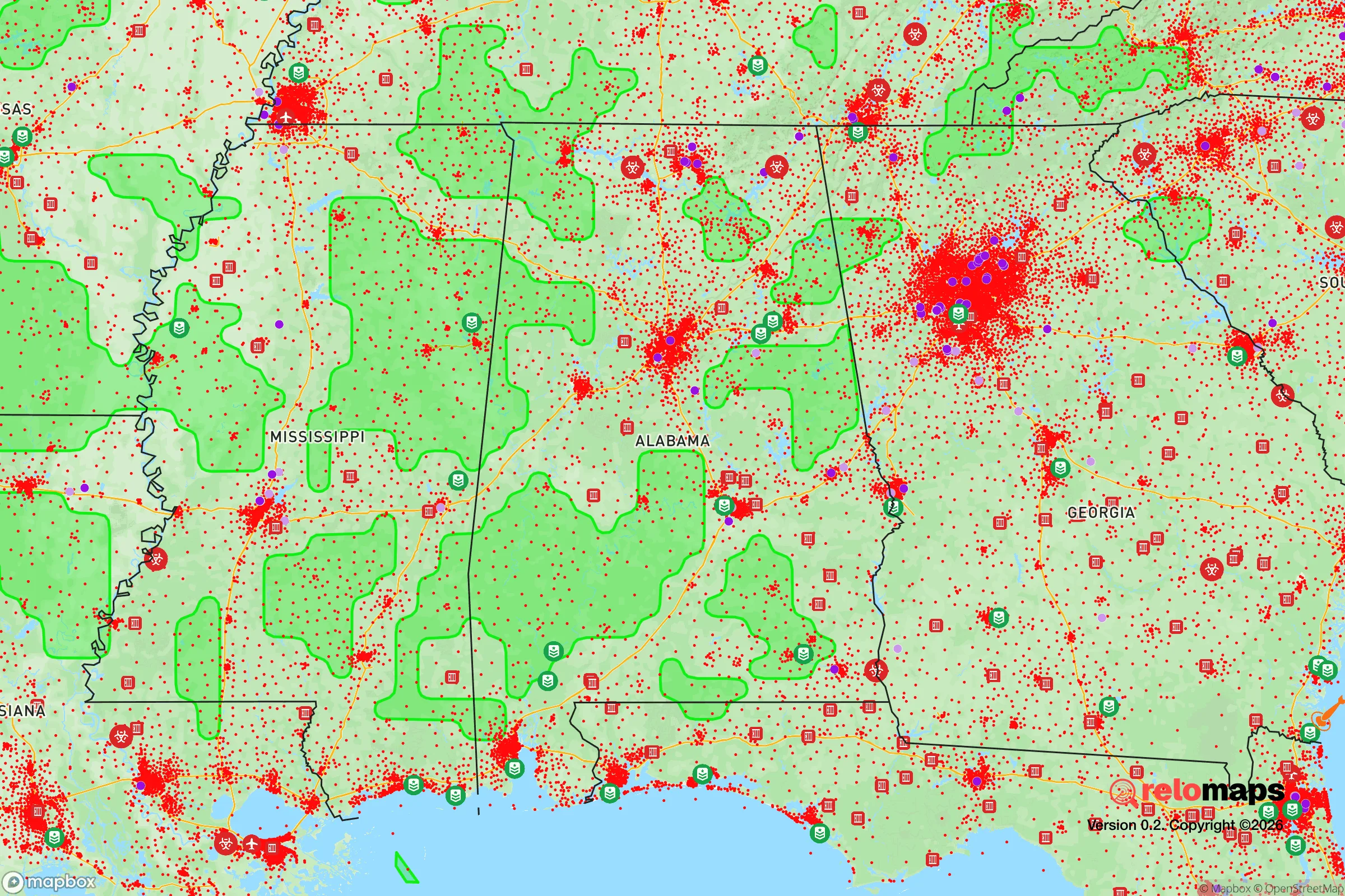
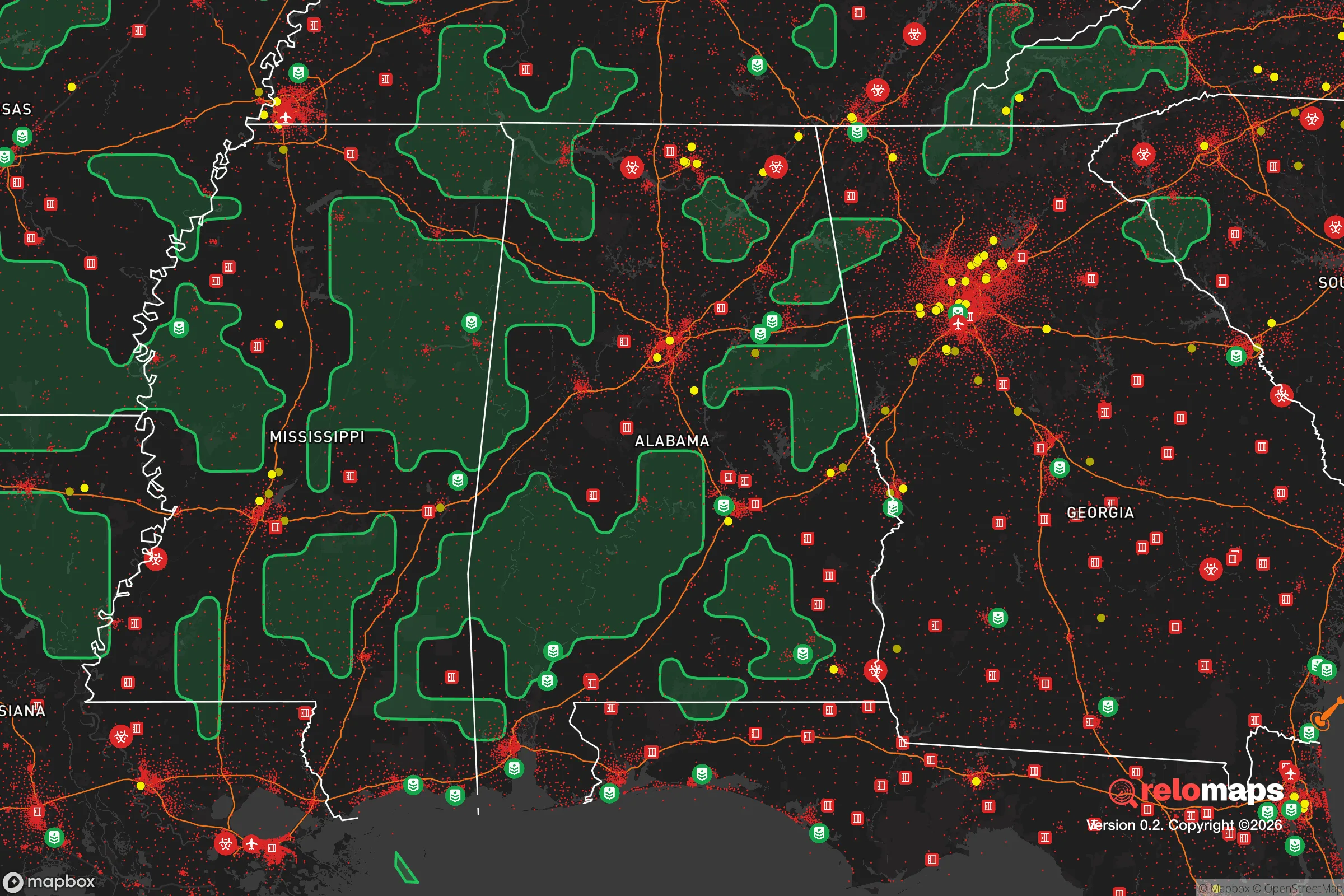
Important Note: For informational purposes only. This does not mean nothing bad ever happens in the green zones. Please use common sense. This is based on public data and modeled with AI. We tried to take a conservative approach but mistakes happen. We update this regularly as new information becomes available.
Solar Generator Recommendations
Backup power matters more here than in safer locations. We've picked three solar generators across budgets and capacity tiers — start with the budget unit if you only need a few essentials, or step up if you want to run a fridge and HVAC for days at a time.

Jackery Portable Power Station Explorer 300
Budget OptionPower on the Go: Weighing only 11 lbs, it's convenient to set up and store with book-sized foldable solar panels

BLUETTI Portable Power Station AC180
Designed for both indoor and outdoor scenarios, AC180 is highly capable as it has a robost capacity and continuous output power.

EF ECOFLOW DELTA Pro Ultra Power Station
Upgraded PickEcoFlow DELTA Pro Ultra is a whole-home energy system designed to grow with your family. Integrated with the Smart Home Panel 2, it scales to meet your evolving energy needs — keeping your home powered, intelligent, and secure through every stage of life.
We earn a commission, at no additional cost to you.
Strategic Assessment Analysis
Talladega, Alabama, sits in a geographic sweet spot that offers genuine strategic depth for those serious about resilience, without requiring a total retreat into the deep wilderness. Its location along the southern edge of the Appalachian foothills provides natural terrain advantages, while its proximity to major highways—I-20 and US-431—gives you a viable escape route or supply corridor if things go sideways. The area’s historical industrial base and low population density (roughly 15,000 in the city proper, with Talladega County around 80,000) mean you’re not dealing with the congestion and target density of Birmingham, which is about 50 miles southwest. For a relocator weighing civic unrest, supply chain disruptions, or natural disasters, Talladega offers a balanced mix of seclusion and access that’s hard to beat in the Southeast.
Geographic position and natural advantages for long-term survival
Talladega’s real asset is the Talladega National Forest, which covers over 390,000 acres just to the east and south of town. This isn’t just recreational land—it’s a buffer zone, a potential hunting ground, and a source of timber and water if supply chains collapse. The forest’s rugged terrain, including the Cheaha Mountain area (the highest point in Alabama at 2,407 feet), provides natural defensibility and line-of-sight advantages for anyone scouting or securing a perimeter. The area sits in the Coosa River basin, with several creeks and the Talladega Creek running through the region, offering reliable surface water sources that don’t depend on municipal infrastructure. The climate is humid subtropical, meaning you’ve got a long growing season (roughly 220 frost-free days) for subsistence gardening, and the local soil in the valley bottoms is decent for row crops if you’re willing to put in the work. For a prepper, this geography means you can establish a self-sufficient homestead with relative ease, provided you secure a property with a well and some acreage away from the main drags.
Risks, exposures, and proximity to fallout-relevant landmarks
No location is perfect, and Talladega has its share of vulnerabilities that a strategic relocator needs to account for. The most obvious is the Talladega Superspeedway, which sits just north of town on I-20. During race weekends, the area swells with tens of thousands of visitors, creating a temporary population spike that strains local resources and could become a flashpoint for civil unrest or disease spread. If you’re planning to bug in, you’ll want to avoid being within a few miles of the track during those events. More concerning is the proximity to Anniston Army Depot (about 30 miles northeast), which stores chemical weapons and conventional munitions. While the depot has been decommissioning its chemical stockpile for years, it remains a high-value target in any conflict scenario, and a major incident there could render a significant downwind area uninhabitable. Talladega is generally upwind of Anniston, but prevailing winds shift, so you’d need to monitor conditions. On the plus side, the area is far from any nuclear power plants (the nearest is Browns Ferry in Athens, about 100 miles northwest) and major ports, reducing the risk of fallout from a maritime or industrial disaster. Tornadoes are the primary natural threat—Talladega County sits in Dixie Alley, and the April 2011 super outbreak produced an EF-4 that hit the area. A reinforced safe room or basement is non-negotiable here.
Practical resilience for a relocator: food, water, energy, and defensibility
For someone serious about self-sufficiency, Talladega offers a workable baseline. Water is the first concern, and the county’s groundwater is generally good—well depths range from 100 to 300 feet, with yields of 10-30 gallons per minute in most areas. Municipal water comes from Lake Logan Martin and the Coosa River, but if the grid goes down, you’ll want your own well and a hand pump or solar-powered backup. The growing season supports warm-weather staples like corn, beans, squash, and sweet potatoes, and the forest provides ample game—white-tailed deer, wild turkey, and feral hogs are abundant. For energy, the area has decent solar potential (about 4.5 peak sun hours per day), and wood heating is viable given the forest proximity. The local power cooperative, Talladega Electric Cooperative, has a decent track record for grid reliability, but a backup generator or off-grid solar setup is wise. Defensibility is mixed: the terrain around the national forest offers natural chokepoints and cover, but the town itself is relatively flat and open, with multiple road access points. A property on the eastern or southern edge, near the forest boundary, gives you the best combination of concealment and escape routes. The local gun culture is strong—there are several gun shops and ranges in the county, and Alabama’s constitutional carry law (effective 2022) means no permit is needed for concealed carry, which simplifies logistics for a prepper.
The overall strategic picture for Talladega is one of moderate resilience with manageable trade-offs. It’s not a remote bunker location like the Idaho panhandle, but it doesn’t require you to abandon all connection to infrastructure and community. The proximity to Birmingham and Atlanta (about 90 miles east) is a double-edged sword: it gives you access to medical centers and supply chains during normal times, but those same cities could become sources of refugee flow during a collapse. The key is to position yourself on the periphery—away from the interstate and the speedway, closer to the forest and the smaller communities like Munford or Alpine. If you’re a single individual or a family looking to build a resilient lifestyle without going full hermit, Talladega deserves a serious look. Just don’t expect it to be a secret forever—the area’s affordability and strategic advantages are drawing more preppers every year, and land prices have been creeping up since 2020. Act sooner rather than later if this fits your plan.
* Values derived from national, state, county, city and local statistics and may differ in a specific area. Last updated: 2026-05-14T18:50:34.000Z
Narrative content on this page is AI-generated and may contain mistakes. Verify any details that matter before acting on them.
ReloMaps may earn a commission from affiliate links at no extra cost to you.