
Photo: Wikipedia
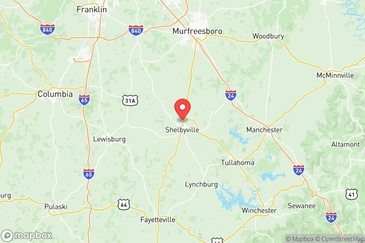
Strategic Assessment of Bedford County
Workable tactical position. Some exposure to population density or targets, but generally defensible in a crisis.
What does the Strategic Assessment tell us?
Our Strategic Assessment grades tactical survivability of an area. Major population centers, military targets, fallout zones, natural disasters, and border exposure all drive risk — lower exposure means a more defensible position in a crisis.
This is heavily inspired by Joel Skousen's Strategic Relocation book. Highly recommended you checkout the book ($)What does this tell us?
Our Strategic Assessment grades tactical survivability of an area. Major population centers, military targets, fallout zones, natural disasters, and border exposure all drive risk — lower exposure means a more defensible position in a crisis.
This is heavily inspired by Joel Skousen's Strategic Relocation book. Highly recommended you checkout the book ($)Strategic Pillars

Key Distances
Strategic Assessment Analysis
Bedford County, Tennessee, sits in a sweet spot that resilience-minded relocators rarely find: close enough to major infrastructure to be practical, far enough from the obvious targets to offer genuine breathing room. Anchored by the county seat of Shelbyville and the smaller community of Wartrace, this is a place where the land itself provides a buffer. The Duck River runs through the heart of the county, offering a reliable water source, and the rolling hills of Middle Tennessee create natural defensibility without the isolation of deep mountain country. For someone thinking in terms of decades, not just next year, Bedford County checks boxes that most suburban sprawl zones simply cannot.
Geographic position and natural advantages for long-term stability
Bedford County sits about 50 miles southeast of Nashville and roughly 70 miles northwest of Chattanooga. That distance is critical: you are outside the immediate blast radius or fallout plume of either city, but close enough to reach medical centers, supply chains, or federal resources if the grid holds. The county is part of the Highland Rim region, which means elevation changes of 200 to 400 feet across the landscape—enough to create natural choke points and defensible ridgelines, but not so steep that daily life becomes a chore. The Duck River, which flows through Shelbyville and continues west, is one of the most biologically diverse rivers in North America and provides a surface water source that does not depend on municipal treatment plants. For a prepper household, that means you can gravity-feed or pump from a river that rarely runs dry, even in drought years. The soil in the valley bottoms is rich limestone-based loam, suitable for small-scale food production, and the growing season runs roughly 200 days. You can raise corn, beans, squash, and livestock without fighting rocky mountain soil or swampy coastal ground.
Risks, exposures, and proximity to fallout-relevant landmarks
No location is perfect, and Bedford County has real exposure that a strategic relocator must weigh. The most obvious risk is the proximity to Nashville International Airport (BNA) and the broader Nashville metropolitan area, which includes a FedEx hub, multiple hospitals, and state government infrastructure. In a major conflict or EMP scenario, Nashville is a likely target. Bedford County sits far enough out that you would not face the direct blast, but fallout patterns depend on prevailing winds, which in Middle Tennessee typically blow from the southwest. That means a strike on Nashville would push fallout northeast, away from Bedford County—a meaningful advantage. However, there are closer potential targets. The Arnold Air Force Base, located just south in Coffee County near Tullahoma, is a research and testing facility for propulsion and hypersonics. It is not a nuclear storage site, but it is a military installation that could draw conventional or cyber attack. Similarly, the Tennessee Valley Authority (TVA) has multiple substations and transmission lines running through the region; the Watts Bar Nuclear Plant is about 90 miles east, and the Browns Ferry plant in Alabama is roughly 80 miles south. A strike on either would not directly threaten Bedford County, but the electromagnetic pulse or grid collapse could cascade. The county also sits within 150 miles of the Oak Ridge National Laboratory, a major nuclear research facility. That is far enough for safety but close enough that a major incident there would affect regional logistics. On the positive side, there are no refineries, major ports, or chemical plants within Bedford County itself. The largest industrial employers are in Shelbyville—primarily automotive parts manufacturing and food processing—which are not high-value military targets.
Practical resilience for a relocator: food, water, energy, and defensibility
For a family or individual serious about self-sufficiency, Bedford County offers a realistic baseline. Water is the first concern, and the Duck River provides a year-round surface source. Many rural properties in the county already have wells, and the water table in the limestone aquifer is generally reliable at depths of 100 to 300 feet. If you are buying land, look for parcels with creek frontage or existing well permits. The county also has multiple natural springs, particularly around the Wartrace area, which historically made it a stop on the railroad for fresh water. Food production is viable: the county has a strong agricultural heritage, with cattle, poultry, and row crops dominating. The Shelbyville Farmers Market operates seasonally, and local feed stores carry seeds, tools, and livestock supplies. For energy, the grid is served by Duck River Electric Membership Corporation, a cooperative that is generally more stable than investor-owned utilities. That said, a co-op is still tied to the TVA grid, so solar panels with battery storage are a wise investment. The county has decent solar exposure—about 4.5 peak sun hours per day—and there are no HOA restrictions in unincorporated areas that would prevent panels or a backup generator. Defensibility is where Bedford County shines compared to flat farmland or dense suburbs. The rolling hills and numerous creek crossings create natural observation points and limited approach routes. The population density is low outside Shelbyville—roughly 100 people per square mile countywide, but far less in the rural precincts. Your nearest neighbor might be a quarter-mile away, which is close enough for mutual aid but far enough for privacy. The county has a strong hunting culture, meaning firearms ownership is common and socially accepted, and the sheriff's office is generally responsive but not overbearing. For a conservative-leaning relocator, the local political climate is a practical advantage: the county voted heavily Republican in recent cycles, and the culture is self-reliant, church-oriented, and skeptical of federal overreach.
The overall strategic picture for Bedford County is one of balanced trade-offs. You are not in a remote bunker location, and you should not expect to disappear from the world. But you are in a place where the land gives you options: water you can access, soil you can work, and terrain you can defend. The proximity to Nashville and military installations is a risk, but it is a manageable one if you plan for fallout sheltering and grid-down scenarios. For a single individual or a family looking to build a resilient life without moving to the far hinterlands, Bedford County offers a rare combination of practicality and security. It is not a fortress, but it is a solid foundation—and in an uncertain world, that is worth more than most people realize.
* Values derived from national, state, county, city and local statistics and may differ in a specific area. Last updated: 2026-06-02T19:45:47.000Z
Narrative content on this page is AI-generated and may contain mistakes. Verify any details that matter before acting on them.
ReloMaps may earn a commission from affiliate links at no extra cost to you.