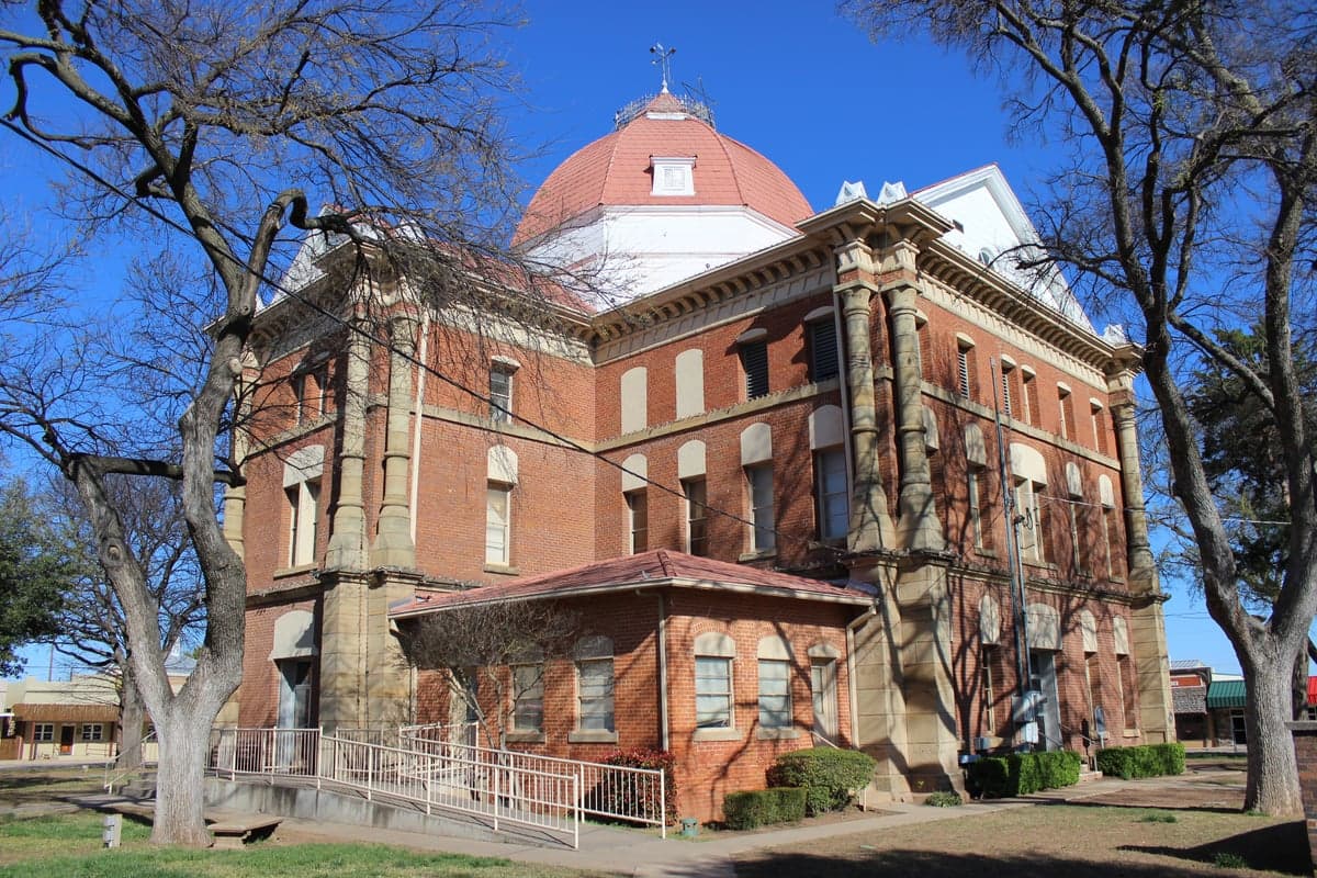
Photo: Wikipedia
Strategic Assessment of Clay County
Strong survivability profile. Good buffer from population centers, with manageable environmental and tactical risks.
What does the Strategic Assessment tell us?
Our Strategic Assessment grades tactical survivability of an area. Major population centers, military targets, fallout zones, natural disasters, and border exposure all drive risk — lower exposure means a more defensible position in a crisis.
This is heavily inspired by Joel Skousen's Strategic Relocation book. Highly recommended you checkout the book ($)What does this tell us?
Our Strategic Assessment grades tactical survivability of an area. Major population centers, military targets, fallout zones, natural disasters, and border exposure all drive risk — lower exposure means a more defensible position in a crisis.
This is heavily inspired by Joel Skousen's Strategic Relocation book. Highly recommended you checkout the book ($)Strategic Pillars

Key Distances
Strategic Assessment Analysis
Clay County, Texas, offers a compelling strategic profile for relocators prioritizing resilience, self-sufficiency, and distance from major metropolitan vulnerabilities. Situated in the north-central part of the state along the Oklahoma border, the county combines low population density with access to the Red River and the Wichita Falls metropolitan area, providing a balance of isolation and practical resource availability. For those assessing long-term stability and disaster preparedness, Clay County presents a mix of genuine geographic advantages and specific risk factors that demand careful consideration.
Geographic position and natural advantages for long-term stability
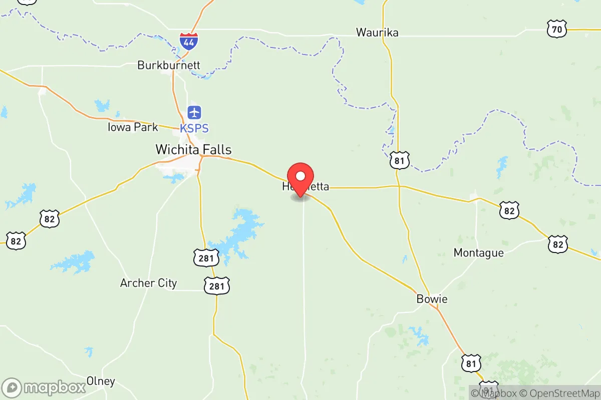
Clay County's location is its primary strategic asset. The county seat, Henrietta, sits roughly 25 miles east of Wichita Falls and about 100 miles northwest of the Dallas-Fort Worth metroplex — close enough for occasional supply runs or medical access, but far enough to avoid the cascading failures common in dense urban centers during grid-down scenarios. The county spans approximately 1,117 square miles, with a population density of roughly 10 people per square mile, offering significant buffer from population-driven risks. The Red River forms the northern boundary, providing a natural water source and a defensible geographic edge. The terrain is rolling plains and prairies, with scattered mesquite and oak, offering decent agricultural potential and natural cover. The region's climate is semi-arid, with hot summers and mild winters, reducing the risk of catastrophic weather events like hurricanes or blizzards, though tornadoes remain a seasonal concern. The Wichita Falls area, including Sheppard Air Force Base roughly 20 miles west, provides a regional hub for supplies and emergency services without the density of a major city.
Risks, exposures, and proximity to fallout-relevant landmarks
While Clay County benefits from rural isolation, it is not without strategic vulnerabilities. The most significant man-made risk comes from proximity to the Wichita Falls metropolitan area and its industrial infrastructure. Sheppard Air Force Base, a major training center for the U.S. Air Force and NATO allies, is a potential target in a conflict scenario, and its location roughly 20 miles west of Henrietta places Clay County within a plausible fallout zone depending on wind patterns. Additionally, the county lies within 150 miles of the Dallas-Fort Worth metroplex, a major population and economic center that could become a secondary target or experience severe civil disruption. On the natural hazard side, the region sits in Tornado Alley, with peak season from March to June. Clay County has experienced significant tornado events historically, including an EF-3 tornado that struck Henrietta in 2012. Wildfire risk is moderate, particularly during drought years, though the relatively flat terrain limits rapid fire spread compared to more rugged areas. Flooding along the Red River and its tributaries, including the Wichita River near Henrietta, is a periodic concern during heavy rain events. The county's water supply is primarily groundwater from the Seymour Aquifer, which is reliable but subject to depletion in extended drought conditions — a factor for those planning long-term self-sufficiency.
Practical resilience for a relocator: food, water, energy, and defensibility
For a relocator focused on practical resilience, Clay County offers several advantages and some limitations. Water access is the strongest asset: the Red River provides a perennial surface water source, and the Seymour Aquifer supports private wells throughout the county. However, well depth varies significantly — some areas require drilling to 200 feet or more — so pre-purchase hydrogeological assessment is essential. Agricultural potential is moderate: the growing season averages 220 days, suitable for warm-season crops like corn, sorghum, and wheat, as well as livestock grazing. The county has a strong ranching tradition, with cattle operations common, making it feasible for relocators to integrate into local food networks. Energy independence is achievable: the region receives abundant sunlight, with over 260 sunny days per year, making solar power a viable primary or backup energy source. Natural gas is available in some rural areas, and propane delivery is common for off-grid heating and cooking. Defensibility is a mixed picture: the flat terrain offers limited natural chokepoints, but the low population density and widely spaced properties provide inherent security through isolation. The county's road network is sparse, with only U.S. Highway 82 and State Highway 148 serving as major arteries, which limits both access and egress — a double-edged sword that reduces outside threats but also complicates evacuation if needed. Local law enforcement presence is minimal, with the Clay County Sheriff's Office covering the entire county, so relocators should plan for self-defense and community-based security arrangements. The nearest major medical facility is in Wichita Falls, roughly 30 minutes from Henrietta, which is adequate for routine care but requires planning for emergencies.
The overall strategic picture for Clay County is one of balanced trade-offs. It offers genuine geographic isolation, reliable water access, and agricultural potential that many rural Texas counties lack. The proximity to Sheppard Air Force Base and the Dallas-Fort Worth metroplex introduces man-made risk factors that cannot be ignored, but the county's low population density and distance from primary targets provide meaningful buffer. For a relocator willing to invest in well drilling, solar infrastructure, and community relationships, Clay County represents a viable long-term base with room to grow food, store supplies, and maintain a low profile. The key is to treat it as a strategic location requiring active preparation rather than a passive safe haven — the natural advantages are real, but they demand deliberate effort to fully realize.

* Values derived from national, state, county, city and local statistics and may differ in a specific area. Last updated: 2026-08-08T13:35:36.000Z
Narrative content on this page is AI-generated and may contain mistakes. Verify any details that matter before acting on them.
ReloMaps may earn a commission from affiliate links at no extra cost to you.

