Strategic Assessment of Hidalgo County
Meaningful friction. Expect exposure to either population pressure, blast zones, or natural disaster risk. Consider buying a retreat property.
What does the Strategic Assessment tell us?
Our Strategic Assessment grades tactical survivability of an area. Major population centers, military targets, fallout zones, natural disasters, and border exposure all drive risk — lower exposure means a more defensible position in a crisis.
This is heavily inspired by Joel Skousen's Strategic Relocation book. Highly recommended you checkout the book ($)What does this tell us?
Our Strategic Assessment grades tactical survivability of an area. Major population centers, military targets, fallout zones, natural disasters, and border exposure all drive risk — lower exposure means a more defensible position in a crisis.
This is heavily inspired by Joel Skousen's Strategic Relocation book. Highly recommended you checkout the book ($)Strategic Pillars

Key Distances
Strategic Assessment Analysis
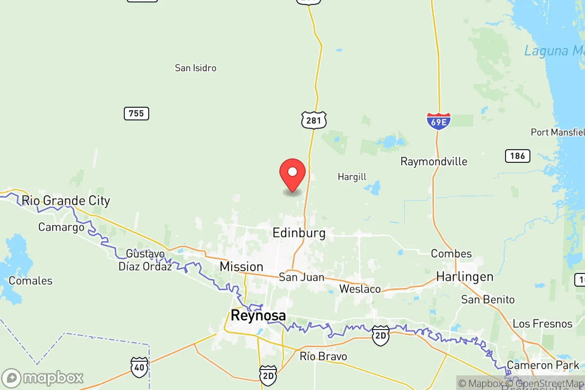
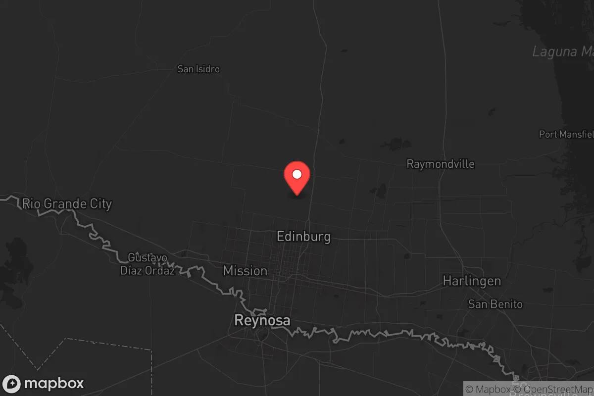
Hidalgo County, Texas, offers a strategic paradox for the conservative prepper: it sits far enough from the nation’s primary power-grid chokepoints and major population centers to avoid the worst of a cascading collapse, yet it is dangerously close to some of the most volatile industrial and border-related flashpoints in the country. The county’s resilience lies in its semi-arid climate, deep agricultural base, and position as a logistical hub for the Rio Grande Valley, but its proximity to the Mexican border, the Port of Brownsville, and the sprawling petrochemical infrastructure along the Gulf Coast introduces risks that cannot be ignored. For a relocator seeking a balance between remoteness and access to resources, Hidalgo County demands a clear-eyed assessment of both its natural advantages and its exposure to fallout-relevant landmarks.
Geographic position and natural advantages for long-term survival
Hidalgo County’s location at the southern tip of Texas, roughly 70 miles from the Gulf of Mexico and 150 miles from the nearest major metro (Corpus Christi), provides a buffer from the immediate chaos that would engulf cities like Houston or San Antonio in a national emergency. The county is part of the Rio Grande Valley, a region defined by the Rio Grande River, which offers a reliable freshwater source—critical for both drinking and irrigation in a grid-down scenario. The climate is subtropical semi-arid, meaning winters are mild and summers hot, but the area avoids the extreme cold snaps that cripple northern grids. The flat, fertile terrain supports extensive agriculture—citrus, sugarcane, and vegetables—which translates into a local food supply that could sustain a community if supply chains fail. Towns like McAllen, Edinburg, and Mission are the population anchors, but the county also includes smaller, more defensible communities like Alamo and Donna, where a relocator could establish a homestead with relative privacy. The lack of major military bases within the county itself (the nearest is Fort Hood, over 300 miles north) reduces the risk of being caught in a conflict zone, but the presence of the McAllen-Miller International Airport and the Anzalduas International Bridge means the area is a transit corridor, not a dead end.
Risks, exposures, and proximity to fallout-relevant landmarks
The most significant risk for Hidalgo County is its position on the U.S.-Mexico border, specifically the stretch between Reynosa (Mexico) and McAllen. In a scenario of civil unrest or mass migration, this border crossing could become a flashpoint for violence, cartel activity, or federal intervention. The Anzalduas and Hidalgo International Bridges are chokepoints that could be shut down or contested, and the county’s law enforcement and Border Patrol presence, while robust, would be overwhelmed in a widespread crisis. Additionally, the county lies within 100 miles of the Port of Brownsville, a major industrial hub for oil and gas exports, and the SpaceX launch facility at Boca Chica. A catastrophic event at either location—a refinery explosion, a rocket failure, or a terrorist strike—could release toxic plumes or trigger evacuations that push refugees south into Hidalgo County. The county is also downwind of the Houston Ship Channel and the Corpus Christi refinery corridor, meaning a major chemical release or nuclear incident at one of those sites could drift into the Rio Grande Valley within hours. While Hidalgo County itself has no nuclear power plants, the South Texas Nuclear Generating Station near Bay City is roughly 200 miles northeast—close enough to be a concern for fallout patterns in a worst-case scenario. The county’s flat terrain offers no natural barriers to shield against airborne contaminants, so a relocator must plan for filtration and shelter-in-place capabilities.
Practical resilience for a relocator: food, water, energy, and defensibility
For a single individual or family with a prepper mindset, Hidalgo County’s practical resilience is a mixed bag. On the positive side, the agricultural base means fresh produce is locally available year-round, and the Rio Grande provides a surface water source that can be treated with basic filtration. The region’s aquifer, the Gulf Coast Aquifer, is deep but accessible via wells, though water rights and drilling permits are regulated by the Edwards Aquifer Authority—something to research before buying land. Energy resilience is a challenge: the county is served by the Electric Reliability Council of Texas (ERCOT) grid, which has a history of failures during extreme weather (e.g., Winter Storm Uri in 2021). However, the mild winters mean solar panels are a viable primary energy source, and the area’s high solar insolation (over 5.5 kWh/m²/day) makes off-grid solar setups practical. Natural gas is abundant in the region, and propane delivery is common in rural areas, so a backup generator is feasible. Defensibility is the weak point: the county is flat, open, and crisscrossed by highways (U.S. 83, U.S. 281, and I-2), making it hard to secure a perimeter. The best strategy is to choose a property on the outskirts of a small town like La Joya or Penitas, where neighbors are sparse and sightlines are long. The local population is predominantly Hispanic and conservative-leaning, with a strong sense of community and self-reliance—cultural traits that align with a prepper ethos. Gun ownership is common, and the county has a high number of licensed firearm dealers, but the proximity to the border means cartel violence occasionally spills over, so a relocator must be prepared for both home defense and community security.
The overall strategic picture for Hidalgo County is one of calculated trade-offs. It offers a warm climate, abundant water, and local food production that many other regions lack, but its border location and proximity to industrial hazards introduce risks that cannot be mitigated by stockpiling alone. For a conservative relocator who values independence and is willing to invest in solar, water filtration, and a solid defensive plan, the county provides a viable base of operations—especially if the goal is to ride out a regional crisis rather than a nationwide collapse. However, those seeking absolute isolation or a bug-out location far from any fallout-relevant landmarks should look farther north or west, into the Texas Hill Country or the Trans-Pecos region. Hidalgo County is not a fortress, but it is a functional, resource-rich area where a prepared individual can thrive—provided they keep one eye on the border and the other on the wind.
* Values derived from national, state, county, city and local statistics and may differ in a specific area. Last updated: 2026-05-09T18:42:44.000Z
Narrative content on this page is AI-generated and may contain mistakes. Verify any details that matter before acting on them.
ReloMaps may earn a commission from affiliate links at no extra cost to you.