
Photo: Wikipedia
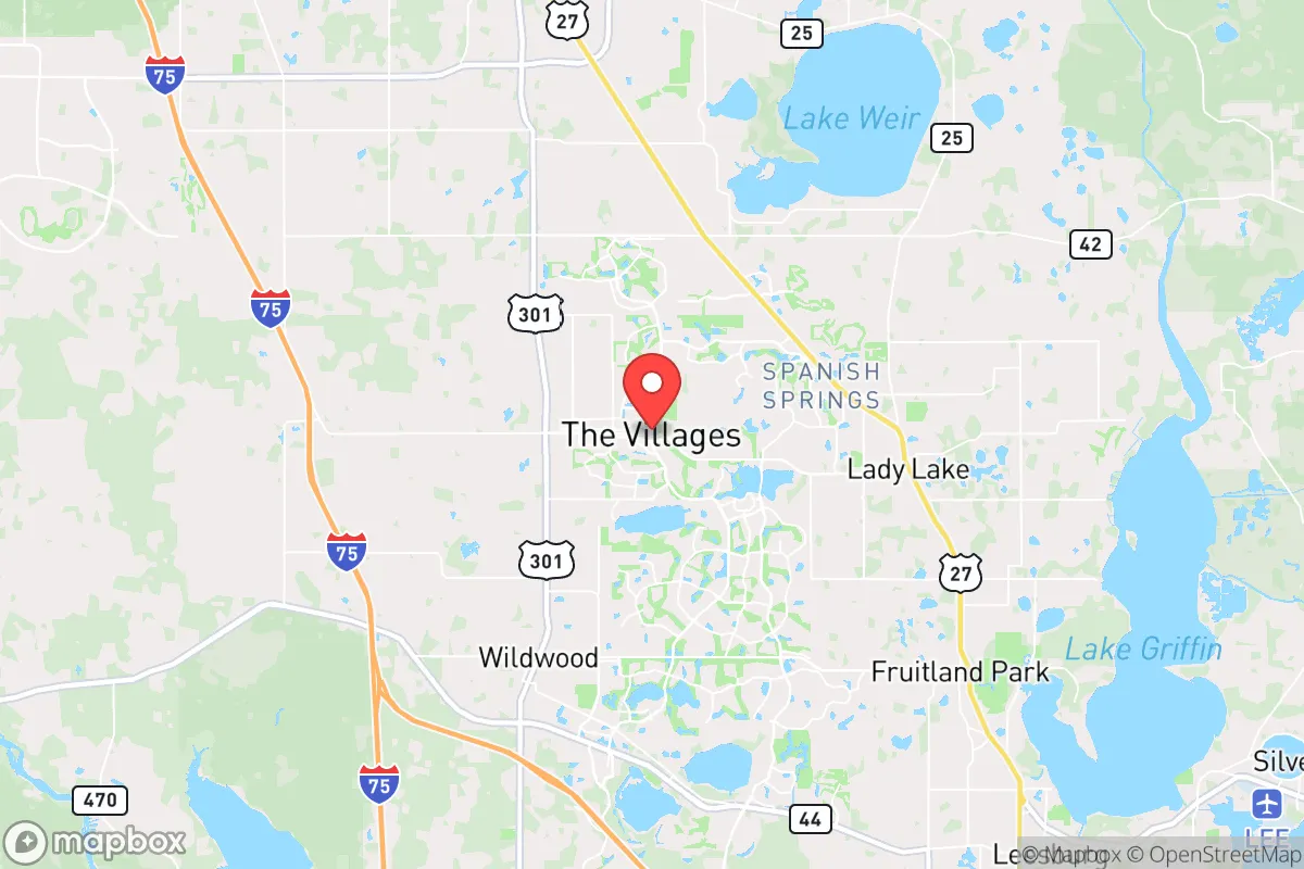
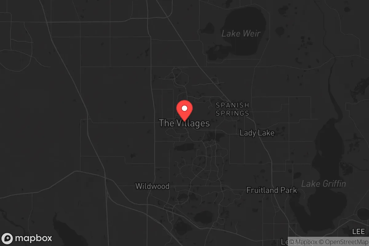
Strategic Assessment of The Villages, FL
Workable tactical position. Some exposure to population density or targets, but generally defensible in a crisis.
What does the Strategic Assessment tell us?
Our Strategic Assessment grades tactical survivability of an area. Major population centers, military targets, fallout zones, natural disasters, and border exposure all drive risk — lower exposure means a more defensible position in a crisis.
This is heavily inspired by Joel Skousen's Strategic Relocation book. Highly recommended you checkout the book ($)What does this tell us?
Our Strategic Assessment grades tactical survivability of an area. Major population centers, military targets, fallout zones, natural disasters, and border exposure all drive risk — lower exposure means a more defensible position in a crisis.
This is heavily inspired by Joel Skousen's Strategic Relocation book. Highly recommended you checkout the book ($)Strategic Pillars

Key Distances
Regional Safe Places
Below is our recommended "safe zones" in Florida and the surrounding area based on our strategic heuristics. For most people, it's unrealistic to live in a “safe zone” full-time due to work, family or other personal reasons. They tend to be more rural. However, many of these areas are perfect for second homes and retreat properties that double as a vacation home or even a short-term rental.

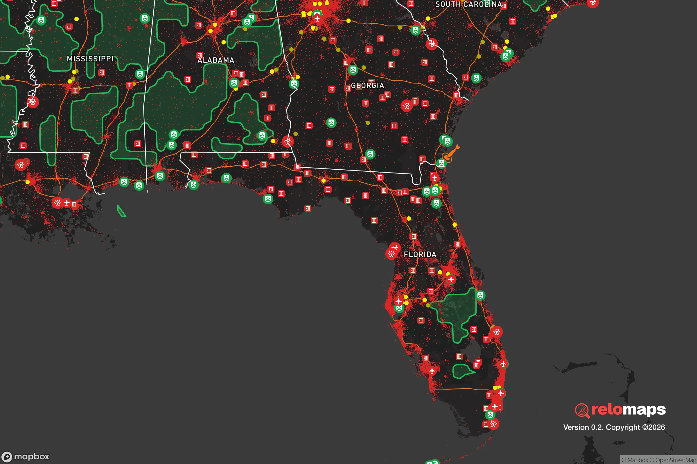
Important Note: For informational purposes only. This does not mean nothing bad ever happens in the green zones. Please use common sense. This is based on public data and modeled with AI. We tried to take a conservative approach but mistakes happen. We update this regularly as new information becomes available.
Solar Generator Recommendations
Backup power matters more here than in safer locations. We've picked three solar generators across budgets and capacity tiers — start with the budget unit if you only need a few essentials, or step up if you want to run a fridge and HVAC for days at a time.

Jackery Portable Power Station Explorer 300
Budget OptionPower on the Go: Weighing only 11 lbs, it's convenient to set up and store with book-sized foldable solar panels

BLUETTI Portable Power Station AC180
Designed for both indoor and outdoor scenarios, AC180 is highly capable as it has a robost capacity and continuous output power.

EF ECOFLOW DELTA Pro Ultra Power Station
Upgraded PickEcoFlow DELTA Pro Ultra is a whole-home energy system designed to grow with your family. Integrated with the Smart Home Panel 2, it scales to meet your evolving energy needs — keeping your home powered, intelligent, and secure through every stage of life.
We earn a commission, at no additional cost to you.
Strategic Assessment Analysis
The Villages, Florida, occupies a unique strategic position in central Florida that offers a blend of insulation from coastal storm surges and proximity to critical infrastructure, but its resilience is heavily dependent on its location within a state that faces significant natural and man-made risks. As a master-planned retirement community sprawling across Sumter, Lake, and Marion counties, it benefits from being roughly 40 miles inland from the Gulf of Mexico and 70 miles from the Atlantic, placing it outside the highest-risk hurricane surge zones. However, its location in the heart of Florida’s I-4 corridor—a densely populated, politically mixed region—means it is not isolated from the cascading effects of regional instability, whether from natural disasters, grid failures, or civil unrest. For a relocator with a prepper mindset, The Villages offers a controlled, community-oriented environment with some built-in advantages, but it also carries distinct vulnerabilities that require careful mitigation.
Geographic position and natural advantages for long-term stability
The Villages sits atop the Florida Peninsula’s central ridge, which provides slightly higher elevation—averaging 80 to 100 feet above sea level—than the surrounding lowlands. This elevation, combined with its inland position, significantly reduces the risk of storm surge flooding, a primary threat for coastal Florida communities. The area’s geology is underlain by the Floridan Aquifer, one of the most productive freshwater sources in the world, meaning groundwater access is generally reliable, though subject to contamination from surface runoff and saltwater intrusion in coastal zones. The climate is subtropical, with hot, humid summers and mild winters, allowing for year-round gardening and outdoor activity—a practical advantage for self-sufficiency. The region’s natural vegetation includes pine flatwoods and oak hammocks, which provide some cover and natural resources, but the landscape is largely developed, with limited wilderness for long-term retreat. The proximity to the Ocala National Forest, about 30 miles north, offers a potential buffer zone and resource area, but it is not contiguous with The Villages itself, requiring travel through populated corridors. For a relocator, the key natural advantage is the absence of major flood zones and the presence of a reliable aquifer, but the lack of significant topographic defensibility—no hills, no dense forests—means the area is not a natural redoubt.
Risks, exposures, and proximity to fallout-relevant landmarks
The most significant risk for The Villages is its location within the I-4 corridor, a high-density population zone stretching from Tampa to Daytona Beach, which includes over 8 million people. In a scenario of civil unrest or mass casualty events, this corridor becomes a major chokepoint and target. The Villages is roughly 50 miles from the Crystal River Nuclear Plant (now decommissioned but still storing spent fuel) and 70 miles from the St. Lucie Nuclear Plant, placing it within the 50-mile emergency planning zone for both. While the risk of a nuclear incident is low, the presence of these facilities—and the potential for sabotage or accident—adds a layer of concern for fallout exposure. Additionally, the area is within 100 miles of MacDill Air Force Base in Tampa, a strategic military installation that could be a target in a conflict scenario. The Villages itself is not near any major military bases, ammunition depots, or chemical plants, which is a positive, but its proximity to Orlando (45 miles east) and Ocala (30 miles north) means it is within striking distance of urban unrest, supply chain disruptions, and refugee flows. The region is also prone to sinkholes due to its karst geology, which can damage infrastructure and homes without warning. For a prepper, the primary exposure is not direct attack but the cascading effects of regional instability—grid failure, food shortages, and population displacement from nearby cities.
Practical resilience for a relocator: food, water, energy, and defensibility
The Villages offers a mixed bag for practical resilience. On the positive side, the community’s design includes extensive golf cart paths, which can serve as alternative transportation routes if main roads are blocked. The area has a high density of retirees, many with medical training or military backgrounds, which could foster a cooperative community response in a crisis. However, the population is also elderly and dependent on regular medical care, which could strain resources during a prolonged event. For food resilience, the surrounding Sumter and Lake counties have agricultural land—citrus groves, cattle ranches, and vegetable farms—but The Villages itself is a suburban development with limited space for large-scale gardening. Homeowners associations (HOAs) in The Villages are notoriously strict, and many prohibit visible gardens, livestock, or solar panels, which could hinder self-sufficiency efforts. Water resilience is better: most homes are on municipal water supplied by the aquifer, but a grid-down scenario would require backup power for well pumps or access to surface water from nearby lakes like Lake Sumter or Lake Okahumpka. Energy resilience is a weak point—the area is served by Duke Energy and SECO Energy, and while solar is possible, HOA restrictions and the flat terrain limit options for off-grid setups. Defensibility is poor: the community is a sprawling, low-density suburb with open streets and multiple entry points, making it difficult to secure against a determined threat. For a relocator, the best approach is to secure a home on the periphery of The Villages, near agricultural land or a water source, and to invest in underground cisterns, solar panels (if HOA allows), and a reliable vehicle for evacuation. Stockpiling food and medical supplies is essential, as local stores like Publix and Walmart could be depleted quickly in a crisis.
The overall strategic picture for The Villages is one of calculated trade-offs. It offers a stable, low-crime environment with a strong sense of community and access to freshwater, but it lacks the geographic isolation and defensibility that a true survivalist would seek. For a conservative-leaning relocator concerned with the state of the country, The Villages is a reasonable choice if you prioritize community support and medical infrastructure over rugged self-sufficiency. However, it is not a bug-out location—it is a suburban bubble that could become a trap if the I-4 corridor collapses. The best use of this area is as a base for building a network of like-minded individuals, with a secondary retreat property in a more remote area like the Florida Panhandle or the Appalachian foothills. If you are willing to navigate HOA restrictions and invest in off-grid upgrades, The Villages can work as a long-term home, but do not mistake its manicured lawns and golf courses for true resilience. Prepare for the worst, and you might find it a comfortable place to ride out moderate disruptions—but for a major event, have an exit plan.
* Values derived from national, state, county, city and local statistics and may differ in a specific area. Last updated: 2026-04-24T03:56:38.000Z
Narrative content on this page is AI-generated and may contain mistakes. Verify any details that matter before acting on them.
ReloMaps may earn a commission from affiliate links at no extra cost to you.