
Photo: Wikipedia
Strategic Assessment of Arlington County
Multiple tactical vulnerabilities. Population density, target proximity, or disaster risk are likely compounding. A retreat property and exit planning is required.
What does the Strategic Assessment tell us?
Our Strategic Assessment grades tactical survivability of an area. Major population centers, military targets, fallout zones, natural disasters, and border exposure all drive risk — lower exposure means a more defensible position in a crisis.
This is heavily inspired by Joel Skousen's Strategic Relocation book. Highly recommended you checkout the book ($)What does this tell us?
Our Strategic Assessment grades tactical survivability of an area. Major population centers, military targets, fallout zones, natural disasters, and border exposure all drive risk — lower exposure means a more defensible position in a crisis.
This is heavily inspired by Joel Skousen's Strategic Relocation book. Highly recommended you checkout the book ($)Strategic Pillars

Key Distances
Strategic Assessment Analysis
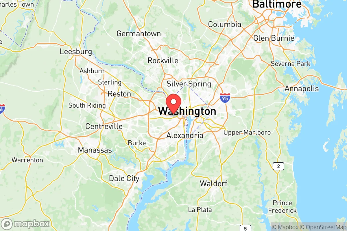
Arlington County presents a paradox for the relocation-minded conservative: it sits in the bullseye of the federal government’s administrative heart, yet its geographic position and infrastructure offer a level of strategic resilience that is rare inside the Beltway. For a single individual or family weighing disaster readiness, Arlington is not a retreat—it is a forward operating base with serious trade-offs. Its proximity to the Pentagon, Reagan National Airport (DCA), and the Potomac River corridor means it is both a high-value target and a logistics hub, demanding a clear-eyed assessment of risks versus practical advantages.
Geographic position and natural advantages: the Potomac corridor and the fall line
Arlington’s location along the fall line of the Potomac River gives it a natural elevation advantage over downstream Washington, D.C., which sits on a floodplain. The county’s western neighborhoods—like Arlington Forest and Barcroft—rise to roughly 300 feet above sea level, offering defensible high ground relative to the tidal Potomac. The river itself is a reliable freshwater source, though it requires filtration for potable use. The county’s position at the junction of I-395, I-66, and the George Washington Memorial Parkway provides multiple egress routes north toward Maryland’s agricultural counties (Montgomery, Frederick) and west toward the Shenandoah Valley, a key food-producing region. However, these same arteries become choke points during an evacuation; the 2023 I-95 snowstorm standstill demonstrated how quickly the region’s road network can fail. Arlington’s compact geography—just 26 square miles—means that no point is more than a 20-minute drive from a major highway, but that density also concentrates risk.
Risks, exposures, and proximity to fallout-relevant landmarks
The single greatest strategic liability for Arlington is its proximity to high-value government and military targets. The Pentagon, located within the county’s borders, is a Tier-1 target for any state-level adversary. Reagan National Airport, just south of the Pentagon, serves as a potential staging ground for military airlift but also as a target for standoff attacks. The I-395 corridor, which funnels traffic past the Pentagon and into D.C., is a likely ground-zero zone for any conventional or asymmetric strike on the federal district. Additionally, the county sits within 10 miles of the White House, the Capitol, and the Supreme Court—all of which are considered primary targets in a nuclear exchange scenario. While Arlington itself has no refineries or heavy industrial plants, the CSX rail line running through the county carries hazardous materials (including chlorine and ammonia) from the Midwest to the East Coast, creating a secondary risk of chemical spills or sabotage. The county’s high population density—over 1,100 people per square mile—means that any localized event (a hazmat release, a power grid failure) quickly becomes a regional crisis. For a relocator, the key takeaway is that Arlington is not a safe haven from man-made disasters; it is a high-exposure zone that demands a robust personal preparedness plan.
Practical resilience for a relocator: food, water, energy, and defensibility
Arlington’s practical resilience is a mixed bag. The county’s water supply comes from the Potomac River, treated at the Dalecarlia and McMillan plants in D.C. This system is vulnerable to upstream contamination (e.g., a spill at the Blue Plains wastewater plant or a sabotage event at the Little Falls Pump Station). A relocator should plan for at least two weeks of stored water per person, as municipal supply could be interrupted for days. Food security is weak: Arlington has no significant agricultural land, and the county’s grocery stores rely on just-in-time delivery from distribution centers in Maryland and Virginia. The closest major food hub is the Shenandoah Valley, 90 miles west, which produces poultry, apples, and grain—but that supply chain is vulnerable to highway disruption. Energy resilience is slightly better: Dominion Energy’s grid is underground in many newer developments (e.g., the Rosslyn-Ballston corridor), reducing storm-related outages, but the county’s reliance on overhead lines in older neighborhoods (like Lyon Village and Cherrydale) means that a winter ice storm or cyberattack on the grid could leave residents without power for days. Defensibility is the weakest link. Arlington is a dense, urban county with no natural barriers—no mountains, no large forests, no rivers wide enough to serve as a moat. The Potomac is fordable in several spots during low water, and the county’s street grid is easily navigable. For a family seeking a retreat, Arlington is not defensible in any traditional sense; its value lies in its logistics and information access, not in its ability to withstand a siege. The county’s police and fire departments are well-funded (Arlington spends over $200 per capita on public safety), but they are designed for rapid response to urban incidents, not for long-term security in a breakdown scenario.
The overall strategic picture for Arlington County is one of high capability paired with high exposure. For a relocator with a conservative mindset—valuing self-reliance, community cohesion, and strategic positioning—Arlington works best as a base of operations rather than a final destination. Its strengths are information density (proximity to federal agencies, think tanks, and military command), infrastructure (multiple airports, rail, and highway links), and a relatively stable local government (Arlington has a AAA bond rating and a history of competent emergency management). Its weaknesses are concentration of target value, dependence on fragile supply chains, and lack of natural defensibility. A prudent relocator would treat Arlington as a place to build skills, networks, and resources—not as a place to ride out a major disaster. The smart play is to use Arlington’s advantages to prepare a secondary location in the Shenandoah Valley or the Blue Ridge foothills, where land is cheaper, water is more abundant, and the fallout risk is lower. In short: Arlington is a high-risk, high-reward outpost for the prepared, not a sanctuary for the unwary.

* Values derived from national, state, county, city and local statistics and may differ in a specific area. Last updated: 2026-10-03T13:55:08.000Z
Narrative content on this page is AI-generated and may contain mistakes. Verify any details that matter before acting on them.
ReloMaps may earn a commission from affiliate links at no extra cost to you.

