Photo: Wikipedia
Strategic Assessment of Pierce County
Meaningful friction. Expect exposure to either population pressure, blast zones, or natural disaster risk. Consider buying a retreat property.
What does the Strategic Assessment tell us?
Our Strategic Assessment grades tactical survivability of an area. Major population centers, military targets, fallout zones, natural disasters, and border exposure all drive risk — lower exposure means a more defensible position in a crisis.
This is heavily inspired by Joel Skousen's Strategic Relocation book. Highly recommended you checkout the book ($)What does this tell us?
Our Strategic Assessment grades tactical survivability of an area. Major population centers, military targets, fallout zones, natural disasters, and border exposure all drive risk — lower exposure means a more defensible position in a crisis.
This is heavily inspired by Joel Skousen's Strategic Relocation book. Highly recommended you checkout the book ($)Strategic Pillars

Key Distances
Strategic Assessment Analysis
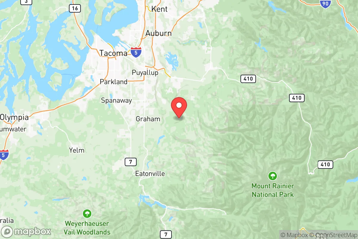
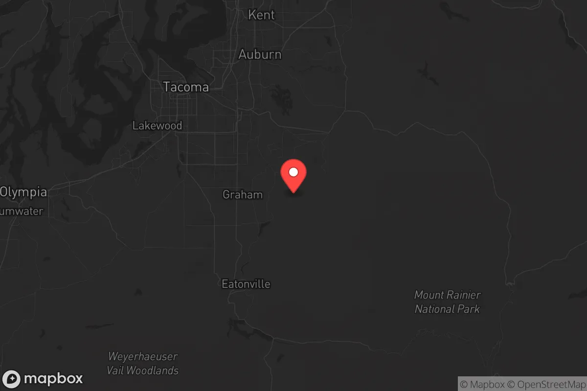
Pierce County, Washington, offers a mixed strategic picture for the conservative prepper or survivalist. Its position south of Seattle provides a buffer from the immediate chaos of a major metropolitan collapse, yet it remains close enough to be affected by fallout—both literal and societal. The county’s geography, anchored by the active Mount Rainier and the sprawling Joint Base Lewis-McChord (JBLM), creates a unique set of advantages and liabilities that demand careful consideration before any relocation decision.
Geographic position and natural advantages: The Rainier shield and the Puget Sound corridor
Pierce County’s primary strategic asset is its location between the Cascade Range and the Puget Sound. The county seat, Tacoma, sits roughly 35 miles south of Seattle, placing it outside the immediate blast radius of a Seattle-centric event but well within the zone of secondary effects—refugee flows, supply chain disruptions, and potential civil unrest. The natural barrier of the Cascades to the east and the Olympic Mountains to the west provides a degree of geographic insulation, but the I-5 corridor running straight through the county is a double-edged sword: it’s your lifeline for trade and movement, but it’s also the primary invasion route for displaced populations from the north. The county’s southern reaches, around towns like Eatonville and Graham, offer more defensible terrain with forested hills and lower population density. The Nisqually River and the Puyallup River watersheds provide reliable freshwater sources, though both are subject to volcanic lahar risks from Mount Rainier. For the relocator, the key takeaway is that the further south and east you go from Tacoma, the better your strategic position becomes.
Risks, exposures, and proximity to fallout-relevant landmarks
The most glaring risk in Pierce County is Mount Rainier itself. It is an active stratovolcano, and the USGS classifies it as one of the most dangerous in the world due to its potential for massive lahars (volcanic mudflows). The Puyallup River valley, which includes the towns of Orting, Sumner, and Puyallup, sits directly in the lahar path. A major eruption could bury these areas under dozens of feet of mud within minutes. This is not a theoretical risk; lahar warning sirens are tested regularly in Orting. Beyond the volcano, the county hosts Joint Base Lewis-McChord, a massive military installation that is a primary staging ground for West Coast operations. In a national emergency, JBLM would be a high-value target for both foreign adversaries and domestic unrest. Its presence also means the area is saturated with military personnel and equipment, which could be a stabilizing force or a flashpoint depending on the scenario. The Port of Tacoma, a major shipping hub, is another critical infrastructure node. A disruption there—whether from a cyberattack, a physical strike, or a labor collapse—would cripple supply chains for the entire region. The refinery complex at the Port of Tacoma, including the Phillips 66 facility, is a clear target for any coordinated attack. For the prepper, living within 20 miles of JBLM or the Port of Tacoma means accepting a higher risk profile. The county’s proximity to the Hanford Site (about 150 miles east) is a lesser concern, but prevailing westerly winds mean that a catastrophic release from Hanford would not directly impact Pierce County—though the psychological and economic fallout would be felt.
Practical resilience for a relocator: Food, water, energy, and defensibility
Water is abundant in Pierce County, but it’s not all drinkable straight from the tap. The county’s municipal water systems draw from the Green River and the South Tacoma aquifer, but a major seismic event could disrupt treatment and distribution. Well water is the gold standard here, and properties in the eastern and southern parts of the county—around Buckley, Carbonado, and Wilkeson—often have reliable private wells. Food resilience is moderate. The Puyallup Valley is historically agricultural, but suburban sprawl has eaten up much of the prime farmland. Small-scale farming is still viable in the Eatonville and Roy areas, and the growing season is long enough for cool-weather crops. The real food security play is access to the Puget Sound for fishing and shellfish, but that requires coastal property, which is expensive and vulnerable to tsunami risk. Energy is a weak point. The county relies heavily on the regional grid, which is fed by hydroelectric dams on the Columbia and Snake Rivers. A Cascadia Subduction Zone earthquake would likely take down the grid for weeks or months. Solar with battery backup is a must, but the Pacific Northwest’s overcast winters mean you need a larger array than you would in Arizona. Defensibility varies wildly. The urban core of Tacoma and the dense suburbs of Lakewood and Parkland are not defensible in any practical sense. The rural fringe—think the foothills around Mount Rainier National Park or the forested areas near the Gifford Pinchot National Forest boundary—offers natural chokepoints and limited road access. The key is to avoid being on a main evacuation route. Properties on dead-end roads off State Route 7 or 161 are preferable to those on the main drag.
The overall strategic picture for Pierce County is one of high potential reward paired with high specific risk. It is not a bug-out location for the faint of heart. The volcanic and seismic threats are real and require active mitigation—property selection, structural reinforcement, and a solid evacuation plan. The proximity to JBLM and the Port of Tacoma means you are living near a potential target, but it also means you are near a source of skilled labor and military-grade logistics. For the conservative relocator who values self-reliance and community, the southern and eastern reaches of the county offer a viable balance of access to resources and distance from urban decay. The key is to treat Pierce County not as a final redoubt, but as a forward operating base—a place to build skills, stockpile supplies, and establish relationships, with a secondary location further east (like the Idaho panhandle) as a deeper fallback. If you can handle the rain and the risk, the land itself is fertile, the water is plentiful, and the people are generally minded toward preparedness. Just don’t buy in the lahar zone.
* Values derived from national, state, county, city and local statistics and may differ in a specific area. Last updated: 2026-05-14T16:36:36.000Z
Narrative content on this page is AI-generated and may contain mistakes. Verify any details that matter before acting on them.
ReloMaps may earn a commission from affiliate links at no extra cost to you.