
Photo: Wikipedia
Strategic Assessment of Waukesha County
Meaningful friction. Expect exposure to either population pressure, blast zones, or natural disaster risk. Consider buying a retreat property.
What does the Strategic Assessment tell us?
Our Strategic Assessment grades tactical survivability of an area. Major population centers, military targets, fallout zones, natural disasters, and border exposure all drive risk — lower exposure means a more defensible position in a crisis.
This is heavily inspired by Joel Skousen's Strategic Relocation book. Highly recommended you checkout the book ($)What does this tell us?
Our Strategic Assessment grades tactical survivability of an area. Major population centers, military targets, fallout zones, natural disasters, and border exposure all drive risk — lower exposure means a more defensible position in a crisis.
This is heavily inspired by Joel Skousen's Strategic Relocation book. Highly recommended you checkout the book ($)Strategic Pillars

Key Distances
Strategic Assessment Analysis
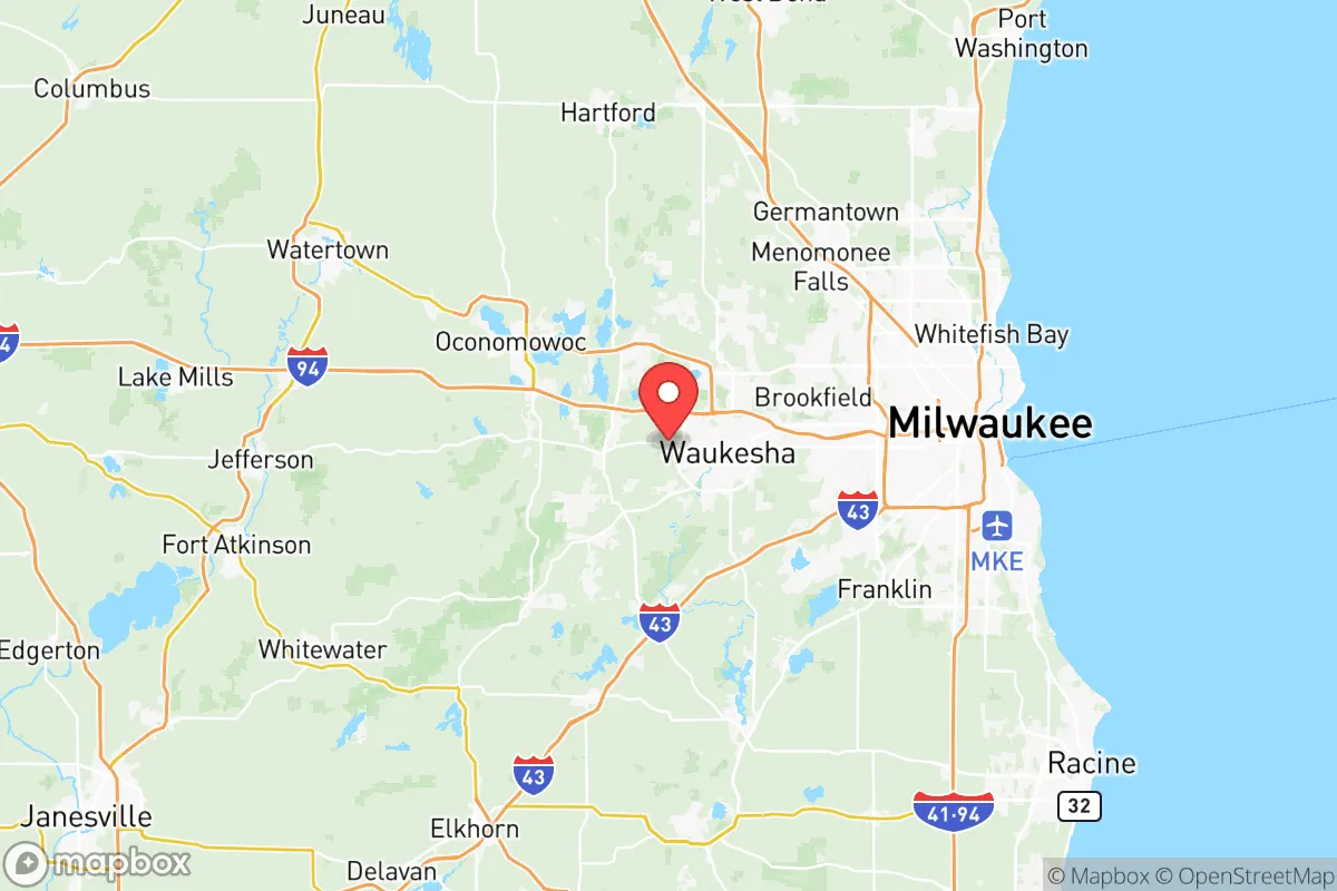
Waukesha County offers a compelling mix of proximity to Milwaukee’s economic engine and a buffer from its urban risks, making it a serious contender for those prioritizing resilience without abandoning career access. The county’s position along the western edge of the Milwaukee metro area provides a strategic depth that few suburban counties can match—close enough to tap into jobs and infrastructure, far enough to avoid the worst of civil unrest or infrastructure collapse. For a conservative-leaning relocator focused on preparedness, Waukesha County’s blend of rural pockets, suburban stability, and conservative governance creates a defensible base of operations.
Geographic position and natural advantages for long-term stability
Waukesha County sits roughly 20 miles west of Milwaukee, with its eastern edge along the Lake Michigan shoreline and its western reaches extending into the Kettle Moraine State Forest region. This geography offers a natural buffer: the county’s western towns like Dousman and Eagle are surrounded by rolling hills, glacial lakes, and dense woodlands that provide cover and resources. The Fox River runs through the county, offering a reliable freshwater source, while the Pewaukee Lake chain and Nagawicka Lake supply additional water access for filtration and irrigation. The county’s elevation—averaging 900 feet above sea level—keeps it above floodplains common in southern Wisconsin, reducing risk from natural disasters like river flooding. The Kettle Moraine State Forest’s 30,000 acres of public land offer hunting, foraging, and timber resources, all within a 30-minute drive from the county seat of Waukesha. This mix of suburban infrastructure and rural wilderness gives relocators a rare ability to live in a defensible home while still commuting to Milwaukee’s job market—a key advantage for those who need to maintain income during uncertain times.
Risks, exposures, and proximity to fallout-relevant landmarks
The county’s primary risk comes from its proximity to Milwaukee, a major Great Lakes port and industrial hub. Milwaukee’s Port of Milwaukee handles bulk cargo, including petroleum and chemicals, making it a potential target for disruption during civil unrest or supply chain collapse. The city’s population density—over 600,000 people within 20 miles of Waukesha County’s eastern border—means that any mass casualty event or riot in Milwaukee could spill westward along Interstate 94. The I-94 corridor is a double-edged sword: it provides evacuation routes but also funnels threats directly into the county. Additionally, the Waukesha County Airport (Crites Field) in Waukesha itself is a general aviation hub that could become a target for aerial threats or a staging ground for FEMA operations during a crisis. The county’s western edge, however, offers a buffer: towns like Oconomowoc and Hartland are 30-40 miles from Milwaukee’s urban core, reducing fallout exposure from a potential dirty bomb or industrial accident. The Pewaukee River and Fox River watersheds are vulnerable to contamination from upstream agricultural runoff, but the county’s groundwater—drawn from deep sandstone aquifers—is generally protected from surface-level threats. For a prepper, the key is to avoid the eastern suburbs like Brookfield and New Berlin, which are too close to Milwaukee’s blast radius, and instead focus on the western towns where population density drops below 200 people per square mile.
Practical resilience for a relocator: food, water, energy, and defensibility
Waukesha County’s agricultural base is a major asset for food security. The county has over 1,200 farms, with significant production of corn, soybeans, and dairy, concentrated in the western townships like Eagle and Mukwonago. Farmers’ markets in Waukesha and Delafield operate year-round, providing fresh produce and meat even in winter. For water, the county’s groundwater is abundant and clean, with the Waukesha Water Utility drawing from the deep sandstone aquifer—though relocators should invest in a well and hand pump for off-grid redundancy. The county’s energy grid is tied to the We Energies system, which relies on coal and natural gas plants in Milwaukee and Oak Creek; a grid-down scenario would require solar panels or a generator, but the county’s tree cover and rolling hills make solar viable on south-facing slopes. Defensibility is strong in the western half: the Kettle Moraine’s dense forests and steep terrain create natural choke points, while the Glacial Drumlin State Trail and Ice Age Trail offer off-road travel routes that avoid main highways. The county’s conservative governance—Waukesha County voted 58% for Trump in 2020—means local law enforcement is generally pro-Second Amendment, and the Waukesha County Sheriff’s Department has a reputation for quick response times in rural areas. For a relocator, the ideal setup is a property in the western townships with a well, septic, and solar array, within 10 miles of a small town like Dousman or Eagle for supplies and community support.
The overall strategic picture for Waukesha County is one of calculated risk: it offers a rare combination of economic access and rural buffer, but demands careful site selection to avoid Milwaukee’s shadow. For a conservative relocator who values self-reliance and community cohesion, the western half of the county—particularly the area between Oconomowoc and Eagle—provides a defensible position with natural resources, low population density, and a like-minded population. The county’s proximity to Milwaukee is a liability, but one that can be managed by staying west of Highway 83 and maintaining a low profile. In a worst-case scenario of civil unrest or supply chain collapse, Waukesha County’s agricultural base and water access make it a viable long-term holdout, provided you’ve built the right infrastructure. It’s not a bug-out location—it’s a strategic base for those who want to stay connected to the economy while preparing for the worst.
* Values derived from national, state, county, city and local statistics and may differ in a specific area. Last updated: 2026-05-13T00:43:39.000Z
Narrative content on this page is AI-generated and may contain mistakes. Verify any details that matter before acting on them.
ReloMaps may earn a commission from affiliate links at no extra cost to you.