Photo: Wikipedia
Strategic Assessment of Yakima, WA
Workable tactical position. Some exposure to population density or targets, but generally defensible in a crisis.
What does the Strategic Assessment tell us?
Our Strategic Assessment grades tactical survivability of an area. Major population centers, military targets, fallout zones, natural disasters, and border exposure all drive risk — lower exposure means a more defensible position in a crisis.
This is heavily inspired by Joel Skousen's Strategic Relocation book. Highly recommended you checkout the book ($)What does this tell us?
Our Strategic Assessment grades tactical survivability of an area. Major population centers, military targets, fallout zones, natural disasters, and border exposure all drive risk — lower exposure means a more defensible position in a crisis.
This is heavily inspired by Joel Skousen's Strategic Relocation book. Highly recommended you checkout the book ($)Strategic Pillars

Key Distances
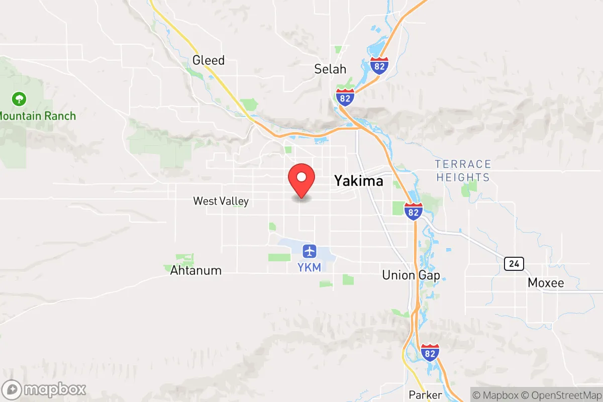
Regional Safe Places
Below is our recommended "safe zones" in Washington and the surrounding area based on our strategic heuristics. For most people, it's unrealistic to live in a “safe zone” full-time due to work, family or other personal reasons. They tend to be more rural. However, many of these areas are perfect for second homes and retreat properties that double as a vacation home or even a short-term rental.


Important Note: For informational purposes only. This does not mean nothing bad ever happens in the green zones. Please use common sense. This is based on public data and modeled with AI. We tried to take a conservative approach but mistakes happen. We update this regularly as new information becomes available.
Solar Generator Recommendations
Backup power matters more here than in safer locations. We've picked three solar generators across budgets and capacity tiers — start with the budget unit if you only need a few essentials, or step up if you want to run a fridge and HVAC for days at a time.

Jackery Portable Power Station Explorer 300
Budget OptionPower on the Go: Weighing only 11 lbs, it's convenient to set up and store with book-sized foldable solar panels

BLUETTI Portable Power Station AC180
Designed for both indoor and outdoor scenarios, AC180 is highly capable as it has a robost capacity and continuous output power.

EF ECOFLOW DELTA Pro Ultra Power Station
Upgraded PickEcoFlow DELTA Pro Ultra is a whole-home energy system designed to grow with your family. Integrated with the Smart Home Panel 2, it scales to meet your evolving energy needs — keeping your home powered, intelligent, and secure through every stage of life.
We earn a commission, at no additional cost to you.
Strategic Assessment Analysis
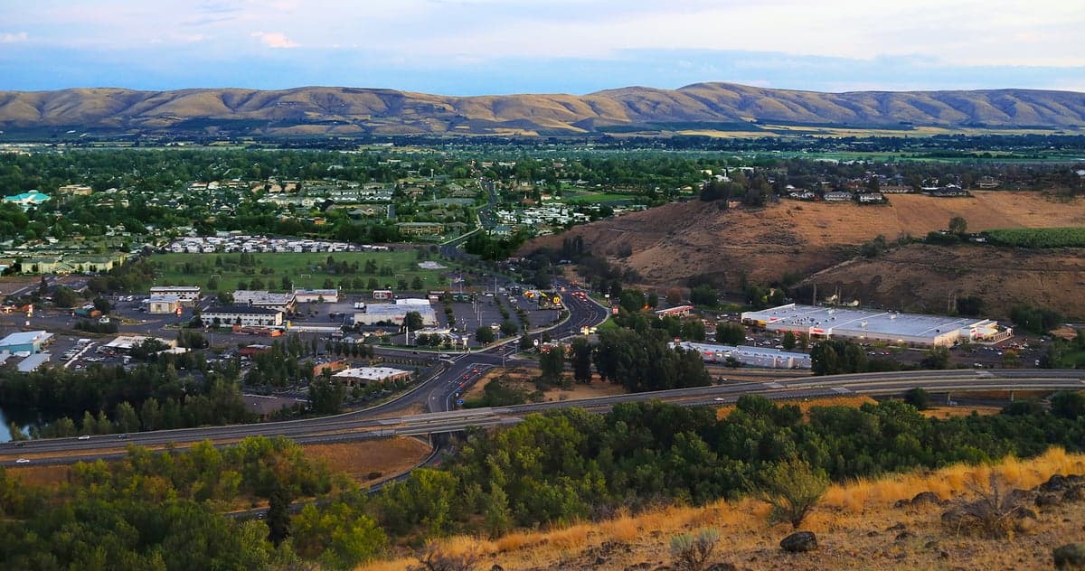
Yakima, Washington, sits in a strategic sweet spot that resilience-minded relocators should take seriously: far enough from the West Coast’s major population centers to avoid the worst of cascading failures, yet close enough to leverage their infrastructure when things are stable. The city anchors the Yakima Valley, a region defined by agriculture, water access, and a conservative-leaning population that tends to keep to itself. For someone weighing the risks of civic unrest, supply chain disruptions, or natural disasters, Yakima offers a blend of defensibility and resource availability that’s hard to find in the Pacific Northwest without going deep into the mountains.
Geographic position and natural advantages for long-term stability
Yakima’s location is its strongest card. It sits in a rain shadow east of the Cascade Range, which means it gets roughly 8 inches of annual precipitation—far less than Seattle’s 37 inches—reducing flood and landslide risks that plague western Washington. The valley floor is flat, fertile, and irrigated by the Yakima River and a network of reservoirs, making it one of the most productive agricultural regions in the state. The surrounding terrain offers natural chokepoints: the Cascades to the west, the Rattlesnake Hills to the south, and the Manastash Ridge to the north. These aren’t impassable barriers, but they slow movement and create defensible perimeters. The area’s elevation (around 1,000 feet) keeps it out of the worst wildfire zones, though smoke can drift in during dry summers. For a relocator, the key takeaway is that Yakima is not a coastal target, not a floodplain, and not a seismic hotspot—it’s a stable platform in a region that’s otherwise prone to shaking and sliding.
Risks, exposures, and proximity to fallout-relevant landmarks
No location is risk-free, and Yakima has its share of exposures. The biggest concern is the Hanford Site, a decommissioned nuclear production facility about 50 miles southeast. Hanford holds the largest volume of radioactive waste in the Western Hemisphere, much of it in aging underground tanks. A major earthquake or terrorist event could release contamination, and prevailing winds would carry fallout northeast—away from Yakima, but not entirely out of the picture. Closer to home, the Yakima Valley is crossed by Interstate 82 and U.S. Highway 12, which are evacuation routes from Seattle and Portland. In a crisis, these roads could become clogged with refugees, bringing security risks and resource strain. The city itself has a population of about 94,000, with a metro area pushing 250,000—small enough to avoid the chaos of a major metro, but large enough to have a police force, hospitals, and a jail. The nearest major military installation is Joint Base Lewis-McChord (JBLM), about 130 miles northwest, which could be a source of order or a target depending on the scenario. For the prepper, the calculus is: Yakima is close enough to Hanford to warrant monitoring, but far enough that a direct hit is unlikely. The real risk is secondary—refugee flow and supply chain disruption from the I-5 corridor.
Practical resilience for a relocator: food, water, energy, and defensibility
Yakima’s practical resilience is where it shines for the survivalist mindset. Food security is exceptional: the valley produces apples, cherries, hops, wine grapes, and a variety of row crops. You can buy directly from farms, join a CSA, or grow your own on the fertile soil. Water access is also strong—the Yakima River runs through town, and the irrigation system is managed by the U.S. Bureau of Reclamation. However, water rights are already over-allocated in dry years, so a relocator should secure a property with a well or a senior water right. Energy infrastructure is a mixed bag: Yakima gets power from the Bonneville Power Administration (hydroelectric), which is reliable but vulnerable to grid failures. Solar potential is good (over 300 sunny days per year), and many rural properties are off-grid capable. Defensibility is moderate—the city itself is not a fortress, but the surrounding rural areas offer plenty of acreage with good sightlines and limited access points. The local population is heavily involved in hunting and firearms ownership, which means a community that’s armed and self-reliant. For a single individual or family, the best strategy is to buy land outside city limits—within a 15-minute drive of Yakima’s hospitals and grocery stores, but far enough to have a buffer. The county’s conservative political leanings also mean less regulatory friction for things like building a root cellar, storing fuel, or keeping livestock.
The overall strategic picture for Yakima is that it’s a solid B+ location for the prepper who wants to stay within striking distance of the Pacific Northwest’s resources without being in the blast zone. It’s not a remote mountain redoubt—you’ll have neighbors, traffic, and the occasional homeless camp—but it’s not a coastal city that will burn in the first 72 hours of a crisis. The agricultural base, water access, and conservative community make it a viable long-term hub for those who plan ahead. The downsides—Hanford proximity, refugee routes, and occasional wildfire smoke—are manageable with proper preparation. For someone looking to relocate with a survivalist lens, Yakima deserves a serious look, especially if you’re willing to trade some isolation for practical self-sufficiency.
* Values derived from national, state, county, city and local statistics and may differ in a specific area. Last updated: 2026-04-21T11:17:58.000Z
Narrative content on this page is AI-generated and may contain mistakes. Verify any details that matter before acting on them.
ReloMaps may earn a commission from affiliate links at no extra cost to you.