
Photo: Wikipedia
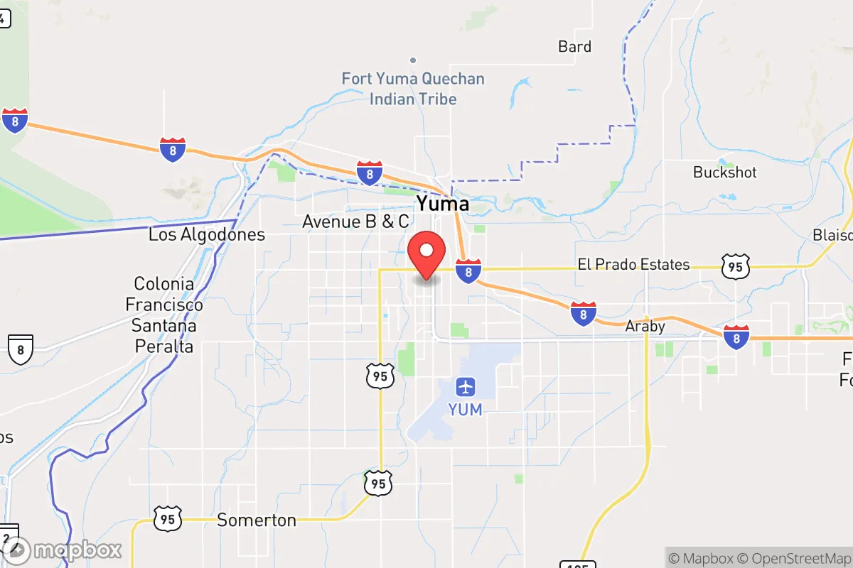
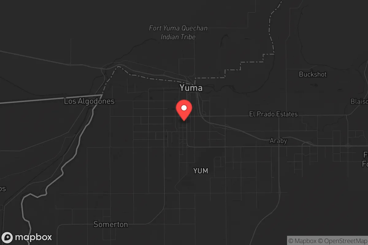
Strategic Assessment of Yuma, AZ
Multiple tactical vulnerabilities. Population density, target proximity, or disaster risk are likely compounding. A retreat property and exit planning is required.
What does the Strategic Assessment tell us?
Our Strategic Assessment grades tactical survivability of an area. Major population centers, military targets, fallout zones, natural disasters, and border exposure all drive risk — lower exposure means a more defensible position in a crisis.
This is heavily inspired by Joel Skousen's Strategic Relocation book. Highly recommended you checkout the book ($)What does this tell us?
Our Strategic Assessment grades tactical survivability of an area. Major population centers, military targets, fallout zones, natural disasters, and border exposure all drive risk — lower exposure means a more defensible position in a crisis.
This is heavily inspired by Joel Skousen's Strategic Relocation book. Highly recommended you checkout the book ($)Strategic Pillars

Key Distances
Regional Safe Places
Below is our recommended "safe zones" in Arizona and the surrounding area based on our strategic heuristics. For most people, it's unrealistic to live in a “safe zone” full-time due to work, family or other personal reasons. They tend to be more rural. However, many of these areas are perfect for second homes and retreat properties that double as a vacation home or even a short-term rental.
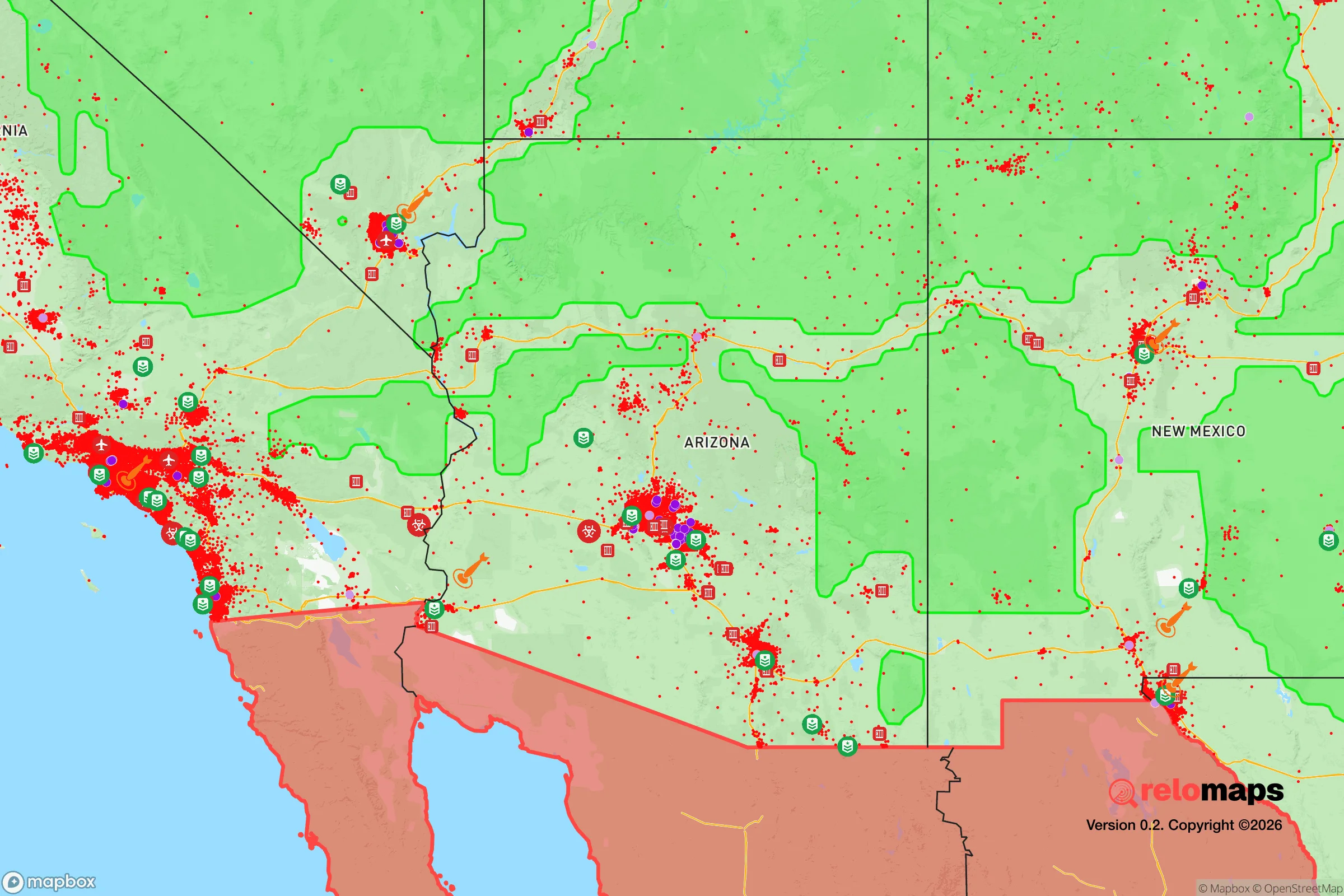
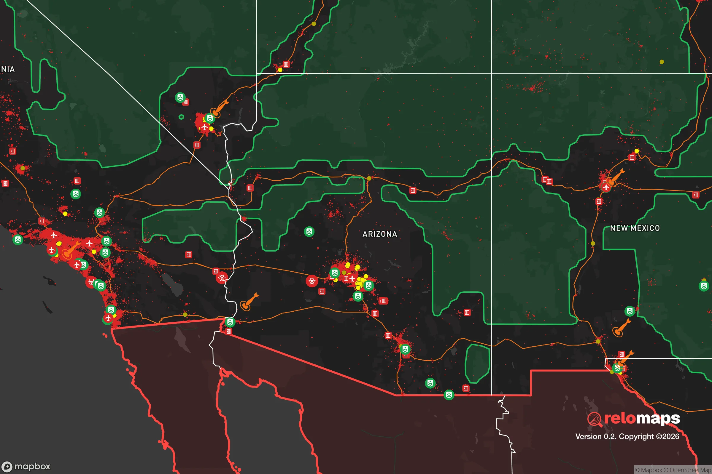
Important Note: For informational purposes only. This does not mean nothing bad ever happens in the green zones. Please use common sense. This is based on public data and modeled with AI. We tried to take a conservative approach but mistakes happen. We update this regularly as new information becomes available.
Solar Generator Recommendations
Backup power matters more here than in safer locations. We've picked three solar generators across budgets and capacity tiers — start with the budget unit if you only need a few essentials, or step up if you want to run a fridge and HVAC for days at a time.

Jackery Portable Power Station Explorer 300
Budget OptionPower on the Go: Weighing only 11 lbs, it's convenient to set up and store with book-sized foldable solar panels

BLUETTI Portable Power Station AC180
Designed for both indoor and outdoor scenarios, AC180 is highly capable as it has a robost capacity and continuous output power.

EF ECOFLOW DELTA Pro Ultra Power Station
Upgraded PickEcoFlow DELTA Pro Ultra is a whole-home energy system designed to grow with your family. Integrated with the Smart Home Panel 2, it scales to meet your evolving energy needs — keeping your home powered, intelligent, and secure through every stage of life.
We earn a commission, at no additional cost to you.
Strategic Assessment Analysis
Yuma, Arizona, offers a unique strategic position for those prioritizing resilience, self-sufficiency, and distance from the most volatile population centers. Its location at the intersection of California, Arizona, and Mexico, combined with a robust agricultural base and a year-round growing season, makes it a rare asset for anyone serious about long-term preparedness. While no place is immune to risk, Yuma’s combination of natural resources, geographic isolation, and practical infrastructure provides a foundation that few other southwestern locations can match for a conservative-minded relocator seeking to weather civic unrest, supply chain disruptions, or large-scale disasters.
Geographic position and natural advantages for long-term security
Yuma sits in the far southwestern corner of Arizona, roughly 175 miles east of San Diego and 180 miles southwest of Phoenix. This distance from major metropolitan areas is a double-edged sword: it provides a buffer against the immediate chaos of urban collapse, but it also means that Yuma is not entirely isolated from the fallout of those cities. The city itself has a population of around 100,000, with the broader Yuma County home to about 210,000 people. That’s small enough to avoid the worst of urban density but large enough to maintain essential services, hospitals, and a local economy. The Colorado River runs right through town, providing a reliable surface water source—critical in a region where water scarcity is the norm. The Gila River also joins the Colorado near Yuma, adding to the local water budget. The area’s desert climate means minimal risk of hurricanes, tornadoes, or blizzards, though extreme heat (summer highs regularly exceed 110°F) is a constant factor that requires planning. The flat terrain and open desert also offer good visibility and defensibility, with few natural chokepoints but plenty of room to maneuver if needed.
Risks, exposures, and proximity to fallout-relevant landmarks
The most significant strategic risk for Yuma is its proximity to the U.S.-Mexico border. The San Luis Port of Entry, just 20 miles south, is a major commercial crossing, and the border itself is a source of both opportunity and vulnerability. In a scenario of widespread civil unrest or a breakdown of federal authority, the border could become a vector for uncontrolled migration, smuggling, or cartel activity. Yuma is also within 200 miles of the San Onofre Nuclear Generating Station (SONGS) in California, a decommissioned but still radioactive site, and roughly 250 miles from the Palo Verde Nuclear Generating Station near Phoenix—the largest nuclear plant in the U.S. by output. While these distances provide some safety from a direct blast or radiation cloud, prevailing winds from the west could carry fallout from a California event toward Yuma. Additionally, the city lies within the broader Southwest earthquake zone, though major seismic activity is rare. The biggest day-to-day risk is extreme heat and the potential for power grid failure during summer months, which could be deadly without proper preparation. For a prepper, the border proximity is the most immediate concern, but it’s also a factor that can be mitigated with situational awareness and a solid plan for self-defense and community cooperation.
Practical resilience for a relocator: food, water, energy, and defensibility
Yuma’s agricultural output is its strongest card. The area produces over 90% of the nation’s winter leafy greens and a significant portion of its melons, citrus, and dates. This isn’t just a talking point—it means that even in a supply chain collapse, local food production can sustain the population. The Yuma County Cooperative Extension and local farmers’ markets provide direct access to fresh produce, and the region’s long growing season allows for year-round gardening for those with the know-how. Water is the other critical resource. The Colorado River is managed by the Bureau of Reclamation and the Yuma Area Office, but local groundwater is also available, though it’s being depleted. For a relocator, securing a property with a well or access to the river is a priority. Energy is less of a concern: Yuma gets over 300 sunny days per year, making solar power a highly viable option. The city’s grid is connected to the larger Arizona network, but a solar array with battery storage can provide independence during outages. Defensibility is moderate. The flat desert offers few natural hiding places, but the open terrain also means you can see threats coming from miles away. The city’s layout, with a mix of suburban neighborhoods and agricultural land, allows for both community-based defense and rural isolation. The Yuma County Sheriff’s Office and local police are generally well-regarded, but in a crisis, self-reliance is the name of the game. Stockpiling ammunition, maintaining a reliable vehicle with off-road capability, and building relationships with like-minded neighbors are all practical steps.
The overall strategic picture for Yuma is one of calculated trade-offs. It offers a rare combination of reliable water, abundant local food, and distance from the worst urban chaos, but it comes with the constant pressure of border proximity and extreme heat. For a conservative relocator who values self-sufficiency, community, and a slower pace of life, Yuma is a strong candidate—provided you’re willing to invest in solar power, water storage, and a solid plan for heat resilience. It’s not a fortress, but it’s a place where a prepared individual or family can build a sustainable life while staying out of the crosshairs of the most likely national disruptions. If you’re looking for a base that can weather the storm without being in the eye of it, Yuma deserves a serious look.
* Values derived from national, state, county, city and local statistics and may differ in a specific area. Last updated: 2026-04-19T08:09:01.000Z
Narrative content on this page is AI-generated and may contain mistakes. Verify any details that matter before acting on them.
ReloMaps may earn a commission from affiliate links at no extra cost to you.