Photo: Wikipedia
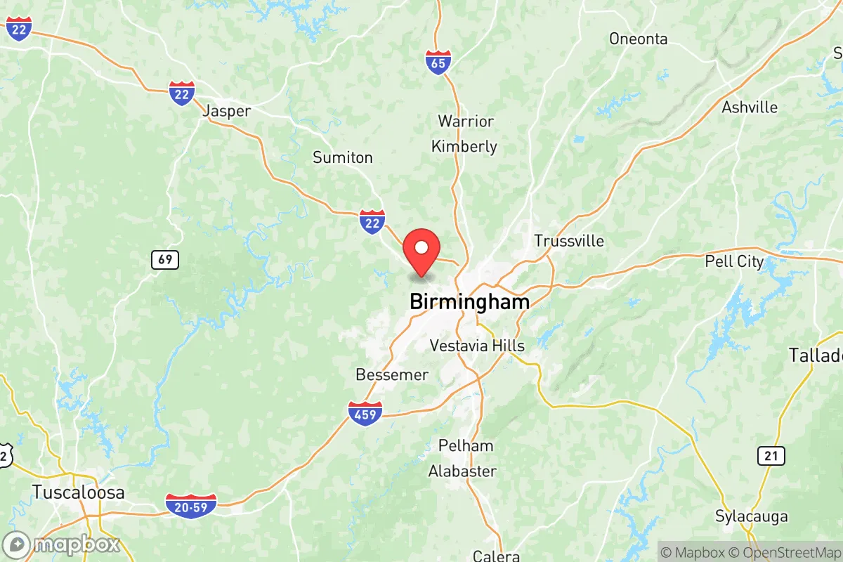
Strategic Assessment of Jefferson County
Workable tactical position. Some exposure to population density or targets, but generally defensible in a crisis.
What does the Strategic Assessment tell us?
Our Strategic Assessment grades tactical survivability of an area. Major population centers, military targets, fallout zones, natural disasters, and border exposure all drive risk — lower exposure means a more defensible position in a crisis.
This is heavily inspired by Joel Skousen's Strategic Relocation book. Highly recommended you checkout the book ($)What does this tell us?
Our Strategic Assessment grades tactical survivability of an area. Major population centers, military targets, fallout zones, natural disasters, and border exposure all drive risk — lower exposure means a more defensible position in a crisis.
This is heavily inspired by Joel Skousen's Strategic Relocation book. Highly recommended you checkout the book ($)Strategic Pillars

Key Distances
Strategic Assessment Analysis
Jefferson County, Alabama, presents a mixed strategic picture for the conservative relocator seeking resilience. Its core advantage is a robust, diversified economic base anchored by the University of Alabama at Birmingham (UAB) and a strong medical sector, which provides a buffer against single-industry collapse. However, its location at the heart of a major metropolitan area—Birmingham itself—introduces significant vulnerabilities that a prepper must weigh carefully. The county's position in the Appalachian foothills offers some natural defensibility, but its proximity to critical infrastructure and dense population centers creates a complex risk profile that demands a clear-eyed assessment.
Geographic position and natural advantages for long-term security
Jefferson County sits at the southern end of the Appalachian Ridge and Valley region, a terrain that provides more natural cover and defensible positions than the flat Gulf Coastal Plain to the south. The area is laced with ridges, hollows, and forested hills, particularly in the northern and eastern parts of the county around places like Pinson and Leeds. This topography complicates large-scale movement and offers numerous chokepoints for those who know the back roads. The county also benefits from a reliable water supply, with the Black Warrior River forming its western boundary and the Cahaba River cutting through the central portion. These rivers are not just scenic; they are functional water sources and potential travel corridors away from the interstate system. The climate is temperate, with four distinct seasons but no extreme weather that are extreme enough to be a primary survival threat. Growing seasons are long enough for serious gardening, and the surrounding national forests—like the Talladega National Forest to the east—provide a buffer zone and potential resource area. For a relocator, the key takeaway is that the county's geography offers more strategic depth than most urbanized areas in the Deep South, but only if you are positioned in the right part of the county, away from the Birmingham urban core.
Risks, exposures, and proximity to fallout-relevant landmarks
This is where the analysis gets serious. Jefferson County's greatest liability is its density and the concentration of high-value targets within and near its borders. The city of Birmingham itself is a major population center with over 200,000 residents, and the county's total population exceeds 650,000. In a scenario of civic unrest or supply chain collapse, that many people concentrated in a relatively small area becomes a liability—competition for resources, potential for civil disorder, and a target for any group seeking to control infrastructure. More concerning is the proximity to critical industrial and military infrastructure. Birmingham-Shuttlester Army Depot (Anniston Army Depot) is roughly 60 miles east, a major repair and storage facility for combat vehicles and munitions. Redstone Arsenal in Huntsville, about 90 miles north, is a primary hub for missile defense and space command. These are not just military bases; they are potential ground-zero locations in a conflict scenario, and fallout patterns from a strike or accident could easily drift into Jefferson County depending on wind direction. Additionally, the county is crisscrossed by major rail lines and interstate highways (I-20, I-65, I-59) that serve as arteries for the entire Southeast. A disruption at the Birmingham Intermodal Facility or a bridge collapse on the I-20/59 corridor would choke offload chaos directly into the county. For the prepper, the risk is not just direct attack but the secondary effects of being downstream from major strategic assets. The county's industrial base, including steel production at U.S. Steel's Fairfield Works, is a double-edged sword: it provides economic resilience but also makes the area a potential target.
Practical resilience for a relocator: food, water, energy, and defensibility
For a relocator looking to set up a sustainable household, Jefferson County offers a mixed bag. Water is generally accessible, with municipal systems drawing from the Cahaba and Black Warrior rivers, but a prepper should not rely on city water. The county's topography allows for well drilling in many areas, particularly in the more rural northern and eastern sections. Rainwater catchment is viable given the region's average 55 inches of annual precipitation. Food production is feasible: the growing season runs from April to October, and the soil in the river valleys is fertile. However, the county is heavily suburbanized, and finding a property with enough acreage for serious self-sufficiency within a reasonable commute to a job is expensive and competitive. Energy resilience is a concern. The county is served by Alabama Power, which relies on a mix of coal, natural gas, and nuclear (from the nearby Farley plant in Houston County). Grid reliability is average for the region, but ice storms and tornadoes can cause multi-day outages. Solar is viable, but the tree cover in many residential areas limits panel efficiency. Defensibility is highly location-dependent. A property in the Mount Laurel area or near Oak Mountain State Park offers natural barriers and limited road access, making it easier to secure. In contrast, a home in the Homewood or Vestavia Hills suburbs is essentially a neighborhood in a dense metro area, with all the vulnerabilities that entails. For the serious prepper, the recommendation is to-do list is clear: secure a property with its own water source, invest in off-grid power, and establish a local network of like-minded individuals. The county's strong gun culture and Second Amendment-friendly environment are a plus, but they also mean that many neighbors are already armed and prepared, which can be either an asset or a complication depending on the scenario.
The overall strategic picture for Jefferson County is one of calculated risk. It is not a remote survivalist paradise, nor is it a doomed urban death trap. It is a mid-sized metro area with genuine economic and geographic strengths that can be leveraged by a prepared individual. The key is to avoid the urban core and the immediate fallout zones around the industrial sites mentioned above. A property in the county's eastern or northern periphery, with good water and defensible terrain, offers a reasonable balance of access to medical care (UAB is a world-class trauma center) and the ability to hunker down. The conservative relocator will find a culture that largely aligns with self-reliance, but they must also accept that they are living in a region that is a potential target due to its industrial and military significance. If you are looking for a place that is not the first to go in a crisis but offers a fighting chance to ride it out, Jefferson County deserves a spot on your short list—provided you do your homework on the specific neighborhood and have a solid plan for the first 72 hours of any event.
* Values derived from national, state, county, city and local statistics and may differ in a specific area. Last updated: 2026-05-19T05:48:49.000Z
Narrative content on this page is AI-generated and may contain mistakes. Verify any details that matter before acting on them.
ReloMaps may earn a commission from affiliate links at no extra cost to you.