
Photo: Wikipedia
Strategic Assessment of Altoona, IA
Meaningful friction. Expect exposure to either population pressure, blast zones, or natural disaster risk. Consider buying a retreat property.
What does the Strategic Assessment tell us?
Our Strategic Assessment grades tactical survivability of an area. Major population centers, military targets, fallout zones, natural disasters, and border exposure all drive risk — lower exposure means a more defensible position in a crisis.
This is heavily inspired by Joel Skousen's Strategic Relocation book. Highly recommended you checkout the book ($)What does this tell us?
Our Strategic Assessment grades tactical survivability of an area. Major population centers, military targets, fallout zones, natural disasters, and border exposure all drive risk — lower exposure means a more defensible position in a crisis.
This is heavily inspired by Joel Skousen's Strategic Relocation book. Highly recommended you checkout the book ($)Strategic Pillars

Key Distances
Regional Safe Places
Below is our recommended "safe zones" in Iowa and the surrounding area based on our strategic heuristics. For most people, it's unrealistic to live in a “safe zone” full-time due to work, family or other personal reasons. They tend to be more rural. However, many of these areas are perfect for second homes and retreat properties that double as a vacation home or even a short-term rental.


Important Note: For informational purposes only. This does not mean nothing bad ever happens in the green zones. Please use common sense. This is based on public data and modeled with AI. We tried to take a conservative approach but mistakes happen. We update this regularly as new information becomes available.
Solar Generator Recommendations
Backup power matters more here than in safer locations. We've picked three solar generators across budgets and capacity tiers — start with the budget unit if you only need a few essentials, or step up if you want to run a fridge and HVAC for days at a time.

Jackery Portable Power Station Explorer 300
Budget OptionPower on the Go: Weighing only 11 lbs, it's convenient to set up and store with book-sized foldable solar panels

BLUETTI Portable Power Station AC180
Designed for both indoor and outdoor scenarios, AC180 is highly capable as it has a robost capacity and continuous output power.

EF ECOFLOW DELTA Pro Ultra Power Station
Upgraded PickEcoFlow DELTA Pro Ultra is a whole-home energy system designed to grow with your family. Integrated with the Smart Home Panel 2, it scales to meet your evolving energy needs — keeping your home powered, intelligent, and secure through every stage of life.
We earn a commission, at no additional cost to you.
Strategic Assessment Analysis
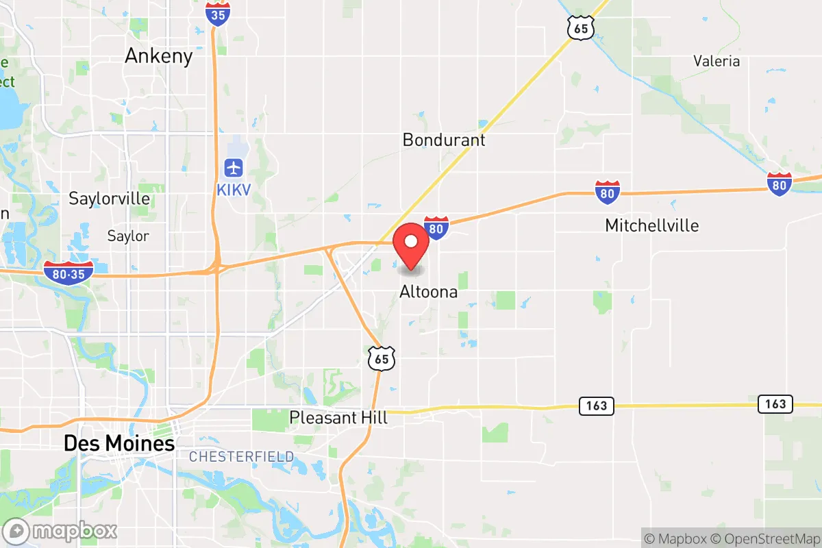
Altoona, Iowa, sits in a precarious but potentially advantageous position for those prioritizing resilience and strategic relocation. Located just east of Des Moines, this community of roughly 20,000 offers a blend of suburban infrastructure and rural proximity that can serve as a buffer zone—close enough to access resources but far enough to avoid the worst of urban collapse. For the conservative-minded prepper, Altoona’s real value lies in its location within the broader Central Iowa region, which benefits from relatively stable governance, a strong agricultural base, and a population that leans toward self-reliance. However, its proximity to a state capital and major transportation corridors introduces risks that demand careful consideration.
Geographic position and natural advantages for long-term security
Altoona’s geography is defined by its placement on the eastern edge of the Des Moines metropolitan area, where the urban sprawl gives way to farmland and small towns. This positioning offers a critical advantage: it sits within a 30-minute drive of the state capital’s hospitals, supply chains, and emergency services, yet it is surrounded by some of the most productive agricultural land in the country. The area’s flat to gently rolling terrain is not defensible in a tactical sense, but it provides excellent visibility and access to multiple escape routes, including Interstate 80 and U.S. Highway 65. For a relocator, this means you can tap into Des Moines’ resources during stable times while having the ability to retreat east toward the Mississippi River or north toward Minnesota if things go sideways. The region’s temperate climate supports year-round gardening and livestock, and the abundant groundwater from the Jordan Aquifer—one of the largest in the Midwest—ensures a reliable water source even during drought. Altoona’s position also places it outside the direct blast radius of any major military or industrial targets, though that calculus changes when you consider what lies within a 100-mile radius.
Risks, exposures, and proximity to fallout-relevant landmarks
The most significant risk for Altoona is its proximity to Des Moines, a city of over 200,000 that serves as a regional hub for government, finance, and transportation. In a scenario involving civil unrest, mass casualty events, or a coordinated attack, Des Moines would likely become a focal point for chaos—think supply chain disruptions, refugee flows, and potential targeting of infrastructure like the Des Moines International Airport or the Iowa State Capitol. Altoona itself is home to Prairie Meadows Racetrack and Casino, a major entertainment venue that could attract looting or become a gathering point for displaced populations. More concerning is the area’s proximity to the Iowa Army Ammunition Plant in Middletown, roughly 150 miles southeast, and the Offutt Air Force Base near Omaha, about 130 miles west. While these are not immediate fallout zones, a major event at either could send shockwaves through the region. Additionally, the interstate highways that make Altoona accessible for trade also make it a natural corridor for evacuation or military movement, which could bring unwanted attention. The risk of tornadoes is real—Iowa averages 50 tornadoes per year—and Altoona lies in the heart of Tornado Alley, meaning a direct hit could level infrastructure and disrupt utilities for weeks. For the prepper, these exposures mean that while Altoona is not a high-value target, it is not a remote sanctuary either; it requires a layered defense plan that accounts for both natural disasters and human-caused disruptions.
Practical resilience for a relocator: food, water, energy, and defensibility
On the practical side, Altoona offers a solid foundation for self-sufficiency, but it demands upfront investment. The surrounding farmland means fresh produce, meat, and dairy are readily available from local farmers’ markets and co-ops, and the soil is rich enough for serious gardening—think heirloom vegetables, fruit trees, and even small grain plots. Water is less of a concern here than in the arid West; the Des Moines River runs just west of the city, and private wells are common in the outlying areas. However, municipal water in Altoona is treated and chlorinated, so a prepper should plan for filtration or storage. Energy resilience is mixed: the grid is reliable but aging, and Iowa’s wind farms provide a decentralized backup if you invest in a small turbine or solar panels. Natural gas is widely available for heating, but a propane tank or wood stove is a smarter bet for grid-down scenarios. Defensibility is the weak point. Altoona’s suburban layout—with cul-de-sacs, strip malls, and a mix of single-family homes—offers limited tactical advantage. The best options are properties on the eastern or southern edges, where acreage is more common and you can establish a perimeter. The local police and fire departments are competent but stretched thin during emergencies, so a neighborhood watch or mutual aid group is essential. For the relocator, the key is to secure a property with a well, a septic system, and enough land to grow food and raise small livestock like chickens or rabbits. Altoona’s zoning is relatively lenient for agricultural use, but check with Polk County for any restrictions on structures like root cellars or rainwater collection.
The overall strategic picture for Altoona is one of calculated compromise. It is not a remote bunker in the mountains, nor is it a high-risk urban center. Instead, it offers a middle ground: a community with enough infrastructure to support a comfortable modern life while retaining the agricultural and water resources needed for a post-disaster scenario. The conservative prepper will appreciate the area’s strong sense of local governance, low crime rates relative to Des Moines, and a population that largely shares values of hard work and self-reliance. However, the proximity to a major city and transportation corridors means you cannot afford complacency. A serious relocation plan here should include a bug-out route east toward the Mississippi River valley, a well-stocked pantry for at least six months, and a network of like-minded neighbors. Altoona is a viable option for those who want to be prepared without living off-grid, but it requires constant vigilance and a willingness to adapt as the national situation deteriorates. If you are looking for a place to ride out the storm while staying connected to resources, this is a solid bet—just don’t mistake it for a fortress.
* Values derived from national, state, county, city and local statistics and may differ in a specific area. Last updated: 2026-04-21T07:16:35.000Z
Narrative content on this page is AI-generated and may contain mistakes. Verify any details that matter before acting on them.
ReloMaps may earn a commission from affiliate links at no extra cost to you.