
Photo: Wikipedia
Strategic Assessment of Santa Cruz County
Meaningful friction. Expect exposure to either population pressure, blast zones, or natural disaster risk. Consider buying a retreat property.
What does the Strategic Assessment tell us?
Our Strategic Assessment grades tactical survivability of an area. Major population centers, military targets, fallout zones, natural disasters, and border exposure all drive risk — lower exposure means a more defensible position in a crisis.
This is heavily inspired by Joel Skousen's Strategic Relocation book. Highly recommended you checkout the book ($)What does this tell us?
Our Strategic Assessment grades tactical survivability of an area. Major population centers, military targets, fallout zones, natural disasters, and border exposure all drive risk — lower exposure means a more defensible position in a crisis.
This is heavily inspired by Joel Skousen's Strategic Relocation book. Highly recommended you checkout the book ($)Strategic Pillars

Key Distances
Strategic Assessment Analysis
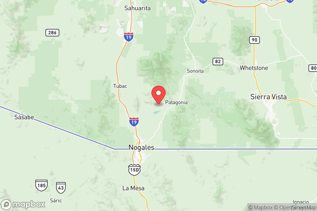
Santa Cruz County, Arizona, offers a unique strategic position for relocation-minded readers prioritizing resilience and self-sufficiency, but it comes with distinct trade-offs. Located in the southernmost corner of the state, the county is anchored by the small city of Nogales (population roughly 20,000) and the unincorporated communities of Rio Rico, Tubac, and Patagonia. Its immediate proximity to the U.S.-Mexico border and the major Sonoran city of Nogales, Sonora (population over 200,000) creates a layered strategic picture: the area benefits from relative isolation from major U.S. metropolitan grids, yet it sits adjacent to a large, dynamic border crossing that introduces both logistical advantages and exposure risks. For a conservative-leaning individual or family weighing disaster readiness, Santa Cruz County’s resilience profile is shaped by its geography, its exposure to border-related vulnerabilities, and its practical capacity for self-sufficiency.
Geographic position and natural advantages for self-sufficiency
Santa Cruz County’s geography is its strongest asset for resilience. The county lies in a high desert valley at roughly 3,800 feet elevation, surrounded by the Patagonia Mountains to the east and the Santa Rita Mountains to the west. This terrain provides natural defensibility—approaches are limited to a handful of paved roads, primarily Interstate 19 and State Route 82, which funnel traffic through narrow corridors. The area is far removed from Arizona’s major population centers: Tucson is about 60 miles north, and Phoenix is over 170 miles away. This distance buffers the county from the cascading effects of a major urban disaster, such as a grid collapse or pandemic surge in those cities. The climate is arid but not extreme—summer highs average 90–95°F, and winter lows rarely dip below freezing—which reduces the risk of catastrophic weather events like hurricanes, tornadoes, or blizzards. The region’s primary natural hazard is wildfire, particularly in the surrounding forested mountain slopes, but the valley floor itself is less prone to large-scale burns. For a relocator, the key takeaway is that Santa Cruz County offers a defensible, low-density environment with multiple escape routes into rural Sonora or northern Arizona, should the need arise.
Risks, exposures, and proximity to fallout-relevant landmarks
The county’s most significant risk stems from its border location. The Nogales Port of Entry is one of the busiest land crossings in the Southwest, processing thousands of vehicles and pedestrians daily. This creates a constant flow of people and goods that can introduce disease vectors, supply chain disruptions, or security concerns during a crisis. The presence of a large Mexican city directly adjacent—Nogales, Sonora, with its own industrial base and potential for civil unrest—means that a regional collapse could spill over the border. Additionally, the county lies within 100 miles of the Davis-Monthan Air Force Base in Tucson, a major military installation that could become a target in a conflict scenario. While Santa Cruz County itself has no nuclear power plants, refineries, or major chemical facilities, the Port of Nogales handles significant commercial traffic, including produce and manufactured goods, which could be disrupted by border closures or trade disputes. For a reader concerned about fallout from a large-scale event, the county’s proximity to a high-traffic border crossing and a military base is a moderate negative—it’s not a primary target, but it’s not a remote, off-grid sanctuary either. The area’s low population density (roughly 47,000 residents countywide) does reduce the risk of civil unrest compared to urban centers, but the border dynamic introduces a layer of unpredictability that a serious prepper should factor into their planning.
Practical resilience for a relocator: food, water, energy, and defensibility
On the practical side, Santa Cruz County offers mixed prospects for self-sufficiency. Water is the most critical constraint. The region relies on groundwater from the Santa Cruz River Basin, which is already over-allocated in some areas. Municipal water in Nogales and Rio Rico is treated and reliable, but well-dependent rural properties—common in Tubac and Patagonia—face declining water tables and increasing drilling costs. A relocator should prioritize properties with a secure, deep well or access to the Nogales Water System. Rainwater harvesting is viable but limited by the 15–18 inches of annual precipitation. Food resilience is more promising: the county has a small but active agricultural sector, including pecan orchards, cattle ranching, and community gardens. The Santa Cruz Valley is historically fertile, and local farmers markets in Nogales and Tubac provide fresh produce during normal times. For long-term food security, a household could supplement with a greenhouse and drought-tolerant crops like beans, squash, and amaranth. Energy resilience is straightforward: the area averages over 280 sunny days per year, making solar power highly effective. Off-grid solar setups are common in rural areas, and the county’s building codes are lenient for self-installed systems. Defensibility is strong due to the terrain—the narrow valleys and mountain passes create natural chokepoints. However, the border location means that law enforcement presence is heavy, with U.S. Border Patrol and Customs and Border Protection operating checkpoints on major roads. This can be a double-edged sword: it provides security against cross-border crime but also means that movement in and out of the county is monitored, which could be a concern for those seeking complete autonomy. Overall, a relocator can achieve a high degree of self-sufficiency here with proper planning, particularly in water and energy, but the border proximity requires a realistic assessment of security trade-offs.
The overall strategic picture for Santa Cruz County is one of balanced opportunity and caution. For a conservative-leaning individual or family seeking a resilient location that is not completely isolated but still removed from major urban risks, the county offers a defensible, low-density environment with good solar potential and a moderate climate. The primary drawbacks are water scarcity and the inherent volatility of a border region. Compared to other Arizona counties like Cochise or Yavapai, Santa Cruz is more exposed to cross-border dynamics but less exposed to wildfire and urban sprawl. For a relocator who values proximity to a functional border crossing for trade or travel, and who is willing to invest in water infrastructure and security measures, Santa Cruz County is a viable strategic choice. It is not a bug-out location for a total collapse scenario, but it is a solid base for a prepared household that wants to balance self-sufficiency with access to regional resources. The key is to enter with eyes open: secure your water, plan for border disruptions, and leverage the natural defensibility of the surrounding mountains.

* Values derived from national, state, county, city and local statistics and may differ in a specific area. Last updated: 2026-07-30T07:59:17.000Z
Narrative content on this page is AI-generated and may contain mistakes. Verify any details that matter before acting on them.
ReloMaps may earn a commission from affiliate links at no extra cost to you.

