Photo: Wikipedia
Strategic Assessment of Augusta, ME
Meaningful friction. Expect exposure to either population pressure, blast zones, or natural disaster risk. Consider buying a retreat property.
What does the Strategic Assessment tell us?
Our Strategic Assessment grades tactical survivability of an area. Major population centers, military targets, fallout zones, natural disasters, and border exposure all drive risk — lower exposure means a more defensible position in a crisis.
This is heavily inspired by Joel Skousen's Strategic Relocation book. Highly recommended you checkout the book ($)What does this tell us?
Our Strategic Assessment grades tactical survivability of an area. Major population centers, military targets, fallout zones, natural disasters, and border exposure all drive risk — lower exposure means a more defensible position in a crisis.
This is heavily inspired by Joel Skousen's Strategic Relocation book. Highly recommended you checkout the book ($)Strategic Pillars

Key Distances
Regional Safe Places
Below is our recommended "safe zones" in Maine and the surrounding area based on our strategic heuristics. For most people, it's unrealistic to live in a “safe zone” full-time due to work, family or other personal reasons. They tend to be more rural. However, many of these areas are perfect for second homes and retreat properties that double as a vacation home or even a short-term rental.


Important Note: For informational purposes only. This does not mean nothing bad ever happens in the green zones. Please use common sense. This is based on public data and modeled with AI. We tried to take a conservative approach but mistakes happen. We update this regularly as new information becomes available.
Solar Generator Recommendations
Backup power matters more here than in safer locations. We've picked three solar generators across budgets and capacity tiers — start with the budget unit if you only need a few essentials, or step up if you want to run a fridge and HVAC for days at a time.

Jackery Portable Power Station Explorer 300
Budget OptionPower on the Go: Weighing only 11 lbs, it's convenient to set up and store with book-sized foldable solar panels

BLUETTI Portable Power Station AC180
Designed for both indoor and outdoor scenarios, AC180 is highly capable as it has a robost capacity and continuous output power.

EF ECOFLOW DELTA Pro Ultra Power Station
Upgraded PickEcoFlow DELTA Pro Ultra is a whole-home energy system designed to grow with your family. Integrated with the Smart Home Panel 2, it scales to meet your evolving energy needs — keeping your home powered, intelligent, and secure through every stage of life.
We earn a commission, at no additional cost to you.
Strategic Assessment Analysis
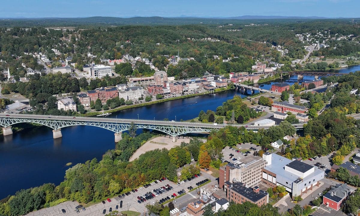
Augusta, Maine, presents a mixed strategic picture for those prioritizing resilience and self-sufficiency. While its small population (roughly 19,000) and state-capital status offer some stability, its location along the I-95 corridor and proximity to the coast create significant vulnerabilities that a prepper must weigh carefully. The city’s advantages lie in its access to freshwater, forested hinterlands, and a relatively low population density compared to major Northeast metros, but its role as a government hub and its position near potential fallout zones from both natural and man-made events demand a hard-nosed assessment.
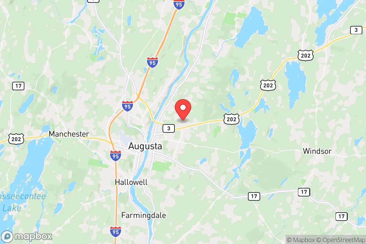
Geographic position and natural advantages for long-term survival
Augusta sits at the head of navigation on the Kennebec River, roughly 50 miles inland from the Atlantic coast. This inland position provides a buffer against direct hurricane storm surge and tsunami risks, while still offering river access for transport and fishing. The surrounding Kennebec County is heavily forested, with abundant wildlife—deer, turkey, and small game—that could supplement food supplies in a collapse scenario. The area’s cold climate (average January lows around 12°F) acts as a natural deterrent to many pests and reduces the spread of vector-borne diseases, a plus for long-term health. The city’s water supply is drawn from the Kennebec River and several groundwater wells, giving it a reliable freshwater source that is less vulnerable to drought than many southern or western locations. For a relocator, the ability to tap into surface water and the presence of numerous lakes (like Cobbosseecontee and Maranacook) within a 20-minute drive mean that off-grid water access is feasible, provided you have filtration and storage systems in place.
Risks, exposures, and proximity to fallout-relevant landmarks
The most glaring vulnerability for Augusta is its position along Interstate 95, a major evacuation and supply route that connects Boston to the Canadian border. In a mass casualty event or civil unrest scenario, this highway becomes a chokepoint for refugees fleeing the Boston-Washington corridor, potentially funneling tens of thousands of people through the Augusta area. The city itself is home to the Maine State Capitol, the Augusta State Airport, and the Maine General Medical Center—all potential targets for symbolic attacks or civil disorder. Additionally, the Maine Yankee nuclear site in Wiscasset, about 25 miles south, is a decommissioned nuclear power plant that still stores spent fuel on-site. While the risk of a catastrophic release is low, any incident there could render large swaths of Kennebec County uninhabitable for decades, depending on wind patterns. The proximity to the coast also means that a major port disruption in Portland (60 miles south) or a naval conflict in the Gulf of Maine could trigger supply chain collapses that hit Augusta hard. For the prepper, the city’s role as a regional government hub means it will be a target for both federal response efforts and potential unrest—not a place to hunker down, but a place to monitor from a distance.
Practical resilience for a relocator: food, water, energy, and defensibility
For those willing to live on the outskirts of Augusta rather than in the city core, the practical resilience picture improves. The surrounding towns—Manchester, Chelsea, Hallowell—offer larger lots, deeper wells, and more forest cover. Food security is a mixed bag: Maine’s short growing season (roughly 120 frost-free days) limits staple crop production, but the region has a strong tradition of hunting, fishing, and foraging. The Kennebec River supports Atlantic salmon and striped bass runs, and the inland lakes are stocked with trout and bass. Local farmers’ markets and CSAs are common, but reliance on them in a crisis is risky—stockpiling non-perishable foods and learning to pressure-can is essential. Water is a strong suit: the Kennebec River flows year-round, and groundwater is generally plentiful, though well depths of 200-400 feet are common. A hand pump or solar-powered well pump is a wise investment. Energy is a concern: Maine’s grid is aging and prone to outages from ice storms and wind events. Solar panels with battery storage are viable, but winter cloud cover reduces output significantly—wood heat and a backup generator are almost mandatory. Defensibility is moderate: the terrain is rolling hills and mixed forest, offering good cover and limited sightlines. A rural property with a long driveway and a stream or pond as a natural barrier can be made quite secure. However, the lack of natural chokepoints (like mountains or deserts) means that a determined group could approach from multiple directions. The local population is generally self-reliant and armed—Maine has a strong gun culture and relatively permissive firearm laws—which can be a double-edged sword: it deters casual crime but means any conflict could be well-armed.
The overall strategic picture for Augusta is one of moderate potential with significant caveats. It is not a bug-out paradise—the climate is harsh, the growing season is short, and the I-95 corridor is a liability. But for a relocator who is willing to invest in off-grid infrastructure, learn cold-weather survival skills, and establish a network of like-minded neighbors in the surrounding rural areas, Augusta offers a defensible base with reliable water, decent hunting, and a low-profile existence. The key is to avoid the city itself and instead target a property at least 10-15 miles from the interstate, with a well, wood heat, and a clear plan for self-sufficiency. The state capital’s presence means that federal and state resources will be concentrated there in a crisis, which could be a magnet for trouble—but also a source of information and supplies if you can access them without drawing attention. For the conservative prepper who values independence and is prepared for a hard winter, Augusta is a viable option, but not a top-tier one. It’s a place to survive, not thrive, in a worst-case scenario—and that may be exactly what you’re looking for.
* Values derived from national, state, county, city and local statistics and may differ in a specific area. Last updated: 2026-05-02T01:26:07.000Z
Narrative content on this page is AI-generated and may contain mistakes. Verify any details that matter before acting on them.
ReloMaps may earn a commission from affiliate links at no extra cost to you.