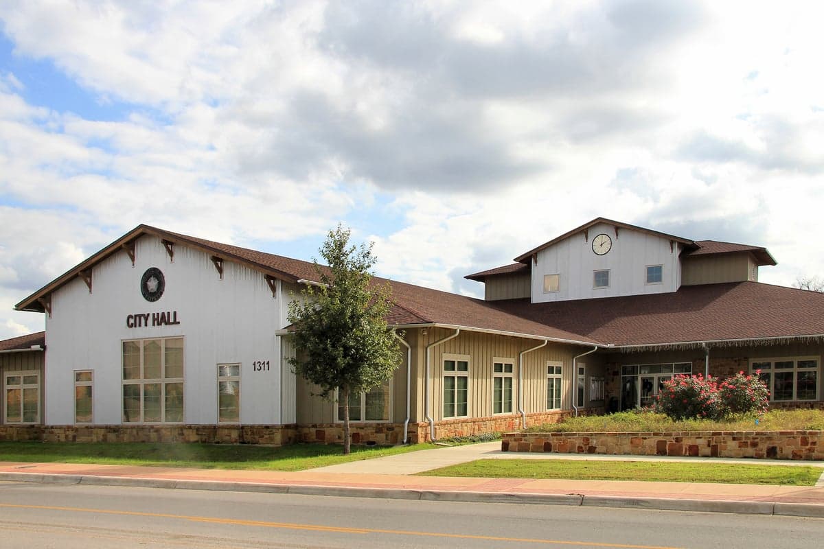
Photo: Wikipedia
Strategic Assessment of Bastrop, TX
Meaningful friction. Expect exposure to either population pressure, blast zones, or natural disaster risk. Consider buying a retreat property.
What does the Strategic Assessment tell us?
Our Strategic Assessment grades tactical survivability of an area. Major population centers, military targets, fallout zones, natural disasters, and border exposure all drive risk — lower exposure means a more defensible position in a crisis.
This is heavily inspired by Joel Skousen's Strategic Relocation book. Highly recommended you checkout the book ($)What does this tell us?
Our Strategic Assessment grades tactical survivability of an area. Major population centers, military targets, fallout zones, natural disasters, and border exposure all drive risk — lower exposure means a more defensible position in a crisis.
This is heavily inspired by Joel Skousen's Strategic Relocation book. Highly recommended you checkout the book ($)Strategic Pillars

Key Distances
Regional Safe Places
Below is our recommended "safe zones" in Texas and the surrounding area based on our strategic heuristics. For most people, it's unrealistic to live in a “safe zone” full-time due to work, family or other personal reasons. They tend to be more rural. However, many of these areas are perfect for second homes and retreat properties that double as a vacation home or even a short-term rental.


Important Note: For informational purposes only. This does not mean nothing bad ever happens in the green zones. Please use common sense. This is based on public data and modeled with AI. We tried to take a conservative approach but mistakes happen. We update this regularly as new information becomes available.
Solar Generator Recommendations
Backup power matters more here than in safer locations. We've picked three solar generators across budgets and capacity tiers — start with the budget unit if you only need a few essentials, or step up if you want to run a fridge and HVAC for days at a time.

Jackery Portable Power Station Explorer 300
Budget OptionPower on the Go: Weighing only 11 lbs, it's convenient to set up and store with book-sized foldable solar panels

BLUETTI Portable Power Station AC180
Designed for both indoor and outdoor scenarios, AC180 is highly capable as it has a robost capacity and continuous output power.

EF ECOFLOW DELTA Pro Ultra Power Station
Upgraded PickEcoFlow DELTA Pro Ultra is a whole-home energy system designed to grow with your family. Integrated with the Smart Home Panel 2, it scales to meet your evolving energy needs — keeping your home powered, intelligent, and secure through every stage of life.
We earn a commission, at no additional cost to you.
Strategic Assessment Analysis
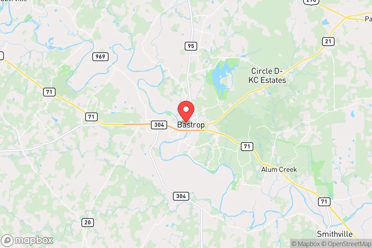
Bastrop, Texas, sits in a strategic sweet spot that resilience-minded relocators should take seriously: close enough to Austin for supply runs and employment options, yet far enough to avoid the worst of urban collapse scenarios. The area’s position along the Colorado River and its surrounding piney woods offer natural buffers and resources, but proximity to the state capital and critical infrastructure introduces real risks. For those weighing a move with an eye toward self-sufficiency and long-term stability, Bastrop presents both genuine advantages and sobering liabilities that demand a clear-eyed assessment.
Geographic position and natural advantages for long-term stability
Bastrop’s location roughly 30 miles southeast of Austin places it in the transitional zone between the Texas Hill Country and the Coastal Plains. This geography provides several practical benefits. The area sits atop the Carrizo-Wilcox Aquifer, one of the most productive groundwater sources in Texas, which means private well drilling is a viable option for those who secure the right property. The Colorado River runs through the county, offering surface water access, though rights and permits require careful navigation. The surrounding Lost Pines Forest—an isolated stand of loblolly pines—provides timber for construction, fuel, and natural cover that breaks up sightlines and reduces noise travel. Elevation in the county ranges from roughly 300 to 600 feet, offering modest defensible terrain without the extreme weather exposure of higher peaks. Bastrop County’s relatively low population density—about 100 people per square mile outside the city limits—means fewer neighbors to compete with for resources during a crisis. The climate is humid subtropical, with hot summers and mild winters, supporting year-round gardening and livestock raising. The growing season stretches from March to November, allowing for substantial food production if you have the land and know-how.
Risks, exposures, and proximity to fallout-relevant landmarks
The most significant vulnerability for Bastrop is its proximity to Austin, a major population center and state government hub. In a scenario involving civil unrest, mass casualty events, or grid-down situations, Austin would become a focal point for chaos, and Bastrop sits directly in the path of any eastward evacuation flow. Highway 71 and State Highway 21 both run through the area, serving as primary escape routes that could become choke points. The Austin-Bergstrom International Airport, roughly 20 miles west, is a potential target for air-based threats or a staging area for federal response, which could draw unwanted attention to the region. The Lower Colorado River Authority operates several dams upstream, including Mansfield Dam on Lake Travis, which, if compromised, could send a flood pulse down the Colorado River corridor. Bastrop itself experienced devastating wildfires in 2011 and 2015, burning over 34,000 acres and destroying hundreds of homes—a reminder that the pine forest that provides cover also fuels fast-moving fires during drought conditions. The area is also within the 100-mile radius of the South Texas Nuclear Generating Station near Bay City, though prevailing winds typically carry fallout eastward toward the Gulf. More immediately concerning is the proximity to the Texas Department of Criminal Justice units in the region, including the Bastrop County Jail and nearby state prison facilities, which could become sources of instability during a breakdown in order.
Practical resilience for a relocator: food, water, energy, and defensibility
For those serious about self-sufficiency, Bastrop offers a workable baseline but requires deliberate investment. Water is the primary concern. While the aquifer is robust, well depths in the area typically range from 200 to 600 feet, and drilling costs have risen to $15–$25 per foot. Rainwater catchment is feasible given the average 34 inches of annual rainfall, but storage tanks and filtration systems add upfront expense. The soil in Bastrop County is sandy loam, well-draining and workable for gardening, though it requires amendment with organic matter to retain nutrients. The Lost Pines region supports deer, turkey, and small game, providing a supplemental protein source for those with hunting skills. Solar energy is viable—the area averages over 260 sunny days per year—but tree cover in the pine forest can limit panel placement unless you clear land. Bastrop’s terrain is generally flat to gently rolling, offering limited natural defensive positions, but the dense forest provides concealment and can slow movement on foot. The local economy is anchored by the Bastrop Independent School District, the city government, and a growing number of remote workers who fled Austin’s cost of living. This means a prepper can blend in without drawing suspicion, as the area already attracts people seeking a quieter, more affordable lifestyle. The Bastrop County Office of Emergency Management runs a reasonably active preparedness program, including CERT training and community alert systems, which can be leveraged for networking with like-minded locals. However, the county’s law enforcement presence is thin—the sheriff’s office has roughly 60 deputies for a 900-square-mile area—so self-defense and neighborhood watch arrangements are practical considerations.
The overall strategic picture for Bastrop is one of cautious opportunity. It offers genuine natural resources, a moderate climate, and enough distance from Austin to avoid the worst of urban collapse, yet it remains close enough to access medical facilities, hardware stores, and supply chains during normal times. The wildfire risk and the potential for evacuation corridor congestion are real, but they can be mitigated with proper land management, defensible space, and multiple exit routes. For a conservative-leaning relocator who values self-reliance, community, and a lower profile, Bastrop represents a viable base of operations—provided you enter with eyes open, secure your water and energy independence early, and build relationships with neighbors before the lights go out. It is not a fortress, but it is a place where preparation and common sense can make the difference between riding out a crisis and being swept up in it.
* Values derived from national, state, county, city and local statistics and may differ in a specific area. Last updated: 2026-05-12T00:00:19.000Z
Narrative content on this page is AI-generated and may contain mistakes. Verify any details that matter before acting on them.
ReloMaps may earn a commission from affiliate links at no extra cost to you.