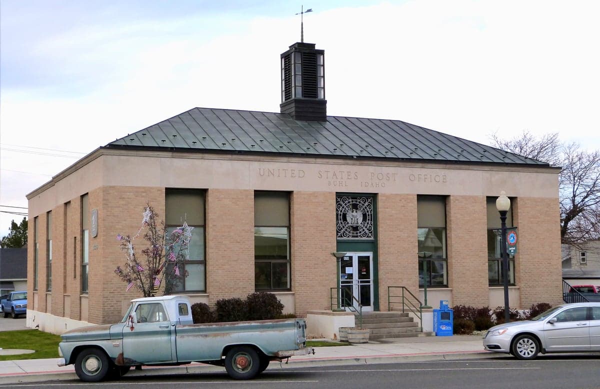
Photo: Wikipedia
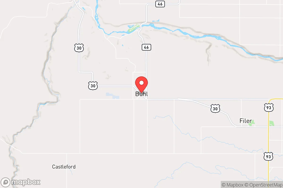
Strategic Assessment of Buhl, ID
Workable tactical position. Some exposure to population density or targets, but generally defensible in a crisis.
What does the Strategic Assessment tell us?
Our Strategic Assessment grades tactical survivability of an area. Major population centers, military targets, fallout zones, natural disasters, and border exposure all drive risk — lower exposure means a more defensible position in a crisis.
This is heavily inspired by Joel Skousen's Strategic Relocation book. Highly recommended you checkout the book ($)What does this tell us?
Our Strategic Assessment grades tactical survivability of an area. Major population centers, military targets, fallout zones, natural disasters, and border exposure all drive risk — lower exposure means a more defensible position in a crisis.
This is heavily inspired by Joel Skousen's Strategic Relocation book. Highly recommended you checkout the book ($)Strategic Pillars

Key Distances
Regional Safe Places
Below is our recommended "safe zones" in Idaho and the surrounding area based on our strategic heuristics. For most people, it's unrealistic to live in a “safe zone” full-time due to work, family or other personal reasons. They tend to be more rural. However, many of these areas are perfect for second homes and retreat properties that double as a vacation home or even a short-term rental.


Important Note: For informational purposes only. This does not mean nothing bad ever happens in the green zones. Please use common sense. This is based on public data and modeled with AI. We tried to take a conservative approach but mistakes happen. We update this regularly as new information becomes available.
Solar Generator Recommendations
Backup power matters more here than in safer locations. We've picked three solar generators across budgets and capacity tiers — start with the budget unit if you only need a few essentials, or step up if you want to run a fridge and HVAC for days at a time.

Jackery Portable Power Station Explorer 300
Budget OptionPower on the Go: Weighing only 11 lbs, it's convenient to set up and store with book-sized foldable solar panels

BLUETTI Portable Power Station AC180
Designed for both indoor and outdoor scenarios, AC180 is highly capable as it has a robost capacity and continuous output power.

EF ECOFLOW DELTA Pro Ultra Power Station
Upgraded PickEcoFlow DELTA Pro Ultra is a whole-home energy system designed to grow with your family. Integrated with the Smart Home Panel 2, it scales to meet your evolving energy needs — keeping your home powered, intelligent, and secure through every stage of life.
We earn a commission, at no additional cost to you.
Strategic Assessment Analysis
Buhl, Idaho, sits in the Magic Valley region, roughly 20 miles east of Twin Falls, and its strategic value for a prepper or survivalist lies in a paradox: it is close enough to essential infrastructure to be practical, yet far enough from major population centers to avoid the worst of cascading collapse. The town itself, with a population hovering around 4,500, is small enough to maintain social cohesion, but its location along the Snake River Plain gives it access to water, fertile soil, and a transportation corridor that doesn't funnel into a single chokepoint. For someone looking to ride out civic unrest, supply chain disruptions, or a mass casualty event, Buhl offers a blend of agricultural self-sufficiency and geographic isolation that is increasingly rare in the lower 48.
Geographic position and natural advantages for long-term survival
Buhl’s position on the Snake River is its single greatest asset. The river provides a reliable, year-round water source for irrigation, drinking, and small-scale hydropower, and the surrounding farmland is some of the most productive in Idaho. The area is part of the Eastern Snake River Plain, a volcanic plateau that offers flat, arable land with deep soils—ideal for growing staple crops like potatoes, wheat, and alfalfa. The climate is semi-arid, with cold winters and hot summers, but the growing season is long enough for most vegetables. The nearby Sawtooth National Forest and the Jarbidge Mountains to the south provide timber, game, and emergency foraging options. Critically, Buhl is not in a floodplain, and the region has low seismic risk compared to the western part of the state. The elevation (around 3,800 feet) means cooler summers and less wildfire risk than lower-elevation areas in California or Oregon. For a relocator, this means you can secure a small acreage with irrigation rights and be largely self-sufficient in food and water within a few seasons.
Risks, exposures, and proximity to fallout-relevant landmarks
The primary risk for Buhl is its proximity to the Mountain Home Air Force Base, about 60 miles northwest. In a major conflict scenario, that base is a legitimate target for a kinetic or EMP strike. While 60 miles provides some buffer, an EMP event could still knock out electronics across the region, and fallout patterns depend entirely on wind direction. The Idaho National Laboratory (INL), about 100 miles northeast near Idaho Falls, is another concern—it handles nuclear research and waste storage. A catastrophic event there could contaminate the Snake River watershed, though prevailing winds generally blow east. On the plus side, Buhl is far from the major population centers that would be targets in a civil unrest scenario: Boise is 120 miles west, Salt Lake City is 200 miles south, and Portland is 400 miles west. The nearest city of any size, Twin Falls (population 50,000), is close enough for supply runs but small enough that it won't generate the kind of mass refugee flows you'd see from a major metro. The interstate highway (I-84) runs through the Magic Valley, which is a double-edged sword—it allows for easy movement of goods, but also for potential evacuation or military convoys. The local roads, however, are mostly two-lane state highways that can be easily blocked or monitored.
Practical resilience for a relocator: food, water, energy, and defensibility
Water is the linchpin of any survival strategy, and Buhl has it in spades. The Snake River is a perennial, snow-fed river, and the area is crisscrossed with irrigation canals. A well-drilled property can tap into the Eastern Snake River Aquifer, one of the largest in the country. For energy, the region has good solar potential—over 200 sunny days per year—and the wind is consistent enough for small turbines. The local power grid is served by Idaho Power, which has a mix of hydro, natural gas, and coal, but a prepper should plan for grid-down scenarios. Propane is widely available for heating and cooking. Food production is straightforward: the soil is fertile, and the growing season runs from May to September. Local farmers grow sugar beets, corn, and beans, and there are several small-scale livestock operations. The town has a grain elevator and a sugar beet processing plant, which could be commandeered for community food storage in a crisis. Defensibility is moderate. The terrain is flat to gently rolling, which means you can see threats coming from a distance, but it also means you have limited natural cover. A rural property with a good perimeter fence, a well, and a root cellar is the ideal setup. The local sheriff's office is small but responsive, and the community is tight-knit—people know their neighbors, which is a force multiplier in a breakdown scenario. The downside is that Buhl is not a "bug-out" location; it's a "bug-in" location. You need to be established here before things go sideways, because the housing market is tight and land prices have risen as people flee coastal cities.
The overall strategic picture for Buhl is one of cautious optimism for the prepared relocator. It is not a fortress, and it has real vulnerabilities—proximity to a military base, a single major highway, and a climate that requires active management of water and heat. But compared to 90% of the country, it offers a realistic path to self-sufficiency. The community is conservative, rural, and self-reliant by default, which means you won't be fighting cultural battles while trying to build a root cellar. The local economy is based on agriculture and light manufacturing, so there are jobs that don't require a security clearance or a tech background. For a single individual or a family looking to get out of the rat race and into a defensible, productive piece of land, Buhl is a solid candidate. It won't make you rich, and it won't protect you from a direct hit, but it will give you the tools to survive the slow unraveling that many see coming. The key is to act now, while the land is still affordable and the community is still intact.
* Values derived from national, state, county, city and local statistics and may differ in a specific area. Last updated: 2026-05-03T04:42:43.000Z
Narrative content on this page is AI-generated and may contain mistakes. Verify any details that matter before acting on them.
ReloMaps may earn a commission from affiliate links at no extra cost to you.