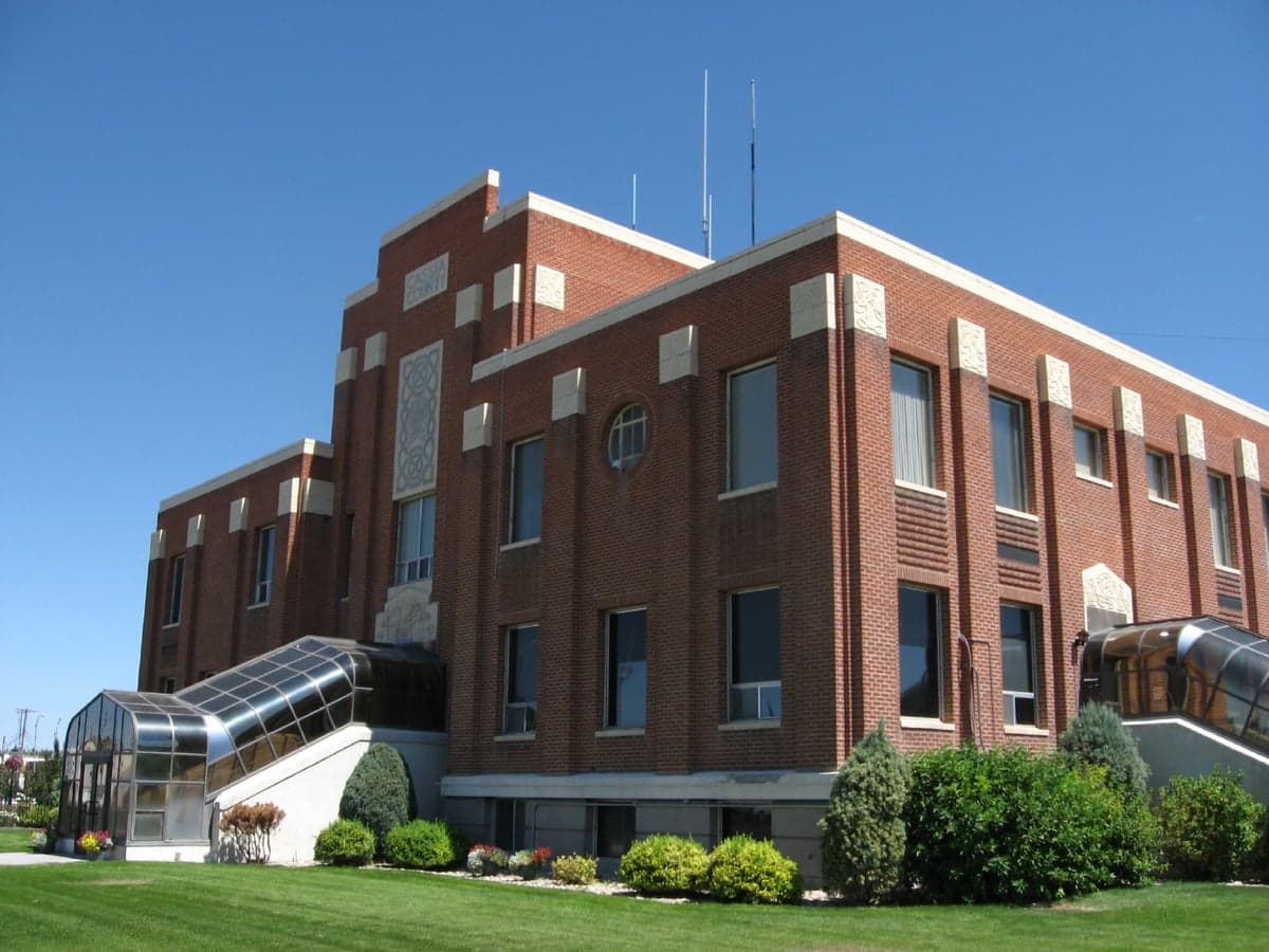
Photo: Wikipedia
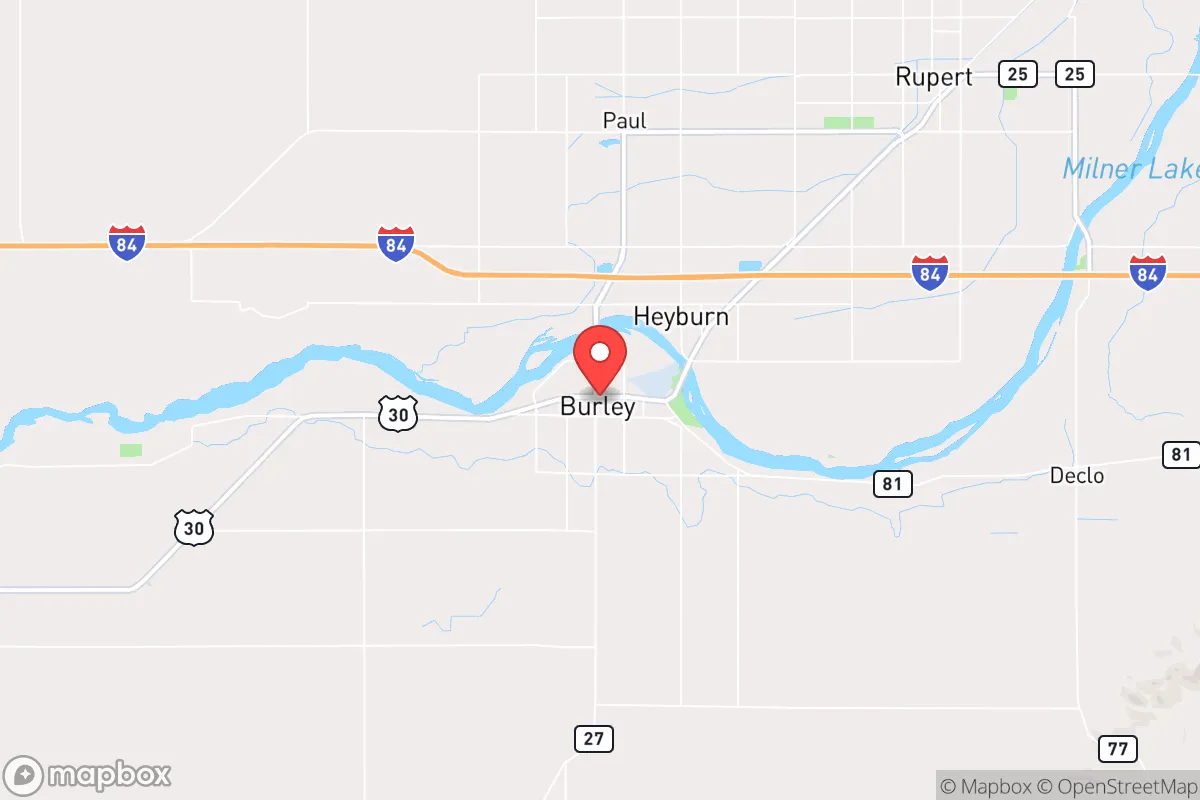
Strategic Assessment of Burley, ID
Strong survivability profile. Good buffer from population centers, with manageable environmental and tactical risks.
What does the Strategic Assessment tell us?
Our Strategic Assessment grades tactical survivability of an area. Major population centers, military targets, fallout zones, natural disasters, and border exposure all drive risk — lower exposure means a more defensible position in a crisis.
This is heavily inspired by Joel Skousen's Strategic Relocation book. Highly recommended you checkout the book ($)What does this tell us?
Our Strategic Assessment grades tactical survivability of an area. Major population centers, military targets, fallout zones, natural disasters, and border exposure all drive risk — lower exposure means a more defensible position in a crisis.
This is heavily inspired by Joel Skousen's Strategic Relocation book. Highly recommended you checkout the book ($)Strategic Pillars

Key Distances
Regional Safe Places
Below is our recommended "safe zones" in Idaho and the surrounding area based on our strategic heuristics. For most people, it's unrealistic to live in a “safe zone” full-time due to work, family or other personal reasons. They tend to be more rural. However, many of these areas are perfect for second homes and retreat properties that double as a vacation home or even a short-term rental.


Important Note: For informational purposes only. This does not mean nothing bad ever happens in the green zones. Please use common sense. This is based on public data and modeled with AI. We tried to take a conservative approach but mistakes happen. We update this regularly as new information becomes available.
Solar Generator Recommendations
Backup power matters more here than in safer locations. We've picked three solar generators across budgets and capacity tiers — start with the budget unit if you only need a few essentials, or step up if you want to run a fridge and HVAC for days at a time.

Jackery Portable Power Station Explorer 300
Budget OptionPower on the Go: Weighing only 11 lbs, it's convenient to set up and store with book-sized foldable solar panels

BLUETTI Portable Power Station AC180
Designed for both indoor and outdoor scenarios, AC180 is highly capable as it has a robost capacity and continuous output power.

EF ECOFLOW DELTA Pro Ultra Power Station
Upgraded PickEcoFlow DELTA Pro Ultra is a whole-home energy system designed to grow with your family. Integrated with the Smart Home Panel 2, it scales to meet your evolving energy needs — keeping your home powered, intelligent, and secure through every stage of life.
We earn a commission, at no additional cost to you.
Strategic Assessment Analysis
Burley, Idaho, sits in a sweet spot that few relocation analysts are talking about, and that silence is itself a strategic advantage. Tucked into the Magic Valley along the Snake River, this town of roughly 12,000 offers a combination of agricultural self-sufficiency, geographic insulation, and low-key infrastructure that makes it a serious candidate for anyone thinking about long-term resilience. It’s not flashy, and that’s the point. Burley’s location—roughly 140 miles from Boise, 170 miles from Salt Lake City, and a solid 200 miles from the nearest major military or nuclear target—gives it a buffer that most people in the Intermountain West simply don’t have. For a conservative-leaning relocator who sees the writing on the wall regarding urban decay, supply chain fragility, and federal overreach, Burley offers a quiet, defensible base of operations.
Geographic position and natural advantages for long-term security
Burley’s position in the Snake River Plain is its single greatest asset. The area sits at roughly 4,200 feet elevation, which means a four-season climate without the brutal extremes of the northern Rockies or the desert heat of southern Idaho. The Snake River itself provides a reliable, year-round water source—something that’s becoming increasingly rare and valuable in the American West. The surrounding landscape is a mix of irrigated farmland, sagebrush steppe, and low volcanic hills, offering multiple avenues for retreat, caching, or simply getting off the grid for a few days if things get hot. The Cassia County region is sparsely populated, with a population density of about 12 people per square mile. That’s low enough that you can own acreage without being visible from the road, but high enough that you’re not completely isolated from medical care or resupply. The nearby Sawtooth National Forest and Minidoka National Wildlife Refuge provide public land access for hunting, foraging, and emergency shelter. For someone who values operational security and the ability to live without constant surveillance, this part of Idaho is hard to beat.
Risks, exposures, and proximity to fallout-relevant landmarks
No location is perfect, and Burley has its share of vulnerabilities. The most obvious is the Idaho National Laboratory (INL), about 90 miles to the northeast near Idaho Falls. INL is a major nuclear research facility with reactors, spent fuel storage, and historical ties to weapons-related work. In a full-scale conflict or major terrorist event, INL is a plausible target for a conventional strike or sabotage. Fallout patterns from a release at INL would depend heavily on wind direction—prevailing winds in the region are from the southwest, which would push contamination toward the Wyoming border and away from Burley. But a shift to a northwesterly flow could put the Magic Valley in the plume path. That’s a real, if low-probability, risk. More immediate is the Union Pacific rail line that runs right through Burley, carrying hazardous materials including crude oil, anhydrous ammonia, and chlorine. A derailment or intentional release could force a temporary evacuation or contaminate local water sources. The town also sits near the intersection of I-84 and US-30, which means it’s a natural chokepoint for east-west traffic. In a collapse scenario, that highway could become a funnel for refugees from Boise or Salt Lake City. The good news is that Burley is small enough that a determined group could establish roadblocks or diversion points on the secondary roads that bypass the main corridors. The bad news is that you can’t control the interstate.
Practical resilience for a relocator: food, water, energy, and defensibility
Burley’s agricultural base is its strongest card. The Magic Valley is one of the most productive farming regions in the country, with over 500,000 acres of irrigated cropland producing potatoes, sugar beets, alfalfa, wheat, and barley. There are multiple grain elevators, seed processors, and a sugar beet factory in nearby Paul. That means local food production is not just a hobby—it’s the regional economy. For a prepper, that translates to bulk purchasing opportunities, direct relationships with farmers, and the ability to barter for staples without relying on grocery store supply chains. Water rights are a more complex issue. The Snake River is managed under the prior appropriation doctrine, and new wells are heavily regulated. Anyone buying land here needs to verify water rights as part of the due diligence—a property without a water right is essentially a dry campsite. That said, the shallow aquifer in the area is accessible with a hand pump or solar-powered well for those who own the mineral rights. Energy is less of a concern. Idaho Power provides electricity from a mix of hydro, natural gas, and wind, and the grid is relatively stable compared to coastal states. Solar potential is good—the area averages over 200 sunny days per year—and off-grid setups are common enough that local contractors know how to install them. Defensibility is where Burley really shines. The town is laid out in a grid along the river, with the interstate to the north and farmland to the south. The surrounding terrain offers multiple natural chokepoints: the Snake River bridges, the railroad underpasses, and the canyon roads leading into the Sawtooths. A small, well-organized group could control access to the town with minimal manpower. The local culture is heavily Mormon and ranching-oriented, which means a strong tradition of community self-reliance, food storage, and mutual aid. For a conservative relocator, that’s a cultural fit that can’t be replicated in a libertarian enclave or a coastal retreat.
The overall strategic picture for Burley is one of moderate risk and high reward. It’s not a bug-out location for a weekend warrior—it’s a place to build a life that’s already aligned with resilience. The risks from INL and the rail line are real but manageable with proper planning, including a fallout shelter or a pre-planned evacuation route to the south or west. The agricultural abundance, water availability, and community culture make it one of the few places in the lower 48 where a family could realistically achieve food sovereignty without being a full-time farmer. The biggest downside is the distance from major medical centers—the nearest Level 1 trauma center is in Boise, a two-hour drive—so anyone with chronic health issues needs to factor that in. But for a healthy individual or family who wants to be prepared for the next decade of uncertainty, Burley offers a quiet, defensible, and surprisingly well-stocked corner of the country. It’s not a secret, but it’s still under the radar. That won’t last forever.
* Values derived from national, state, county, city and local statistics and may differ in a specific area. Last updated: 2026-04-21T09:15:47.000Z
Narrative content on this page is AI-generated and may contain mistakes. Verify any details that matter before acting on them.
ReloMaps may earn a commission from affiliate links at no extra cost to you.