Photo: Wikipedia
Strategic Assessment of Tulare County
Meaningful friction. Expect exposure to either population pressure, blast zones, or natural disaster risk. Consider buying a retreat property.
What does the Strategic Assessment tell us?
Our Strategic Assessment grades tactical survivability of an area. Major population centers, military targets, fallout zones, natural disasters, and border exposure all drive risk — lower exposure means a more defensible position in a crisis.
This is heavily inspired by Joel Skousen's Strategic Relocation book. Highly recommended you checkout the book ($)What does this tell us?
Our Strategic Assessment grades tactical survivability of an area. Major population centers, military targets, fallout zones, natural disasters, and border exposure all drive risk — lower exposure means a more defensible position in a crisis.
This is heavily inspired by Joel Skousen's Strategic Relocation book. Highly recommended you checkout the book ($)Strategic Pillars

Key Distances
Strategic Assessment Analysis
Tulare County, California, offers a compelling mix of strategic advantages and notable vulnerabilities for the relocation-minded individual or family prioritizing resilience and self-sufficiency. Situated in the heart of California’s Central Valley, its primary strengths lie in its agricultural abundance and relative geographic isolation from major metropolitan targets, while its chief exposures include proximity to critical infrastructure and the state’s well-documented natural disaster risks. For a conservative-leaning reader assessing long-term preparedness, this region presents a trade-off between food security and exposure to systemic risks tied to California’s broader vulnerabilities.
Geographic position and natural advantages for long-term stability
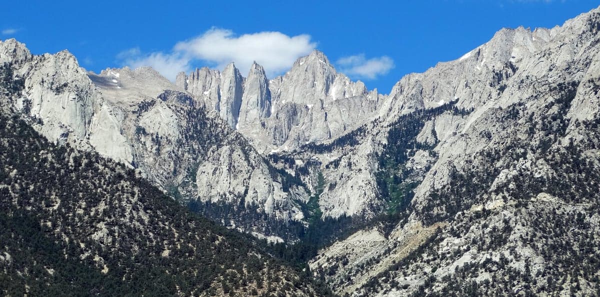
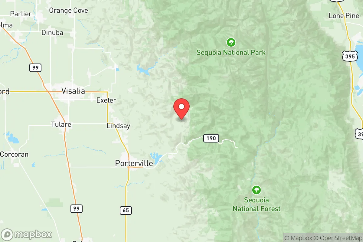
Tulare County’s location is defined by its position at the southern end of the San Joaquin Valley, roughly equidistant from the major population centers of Los Angeles (about 180 miles south) and the San Francisco Bay Area (about 200 miles northwest). This distance provides a meaningful buffer against the immediate fallout from a major event targeting those urban hubs, such as a large-scale earthquake, industrial accident, or civil disruption. The county’s eastern boundary is the Sierra Nevada mountain range, offering a natural defensive barrier and access to high-altitude retreat areas like the Sequoia National Forest and the communities of Three Rivers and Springville. To the west, the Coast Ranges provide a secondary barrier, though the valley floor itself is flat and open. The county seat, Visalia, is the largest city, with a population of roughly 140,000, while other key towns include Tulare (about 70,000), Porterville (about 65,000), and the smaller agricultural hubs of Dinuba, Exeter, and Lindsay. This distribution of population across multiple smaller cities, rather than a single dense metro, reduces the risk of a single point of failure and offers more dispersed living options for those seeking a rural or semi-rural lifestyle. The region’s primary natural advantage is its role as one of the most productive agricultural zones in the world, with over 1.5 million acres of irrigated farmland producing a vast array of crops, from citrus and grapes to almonds and dairy. This local food production capacity is a significant resilience asset, as it means a relocator could potentially access fresh, locally grown food even during broader supply chain disruptions.
Risks, exposures, and proximity to fallout-relevant landmarks
While Tulare County’s distance from major cities is a plus, it is not without its own strategic vulnerabilities. The county sits within the Central Valley, a region that is home to a dense concentration of critical infrastructure. The most notable nearby landmark is the Naval Air Station Lemoore, located just west of the county line in Kings County, approximately 30 miles southwest of Visalia. This is the U.S. Navy’s largest master jet base on the West Coast, housing multiple F/A-18 squadrons. In a conflict scenario, this base would be a high-value target, and its proximity means Tulare County could experience secondary effects from a strike or accident, including potential fallout or disruption from a base-related event. Additionally, the county is crisscrossed by major transportation corridors, including Highway 99 (a primary north-south freight route) and Interstate 5 (just west of the county line), which carry hazardous materials daily. The California Aqueduct and the Friant-Kern Canal run through the county, making it a critical node in the state’s water distribution system—a potential target for sabotage or a point of failure during a drought or earthquake. On the natural disaster front, Tulare County faces significant earthquake risk from the nearby San Andreas Fault (about 70 miles west) and the Garlock Fault (about 100 miles south). A major quake on either could disrupt the aqueducts, damage roads, and trigger liquefaction in the valley’s alluvial soils. The county also experiences periodic flooding, particularly in the low-lying areas near the Kings River and Tule River, and is subject to extreme heat events, with summer temperatures regularly exceeding 100°F. Wildfire risk is primarily confined to the Sierra Nevada foothills, but the Sequoia National Forest and the Giant Sequoia National Monument have seen devastating fires in recent years, such as the 2020 Castle Fire and the 2021 KNP Complex Fire, which can generate smoke that blankets the valley for weeks.
Practical resilience for a relocator: food, water, energy, and defensibility
For the self-sufficiency-minded relocator, Tulare County offers a strong foundation in food and water security, but energy and defensibility present challenges. Food production is the county’s standout asset. The region is a national leader in dairy, citrus, grapes, and nuts, and a relocator with even a modest plot of land can grow a substantial portion of their own food, given the long growing season (March to November) and fertile soil. Farmers’ markets are abundant in Visalia, Tulare, and Porterville, and local food co-ops provide access to bulk staples. Water availability is a more complex issue. The county relies heavily on groundwater from the Tulare Lake Subbasin, which has been severely overdrafted for decades, leading to land subsidence and declining well levels. While the 2023 winter storms temporarily refilled the historic Tulare Lake bed (which re-emerged after a century), long-term water security is uncertain. A relocator should verify that any property has a reliable, permitted well with a recent flow test, and consider rainwater catchment as a backup. Energy infrastructure is a vulnerability. The county is served by Southern California Edison and Pacific Gas & Electric, both of which have faced criticism for grid reliability during heat waves and fire seasons. Power shutoffs (Public Safety Power Shutoffs) are common during high-wind events, and the grid is not hardened against a major earthquake. Solar panels with battery storage are a wise investment, as the region receives over 260 sunny days per year. Defensibility is mixed. The flat, open terrain of the valley floor offers little natural cover, making a rural homestead relatively exposed. However, the foothill communities like Three Rivers, Springville, and the area around Lake Kaweah provide more defensible positions with elevation, tree cover, and limited road access. The county’s law enforcement presence is moderate, with the Tulare County Sheriff’s Office covering most unincorporated areas, but response times in remote areas can be 30 minutes or more. The local population is generally conservative and self-reliant, with a strong agricultural work ethic, which can be an asset for building a community network. Gun ownership is common, and the county has a relatively low crime rate compared to urban California, though property crime in Visalia and Porterville is a concern.
Overall, Tulare County presents a strategic picture of a region with high potential for food and water self-sufficiency, offset by significant exposure to natural disasters and proximity to a major military target. For the relocator who is willing to invest in off-grid energy, secure a reliable water source, and choose a defensible location in the foothills, it offers a viable base for long-term resilience. However, the county’s dependence on a fragile water system and its location within a state facing systemic governance and infrastructure challenges means that it is not a low-risk option—it is a calculated trade-off. The key is to avoid the valley floor and instead focus on the eastern foothills, where elevation, water access, and community cohesion are stronger. For those who can navigate these trade-offs, Tulare County provides a rare combination of agricultural abundance and geographic buffer that is hard to find elsewhere in California.

* Values derived from national, state, county, city and local statistics and may differ in a specific area. Last updated: 2026-09-30T14:13:48.000Z
Narrative content on this page is AI-generated and may contain mistakes. Verify any details that matter before acting on them.
ReloMaps may earn a commission from affiliate links at no extra cost to you.

