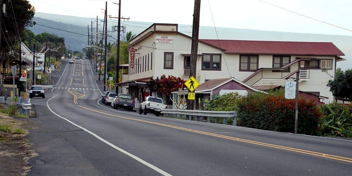

Photo: Wikipedia
Strategic Assessment of Captain Cook, HI
Strong survivability profile. Good buffer from population centers, with manageable environmental and tactical risks.
What does the Strategic Assessment tell us?
Our Strategic Assessment grades tactical survivability of an area. Major population centers, military targets, fallout zones, natural disasters, and border exposure all drive risk — lower exposure means a more defensible position in a crisis.
This is heavily inspired by Joel Skousen's Strategic Relocation book. Highly recommended you checkout the book ($)What does this tell us?
Our Strategic Assessment grades tactical survivability of an area. Major population centers, military targets, fallout zones, natural disasters, and border exposure all drive risk — lower exposure means a more defensible position in a crisis.
This is heavily inspired by Joel Skousen's Strategic Relocation book. Highly recommended you checkout the book ($)Strategic Pillars

Key Distances
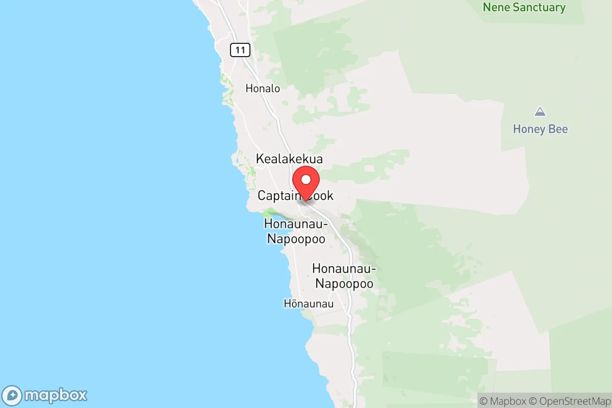
Regional Safe Places
Below is our recommended "safe zones" in Hawaii and the surrounding area based on our strategic heuristics. For most people, it's unrealistic to live in a “safe zone” full-time due to work, family or other personal reasons. They tend to be more rural. However, many of these areas are perfect for second homes and retreat properties that double as a vacation home or even a short-term rental.


Important Note: For informational purposes only. This does not mean nothing bad ever happens in the green zones. Please use common sense. This is based on public data and modeled with AI. We tried to take a conservative approach but mistakes happen. We update this regularly as new information becomes available.
Solar Generator Recommendations
Backup power matters more here than in safer locations. We've picked three solar generators across budgets and capacity tiers — start with the budget unit if you only need a few essentials, or step up if you want to run a fridge and HVAC for days at a time.

Jackery Portable Power Station Explorer 300
Budget OptionPower on the Go: Weighing only 11 lbs, it's convenient to set up and store with book-sized foldable solar panels

BLUETTI Portable Power Station AC180
Designed for both indoor and outdoor scenarios, AC180 is highly capable as it has a robost capacity and continuous output power.

EF ECOFLOW DELTA Pro Ultra Power Station
Upgraded PickEcoFlow DELTA Pro Ultra is a whole-home energy system designed to grow with your family. Integrated with the Smart Home Panel 2, it scales to meet your evolving energy needs — keeping your home powered, intelligent, and secure through every stage of life.
We earn a commission, at no additional cost to you.
Strategic Assessment Analysis
Captain Cook, Hawaii, offers a strategic relocation option that is often overlooked by those focused solely on Oahu or the more tourist-heavy parts of the Big Island. Its resilience stems from a combination of geographic isolation, a relatively stable microclimate, and a position that is far enough from the major population centers of Hilo and Kona to avoid the worst of any cascading urban collapse, yet close enough to access critical supplies and infrastructure when things are stable. For a prepper or survivalist with a conservative bent, this is not a bug-out location for a weekend—it is a long-term, multi-generational homesteading play in a place where the state of the mainland feels very, very far away.
Geographic position and natural advantages for long-term stability
Captain Cook sits on the leeward (west) side of the Big Island, in the Kona District, at an elevation that provides a significant advantage over the coastal strip. The area is famous for its coffee farms and macadamia nut orchards, which is a clue to its agricultural viability. The elevation—roughly 1,200 to 1,800 feet above sea level—means the climate is consistently cooler and less humid than the Kona coast, reducing the risk of heat-related health issues and making food storage easier without heavy reliance on refrigeration. The area receives reliable rainfall, but not the deluge that plagues the Hilo side, making it a sweet spot for rain-fed catchment systems. This is a place where you can realistically grow a significant portion of your own food year-round, including citrus, avocados, bananas, and a variety of vegetables. The volcanic soil is deep and fertile. From a strategic standpoint, the Big Island’s isolation from the other Hawaiian islands and the mainland is a double-edged sword, but for a prepper, it is a net positive: it is difficult for any cascading societal breakdown to reach you quickly, and the local population is small enough that resource competition, while real, is not the desperate scramble you would see in Honolulu or even Kailua-Kona.
Risks, exposures, and proximity to fallout-relevant landmarks
No place in Hawaii is without risk, and Captain Cook has specific exposures that must be factored into any serious plan. The most obvious is volcanic activity. While the 2018 Kilauea eruption devastated the Puna district, Captain Cook is on the western flank of Mauna Loa, which is a shield volcano that can erupt with fast-moving lava flows. The 2022 Mauna Loa eruption sent lava toward the Daniel K. Inouye Highway (Saddle Road), which is the critical east-west artery. A major eruption on the southwest rift zone could cut off access to Hilo or Kona, effectively isolating the area. Captain Cook is not in a lava flow hazard zone 1 or 2, but it is adjacent to zone 3, meaning the risk is low but not zero. The bigger concern is the potential for a large earthquake, which could trigger landslides on the steep slopes of the area and damage the single road in and out—the Mamalahoa Highway (Highway 11). That road is your lifeline. If it is blocked by a landslide or a lava flow, you are effectively on an island within an island. Regarding fallout-relevant landmarks, the nearest major military installation is Pohakuloa Training Area, about 40 miles north, which is a live-fire training range. The Pacific Missile Range Facility on Kauai is far away, but the Big Island hosts the Mauna Kea Observatories and the Hawaii Volcanoes National Park, neither of which are high-value strategic targets in a conventional sense. The real danger is not a nuclear strike on the island; it is the collapse of the supply chain. Nearly 90% of Hawaii's food is imported, and most of it arrives at Hilo and Kona harbors. If those ports are disrupted by a hurricane, a tsunami, or civil unrest, Captain Cook will feel the pinch within days. The area is also within the tsunami inundation zone for the coast, but the elevation of the main residential areas (above 1,000 feet) provides a natural buffer.
Practical resilience for a relocator: food, water, energy, and defensibility
For a relocator serious about self-sufficiency, Captain Cook offers a rare combination of resources. Water is the most critical. Most homes in the area rely on rainwater catchment systems, and the average annual rainfall of 60-80 inches means a well-designed system with a large tank (10,000 gallons or more) can provide year-round water for a family. You must have a backup filtration system—a Berkey or a Sawyer filter—because a volcanic ashfall event or a hurricane can contaminate your roof and gutters. Food production is viable, but it requires work. The soil is rocky and requires amendment, but the growing season is perpetual. You can have a productive garden within three months of arrival. The local farmers' markets in Captain Cook and nearby Kealakekua are excellent sources of local produce and eggs, but in a crisis, those will dry up. You need to be growing your own. Energy is a mixed bag. The island's grid is fragile and expensive (electricity rates are among the highest in the nation). Solar is the obvious answer, but the area's frequent cloud cover and afternoon trade wind showers mean you need a larger battery bank than you would in a sunnier location. A backup generator running on propane is a wise investment. Defensibility is a strong point. The area is rural, with properties often set back from the road, separated by dense vegetation and steep terrain. The single road in and out (Highway 11) is a natural chokepoint. A small group could effectively monitor and control access to the Captain Cook area. The local community is a mix of long-time farmers, coffee growers, and retirees, many of whom are already self-reliant and suspicious of government overreach. This is not a liberal enclave; the political leanings in the Kona District are more libertarian and conservative than the rest of the state. You will find neighbors who share your worldview and are willing to form a mutual aid network. The biggest practical challenge is the cost of land and housing. A modest three-bedroom home on an acre of land in Captain Cook will cost $500,000 to $800,000, and prices have been rising as mainlanders flee urban chaos. You need capital to get in the door.
The overall strategic picture for Captain Cook is one of high potential paired with high entry cost and specific, manageable risks. It is not a place for someone looking for a cheap bug-out location. It is a place for a serious relocator who has the resources to buy land, build a catchment system, install solar, and start a food forest. The isolation that makes it resilient also makes it difficult to leave if things go sideways on the mainland—you are committed. The area’s distance from the major ports and population centers of Hilo and Kona is a double-edged sword: it protects you from the immediate chaos of a port closure or a riot, but it also means you are further from the hospitals, hardware stores, and supply depots you might need in a non-catastrophic emergency. For the conservative prepper who values self-reliance, community, and a climate that supports year-round food production, Captain Cook is one of the best options in the state. The key is to treat it as a permanent relocation, not a temporary retreat. If you are willing to put in the work and the capital, this area can sustain you and your family through most scenarios short of a direct volcanic catastrophe. The state of the country may be uncertain, but the land here is not.
* Values derived from national, state, county, city and local statistics and may differ in a specific area. Last updated: 2026-05-15T21:56:05.000Z
Narrative content on this page is AI-generated and may contain mistakes. Verify any details that matter before acting on them.
ReloMaps may earn a commission from affiliate links at no extra cost to you.