
Photo: Wikipedia
Strategic Assessment of Chattanooga, TN
Meaningful friction. Expect exposure to either population pressure, blast zones, or natural disaster risk. Consider buying a retreat property.
What does the Strategic Assessment tell us?
Our Strategic Assessment grades tactical survivability of an area. Major population centers, military targets, fallout zones, natural disasters, and border exposure all drive risk — lower exposure means a more defensible position in a crisis.
This is heavily inspired by Joel Skousen's Strategic Relocation book. Highly recommended you checkout the book ($)What does this tell us?
Our Strategic Assessment grades tactical survivability of an area. Major population centers, military targets, fallout zones, natural disasters, and border exposure all drive risk — lower exposure means a more defensible position in a crisis.
This is heavily inspired by Joel Skousen's Strategic Relocation book. Highly recommended you checkout the book ($)Strategic Pillars

Key Distances
Regional Safe Places
Below is our recommended "safe zones" in Tennessee and the surrounding area based on our strategic heuristics. For most people, it's unrealistic to live in a “safe zone” full-time due to work, family or other personal reasons. They tend to be more rural. However, many of these areas are perfect for second homes and retreat properties that double as a vacation home or even a short-term rental.
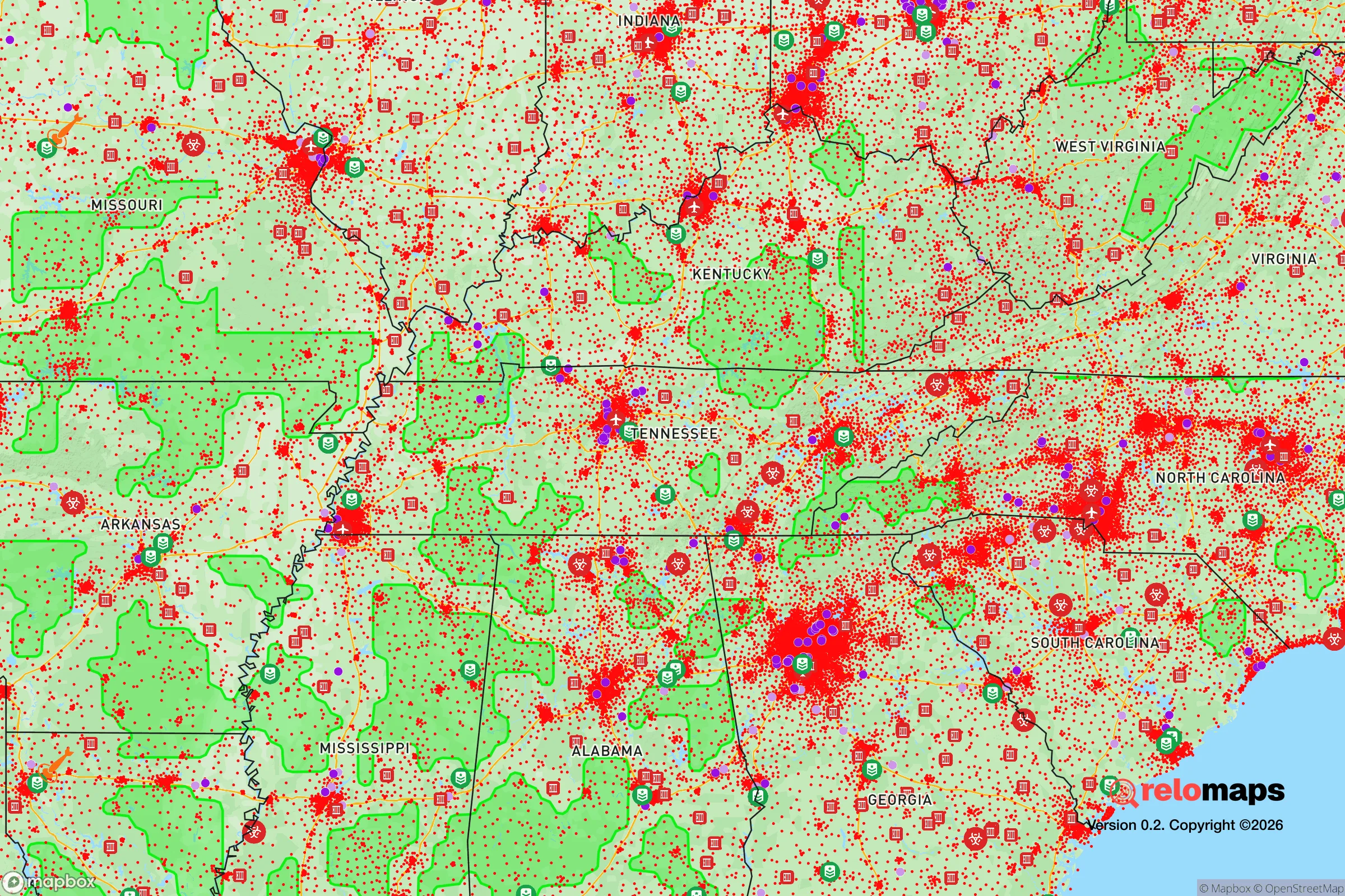
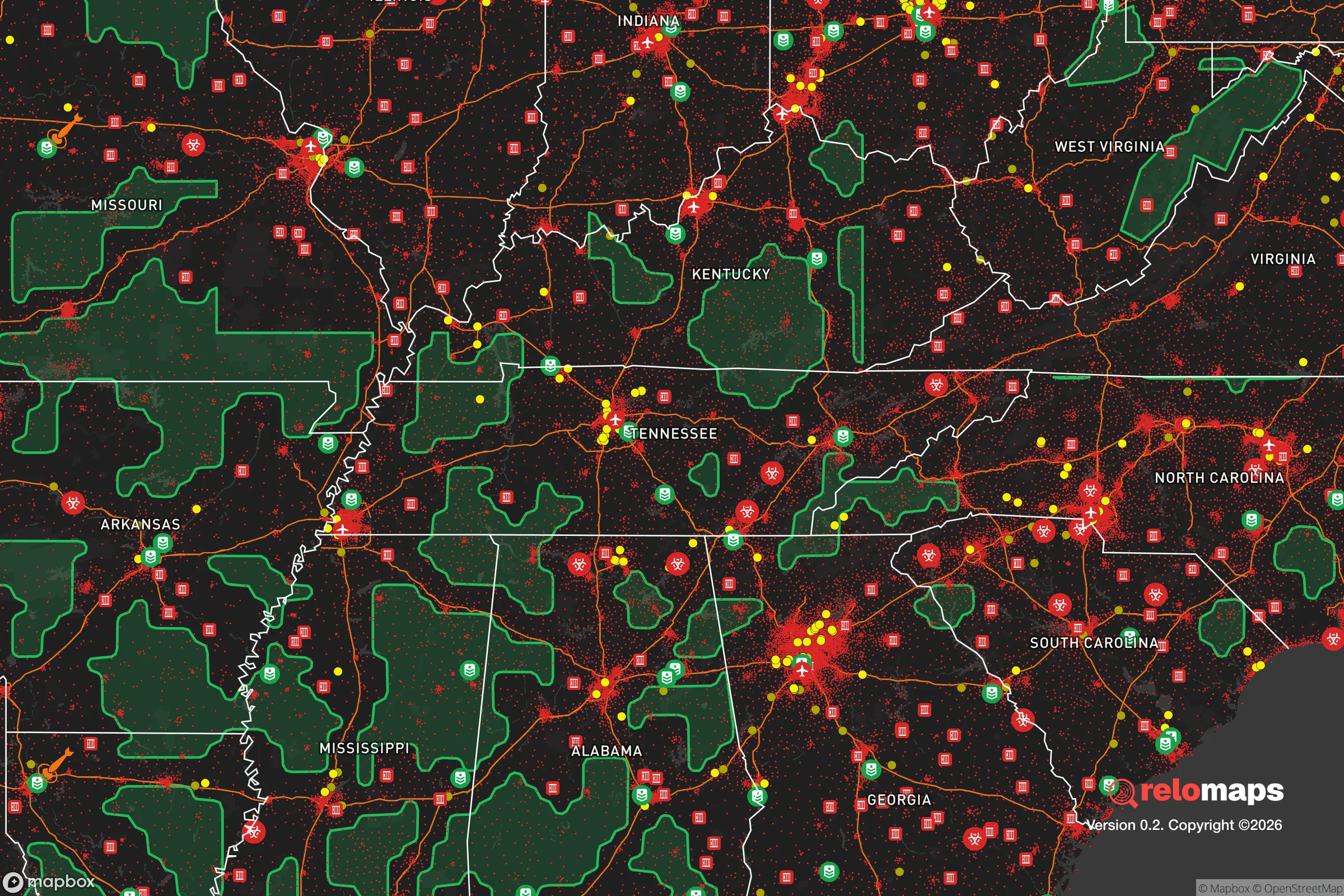
Important Note: For informational purposes only. This does not mean nothing bad ever happens in the green zones. Please use common sense. This is based on public data and modeled with AI. We tried to take a conservative approach but mistakes happen. We update this regularly as new information becomes available.
Solar Generator Recommendations
Backup power matters more here than in safer locations. We've picked three solar generators across budgets and capacity tiers — start with the budget unit if you only need a few essentials, or step up if you want to run a fridge and HVAC for days at a time.

Jackery Portable Power Station Explorer 300
Budget OptionPower on the Go: Weighing only 11 lbs, it's convenient to set up and store with book-sized foldable solar panels

BLUETTI Portable Power Station AC180
Designed for both indoor and outdoor scenarios, AC180 is highly capable as it has a robost capacity and continuous output power.

EF ECOFLOW DELTA Pro Ultra Power Station
Upgraded PickEcoFlow DELTA Pro Ultra is a whole-home energy system designed to grow with your family. Integrated with the Smart Home Panel 2, it scales to meet your evolving energy needs — keeping your home powered, intelligent, and secure through every stage of life.
We earn a commission, at no additional cost to you.
Strategic Assessment Analysis
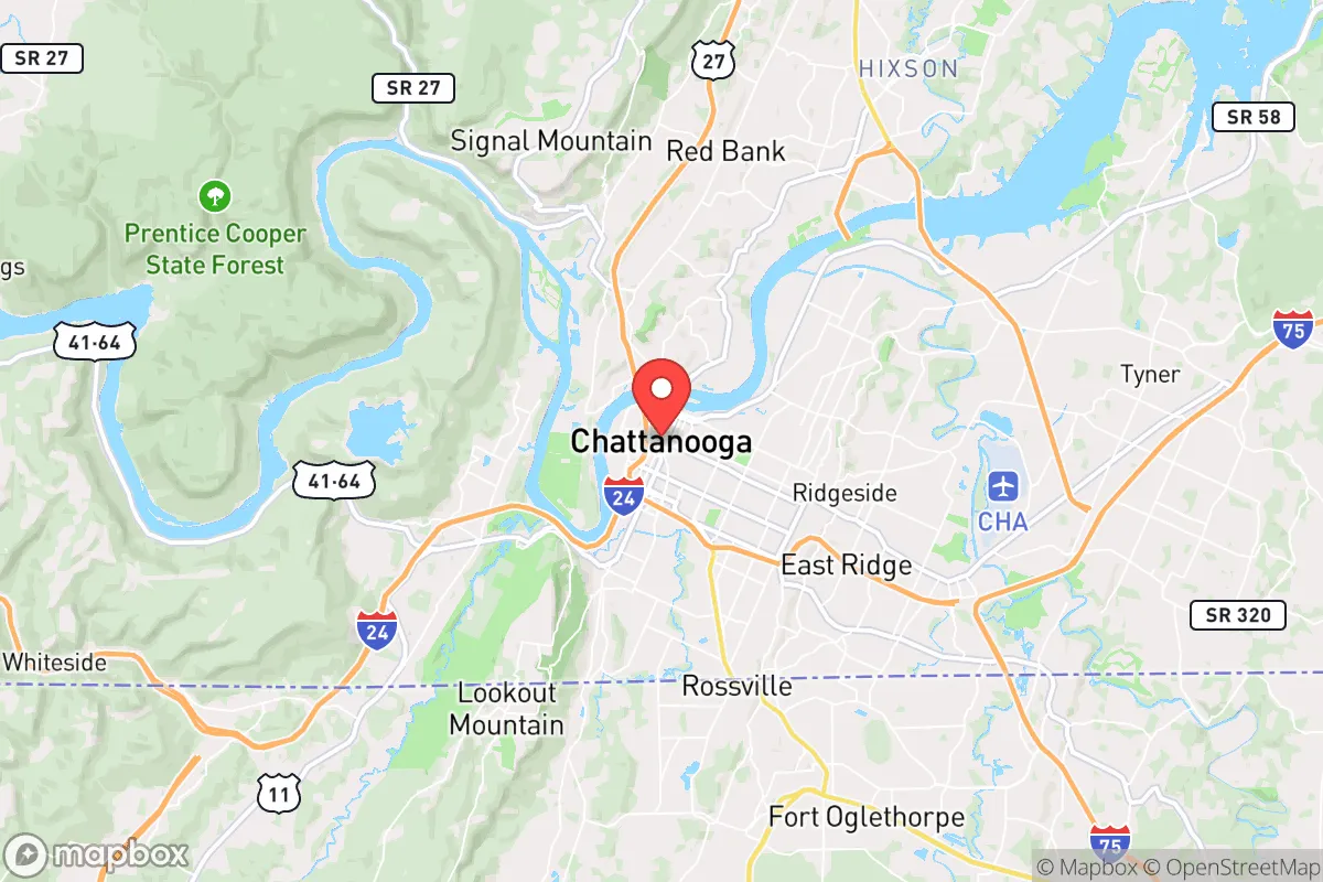
Chattanooga, Tennessee, occupies a strategic niche that balances access to critical infrastructure with a degree of natural separation from the most obvious fallout zones, making it a location worth serious consideration for those prioritizing resilience and self-sufficiency. Nestled in a valley carved by the Tennessee River and ringed by the Cumberland Plateau and Appalachian foothills, the city offers a defensible geography that has historically made it a transportation and logistics hub—and today gives it a mix of advantages and exposures that a prepper-minded relocator must weigh carefully. The area’s relative proximity to major population centers like Atlanta (about 120 miles south) and Nashville (about 130 miles northwest) is a double-edged sword: it provides access to supply chains and medical resources, but also places it within the shadow of potential civil unrest or infrastructure collapse radiating from those metros. For a conservative-leaning individual or family looking to plant roots in a place that can weather both natural and man-made storms, Chattanooga presents a compelling but not risk-free picture.
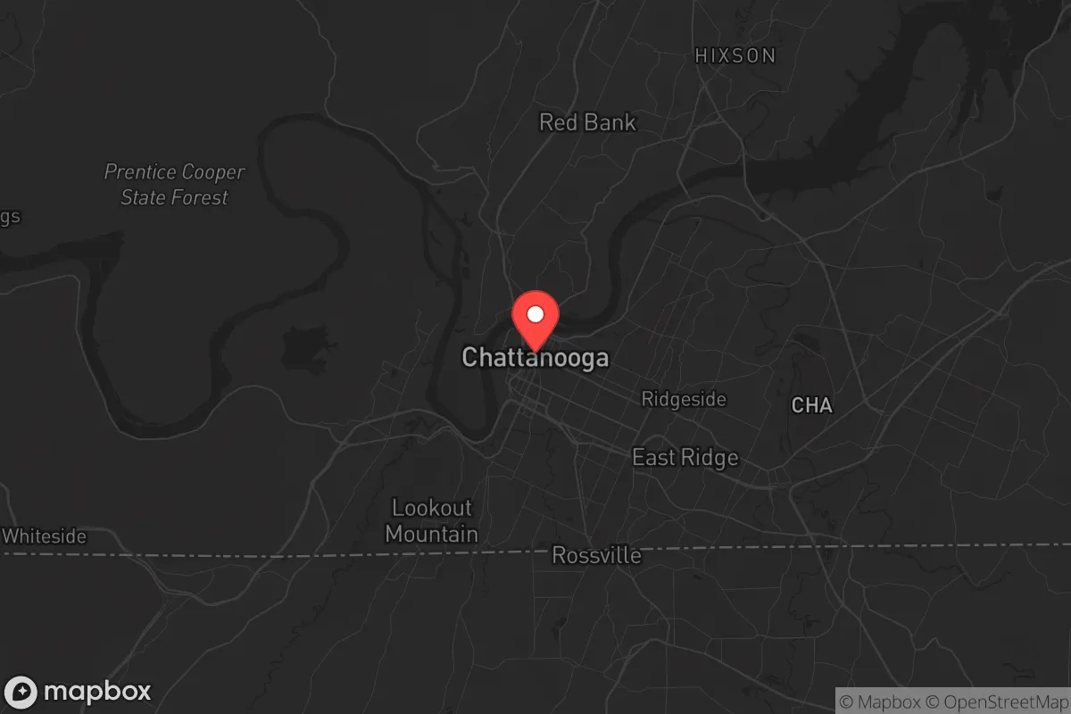
Geographic position and natural advantages for long-term stability
Chattanooga’s location in the Tennessee River Valley gives it a rare combination of defensible terrain and resource abundance. The surrounding mountains—Lookout Mountain, Signal Mountain, and the broader Cumberland Plateau—create natural chokepoints and observation points that could be leveraged for perimeter awareness in a grid-down scenario. The Tennessee River itself is a major water artery, providing a reliable surface water source that, with proper filtration, can sustain a household indefinitely. The region’s temperate climate means four distinct seasons but no extreme cold snaps or hurricane threats, reducing the risk of weather-related infrastructure failure. The valley’s fertile soil and long growing season (roughly 200 frost-free days) support small-scale agriculture, a critical factor for anyone planning to supplement food stores with gardening or livestock. Additionally, the area sits atop the Cumberland Plateau aquifer system, which offers groundwater potential for well drilling in outlying properties—a key consideration for water security when municipal systems might fail. From a strategic standpoint, Chattanooga’s position along Interstate 75 and the CSX rail corridor gives it logistical connectivity, but the surrounding topography means that road access can be easily controlled or disrupted, which is both a vulnerability and a defensive asset depending on your perspective.
Risks, exposures, and proximity to fallout-relevant landmarks
The most significant risk for a Chattanooga-based prepper is the city’s proximity to critical infrastructure that could become targets or sources of cascading failure. The Chickamauga Dam, located just upstream on the Tennessee River, is a hydroelectric facility that powers much of the region; a catastrophic failure or targeted attack could flood large portions of downtown and disrupt power for weeks. The nearby Sequoyah Nuclear Plant (about 20 miles north, near Soddy-Daisy) is a two-unit pressurized water reactor that, while well-regulated, represents a potential radiological hazard in the event of a major incident or sabotage. Chattanooga also sits within a 150-mile radius of the Oak Ridge National Laboratory (about 100 miles northeast), a key nuclear research and weapons-related facility that could be a target in a conflict scenario. On the civil unrest front, the city’s own population of roughly 185,000 (metro area about 570,000) is small enough to avoid the worst of urban chaos, but the influx of refugees from Atlanta or Nashville during a crisis could strain resources rapidly. The area has a moderate risk of tornadoes (part of Dixie Alley) and occasional flooding in low-lying neighborhoods, but these are manageable with proper planning—unlike the seismic or wildfire risks found in other regions. For a relocator, the key takeaway is that Chattanooga’s risks are primarily industrial and proximity-based, not natural, and can be mitigated by choosing a home site outside the floodplain and at least 10 miles from the dam or nuclear plant.
Practical resilience for a relocator: food, water, energy, and defensibility
For a family or individual serious about self-sufficiency, Chattanooga offers a mix of urban amenities and rural escape routes that few mid-sized cities can match. The surrounding counties—Hamilton, Marion, and Sequatchie—contain hundreds of thousands of acres of national forest (Cherokee National Forest is a 30-minute drive east) and public land that can serve as a resource for foraging, hunting, and timber. Water is abundant: the Tennessee River alone carries over 30,000 cubic feet per second past the city, and numerous creeks and springs feed into it from the mountains. A well-installed property in the foothills can provide 10–20 gallons per minute of potable water with minimal treatment. Energy resilience is improving, with a growing number of off-grid solar installations in the rural outskirts, though the local utility (EPB) has a strong grid with underground lines in many areas, reducing outage frequency. Defensibility is where Chattanooga shines: the valley is a natural bowl, meaning that a small group with knowledge of the terrain could control the major ingress points (I-24, I-75, US-27) with relative ease. The city’s gun culture is robust—Tennessee has constitutional carry, and Hamilton County has a high per-capita firearm ownership rate—which acts as a deterrent to organized looting or home invasions. For food storage, the area has multiple Costco, Sam’s Club, and local farm co-ops within a 20-minute drive, allowing for bulk purchasing before a crisis. The biggest practical challenge is land cost: desirable acreage with water access within 30 minutes of downtown runs $15,000–$25,000 per acre as of 2026, which is higher than rural Tennessee but still affordable compared to the West Coast or Northeast. A relocator should prioritize a property with a south-facing slope for solar, a well, and at least 5 acres for garden and livestock—this is achievable in places like Sale Creek, Dunlap, or Whitwell, all within a 40-minute drive of Chattanooga’s hospitals and supply points.
Overall, Chattanooga presents a balanced strategic picture for the conservative prepper: it offers genuine natural advantages in water, terrain, and climate, but carries real exposure to industrial and population-related risks that require deliberate mitigation. The city’s small size and strong community ties (many churches, gun clubs, and volunteer fire departments) provide a social fabric that can hold together under stress better than a sprawling suburb or dense urban core. The smart move for a relocator is to buy land in the surrounding rural counties—not inside the city limits—and treat Chattanooga as a supply hub and medical access point rather than a primary residence. If you can tolerate the humidity and the occasional tornado warning, and you’re willing to invest in a well, solar panels, and a good water filtration system, this valley can serve as a long-term base that keeps you close enough to civilization to function, but far enough from the blast zones to survive. It’s not a bunker, but it’s a solid foundation for a resilient life in uncertain times.
* Values derived from national, state, county, city and local statistics and may differ in a specific area. Last updated: 2026-04-15T23:51:52.000Z
Narrative content on this page is AI-generated and may contain mistakes. Verify any details that matter before acting on them.
ReloMaps may earn a commission from affiliate links at no extra cost to you.