Photo: Wikipedia
Strategic Assessment of Chicopee, MA
Multiple tactical vulnerabilities. Population density, target proximity, or disaster risk are likely compounding. A retreat property and exit planning is required.
What does the Strategic Assessment tell us?
Our Strategic Assessment grades tactical survivability of an area. Major population centers, military targets, fallout zones, natural disasters, and border exposure all drive risk — lower exposure means a more defensible position in a crisis.
This is heavily inspired by Joel Skousen's Strategic Relocation book. Highly recommended you checkout the book ($)What does this tell us?
Our Strategic Assessment grades tactical survivability of an area. Major population centers, military targets, fallout zones, natural disasters, and border exposure all drive risk — lower exposure means a more defensible position in a crisis.
This is heavily inspired by Joel Skousen's Strategic Relocation book. Highly recommended you checkout the book ($)Strategic Pillars

Key Distances
Regional Safe Places
Below is our recommended "safe zones" in Massachusetts and the surrounding area based on our strategic heuristics. For most people, it's unrealistic to live in a “safe zone” full-time due to work, family or other personal reasons. They tend to be more rural. However, many of these areas are perfect for second homes and retreat properties that double as a vacation home or even a short-term rental.


Important Note: For informational purposes only. This does not mean nothing bad ever happens in the green zones. Please use common sense. This is based on public data and modeled with AI. We tried to take a conservative approach but mistakes happen. We update this regularly as new information becomes available.
Solar Generator Recommendations
Backup power matters more here than in safer locations. We've picked three solar generators across budgets and capacity tiers — start with the budget unit if you only need a few essentials, or step up if you want to run a fridge and HVAC for days at a time.

Jackery Portable Power Station Explorer 300
Budget OptionPower on the Go: Weighing only 11 lbs, it's convenient to set up and store with book-sized foldable solar panels

BLUETTI Portable Power Station AC180
Designed for both indoor and outdoor scenarios, AC180 is highly capable as it has a robost capacity and continuous output power.

EF ECOFLOW DELTA Pro Ultra Power Station
Upgraded PickEcoFlow DELTA Pro Ultra is a whole-home energy system designed to grow with your family. Integrated with the Smart Home Panel 2, it scales to meet your evolving energy needs — keeping your home powered, intelligent, and secure through every stage of life.
We earn a commission, at no additional cost to you.
Strategic Assessment Analysis
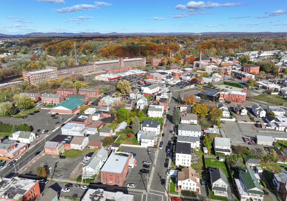
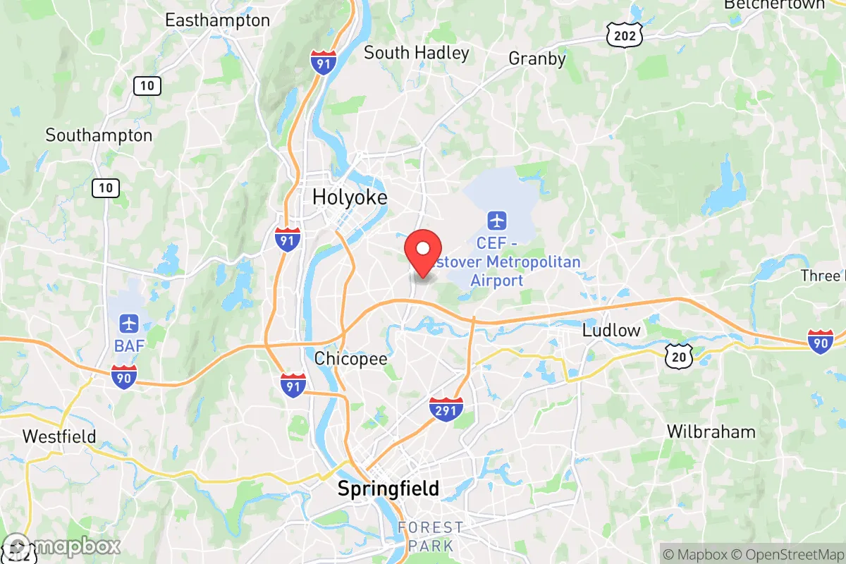
Chicopee, Massachusetts, presents a mixed strategic picture for the conservative prepper or survivalist. Its location in the Connecticut River Valley offers some natural advantages, but its proximity to major population centers, critical infrastructure, and the dense Northeast corridor introduces significant vulnerabilities. For a relocator prioritizing long-term resilience, Chicopee is less a fortress and more a forward operating base—close enough to urban resources to be useful, but dangerously close to the blast zones and fallout patterns of a major crisis. The key is understanding that this location trades absolute safety for immediate access to supply lines and a moderate climate, a trade that demands a clear-eyed assessment of risks.
Geographic position and natural advantages for long-term survival
Chicopee sits at the confluence of the Connecticut and Chicopee Rivers, a position that historically made it a manufacturing hub and today offers a reliable freshwater source. The surrounding terrain is a mix of river valley floodplains and low, forested hills, providing decent cover and some natural barriers to movement. The area benefits from a temperate climate with four distinct seasons, which supports subsistence gardening and small-scale agriculture, though the growing season is short (roughly 150 days). The proximity to the Quabbin Reservoir, about 20 miles east, is a significant strategic asset—it's one of the largest unfiltered water supplies in the country, and its watershed is heavily protected. For a relocator, this means a potential backup water source that is less likely to be immediately compromised by local contamination. The Connecticut River itself, while navigable, is also a natural corridor that could be used for transport or as a defensive line, but it also funnels traffic and potential threats from both north and south.
Risks, exposures, and proximity to fallout-relevant landmarks
The primary strategic weakness of Chicopee is its location within the Boston–Washington corridor. It lies just 90 miles west of Boston and 30 miles north of Hartford, Connecticut, both major population centers that would be primary targets in a conflict or major civil unrest. The city itself is part of the Springfield metropolitan area, which has a population of roughly 700,000. In a grid-down or societal collapse scenario, this density means competition for resources, potential for civil unrest, and a high likelihood of refugee flows. More critically, Chicopee is within 20 miles of the Westover Air Reserve Base, a major military installation that houses aerial refueling and airlift assets. This base is a high-value target in any conventional conflict, and its proximity means Chicopee sits in a likely fallout zone. Additionally, the area is crisscrossed by major highways (I-90, I-91, I-291) and rail lines, which are both evacuation routes and vectors for looting or hostile movement. The Connecticut River itself is a natural chokepoint; bridges over it would become contested points in any crisis. For the prepper, these factors mean that Chicopee is not a retreat location—it's a location that requires a plan to either harden in place or bug out quickly to more defensible terrain to the west (the Berkshires) or north (Vermont/New Hampshire).
Practical resilience for a relocator: food, water, energy, and defensibility
For a relocator willing to invest in preparation, Chicopee offers some practical advantages. The city's soil is generally fertile in the river valley, and there are community gardens and small farms in the surrounding towns (South Hadley, Granby, Ludlow) that could be tapped for seed stock and local knowledge. Water is abundant from the rivers and the Quabbin, but treatment will be necessary—boiling or filtration is non-negotiable given agricultural runoff and upstream sewage. Energy resilience is a mixed bag: the region has decent solar potential (about 4.5 peak sun hours per day), but tree cover in residential areas can be limiting. Wood heat is a viable option given the surrounding forests, but sourcing firewood sustainably requires land. The housing stock in Chicopee is older, with many pre-war homes that have thick walls and basements—good for storm sheltering but not built for modern security. Defensibility is poor in the city itself; the street grid is dense, and there are few natural chokepoints. A better strategy is to look at the rural edges of town, near the Chicopee River or in the forested areas toward Wilbraham, where property lines offer more standoff. The local government is typical for Massachusetts—blue-leaning, with higher taxes and regulations that can complicate stockpiling or off-grid modifications. For the conservative prepper, this means operating under the radar is essential; building a visible bunker or stockpile could attract unwanted attention from local authorities or neighbors.
The overall strategic picture for Chicopee is one of calculated risk. It is not a bug-out destination for a national crisis—the proximity to military targets, population density, and infrastructure chokepoints make it a high-risk zone. However, for a relocator who needs to stay within commuting distance of employment in the Northeast, it offers a middle ground: access to water, moderate climate, and a position that allows for a quick retreat to the more defensible hill country to the west. The key is to treat Chicopee as a base of operations, not a final redoubt. Stockpile for 90 days of self-sufficiency, have a vehicle prepped for a westward bug-out, and build relationships with like-minded neighbors in the surrounding rural towns. If you can accept that you're living in the suburbs of a potential target zone, and you have a plan to leave when the indicators turn red, Chicopee can work. If you're looking for a place to ride out the storm in place, look further west.
* Values derived from national, state, county, city and local statistics and may differ in a specific area. Last updated: 2026-05-01T02:07:01.000Z
Narrative content on this page is AI-generated and may contain mistakes. Verify any details that matter before acting on them.
ReloMaps may earn a commission from affiliate links at no extra cost to you.