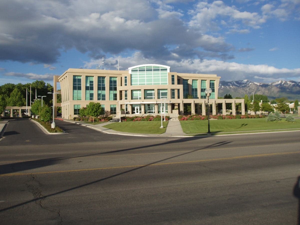
Photo: Wikipedia
Strategic Assessment of Clearfield, UT
Workable tactical position. Some exposure to population density or targets, but generally defensible in a crisis.
What does the Strategic Assessment tell us?
Our Strategic Assessment grades tactical survivability of an area. Major population centers, military targets, fallout zones, natural disasters, and border exposure all drive risk — lower exposure means a more defensible position in a crisis.
This is heavily inspired by Joel Skousen's Strategic Relocation book. Highly recommended you checkout the book ($)What does this tell us?
Our Strategic Assessment grades tactical survivability of an area. Major population centers, military targets, fallout zones, natural disasters, and border exposure all drive risk — lower exposure means a more defensible position in a crisis.
This is heavily inspired by Joel Skousen's Strategic Relocation book. Highly recommended you checkout the book ($)Strategic Pillars

Key Distances
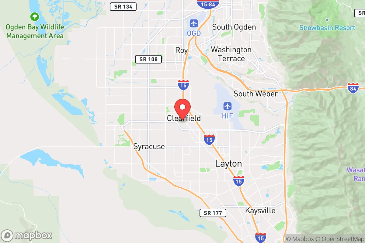
Regional Safe Places
Below is our recommended "safe zones" in Utah and the surrounding area based on our strategic heuristics. For most people, it's unrealistic to live in a “safe zone” full-time due to work, family or other personal reasons. They tend to be more rural. However, many of these areas are perfect for second homes and retreat properties that double as a vacation home or even a short-term rental.


Important Note: For informational purposes only. This does not mean nothing bad ever happens in the green zones. Please use common sense. This is based on public data and modeled with AI. We tried to take a conservative approach but mistakes happen. We update this regularly as new information becomes available.
Solar Generator Recommendations
Backup power matters more here than in safer locations. We've picked three solar generators across budgets and capacity tiers — start with the budget unit if you only need a few essentials, or step up if you want to run a fridge and HVAC for days at a time.

Jackery Portable Power Station Explorer 300
Budget OptionPower on the Go: Weighing only 11 lbs, it's convenient to set up and store with book-sized foldable solar panels

BLUETTI Portable Power Station AC180
Designed for both indoor and outdoor scenarios, AC180 is highly capable as it has a robost capacity and continuous output power.

EF ECOFLOW DELTA Pro Ultra Power Station
Upgraded PickEcoFlow DELTA Pro Ultra is a whole-home energy system designed to grow with your family. Integrated with the Smart Home Panel 2, it scales to meet your evolving energy needs — keeping your home powered, intelligent, and secure through every stage of life.
We earn a commission, at no additional cost to you.
Strategic Assessment Analysis
Clearfield, Utah, offers a surprisingly strong strategic position for those prioritizing resilience and self-reliance, largely due to its location within the Wasatch Front but at a critical distance from the region's most obvious vulnerabilities. While not a remote mountain redoubt, its position between the Great Salt Lake and the Wasatch Mountains provides a natural buffer and multiple escape corridors that many denser urban areas lack. For the conservative-minded relocator looking to balance access to infrastructure with a defensible, lower-profile base of operations, Clearfield presents a compelling, albeit nuanced, case.
Geographic position and natural advantages for long-term security
Clearfield sits in Davis County, roughly 25 miles north of Salt Lake City and 30 miles south of Ogden. This "middle ground" is its first strategic asset. It is close enough to the economic and logistical hubs of the Wasatch Front to access jobs, medical facilities, and supply chains, but far enough from the core urban centers to avoid being caught in the immediate chaos of a major civic disruption or a mass casualty event targeting a high-profile city. The city is flanked by the Great Salt Lake to the west and the Wasatch Mountains to the east, creating a natural funnel that limits approach vectors. This geography is a double-edged sword, but for a prepared individual, it means you can control the chokepoints. The nearby Antelope Island and the vast, open spaces of the Great Salt Lake Desert to the west offer a potential retreat route that is difficult to monitor or block. The mountains to the east provide watershed, timber, and high-ground observation points. The local climate, with four distinct seasons and reliable snowpack in the mountains, supports a more predictable water cycle than many arid Western states, a critical factor for long-term sustainability.
Risks, exposures, and proximity to fallout-relevant landmarks
The most significant strategic drawback of Clearfield is its proximity to Hill Air Force Base (HAFB), located immediately south of the city. HAFB is a major logistics and maintenance hub for the U.S. Air Force, including the F-35 and Minuteman III ICBM systems. In any scenario involving a major power conflict or a coordinated terrorist attack on military infrastructure, HAFB is a high-value, high-probability target. This makes Clearfield a potential fallout zone or secondary target area. The risk is not theoretical; it is a concrete, calculable exposure. Additionally, the Wasatch Front is a known seismic zone. A major earthquake along the Wasatch Fault could disrupt the I-15 corridor, the region's main artery, effectively isolating Clearfield from both Salt Lake City and Ogden. The city's reliance on a single major highway (I-15) and a single rail line for resupply is a vulnerability. A determined adversary or a natural disaster could sever these lines, turning Clearfield from a strategic midpoint into a trapped pocket. The presence of the Great Salt Lake also introduces a unique environmental risk: a "dust bowl" event where exposed lakebed sediments, laden with heavy metals and arsenic, become airborne, creating a long-term respiratory and agricultural hazard. For the prepper, this means your filtration and water purification plans must account for particulate and chemical contamination, not just biological threats.
Practical resilience for a relocator: food, water, energy, and defensibility
For the individual or family looking to establish a resilient household, Clearfield's practical assets are mixed but workable. Water is the primary concern. The city draws from the Weber River Basin and local groundwater, which are generally reliable but subject to drought cycles and upstream competition. A well on a private property is a significant advantage here, but many residential lots in Clearfield are on city water. You must have a plan for rainwater catchment or a deep well if you are outside city limits. Food security is achievable through local agriculture. Davis County has a strong history of farming, and the nearby communities of Kaysville and Layton have active farmers' markets and U-pick operations. The growing season is short (roughly May to September) but productive for cold-hardy crops. For long-term storage, the dry climate is excellent for preserving grains and dehydrated goods. Energy resilience is a bright spot. Utah has a deregulated energy market in some areas, and rooftop solar is a viable option given the region's high number of sunny days. Net metering policies are favorable, allowing you to build a battery-backed system that can island from the grid. Natural gas is the primary heating fuel, which is a vulnerability if the grid goes down, but wood-burning stoves are common in older homes and can be retrofitted. Defensibility is neighborhood-dependent. Clearfield is a suburban grid, not a fortress. However, the city's layout, with its mix of older, tree-lined neighborhoods and newer developments, offers multiple egress routes. The key is to choose a home on a cul-de-sac or near a dead-end street, preferably with a view of the main approaches. The local culture, with a strong LDS (Mormon) population, emphasizes community preparedness, food storage, and mutual aid. This is a soft asset that cannot be overstated. Your neighbors are likely to be more prepared and more willing to cooperate than in a typical suburban environment. This creates a natural network of resilience that a savvy relocator can integrate into.
The overall strategic picture for Clearfield is one of calculated risk. It is not a bug-out location; it is a stand-your-ground location for those who accept the proximity to Hill AFB as a manageable threat in exchange for access to the Wasatch Front's economic and logistical infrastructure. The city's greatest strength is its community culture of preparedness and its geographic position as a gateway to both the Great Salt Lake Desert and the Wasatch Mountains. For the conservative relocator who wants to be part of a functioning, resilient community rather than a lone wolf in the wilderness, Clearfield offers a viable base. The key is to harden your home against seismic and fallout risks, secure a private water source, and build strong relationships with your neighbors. If you can do that, Clearfield provides a solid foundation for weathering the storms ahead, whether they are natural, economic, or societal. The calculus is simple: you trade absolute safety from a military strike for a high degree of practical, community-based resilience. For many, that is a trade worth making.
* Values derived from national, state, county, city and local statistics and may differ in a specific area. Last updated: 2026-05-03T20:34:19.000Z
Narrative content on this page is AI-generated and may contain mistakes. Verify any details that matter before acting on them.
ReloMaps may earn a commission from affiliate links at no extra cost to you.