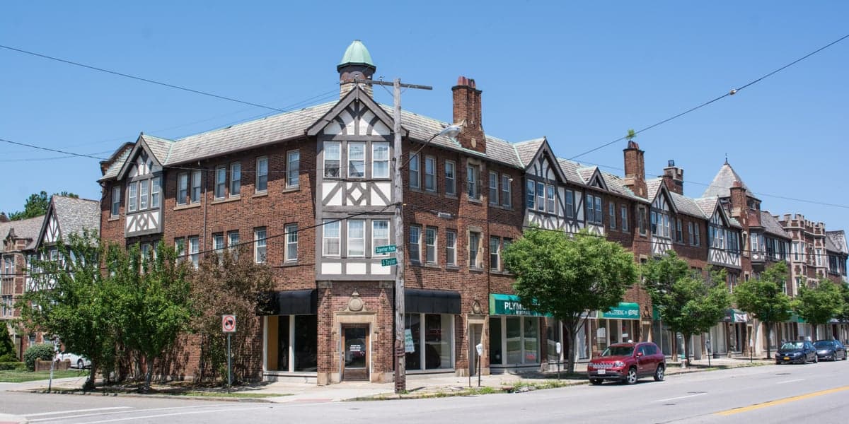
Photo: Wikipedia
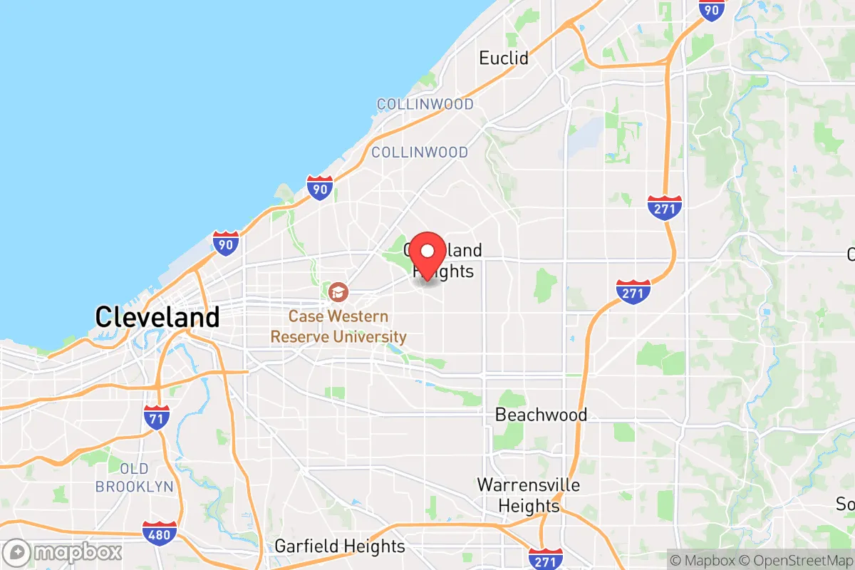
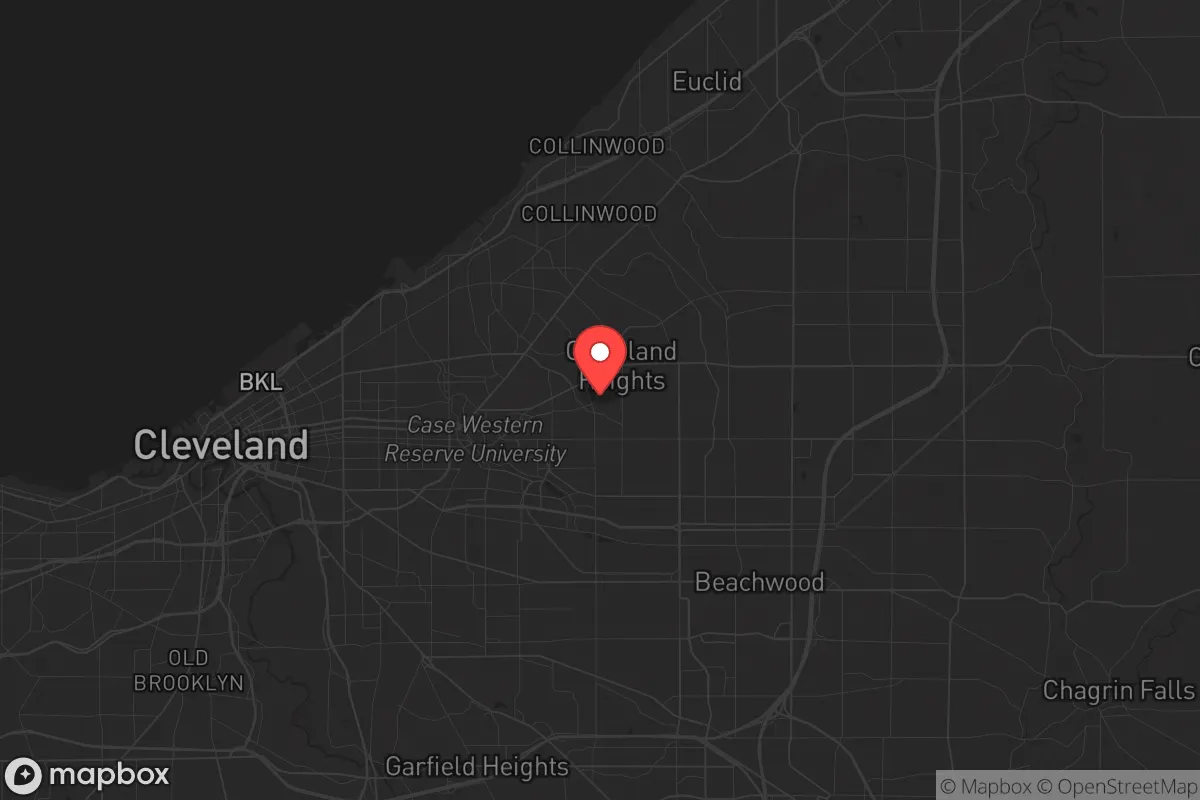
Strategic Assessment of Cleveland Heights, OH
Multiple tactical vulnerabilities. Population density, target proximity, or disaster risk are likely compounding. A retreat property and exit planning is required.
What does the Strategic Assessment tell us?
Our Strategic Assessment grades tactical survivability of an area. Major population centers, military targets, fallout zones, natural disasters, and border exposure all drive risk — lower exposure means a more defensible position in a crisis.
This is heavily inspired by Joel Skousen's Strategic Relocation book. Highly recommended you checkout the book ($)What does this tell us?
Our Strategic Assessment grades tactical survivability of an area. Major population centers, military targets, fallout zones, natural disasters, and border exposure all drive risk — lower exposure means a more defensible position in a crisis.
This is heavily inspired by Joel Skousen's Strategic Relocation book. Highly recommended you checkout the book ($)Strategic Pillars

Key Distances
Regional Safe Places
Below is our recommended "safe zones" in Ohio and the surrounding area based on our strategic heuristics. For most people, it's unrealistic to live in a “safe zone” full-time due to work, family or other personal reasons. They tend to be more rural. However, many of these areas are perfect for second homes and retreat properties that double as a vacation home or even a short-term rental.

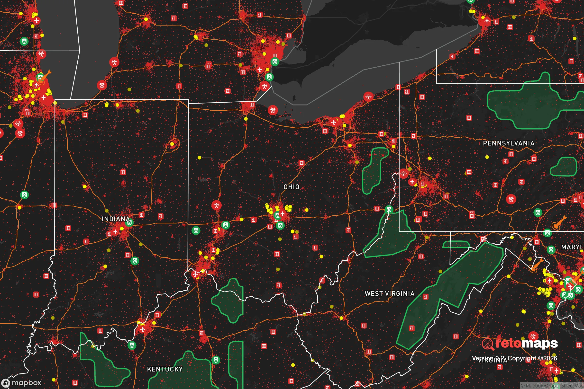
Important Note: For informational purposes only. This does not mean nothing bad ever happens in the green zones. Please use common sense. This is based on public data and modeled with AI. We tried to take a conservative approach but mistakes happen. We update this regularly as new information becomes available.
Solar Generator Recommendations
Backup power matters more here than in safer locations. We've picked three solar generators across budgets and capacity tiers — start with the budget unit if you only need a few essentials, or step up if you want to run a fridge and HVAC for days at a time.

Jackery Portable Power Station Explorer 300
Budget OptionPower on the Go: Weighing only 11 lbs, it's convenient to set up and store with book-sized foldable solar panels

BLUETTI Portable Power Station AC180
Designed for both indoor and outdoor scenarios, AC180 is highly capable as it has a robost capacity and continuous output power.

EF ECOFLOW DELTA Pro Ultra Power Station
Upgraded PickEcoFlow DELTA Pro Ultra is a whole-home energy system designed to grow with your family. Integrated with the Smart Home Panel 2, it scales to meet your evolving energy needs — keeping your home powered, intelligent, and secure through every stage of life.
We earn a commission, at no additional cost to you.
Strategic Assessment Analysis
Cleveland Heights, Ohio, presents a complex strategic picture for the conservative prepper. While its location in the Greater Cleveland area offers certain logistical advantages, its proximity to a major urban center and legacy industrial infrastructure introduces significant vulnerabilities that must be weighed carefully. This assessment evaluates the area’s resilience from a survivalist perspective, focusing on geographic positioning, risk exposure, and practical self-sufficiency for a relocator seeking to weather civic unrest, mass casualty events, and large-scale disasters.
Geographic position and natural advantages for long-term survival
Cleveland Heights sits on a high ridge east of downtown Cleveland, roughly 8 miles from the Lake Erie shoreline. This elevation—averaging 950 feet above sea level—provides a modest but real defensive advantage: it’s less prone to flooding than low-lying areas like the Cuyahoga Valley or lakefront neighborhoods, and it offers better line-of-sight for situational awareness. The area is part of the Allegheny Plateau, with rolling hills and mature tree cover that can aid in concealment and natural resource gathering. The local geology is underlain by Devonian shale and sandstone, which means well water is feasible but requires drilling 100–200 feet deep—a factor for off-grid water planning. The region’s four-season climate includes cold, snowy winters (average January low of 20°F) and humid summers, which tests cold-weather gear and food storage but also reduces the year-round threat of wildfires common in drier western states. For a relocator, the key natural advantage is access to Lake Erie, a massive freshwater source, though it’s 15–20 minutes away by car and vulnerable to contamination from industrial runoff and potential upstream incidents. The Cuyahoga River and numerous smaller creeks (like Doan Brook, which runs through the city) offer secondary water sources, but all require robust filtration and testing due to historical pollution.
Risks, exposures, and proximity to fallout-relevant landmarks
The single biggest strategic negative for Cleveland Heights is its proximity to Cleveland itself—a major Great Lakes population center with over 370,000 residents and a regional economy heavily dependent on healthcare, manufacturing, and logistics. In a scenario of civil unrest or mass casualty event, the city’s density (about 5,200 people per square mile) and its role as a transit hub (Interstates 90, 71, and 77 converge nearby) make it a likely flashpoint for looting, riots, or refugee flows. Cleveland Heights is also within 10 miles of the Cleveland Clinic’s main campus and University Hospitals—both high-value targets for bioweapon or chemical attacks, or simply overwhelmed facilities that could draw desperate crowds. The area sits roughly 40 miles from the Perry Nuclear Power Plant (Perry, OH), a boiling water reactor that, while generally well-regulated, represents a fallout risk in the event of a catastrophic failure or targeted attack. Prevailing winds from the west-northwest would carry a plume toward the Cleveland metro area, including Cleveland Heights, within 2–4 hours. Additionally, the region’s legacy as a Rust Belt industrial hub means numerous Superfund sites and abandoned factories (e.g., the former Cleveland Works steel mill along the Cuyahoga) could become secondary contamination sources during a disaster. For the prepper, the concentration of rail lines carrying hazardous materials (including crude oil from the Bakken fields) through the Cleveland rail corridor adds a daily low-probability, high-consequence risk of derailment and toxic release.
Practical resilience for a relocator: food, water, energy, and defensibility
For a single individual or family looking to establish a resilient homestead, Cleveland Heights offers a mixed bag. The housing stock is dominated by older, well-built structures (many from the 1920s–1950s) with thick plaster walls and basements that can double as storm shelters or root cellars. However, most homes are on small lots (typically 0.1–0.3 acres), limiting space for large-scale gardening or livestock. Community gardening is possible through the city’s five designated community gardens, but these are public and vulnerable to looting. For food security, a relocator would need to rely on suburban foraging (acorns, dandelions, and invasive garlic mustard are abundant) and partnerships with rural growers in surrounding counties like Geauga or Ashtabula, which are 30–45 minutes east. Water resilience is a critical weakness: the municipal water supply comes from Lake Erie via the Cleveland Water Department, a centralized system that could be disrupted by power outages, cyberattacks, or contamination. Installing a rainwater catchment system (average annual rainfall is 38 inches) and a deep-well hand pump is advisable, but zoning restrictions on wells in urban areas may require a variance. Energy-wise, the grid is reliable day-to-day but aging; natural gas is common for heating, but a propane backup generator or solar array with battery storage (e.g., a 5 kW system with 10 kWh of storage) is prudent given the region’s cloudy winters. Defensibility is mediocre: the street grid is interconnected, with multiple access points from Cedar Road, Mayfield Road, and Euclid Avenue, making it hard to secure a perimeter. A better option for a prepper might be a home on a cul-de-sac near the eastern edge of the city, closer to the Cleveland Metroparks’ North Chagrin Reservation, which offers 3,700 acres of forest for hunting, trapping, and emergency retreat. The local police force (about 60 officers) is professional but would be overwhelmed in a large-scale event, so personal security—firearms, reinforced doors, and a neighborhood watch network—is non-negotiable.
The overall strategic picture for Cleveland Heights is one of calculated risk. It is not a remote bug-out location; it is a suburban buffer zone that offers access to freshwater, moderate natural resources, and a dense population that could become a liability. For the conservative prepper who values community ties and the ability to blend into a working-class suburb while maintaining a low profile, it can work—but only with serious investment in water independence, food storage, and a plan to relocate to more rural areas (like the Appalachian foothills 60 miles southeast) if the SHTF. The area’s proximity to Cleveland’s hospitals, universities, and industrial infrastructure is a double-edged sword: it provides economic opportunity in stable times but turns into a target-rich environment during unrest. If you’re looking for a place to ride out a short-term crisis (weeks to months) with a solid basement, good neighbors, and a stocked pantry, Cleveland Heights is viable. For a long-term collapse scenario, the lack of land, defensible terrain, and distance from fallout-safe zones make it a staging ground at best—not a final destination.
* Values derived from national, state, county, city and local statistics and may differ in a specific area. Last updated: 2026-04-21T18:21:56.000Z
Narrative content on this page is AI-generated and may contain mistakes. Verify any details that matter before acting on them.
ReloMaps may earn a commission from affiliate links at no extra cost to you.