
Photo: Wikipedia
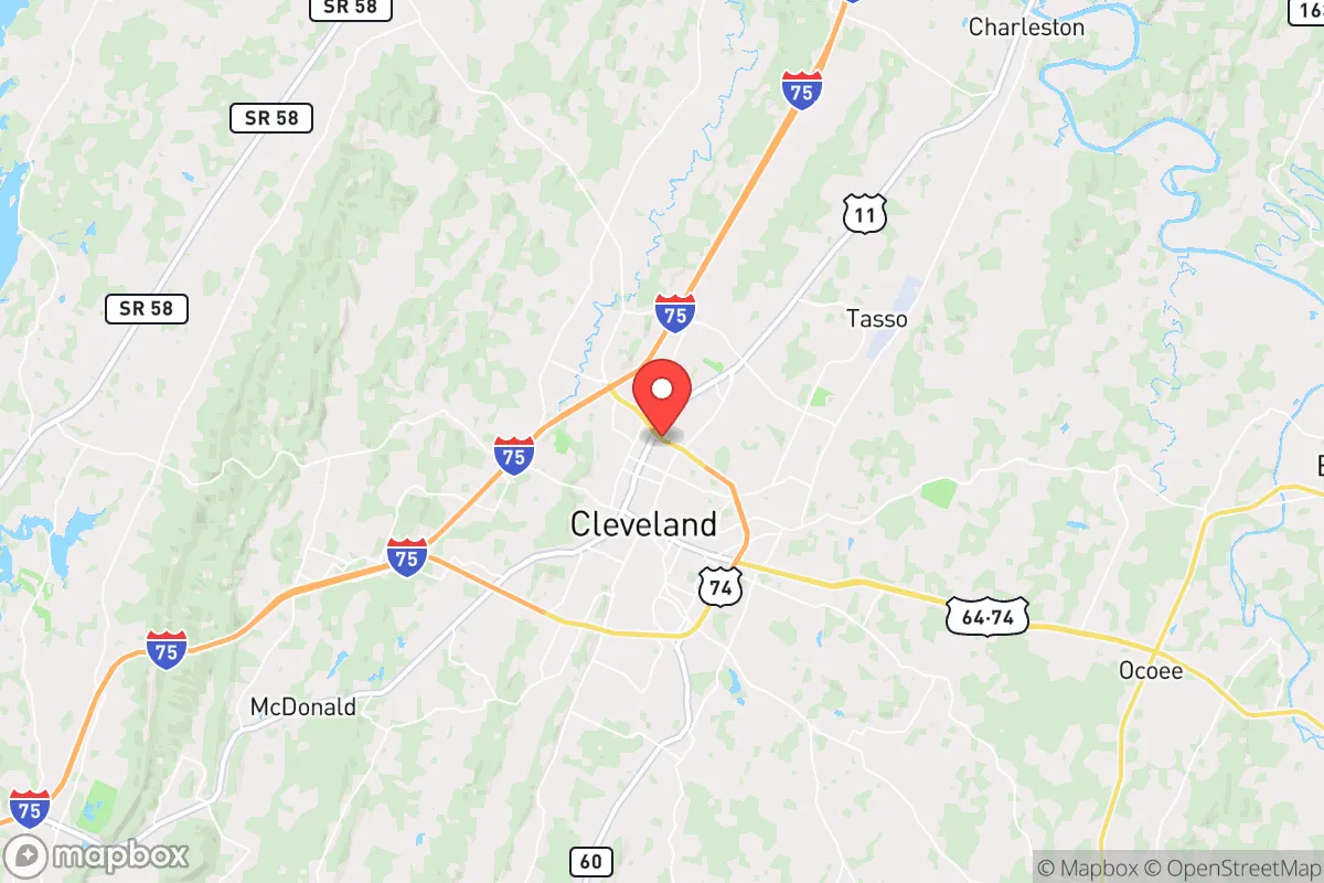
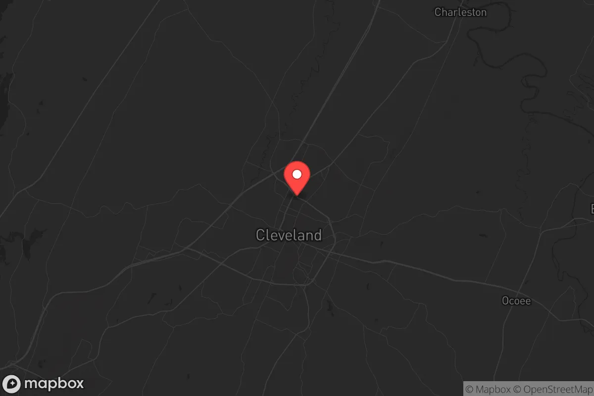
Strategic Assessment of Cleveland, TN
Workable tactical position. Some exposure to population density or targets, but generally defensible in a crisis.
What does the Strategic Assessment tell us?
Our Strategic Assessment grades tactical survivability of an area. Major population centers, military targets, fallout zones, natural disasters, and border exposure all drive risk — lower exposure means a more defensible position in a crisis.
This is heavily inspired by Joel Skousen's Strategic Relocation book. Highly recommended you checkout the book ($)What does this tell us?
Our Strategic Assessment grades tactical survivability of an area. Major population centers, military targets, fallout zones, natural disasters, and border exposure all drive risk — lower exposure means a more defensible position in a crisis.
This is heavily inspired by Joel Skousen's Strategic Relocation book. Highly recommended you checkout the book ($)Strategic Pillars

Key Distances
Regional Safe Places
Below is our recommended "safe zones" in Tennessee and the surrounding area based on our strategic heuristics. For most people, it's unrealistic to live in a “safe zone” full-time due to work, family or other personal reasons. They tend to be more rural. However, many of these areas are perfect for second homes and retreat properties that double as a vacation home or even a short-term rental.
Important Note: For informational purposes only. This does not mean nothing bad ever happens in the green zones. Please use common sense. This is based on public data and modeled with AI. We tried to take a conservative approach but mistakes happen. We update this regularly as new information becomes available.
Solar Generator Recommendations
Backup power matters more here than in safer locations. We've picked three solar generators across budgets and capacity tiers — start with the budget unit if you only need a few essentials, or step up if you want to run a fridge and HVAC for days at a time.

Jackery Portable Power Station Explorer 300
Budget OptionPower on the Go: Weighing only 11 lbs, it's convenient to set up and store with book-sized foldable solar panels

BLUETTI Portable Power Station AC180
Designed for both indoor and outdoor scenarios, AC180 is highly capable as it has a robost capacity and continuous output power.

EF ECOFLOW DELTA Pro Ultra Power Station
Upgraded PickEcoFlow DELTA Pro Ultra is a whole-home energy system designed to grow with your family. Integrated with the Smart Home Panel 2, it scales to meet your evolving energy needs — keeping your home powered, intelligent, and secure through every stage of life.
We earn a commission, at no additional cost to you.
Strategic Assessment Analysis
Cleveland, Tennessee, sits in a strategic pocket of the southeastern U.S. that offers a blend of geographic insulation and practical resilience for those thinking long-term about stability. Located roughly 30 miles northeast of Chattanooga and 90 miles from Knoxville, this Bradley County hub benefits from being close enough to regional infrastructure but far enough from the immediate blast radius of major metropolitan targets. The area’s position along the Ocoee River watershed and its access to the Cherokee National Forest provide natural buffers that matter when considering supply chain disruptions or population displacement events. For a relocator with a prepper mindset, Cleveland’s real advantage is its position as a secondary node—not a primary target—with enough local economic gravity to sustain itself if larger cities falter.
Geographic position and natural advantages for long-term stability
Cleveland’s location in the Tennessee Valley gives it a mix of defensible terrain and resource accessibility that’s hard to beat in the eastern U.S. The area sits in a valley ringed by the Appalachian foothills, which creates natural chokepoints for any large-scale movement—whether that’s a refugee flow from Atlanta or a supply convoy from Nashville. The Hiwassee and Ocoee Rivers run nearby, offering reliable freshwater sources that don’t depend on municipal treatment plants alone. The surrounding national forest land, roughly 650,000 acres of the Cherokee National Forest within a 45-minute drive, provides timber, game, and forage options that urban refugees won’t have. For a family or individual looking to establish a semi-self-sufficient homestead, the growing season here runs about 210 days, and the USDA hardiness zone (7a/7b) supports a wide range of food crops. The area’s elevation—around 900 feet—keeps it above the worst of Tennessee’s floodplain risks while still avoiding the extreme winter conditions of higher Appalachian zones. This isn’t a remote mountain redoubt, but it’s a solid middle ground: accessible enough for resupply, remote enough to avoid the first wave of chaos.
Risks, exposures, and proximity to fallout-relevant landmarks
The biggest vulnerability for Cleveland is its proximity to Chattanooga, a city with multiple critical infrastructure targets that could draw attention in a conflict or collapse scenario. Chattanooga hosts a major rail hub, the TVA’s Sequoyah Nuclear Plant (about 25 miles southwest), and a significant interstate junction (I-75/I-24) that would become a chokepoint during any evacuation. The Sequoyah plant is a pressurized water reactor—not the worst design for containment, but any major incident there would put Cleveland in the downwind plume path depending on weather patterns. Additionally, the Ocoee River dams upstream could be a target for sabotage or simply fail under neglect, though the TVA maintains them well. On the plus side, Cleveland itself has no major military bases, no large-scale chemical plants, and no federal government facilities that would make it a primary target. The closest military installation is the Army’s Fort Oglethorpe (now a historical site) or the Navy’s facility in Chattanooga—both low-priority. The real risk is secondary: if Atlanta or Nashville experiences a mass casualty event, Cleveland sits on the I-75 corridor that would funnel displaced populations north or south. That means a relocator needs a plan for filtering or diverting traffic, not for surviving a direct strike. The area’s rural buffer zones—especially to the east toward the national forest—offer escape routes if the valley becomes compromised.
Practical resilience for a relocator: food, water, energy, and defensibility
For someone serious about self-reliance, Cleveland’s practical assets are solid but require work. The local water table is generally good—Bradley County sits on a karst limestone aquifer, which means well water is viable but may need filtration for hardness and potential contaminants from agricultural runoff. The Ocoee River provides a surface water backup, but you’ll want a gravity-fed or hand-pump system since grid power is unreliable during storms (the area sees about 50 thunderstorm days per year). Food production is realistic: the county has over 1,200 farms, many of which are small operations that could be bartered with or absorbed into a community network. The Cleveland Farmers Market operates year-round, and local growers are accustomed to direct sales—a cultural advantage for building supply chains outside the grocery system. Energy-wise, the TVA grid is stable but centralized; solar is viable here with about 4.5 peak sun hours per day, and wood heating is practical given the forest access. Defensibility is moderate: the valley floor is open, but the surrounding ridges offer observation points and natural barriers. A property on the eastern side of the county, toward the Polk County line, gives you the best mix of seclusion and access to forest resources. The local gun culture is strong—Bradley County has a high rate of concealed carry permits and multiple shooting ranges—which means a relocator won’t stand out for being armed)Skip. The sheriff’s office is well-funded and generally responsive, but in a prolonged grid-down scenario, you’re relying on your own perimeter and community ties.
The overall strategic picture for Cleveland is that of a solid B-tier relocation choice for the conservative prepper. It’s not a hardened bunker location like the Idaho panhandle or the Montana Rockies, but it offers a realistic balance of accessibility, resources, and low-target status for someone who wants to stay within the eastern U.S. The proximity to Chattanooga is a double-edged sword—it provides medical and supply access in normal times but becomes a liability during a crisis. The key is to position yourself on the eastern or northern edges of the county, away from the I-75 corridor and closer to the forested escape routes. If you’re looking for a place where you can build a resilient lifestyle without going full off-grid hermit, Cleveland warrants a serious look. Just don’t expect it to stay quiet if the SHTF—everyone within a 50-mile radius will have the same idea.
* Values derived from national, state, county, city and local statistics and may differ in a specific area. Last updated: 2026-05-01T08:07:25.000Z
Narrative content on this page is AI-generated and may contain mistakes. Verify any details that matter before acting on them.
ReloMaps may earn a commission from affiliate links at no extra cost to you.