
Photo: Wikipedia
Strategic Assessment of Montrose County
Strong survivability profile. Good buffer from population centers, with manageable environmental and tactical risks.
What does the Strategic Assessment tell us?
Our Strategic Assessment grades tactical survivability of an area. Major population centers, military targets, fallout zones, natural disasters, and border exposure all drive risk — lower exposure means a more defensible position in a crisis.
This is heavily inspired by Joel Skousen's Strategic Relocation book. Highly recommended you checkout the book ($)What does this tell us?
Our Strategic Assessment grades tactical survivability of an area. Major population centers, military targets, fallout zones, natural disasters, and border exposure all drive risk — lower exposure means a more defensible position in a crisis.
This is heavily inspired by Joel Skousen's Strategic Relocation book. Highly recommended you checkout the book ($)Strategic Pillars

Key Distances
Strategic Assessment Analysis
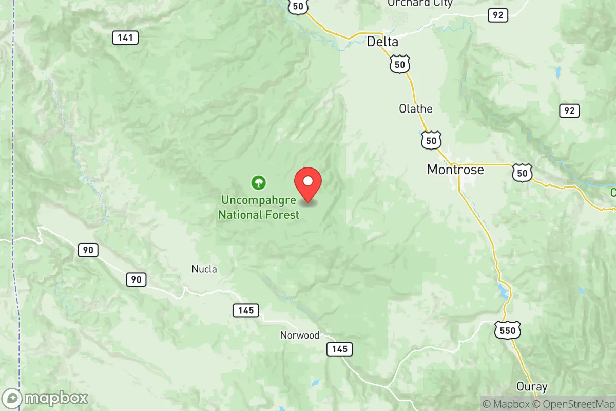
Montrose County, Colorado, offers a compelling strategic position for relocators prioritizing resilience and self-sufficiency, combining high-altitude geography with relative isolation from major metropolitan vulnerabilities. Located on the western slope of the Rocky Mountains, the county seat of Montrose sits roughly 250 miles southwest of Denver and 170 miles east of Moab, Utah, placing it well outside the immediate fallout zones of Colorado's Front Range urban corridor. The area's economic and logistical anchor is the city of Montrose (population ~20,000), with smaller communities like Olathe, Nucla, and Naturita providing additional rural nodes. For a reader serious about disaster readiness, Montrose County presents a mixed picture: strong natural defenses and resource access, but with specific exposure risks tied to regional infrastructure and wildfire.
Geographic position and natural advantages for self-sufficiency
Montrose County's geography is defined by the Uncompahgre Plateau to the west and the San Juan Mountains to the south, creating a natural basin that offers both defensibility and resource abundance. The Uncompahgre River runs through the county, providing a reliable surface water source that supports agriculture and domestic use — a critical advantage over drier parts of the western slope. The county sits at an average elevation of 5,800 feet, which reduces exposure to many airborne contaminants compared to lower-elevation areas, though it does not eliminate risk entirely. The surrounding topography includes the Gunnison Gorge and Black Canyon to the east, which serve as natural barriers to vehicular movement from that direction. For a relocator, the key advantage is the county's position outside the 150-mile prevailing wind corridor from Denver and Colorado Springs, significantly reducing fallout exposure from a Front Range event. The area also benefits from proximity to the Grand Mesa to the north, one of the largest flat-topped mountains in the world, which provides additional geographic shielding and a potential high-ground retreat option.
Risks, exposures, and proximity to fallout-relevant landmarks
While Montrose County avoids the worst of Front Range fallout risks, it is not without strategic vulnerabilities. The county lies approximately 120 miles southwest of the Uravan Mineral Belt, a historic uranium mining and milling region centered around the now-superfund site of Uravan, Colorado. While largely remediated, residual contamination and the presence of abandoned mine sites represent a localized environmental hazard. More immediately relevant is the county's proximity to the Grand Junction area (Mesa County), roughly 60 miles northwest, which hosts the Grand Junction Regional Airport (a potential military logistics hub) and the Colorado River corridor — a likely secondary target in a conflict scenario. The Montrose Regional Airport itself, while small, could become a point of interest for evacuation or military staging. Wildfire is the most probable natural risk: the 2020 Pine Gulch Fire burned over 139,000 acres just north of the county line, and the 2018 Lake Christine Fire near Basalt demonstrated how quickly western slope fires can threaten communities. Seismic risk is low but non-zero, with the Uncompahgre Fault Zone running through the area. For a relocator, the practical takeaway is that Montrose County is well-insulated from nuclear fallout originating from major Front Range targets, but remains exposed to regional infrastructure risks and seasonal wildfire threats.
Practical resilience for a relocator: food, water, energy, and defensibility
Montrose County's practical resilience metrics are generally favorable for a self-sufficiency-minded relocator. The county sits within the Uncompahgre Valley Water Users Association system, which delivers irrigation water from the Gunnison River via the Gunnison Tunnel — a 5.8-mile diversion completed in 1909 that provides a gravity-fed water supply independent of electrical pumping. This infrastructure gives the valley a significant agricultural advantage: the area produces alfalfa, hay, pinto beans, and livestock, with local food production capacity well above the Colorado average. The Montrose Farmers Market and multiple CSAs support local food networks, and the county's agricultural extension office offers resources for small-scale farming. For energy, the county is served by the Delta-Montrose Electric Association (DMEA), a cooperative that sources roughly 30% of its power from renewable sources including the nearby Mount Emmons hydroelectric plant. However, the grid is still connected to the Western Interconnection, meaning a major grid-down event would affect the area. Propane and firewood are commonly used for heating in rural areas, and solar potential is excellent with over 300 days of sunshine annually. Defensibility is a mixed picture: the county's dispersed population (roughly 43,000 people across 2,241 square miles) means low population density, but the valley floor is open and accessible from multiple directions. The San Juan Mountains to the south provide a natural redoubt, and the Uncompahgre Plateau offers retreat options for those with backcountry capability. Medical infrastructure is limited to Montrose Memorial Hospital, a 75-bed critical access facility, with major trauma care requiring transport to Grand Junction or Denver — a significant vulnerability in a prolonged crisis.
Overall, Montrose County presents a strong strategic option for the relocator who values geographic insulation, water security, and agricultural self-sufficiency, but who is willing to accept moderate wildfire risk and limited medical infrastructure. The county's position west of the Continental Divide and outside the prevailing fallout patterns from Colorado's Front Range makes it one of the more defensible locations in the state for a family or individual preparing for systemic disruption. The combination of reliable irrigation water, cooperative electric service, and a working agricultural economy provides a foundation for long-term resilience that many western slope counties lack. For the reader weighing trade-offs, Montrose County offers a realistic balance of isolation and access — far enough from major targets to reduce risk, but close enough to regional supply chains to maintain a functional lifestyle during normal times. The key strategic recommendation is to secure a property with private water rights and solar capacity, and to establish relationships with local agricultural producers before any crisis event.

* Values derived from national, state, county, city and local statistics and may differ in a specific area. Last updated: 2026-08-08T12:42:46.000Z
Narrative content on this page is AI-generated and may contain mistakes. Verify any details that matter before acting on them.
ReloMaps may earn a commission from affiliate links at no extra cost to you.

