Photo: Wikipedia
Strategic Assessment of Commerce City, CO
Multiple tactical vulnerabilities. Population density, target proximity, or disaster risk are likely compounding. A retreat property and exit planning is required.
What does the Strategic Assessment tell us?
Our Strategic Assessment grades tactical survivability of an area. Major population centers, military targets, fallout zones, natural disasters, and border exposure all drive risk — lower exposure means a more defensible position in a crisis.
This is heavily inspired by Joel Skousen's Strategic Relocation book. Highly recommended you checkout the book ($)What does this tell us?
Our Strategic Assessment grades tactical survivability of an area. Major population centers, military targets, fallout zones, natural disasters, and border exposure all drive risk — lower exposure means a more defensible position in a crisis.
This is heavily inspired by Joel Skousen's Strategic Relocation book. Highly recommended you checkout the book ($)Strategic Pillars

Key Distances
Regional Safe Places
Below is our recommended "safe zones" in Colorado and the surrounding area based on our strategic heuristics. For most people, it's unrealistic to live in a “safe zone” full-time due to work, family or other personal reasons. They tend to be more rural. However, many of these areas are perfect for second homes and retreat properties that double as a vacation home or even a short-term rental.


Important Note: For informational purposes only. This does not mean nothing bad ever happens in the green zones. Please use common sense. This is based on public data and modeled with AI. We tried to take a conservative approach but mistakes happen. We update this regularly as new information becomes available.
Solar Generator Recommendations
Backup power matters more here than in safer locations. We've picked three solar generators across budgets and capacity tiers — start with the budget unit if you only need a few essentials, or step up if you want to run a fridge and HVAC for days at a time.

Jackery Portable Power Station Explorer 300
Budget OptionPower on the Go: Weighing only 11 lbs, it's convenient to set up and store with book-sized foldable solar panels

BLUETTI Portable Power Station AC180
Designed for both indoor and outdoor scenarios, AC180 is highly capable as it has a robost capacity and continuous output power.

EF ECOFLOW DELTA Pro Ultra Power Station
Upgraded PickEcoFlow DELTA Pro Ultra is a whole-home energy system designed to grow with your family. Integrated with the Smart Home Panel 2, it scales to meet your evolving energy needs — keeping your home powered, intelligent, and secure through every stage of life.
We earn a commission, at no additional cost to you.
Strategic Assessment Analysis
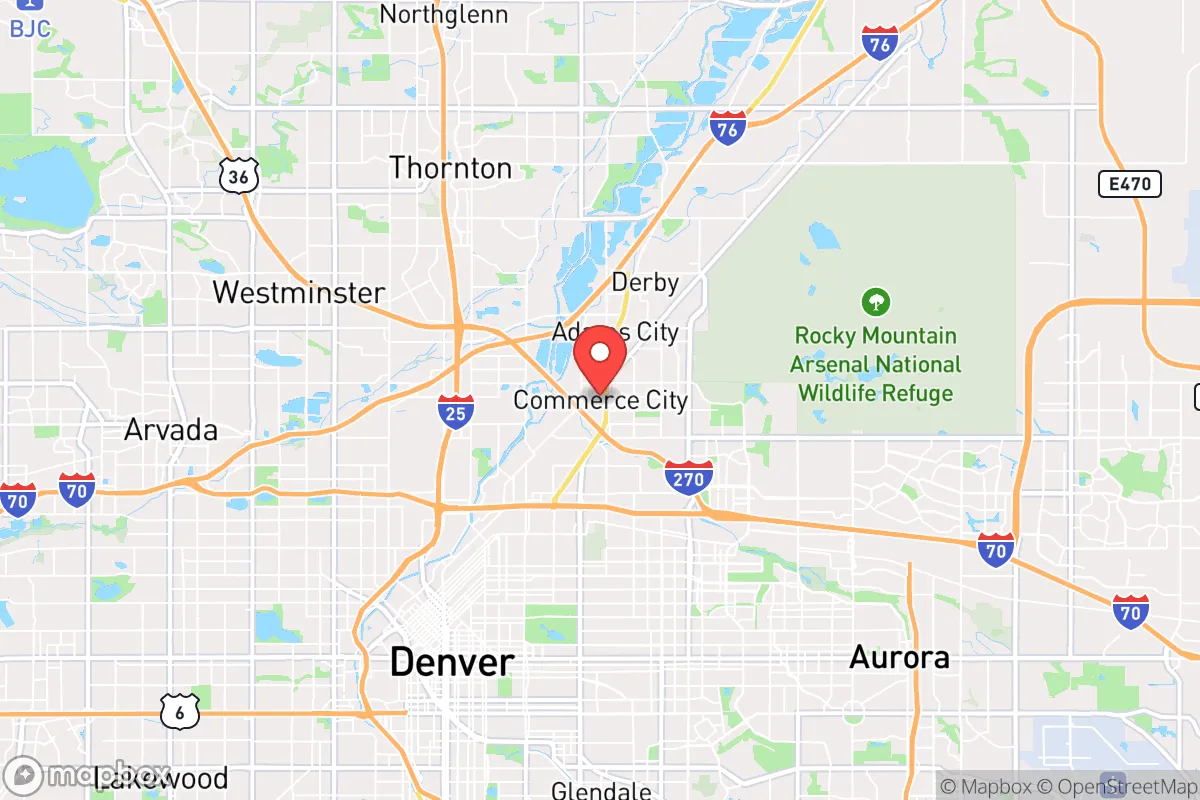
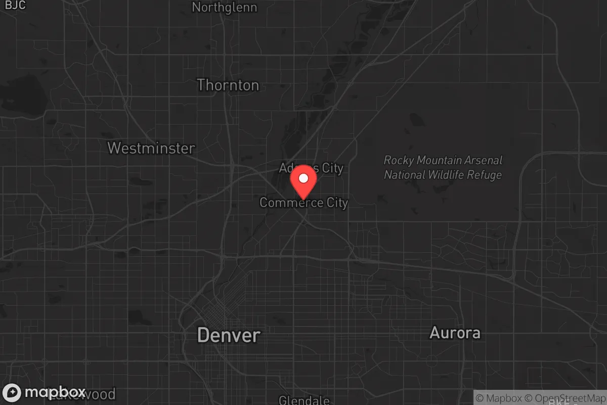
Commerce City, Colorado, sits in a precarious but potentially strategic pocket along the northern edge of the Denver metro area. Its location offers a mix of industrial resilience and suburban buffer, but for a prepper or conservative relocator, the calculus is heavily weighted by proximity to major population centers and critical infrastructure. The city’s position near the intersection of I-70 and I-76, combined with its access to the South Platte River and the Rocky Mountain Arsenal National Wildlife Refuge, creates a unique set of advantages and liabilities that demand careful consideration before any relocation decision.
Geographic position and natural buffer zones around the Denver metro
Commerce City’s geography is defined by its place on the high plains, just east of the Front Range urban corridor. The city is roughly 8 miles northeast of downtown Denver, which places it within the blast radius of any major event targeting the capital, but also gives it a critical buffer of open land and industrial zones that many closer suburbs lack. The Rocky Mountain Arsenal National Wildlife Refuge, a 15,000-acre former chemical weapons manufacturing site turned protected area, sits directly to the north and east. This massive tract of undeveloped land acts as a natural barrier against urban sprawl and provides a potential retreat zone for those with local knowledge. The South Platte River runs through the western edge of the city, offering a water source that is both a strategic asset and a flood risk. The area’s elevation, around 5,100 feet, means winters are cold but manageable, and the dry climate reduces the risk of mold and rot in stored supplies. However, the flat terrain offers little natural defensibility—there are no hills, ridges, or forests to provide cover or vantage points. The city’s position also puts it directly under the flight paths for Denver International Airport, which is a major logistical hub but also a prime target for disruption.
Risks, exposures, and proximity to fallout-relevant landmarks
The most significant risk for Commerce City is its proximity to what preppers call "high-value targets." The Suncor Energy refinery, located right in the city limits, is one of the largest oil refineries in the Rocky Mountain region. In a scenario involving civil unrest, sabotage, or EMP attack, this facility becomes a massive liability—a potential source of toxic releases, fire, or secondary explosions. The refinery’s presence also means the area is a likely staging ground for federal response or military assets, which could draw unwanted attention. Just south, Denver International Airport is a major hub for both civilian and military cargo, making it a prime target for any coordinated attack. The city is also within 20 miles of Buckley Space Force Base in Aurora, a key node in the U.S. space surveillance network. In a conflict scenario, this base would be a high-priority target, and Commerce City sits squarely in the fallout zone. The Arsenal itself, while now a wildlife refuge, still contains buried contamination from Cold War-era chemical weapons production. A major earthquake or deliberate breach could release hazardous materials. The city’s industrial corridor along I-70 is lined with rail lines, fuel storage tanks, and chemical plants, creating a "toxic triangle" that could become uninhabitable in a crisis. For a relocator seeking to avoid these risks, Commerce City’s location is a double-edged sword—close enough to Denver to be affected by its collapse, but far enough to offer a slim margin of escape if you have a vehicle and a plan.
Practical resilience for a relocator: food, water, energy, and defensibility
For the individual or family looking to hunker down, Commerce City presents a mixed bag. Water access is decent—the South Platte River is a year-round source, but it requires heavy filtration due to agricultural runoff and industrial pollution upstream. The city’s municipal water comes from Denver Water, which relies on reservoirs in the mountains. A prolonged grid-down scenario would likely cut supply within days. Drilling a private well is possible in some areas, but the water table is deep and permits are restrictive. Food resilience is weak. The area is not agricultural—most of the land is industrial, residential, or prairie. The nearest significant farming is in Weld County to the north, about 30 miles away. For a prepper, this means you’d need to stockpile at least 6-12 months of supplies or have a vehicle capable of making supply runs. Energy is a bright spot. Colorado has a deregulated energy market, and solar is viable with over 300 days of sun per year. However, the city’s zoning can be restrictive for off-grid setups, and HOAs in newer subdivisions often ban visible panels. Natural gas is the primary heating fuel, which is reliable but vulnerable to pipeline disruptions. Defensibility is the biggest concern. The flat, open terrain means your home is visible from a distance. The city’s layout is a mix of older neighborhoods with chain-link fences and newer subdivisions with vinyl siding—neither offers much ballistic protection. The best bet for a relocator is to find a property on the northern or eastern edge, near the Arsenal or the prairie, where you have a clear line of sight and fewer neighbors. The local gun culture is strong—Colorado is a shall-issue state for concealed carry, and there are several gun ranges within 20 minutes—but the state’s red flag law and magazine capacity restrictions are a concern for those who value maximum preparedness.
The overall strategic picture for Commerce City is one of calculated risk. It is not a bug-out location or a remote retreat. It is a working-class suburb with industrial muscle and a front-row seat to Denver’s vulnerabilities. For a relocator who values proximity to jobs and infrastructure but is willing to invest in hardening a home, stockpiling supplies, and maintaining a low profile, it can work. The key is to avoid the high-risk zones near the refinery and the interstate, and to build relationships with like-minded neighbors in the less dense areas. The city’s population is around 60,000, which is small enough to maintain a sense of community but large enough to attract trouble. If you’re looking for a place to ride out the coming storms with a foot in the urban economy and a path to the plains, Commerce City deserves a hard look—but only if you go in with eyes wide open and a fully stocked pantry.
* Values derived from national, state, county, city and local statistics and may differ in a specific area. Last updated: 2026-04-19T09:27:46.000Z
Narrative content on this page is AI-generated and may contain mistakes. Verify any details that matter before acting on them.
ReloMaps may earn a commission from affiliate links at no extra cost to you.