
Photo: Wikipedia
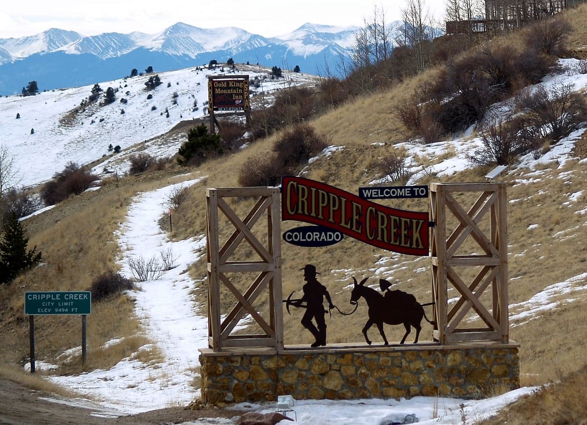
Strategic Assessment of Cripple Creek, CO
Meaningful friction. Expect exposure to either population pressure, blast zones, or natural disaster risk. Consider buying a retreat property.
What does the Strategic Assessment tell us?
Our Strategic Assessment grades tactical survivability of an area. Major population centers, military targets, fallout zones, natural disasters, and border exposure all drive risk — lower exposure means a more defensible position in a crisis.
This is heavily inspired by Joel Skousen's Strategic Relocation book. Highly recommended you checkout the book ($)What does this tell us?
Our Strategic Assessment grades tactical survivability of an area. Major population centers, military targets, fallout zones, natural disasters, and border exposure all drive risk — lower exposure means a more defensible position in a crisis.
This is heavily inspired by Joel Skousen's Strategic Relocation book. Highly recommended you checkout the book ($)Strategic Pillars

Key Distances
Regional Safe Places
Below is our recommended "safe zones" in Colorado and the surrounding area based on our strategic heuristics. For most people, it's unrealistic to live in a “safe zone” full-time due to work, family or other personal reasons. They tend to be more rural. However, many of these areas are perfect for second homes and retreat properties that double as a vacation home or even a short-term rental.


Important Note: For informational purposes only. This does not mean nothing bad ever happens in the green zones. Please use common sense. This is based on public data and modeled with AI. We tried to take a conservative approach but mistakes happen. We update this regularly as new information becomes available.
Solar Generator Recommendations
Backup power matters more here than in safer locations. We've picked three solar generators across budgets and capacity tiers — start with the budget unit if you only need a few essentials, or step up if you want to run a fridge and HVAC for days at a time.

Jackery Portable Power Station Explorer 300
Budget OptionPower on the Go: Weighing only 11 lbs, it's convenient to set up and store with book-sized foldable solar panels

BLUETTI Portable Power Station AC180
Designed for both indoor and outdoor scenarios, AC180 is highly capable as it has a robost capacity and continuous output power.

EF ECOFLOW DELTA Pro Ultra Power Station
Upgraded PickEcoFlow DELTA Pro Ultra is a whole-home energy system designed to grow with your family. Integrated with the Smart Home Panel 2, it scales to meet your evolving energy needs — keeping your home powered, intelligent, and secure through every stage of life.
We earn a commission, at no additional cost to you.
Strategic Assessment Analysis
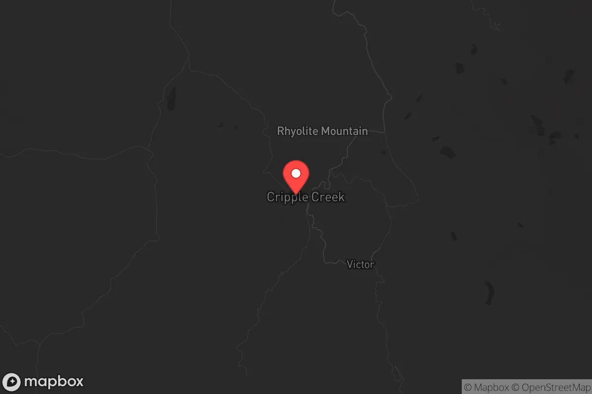
Cripple Creek, Colorado, sits at roughly 9,500 feet in the Teller County high country, offering a strategic combination of natural isolation, historical resilience, and limited exposure to major population centers that makes it a serious candidate for those prioritizing long-term preparedness. The town’s location—roughly 45 miles southwest of Colorado Springs and 90 miles from Denver—places it far enough from the Front Range urban corridor to avoid the immediate fallout of a major disaster, yet close enough to access supplies and medical care in a stable scenario. Its mining-era infrastructure, including a robust water system from the nearby Cripple Creek watershed and a history of self-sufficiency during the 1890s gold rush, provides a foundation that modern relocators can build upon. For a conservative-leaning audience concerned with civic unrest, mass casualty events, or systemic collapse, this area offers a defensible, resource-rich redoubt that has already proven its ability to endure boom-and-bust cycles without outside support.
Geographic position and natural advantages for long-term survival
Cripple Creek’s primary strategic asset is its elevation and terrain. Situated in the southern Mosquito Range, the town is surrounded by national forest—primarily the Pike and San Isabel National Forests—which creates a natural buffer zone against encroachment. The area’s steep, rocky slopes and limited road access (primarily via Highway 67 from the north or Highway 122 from the south) make it inherently defensible; a small group could monitor or block the few entry points with relative ease. The climate is harsh—winter temperatures often drop below zero, and snowpack can exceed 100 inches annually—but this also discourages casual visitors and provides a natural water reservoir in the form of snowmelt that feeds Cripple Creek and nearby reservoirs like the Victor Reservoir. The region’s gold mining history means the soil is rich in minerals, and while large-scale agriculture is impractical at this altitude, small-scale greenhouse operations and livestock (goats, chickens) are viable with proper shelter. The town’s elevation also places it above the inversion layer that traps pollution in Colorado Springs and Denver, ensuring clean air and clear skies even during regional emergencies.
Risks, exposures, and proximity to fallout-relevant landmarks
The most significant risk for Cripple Creek is its proximity to the Front Range’s critical infrastructure. Colorado Springs is home to Peterson Space Force Base, Schriever Space Force Base, and the U.S. Air Force Academy—all high-value targets in a conflict scenario. Denver’s Federal Center, Buckley Space Force Base, and the Denver International Airport (a major logistics hub) are within 90 miles. In a nuclear exchange or large-scale terrorist attack, these sites could be primary targets, and Cripple Creek sits within the potential fallout plume zone depending on wind patterns. However, the prevailing winds in the region are westerly, meaning fallout from a strike on Colorado Springs or Denver would likely be carried eastward, away from the town. The Cripple Creek area itself has no major military or industrial targets, though the town’s casinos and tourism infrastructure could attract secondary attention during civil unrest. Wildfire risk is moderate—the 2012 Waldo Canyon Fire and 2013 Black Forest Fire both occurred east of the Continental Divide, but Cripple Creek’s high elevation and sparse tree cover in the immediate town limits reduce the likelihood of a catastrophic fire. Earthquake risk is negligible, and the area is not prone to tornadoes or hurricanes. The primary natural threat is severe winter storms that can cut off road access for days, which is a manageable risk for a prepared household with stored supplies.
Practical resilience for a relocator: food, water, energy, and defensibility
For a single individual or family looking to establish a resilient homestead, Cripple Creek offers several practical advantages. Water is the strongest asset: the town’s municipal supply comes from the Cripple Creek watershed, which is fed by snowmelt and springs, and many properties have access to private wells or seasonal streams. A backup gravity-fed system from a rooftop catchment or a hand pump on a well is feasible. Food production is limited by the short growing season (roughly 60-90 frost-free days), but high-tunnel greenhouses and cold frames can extend it significantly; root vegetables, leafy greens, and hardy grains like amaranth can be grown. The surrounding national forest provides game—elk, mule deer, and wild turkey—though hunting pressure is moderate and requires a license. Energy independence is achievable: solar panels perform well at this altitude due to clear skies and high UV exposure, though snow accumulation requires regular clearing. Wind is consistent but not extreme, making small-scale wind turbines a viable supplement. Wood heating is the norm, with ample deadfall and firewood available on public lands (with a permit). Defensibility is excellent: the town’s layout on a series of ridges and valleys means most homes have clear sightlines over approach routes. The local population is small (roughly 1,200 year-round residents) and politically conservative, with a strong culture of self-reliance and firearm ownership. The Teller County Sheriff’s Office has a reputation for being responsive, but response times in remote areas can exceed 30 minutes, reinforcing the need for personal security measures. Medical facilities are limited—the closest hospital is in Woodland Park (30 minutes) or Colorado Springs (45 minutes)—so a trauma kit and basic medical training are essential.
In the broader strategic picture, Cripple Creek represents a viable fallback position for those who can tolerate isolation, altitude, and cold. It is not a self-sufficient paradise—no location is—but it offers a combination of natural barriers, resource availability, and a like-minded community that is rare in the lower 48. The town’s dependence on tourism and casino revenue makes it vulnerable to economic shocks, but a prepared relocator can mitigate this by building a home-based food and energy system. For a conservative individual or family looking to step away from the vulnerabilities of urban life—whether from civil unrest, economic collapse, or geopolitical instability—Cripple Creek provides a defensible, water-secure, and politically aligned base of operations. The key is to arrive with supplies, skills, and a plan for the first winter, because the learning curve at 9,500 feet is steep. But for those willing to put in the work, this high-country outpost offers a level of strategic depth that few other Colorado towns can match.
* Values derived from national, state, county, city and local statistics and may differ in a specific area. Last updated: 2026-04-29T01:05:29.000Z
Narrative content on this page is AI-generated and may contain mistakes. Verify any details that matter before acting on them.
ReloMaps may earn a commission from affiliate links at no extra cost to you.