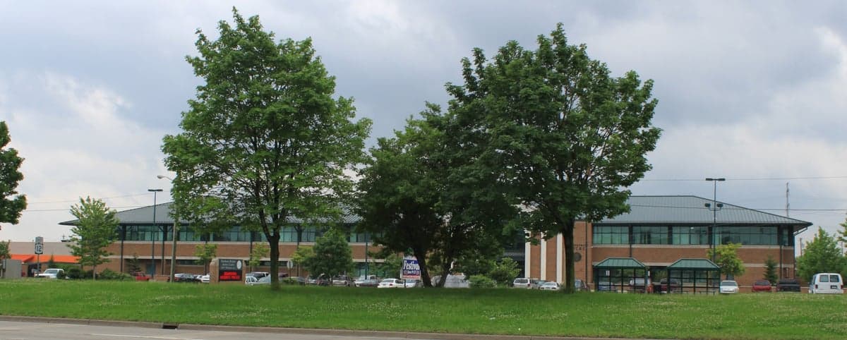
Photo: Wikipedia
Strategic Assessment of Dearborn Heights, MI
Multiple tactical vulnerabilities. Population density, target proximity, or disaster risk are likely compounding. A retreat property and exit planning is required.
What does the Strategic Assessment tell us?
Our Strategic Assessment grades tactical survivability of an area. Major population centers, military targets, fallout zones, natural disasters, and border exposure all drive risk — lower exposure means a more defensible position in a crisis.
This is heavily inspired by Joel Skousen's Strategic Relocation book. Highly recommended you checkout the book ($)What does this tell us?
Our Strategic Assessment grades tactical survivability of an area. Major population centers, military targets, fallout zones, natural disasters, and border exposure all drive risk — lower exposure means a more defensible position in a crisis.
This is heavily inspired by Joel Skousen's Strategic Relocation book. Highly recommended you checkout the book ($)Strategic Pillars

Key Distances
Regional Safe Places
Below is our recommended "safe zones" in Michigan and the surrounding area based on our strategic heuristics. For most people, it's unrealistic to live in a “safe zone” full-time due to work, family or other personal reasons. They tend to be more rural. However, many of these areas are perfect for second homes and retreat properties that double as a vacation home or even a short-term rental.


Important Note: For informational purposes only. This does not mean nothing bad ever happens in the green zones. Please use common sense. This is based on public data and modeled with AI. We tried to take a conservative approach but mistakes happen. We update this regularly as new information becomes available.
Solar Generator Recommendations
Backup power matters more here than in safer locations. We've picked three solar generators across budgets and capacity tiers — start with the budget unit if you only need a few essentials, or step up if you want to run a fridge and HVAC for days at a time.

Jackery Portable Power Station Explorer 300
Budget OptionPower on the Go: Weighing only 11 lbs, it's convenient to set up and store with book-sized foldable solar panels

BLUETTI Portable Power Station AC180
Designed for both indoor and outdoor scenarios, AC180 is highly capable as it has a robost capacity and continuous output power.

EF ECOFLOW DELTA Pro Ultra Power Station
Upgraded PickEcoFlow DELTA Pro Ultra is a whole-home energy system designed to grow with your family. Integrated with the Smart Home Panel 2, it scales to meet your evolving energy needs — keeping your home powered, intelligent, and secure through every stage of life.
We earn a commission, at no additional cost to you.
Strategic Assessment Analysis
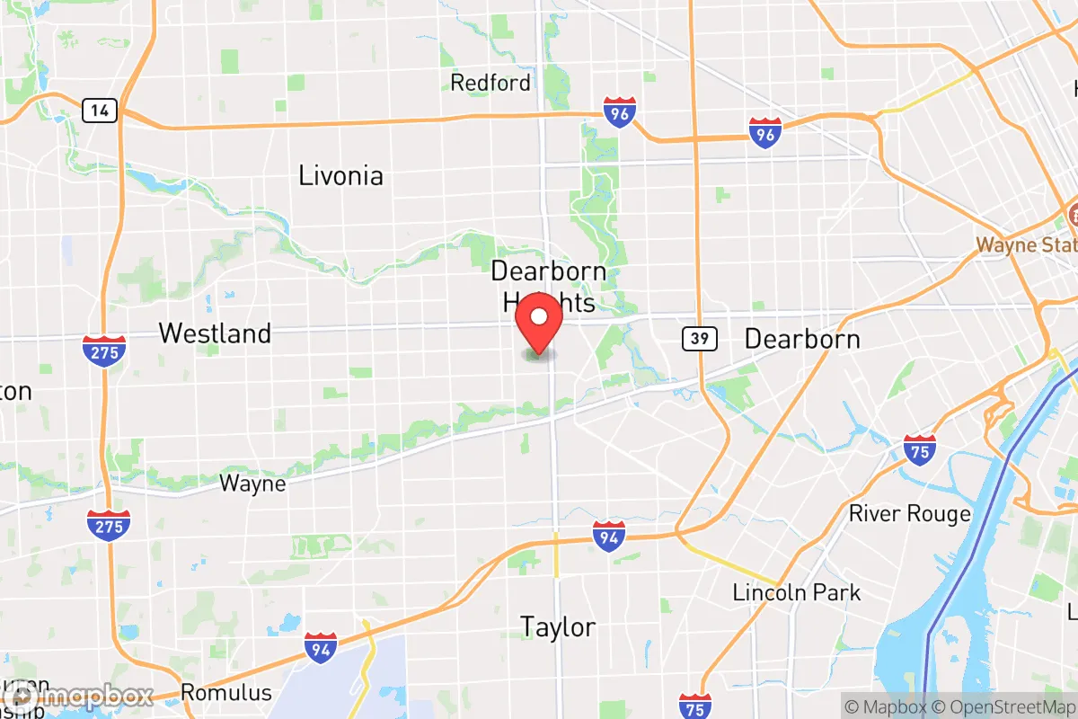
Dearborn Heights, Michigan, sits in a precarious strategic position that demands a clear-eyed assessment. Its location within the Detroit metropolitan area offers immediate access to resources and infrastructure, but that same proximity to a major urban center introduces significant vulnerabilities for anyone planning for long-term resilience. For the conservative prepper or survivalist, this suburb presents a mixed picture: it has some practical advantages in terms of housing stock and local governance, but its geographic and demographic realities create exposures that are hard to ignore.
Geographic position and natural advantages for a survivalist
Dearborn Heights is located roughly 10 miles west of downtown Detroit, placing it squarely in the suburban ring of a major Rust Belt city. The area sits on relatively flat terrain, part of the former lakebed of glacial Lake Warren, which means the soil is heavy clay and prone to poor drainage—not ideal for large-scale agriculture without significant amendment. However, the region benefits from the proximity of the Rouge River, which runs along the city's eastern edge, providing a potential surface water source for filtration and emergency use. The city itself is about 12 square miles, densely populated with roughly 57,000 residents as of 2023, which limits the availability of private land for off-grid projects. For a relocator, the key natural advantage is access to the Great Lakes water system: Lake Erie and Lake St. Clair are within a 30-minute drive, offering a massive, renewable freshwater supply that few other regions in the country can match. The climate is temperate, with cold winters and warm summers, which means you'll need robust heating and cold-weather gear, but the growing season (roughly 150 days) is long enough for a serious garden if you can manage the clay soil.
Risks, exposures, and proximity to fallout-relevant landmarks
The single biggest strategic liability of Dearborn Heights is its location in the shadow of Detroit. The city is within the blast radius of several high-value targets: the Ambassador Bridge and Detroit-Windsor Tunnel (critical border crossings), the Ford River Rouge Complex in Dearborn (one of the largest industrial plants in the world), and the Detroit Metropolitan Airport (DTW) about 12 miles south. In a major conflict or terrorist event, these are prime targets for conventional or even nuclear strikes. The prevailing winds in southeast Michigan blow from the west and southwest, meaning fallout from a strike on Detroit or the industrial corridor would likely drift directly over Dearborn Heights. Additionally, the city is crisscrossed by major highways (I-94, I-75, M-39) and rail lines that serve as logistical chokepoints—any disruption to these arteries would choke off supply lines quickly. The population density (roughly 4,700 people per square mile) means that in a grid-down scenario, you'd be competing with tens of thousands of neighbors for limited resources. There's also the risk of civil unrest spilling over from Detroit, which has a history of riots and protests; Dearborn Heights sits right on the border with Dearborn, home to the largest Arab-American population in the U.S., which could become a flashpoint in a national crisis. The city's proximity to the Fermi 2 nuclear power plant (about 25 miles south) adds another layer of risk—though the plant is designed to withstand severe events, a major accident would put the area in the plume zone.
Practical resilience for a relocator: food, water, energy, and defensibility
For someone looking to set up a resilient household in Dearborn Heights, the practical challenges are significant but not insurmountable. Water is the biggest win: the city's municipal supply comes from the Detroit Water and Sewerage Department, which draws from the Detroit River and Lake Huron. In a prolonged outage, you'd need to store at least two weeks' worth (roughly 14 gallons per person) or have a means to treat surface water from the Rouge River, which is heavily polluted with industrial runoff and requires multi-stage filtration (sediment, carbon, and UV or chemical treatment). Food is a tougher nut: the city has no significant agricultural land, and the nearest farm markets are in rural areas like Monroe County (30 miles south) or Washtenaw County (20 miles west). You'd need to rely on a robust pantry, with at least a three-month supply of shelf-stable goods, plus a plan for barter or trade. Community gardens exist but are small and likely to be contested in a crisis. Energy is a mixed bag: DTE Energy provides electricity, and the grid is aging but generally reliable. For off-grid capability, solar panels are viable (Michigan gets about 4.5 peak sun hours per day in summer, dropping to 1.5 in winter), but you'll need battery storage and a backup generator for the cloudy months. Natural gas is available for heating, which is a plus, but the pipeline infrastructure is vulnerable to disruption. Defensibility is the weakest point: the typical Dearborn Heights home is a post-war ranch or colonial on a quarter-acre lot, with neighbors close on both sides. There's no rural buffer, no natural chokepoints, and the street grid offers multiple approach vectors. You'd need to harden your home with reinforced doors, window film, and a layered security plan (fencing, lighting, and a neighborhood watch network). The city's police force is modest (about 80 officers), and response times would stretch in a widespread event. For a single individual or family, the best strategy is to treat Dearborn Heights as a temporary base while scouting a more defensible rural property within a two-hour drive—areas like the Irish Hills (Lenawee County) or the Thumb region (Sanilac County) offer lower density and better natural barriers.
The overall strategic picture for Dearborn Heights is one of calculated risk. It's not a place to hunker down for the long haul, but it could serve as a staging ground if you have the resources to fortify and the discipline to maintain a low profile. The proximity to Detroit's industrial base means you can stockpile supplies and trade goods before the balloon goes up, but the same proximity means you'll be in the crosshairs when it does. For the conservative relocator who values community ties and existing infrastructure, Dearborn Heights offers a foothold—just don't mistake it for a redoubt. The smart play is to use it as a launchpad for a more remote setup, ideally within a year or two of moving in. If you're willing to put in the work on water storage, food reserves, and home defense, you can ride out the first wave of a crisis here. But the long-term survival calculus favors moving farther out, where the fallout maps are cleaner and the neighbors are fewer.
* Values derived from national, state, county, city and local statistics and may differ in a specific area. Last updated: 2026-04-29T20:59:35.000Z
Narrative content on this page is AI-generated and may contain mistakes. Verify any details that matter before acting on them.
ReloMaps may earn a commission from affiliate links at no extra cost to you.