Photo: Wikipedia
Strategic Assessment of Des Moines, WA
High tactical risk. This location is likely close to major population centers, strategic targets, or sits in a high-disaster corridor. A retreat property and careful exit planning is required.
What does the Strategic Assessment tell us?
Our Strategic Assessment grades tactical survivability of an area. Major population centers, military targets, fallout zones, natural disasters, and border exposure all drive risk — lower exposure means a more defensible position in a crisis.
This is heavily inspired by Joel Skousen's Strategic Relocation book. Highly recommended you checkout the book ($)What does this tell us?
Our Strategic Assessment grades tactical survivability of an area. Major population centers, military targets, fallout zones, natural disasters, and border exposure all drive risk — lower exposure means a more defensible position in a crisis.
This is heavily inspired by Joel Skousen's Strategic Relocation book. Highly recommended you checkout the book ($)Strategic Pillars

Key Distances
Regional Safe Places
Below is our recommended "safe zones" in Washington and the surrounding area based on our strategic heuristics. For most people, it's unrealistic to live in a “safe zone” full-time due to work, family or other personal reasons. They tend to be more rural. However, many of these areas are perfect for second homes and retreat properties that double as a vacation home or even a short-term rental.


Important Note: For informational purposes only. This does not mean nothing bad ever happens in the green zones. Please use common sense. This is based on public data and modeled with AI. We tried to take a conservative approach but mistakes happen. We update this regularly as new information becomes available.
Solar Generator Recommendations
Backup power matters more here than in safer locations. We've picked three solar generators across budgets and capacity tiers — start with the budget unit if you only need a few essentials, or step up if you want to run a fridge and HVAC for days at a time.

Jackery Portable Power Station Explorer 300
Budget OptionPower on the Go: Weighing only 11 lbs, it's convenient to set up and store with book-sized foldable solar panels

BLUETTI Portable Power Station AC180
Designed for both indoor and outdoor scenarios, AC180 is highly capable as it has a robost capacity and continuous output power.

EF ECOFLOW DELTA Pro Ultra Power Station
Upgraded PickEcoFlow DELTA Pro Ultra is a whole-home energy system designed to grow with your family. Integrated with the Smart Home Panel 2, it scales to meet your evolving energy needs — keeping your home powered, intelligent, and secure through every stage of life.
We earn a commission, at no additional cost to you.
Strategic Assessment Analysis
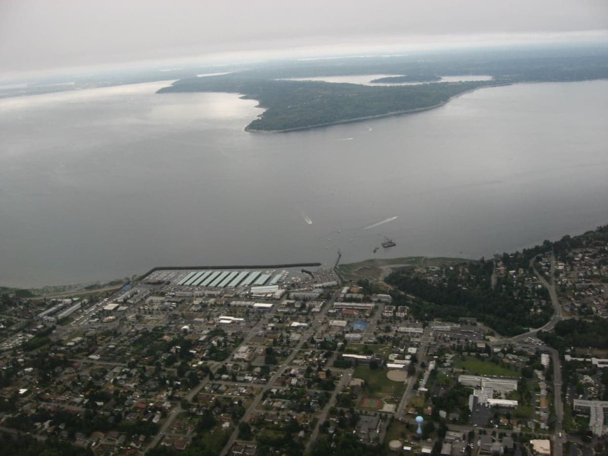
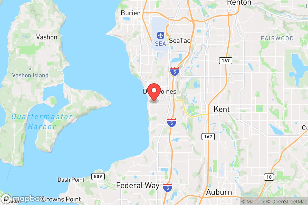
Des Moines, Washington, sits in a precarious but potentially strategic pocket of the Pacific Northwest, offering a mix of coastal access and suburban buffer that a prepper or survival-minded relocator should weigh carefully. Its location on the eastern shore of Puget Sound, roughly 20 miles south of Seattle and 10 miles north of Tacoma, places it within the I-5 corridor’s shadow—a double-edged sword for anyone prioritizing resilience. The city’s 2024 population hovers around 32,000, with a density that’s suburban enough to avoid the worst of urban chaos but close enough to major population centers to feel the ripple effects of any regional collapse. For a conservative-leaning individual or family looking to balance proximity to resources with the need for defensible space, Des Moines offers a nuanced starting point, but it demands a clear-eyed assessment of its vulnerabilities and strengths.
Geographic position and natural advantages for long-term survival
Des Moines benefits from a temperate marine climate that supports year-round food cultivation, with average temperatures ranging from 35°F in January to 75°F in July, and rainfall averaging 37 inches annually—enough to sustain rain gardens and small-scale agriculture without the drought risks of the interior West. The city’s 3.5 miles of Puget Sound shoreline provide direct access to marine protein sources like salmon, Dungeness crab, and shellfish, though harvesting requires knowledge of local tides and red tide seasons. The Des Moines Creek Trail and nearby Saltwater State Park offer 88 acres of forested green space for foraging, firewood collection, and low-visibility movement. Elevation is modest—most of the city sits between 10 and 200 feet above sea level—but the surrounding hills to the east, like those in Federal Way and Kent, create natural chokepoints that could slow an advancing threat from the I-5 corridor. The presence of the Des Moines Marina, a deep-water facility, also offers a potential waterborne escape route to the Kitsap Peninsula or Olympic Peninsula, areas with lower population density and more rugged terrain. However, the city’s flat coastal plain means it’s exposed to tsunami risk from a Cascadia Subduction Zone quake, with inundation models showing waves reaching up to 15 feet in low-lying areas within 20 minutes of a magnitude 9.0 event—a sobering reality that makes elevation-aware property selection critical.
Risks, exposures, and proximity to fallout-relevant landmarks
The most glaring vulnerability for Des Moines is its position within the blast and fallout radius of multiple high-value targets. Joint Base Lewis-McChord (JBLM), a major Army and Air Force installation, lies just 12 miles south, making it a prime target for any state-actor strike or EMP event. The Port of Seattle and Sea-Tac International Airport, both 15 miles north, are similarly high-risk. In a nuclear exchange scenario, prevailing westerly winds would carry fallout from a JBLM strike directly over Des Moines, with lethal radiation levels potentially reaching the city within 30 minutes. The I-5 corridor, running 5 miles east, would become a chokepoint for fleeing populations, turning the city into a potential refugee funnel. On the natural disaster front, the Seattle Fault zone runs 20 miles north, capable of generating a magnitude 7.0 quake that could liquefy the sandy soils beneath much of Des Moines’ waterfront. The city’s reliance on the Cedar River and Green River watersheds for drinking water—both fed by Cascade snowpack—means a major earthquake could disrupt supply for weeks, as seen in the 2001 Nisqually quake’s minor damage to regional infrastructure. For a prepper, these factors argue against Des Moines as a primary bug-out location, but it could serve as a temporary staging point if you’re already embedded in the region and have a plan to move inland or to the Olympic Peninsula within 48 hours of a major event.
Practical resilience for a relocator: food, water, energy, and defensibility
For a family or individual looking to hunker down in Des Moines, the practicalities of self-sufficiency require significant upfront investment. The city’s water supply comes from the regional water utility, which draws from the Green River—a surface source vulnerable to contamination from upstream industrial sites like the former Superfund cleanup at the Tacoma Tar Pits. A prepper should budget for a Berkey or similar gravity-fed filter rated for heavy metals and pathogens, plus a 55-gallon rain barrel system for non-potable use. The average residential lot in Des Moines is 6,000 to 8,000 square feet, enough for a 20x20-foot garden that could yield 200-300 pounds of vegetables annually with intensive planting—think potatoes, kale, and squash for calorie density. Backyard chickens are legal within city limits, with a limit of six hens and no roosters, providing a steady egg supply. Energy resilience is weaker: Puget Sound Energy’s grid is prone to outages during winter storms, with an average of 1.2 events per year lasting 4-6 hours. Solar panels are viable given the 150 sunny days annually, but a 5kW system with battery storage (like a Tesla Powerwall) would cost $15,000-$20,000 and still require a backup generator for extended cloud cover. Defensibility is the biggest concern: Des Moines is a grid of suburban streets with few natural barriers, and the city’s police force of 35 officers means response times could stretch to 20 minutes during a widespread event. A relocator should prioritize a home on a cul-de-sac with a fenced perimeter, ideally on the eastern hillside above 100 feet elevation, where sightlines improve and flood risk drops. The nearby Highline College campus, with its emergency generator and food storage, could become a contested resource, so plan to avoid it.
The overall strategic picture for Des Moines is one of calculated risk—it’s not a fortress, but it’s not a death trap either. For a conservative-minded prepper, the city’s best use is as a coastal outpost for a larger network of retreats, perhaps linked to property on the Olympic Peninsula or in the Cascade foothills. The proximity to Seattle and Tacoma means you’ll face the first wave of any urban exodus, but the marina and creek trails offer low-visibility egress routes that a car-dependent population won’t use. If you’re single and mobile, Des Moines could work as a 2-3 year staging point to build skills and supplies before moving to a more defensible rural property. For families, the trade-offs are steeper: the schools are average (Des Moines Elementary scores 6/10 on GreatSchools), and the lack of a strong community prepper network means you’ll be largely on your own. In a worst-case scenario—a Cascadia quake followed by civil unrest—your best bet is to have a pre-staged bug-out vehicle at the marina and a destination locked in on the Kitsap Peninsula, where the population density drops to 150 per square mile versus Des Moines’ 3,200. Treat this city as a hub, not a home, and you’ll extract its value without being trapped by its flaws.
* Values derived from national, state, county, city and local statistics and may differ in a specific area. Last updated: 2026-04-21T11:06:47.000Z
Narrative content on this page is AI-generated and may contain mistakes. Verify any details that matter before acting on them.
ReloMaps may earn a commission from affiliate links at no extra cost to you.