

Photo: Wikipedia
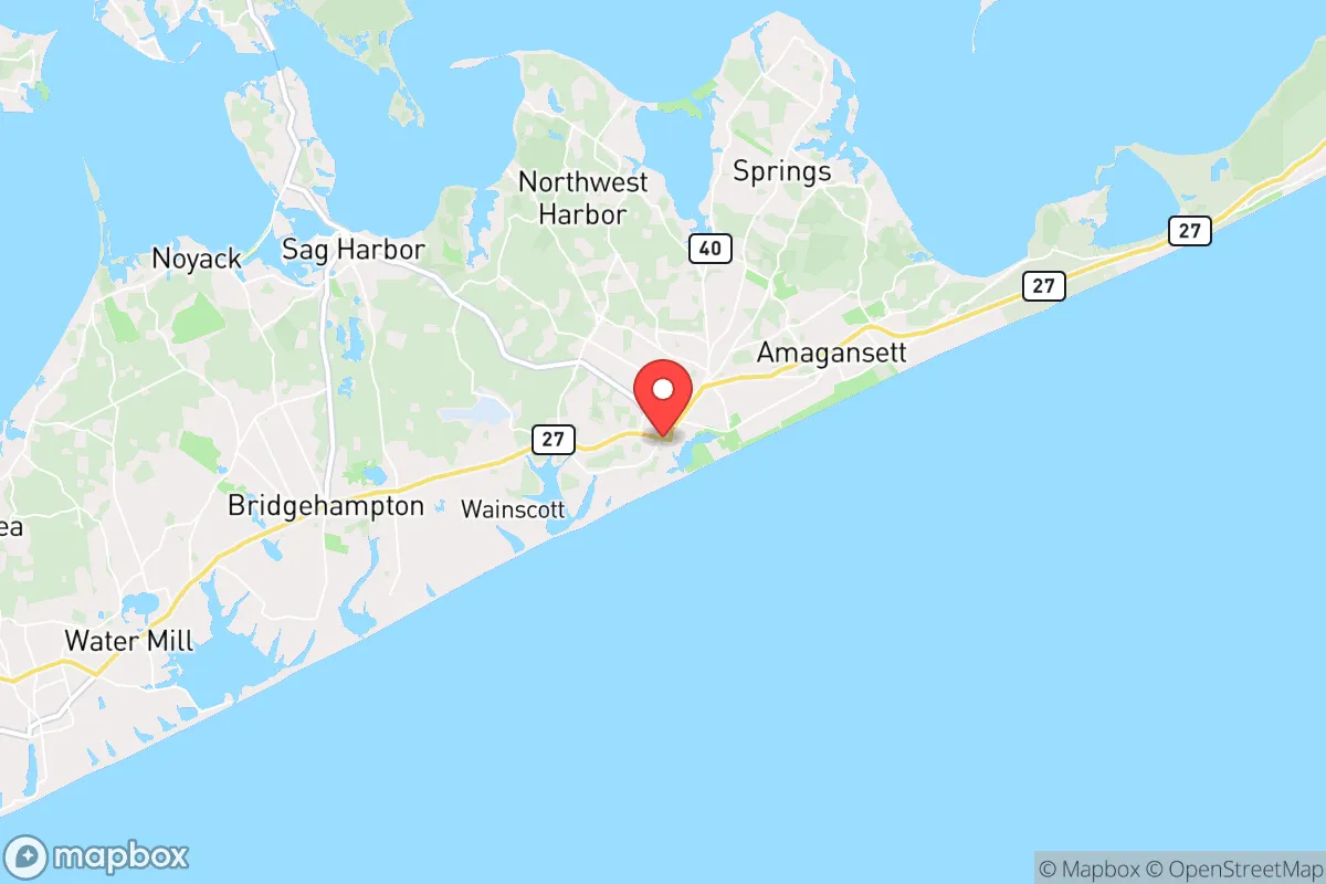
Strategic Assessment of East Hampton, NY
Multiple tactical vulnerabilities. Population density, target proximity, or disaster risk are likely compounding. A retreat property and exit planning is required.
What does the Strategic Assessment tell us?
Our Strategic Assessment grades tactical survivability of an area. Major population centers, military targets, fallout zones, natural disasters, and border exposure all drive risk — lower exposure means a more defensible position in a crisis.
This is heavily inspired by Joel Skousen's Strategic Relocation book. Highly recommended you checkout the book ($)What does this tell us?
Our Strategic Assessment grades tactical survivability of an area. Major population centers, military targets, fallout zones, natural disasters, and border exposure all drive risk — lower exposure means a more defensible position in a crisis.
This is heavily inspired by Joel Skousen's Strategic Relocation book. Highly recommended you checkout the book ($)Strategic Pillars

Key Distances
Regional Safe Places
Below is our recommended "safe zones" in New York and the surrounding area based on our strategic heuristics. For most people, it's unrealistic to live in a “safe zone” full-time due to work, family or other personal reasons. They tend to be more rural. However, many of these areas are perfect for second homes and retreat properties that double as a vacation home or even a short-term rental.


Important Note: For informational purposes only. This does not mean nothing bad ever happens in the green zones. Please use common sense. This is based on public data and modeled with AI. We tried to take a conservative approach but mistakes happen. We update this regularly as new information becomes available.
Solar Generator Recommendations
Backup power matters more here than in safer locations. We've picked three solar generators across budgets and capacity tiers — start with the budget unit if you only need a few essentials, or step up if you want to run a fridge and HVAC for days at a time.

Jackery Portable Power Station Explorer 300
Budget OptionPower on the Go: Weighing only 11 lbs, it's convenient to set up and store with book-sized foldable solar panels

BLUETTI Portable Power Station AC180
Designed for both indoor and outdoor scenarios, AC180 is highly capable as it has a robost capacity and continuous output power.

EF ECOFLOW DELTA Pro Ultra Power Station
Upgraded PickEcoFlow DELTA Pro Ultra is a whole-home energy system designed to grow with your family. Integrated with the Smart Home Panel 2, it scales to meet your evolving energy needs — keeping your home powered, intelligent, and secure through every stage of life.
We earn a commission, at no additional cost to you.
Strategic Assessment Analysis
East Hampton, New York, presents a complex strategic picture for the conservative prepper or survivalist. Its primary resilience advantage is its geographic isolation on the South Fork of Long Island, a peninsula off a peninsula, which inherently limits both access and egress. However, this same isolation, combined with extreme wealth concentration and proximity to New York City, creates a unique set of vulnerabilities that demand careful consideration. For the relocator prioritizing long-term security, East Hampton is less a fortress and more a high-value, high-risk outpost.
Geographic position and natural advantages for long-term security
East Hampton’s location is its single strongest asset for a survival scenario. Situated roughly 100 miles east of Manhattan, it sits at the far eastern end of Long Island’s South Fork, bordered by the Atlantic Ocean to the south and Gardiners Bay to the north. This creates a natural chokepoint: the only road access is via the Sunrise Highway (NY-27) or Montauk Highway (NY-27A), both of which narrow to two lanes in places. In a mass evacuation event, these roads would become impassable within hours, but for those already in the area, that same bottleneck makes it extremely difficult for large, disorganized groups to enter. The surrounding waters—Gardiners Bay, Napeague Bay, and the Atlantic—provide a natural moat. A relocator with a seaworthy boat gains a significant tactical advantage for resupply or escape, as the maritime routes to Connecticut or Rhode Island are viable, if weather-dependent. The local topography is flat and wooded, with extensive pine barrens and scrub oak, offering decent cover and a moderate supply of firewood. The area’s groundwater is generally good, though the shallow aquifer is vulnerable to saltwater intrusion in a prolonged crisis. The climate is maritime, meaning winters are milder than upstate but summers are humid; the growing season is long enough for cool-weather crops, but the sandy, acidic soil requires serious amendment for any meaningful food production.
Risks, exposures, and proximity to fallout-relevant landmarks
The downsides are substantial and cannot be ignored. East Hampton’s proximity to New York City—the single largest target for any mass casualty event, whether nuclear, biological, or civil unrest—is its greatest liability. A ground burst over Manhattan would produce fallout that, depending on wind patterns, could easily drift east across Long Island. The prevailing westerlies mean the South Fork is directly downwind of the city. The Shoreham Nuclear Power Plant, though decommissioned, sits just 40 miles west and still contains spent fuel in dry casks—a potential radiological hazard in a disaster. Additionally, the area is home to several high-profile estates and seasonal residents with private security details, making it a potential target for looting or organized crime during a breakdown of civil order. The local police force is well-funded but small; the East Hampton Town Police Department has roughly 60 sworn officers. In a widespread crisis, they would be overwhelmed within hours. The population swells from roughly 20,000 year-round to over 100,000 in summer, meaning the summer stock of food and fuel is calibrated for a transient, wealthy crowd—not for a sustained emergency. When the tourists leave, the supply chain tightens dramatically. The nearest major hospital, Stony Brook Southampton Hospital, is 20 miles west and has limited trauma capacity. For a serious injury or illness in a grid-down scenario, medical evacuation by helicopter or boat would be the only realistic option.
Practical resilience for a relocator: food, water, energy, and defensibility
For the individual or family serious about self-sufficiency, East Hampton demands a high level of preparation. Water is the first concern. Municipal water comes from the Suffolk County Water Authority, which relies on electric pumps. Without power, wells are useless unless you have a manual pump or a generator with a deep-cycle battery bank. Rainwater collection is viable—the area gets about 45 inches of rain annually—but storage must be substantial. Food production is challenging. The sandy soil is poor for row crops; raised beds with imported soil and compost are necessary. Hunting is limited—white-tailed deer are abundant but hunting is restricted to specific seasons and private land access is tightly controlled. Fishing, however, is excellent. The local waters are rich with striped bass, bluefish, fluke, and shellfish. A family with a surf rod, a clam rake, and a crab net can reliably supplement their diet, even in a crisis. Energy independence is achievable but expensive. Solar is viable—the area gets good sun—but net metering agreements with PSEG Long Island are fragile in a grid-down scenario. A robust off-grid system with battery storage (e.g., Tesla Powerwall or similar) and a backup propane or diesel generator is the baseline. Propane is widely available but requires a contract and delivery; stockpiling 500+ gallons is wise. Defensibility is mixed. The dense, wooded lots in areas like Amagansett or Springs offer good concealment, but the open, flat terrain near the ocean leaves you exposed. The best properties are those with a single, controllable access point—a long driveway with good sightlines. Neighbors are often seasonal or absentee, which reduces the risk of unwanted attention but also means fewer mutual-aid opportunities. The local culture is not prepper-friendly; overt displays of preparedness (e.g., visible firearms, stockpiles, fortified structures) will draw unwanted scrutiny from both law enforcement and the wealthy, progressive local population. Discretion is paramount.
The overall strategic picture for East Hampton is one of high risk with a narrow but real path to viability. It is not a place to ride out a nationwide collapse—the supply lines are too fragile, the population density too seasonal, and the proximity to New York City too dangerous. However, for a relocator who is already established, has a fully off-grid setup, and is willing to accept the trade-offs, it can serve as a temporary refuge for the first 30 to 90 days of a crisis. After that, the lack of arable land, the difficulty of resupply, and the inevitable pressure from refugees fleeing the city make a secondary retreat plan—likely by boat to New England—a necessity. East Hampton is a beautiful, expensive, and strategically flawed location. It rewards the prepared but punishes the complacent. If you have the resources to build a true self-sufficient compound and the discipline to keep a low profile, it can work. If not, look further inland, where the soil is deeper, the neighbors are fewer, and the fallout is less likely to land on your doorstep.
* Values derived from national, state, county, city and local statistics and may differ in a specific area. Last updated: 2026-04-24T01:45:50.000Z
Narrative content on this page is AI-generated and may contain mistakes. Verify any details that matter before acting on them.
ReloMaps may earn a commission from affiliate links at no extra cost to you.