

Photo: Wikipedia
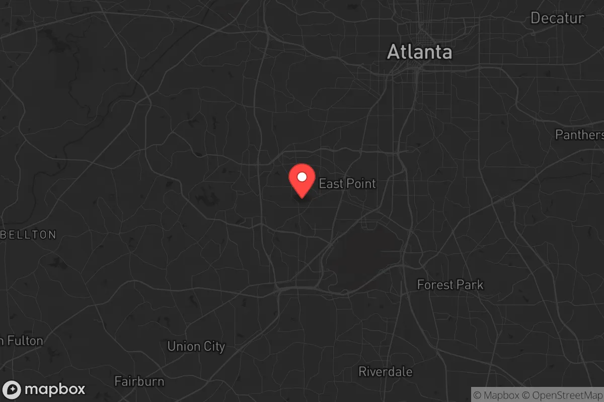
Strategic Assessment of East Point, GA
Multiple tactical vulnerabilities. Population density, target proximity, or disaster risk are likely compounding. A retreat property and exit planning is required.
What does the Strategic Assessment tell us?
Our Strategic Assessment grades tactical survivability of an area. Major population centers, military targets, fallout zones, natural disasters, and border exposure all drive risk — lower exposure means a more defensible position in a crisis.
This is heavily inspired by Joel Skousen's Strategic Relocation book. Highly recommended you checkout the book ($)What does this tell us?
Our Strategic Assessment grades tactical survivability of an area. Major population centers, military targets, fallout zones, natural disasters, and border exposure all drive risk — lower exposure means a more defensible position in a crisis.
This is heavily inspired by Joel Skousen's Strategic Relocation book. Highly recommended you checkout the book ($)Strategic Pillars

Key Distances
Regional Safe Places
Below is our recommended "safe zones" in Georgia and the surrounding area based on our strategic heuristics. For most people, it's unrealistic to live in a “safe zone” full-time due to work, family or other personal reasons. They tend to be more rural. However, many of these areas are perfect for second homes and retreat properties that double as a vacation home or even a short-term rental.


Important Note: For informational purposes only. This does not mean nothing bad ever happens in the green zones. Please use common sense. This is based on public data and modeled with AI. We tried to take a conservative approach but mistakes happen. We update this regularly as new information becomes available.
Solar Generator Recommendations
Backup power matters more here than in safer locations. We've picked three solar generators across budgets and capacity tiers — start with the budget unit if you only need a few essentials, or step up if you want to run a fridge and HVAC for days at a time.

Jackery Portable Power Station Explorer 300
Budget OptionPower on the Go: Weighing only 11 lbs, it's convenient to set up and store with book-sized foldable solar panels

BLUETTI Portable Power Station AC180
Designed for both indoor and outdoor scenarios, AC180 is highly capable as it has a robost capacity and continuous output power.

EF ECOFLOW DELTA Pro Ultra Power Station
Upgraded PickEcoFlow DELTA Pro Ultra is a whole-home energy system designed to grow with your family. Integrated with the Smart Home Panel 2, it scales to meet your evolving energy needs — keeping your home powered, intelligent, and secure through every stage of life.
We earn a commission, at no additional cost to you.
Strategic Assessment Analysis
East Point, Georgia, sits in a precarious strategic position that demands a clear-eyed assessment. While its location just south of Atlanta offers some logistical advantages, the city’s deep entanglement with a major metropolitan hub introduces severe vulnerabilities for anyone prioritizing long-term resilience. For the conservative prepper or survivalist, East Point is less a sanctuary and more a forward operating base—one that requires constant awareness of its proximity to high-value targets, dense populations, and the cascading failures that could follow a major disruption.
Geographic position and natural advantages for a survivalist
East Point occupies a spot roughly 10 miles southwest of downtown Atlanta, placing it within the sprawling Atlanta-Sandy Springs-Roswell metropolitan statistical area. The city itself covers about 15 square miles of relatively flat terrain, with an elevation around 1,000 feet that provides modest drainage advantages but no significant defensive high ground. The area’s natural assets include the nearby Chattahoochee River, which flows roughly 5 miles west of the city center and offers a potential water source—though access is complicated by suburban development and private property. The region’s temperate climate means winters are mild, rarely dropping below freezing for extended periods, which reduces the risk of hypothermia and simplifies off-grid heating. However, the same climate supports dense vegetation that could provide limited cover but also fuels wildfire risks during dry spells. The Piedmont soil is clay-heavy, making large-scale gardening a challenge without significant amendment, though raised beds and container gardening remain viable. For the relocator, the primary natural advantage is the moderate climate and proximity to the Chattahoochee, but the lack of rugged terrain or natural barriers means East Point offers little inherent defensibility against a determined threat.
Risks, exposures, and proximity to fallout-relevant landmarks
The most glaring risk for East Point is its location within the bullseye of a major American city. Atlanta is home to Hartsfield-Jackson Atlanta International Airport, the world’s busiest airport by passenger traffic, located just 4 miles east of East Point. In a scenario involving an EMP, nuclear detonation, or large-scale terrorist attack, that airport becomes a primary target. The city also lies within 15 miles of multiple federal facilities, including the Centers for Disease Control and Prevention (CDC) headquarters, Fort Gillem (a former Army base now used for logistics), and the Georgia State Capitol. These are high-value targets in any conflict scenario. Additionally, the proximity to I-285 and I-85 means East Point sits on major evacuation and supply routes that would become choke points during a crisis. The population density of the surrounding area—over 1,000 people per square mile in East Point itself, with Atlanta proper packing over 3,500 per square mile—creates a scenario where civil unrest, resource competition, and disease spread would accelerate rapidly. The city’s demographics skew younger and lower-income, which in a collapse scenario could lead to heightened social instability. For the prepper, the concentration of people and infrastructure within a 20-mile radius is a liability, not an asset.
Practical resilience for a relocator: food, water, energy, and defensibility
When assessing day-to-day resilience, East Point presents a mixed picture. The city’s water supply comes from the Chattahoochee River via the Atlanta water system, which means any disruption to that infrastructure—whether from cyberattack, physical sabotage, or natural disaster—would cut off municipal water. A private well is not a realistic option in this dense suburban environment, so a relocator would need to stockpile at least 14 gallons per person for a two-week supply, plus a reliable filtration system for local surface water. Food security is equally challenging: the city has a handful of grocery stores, but they are typical chain operations with just 3-5 days of shelf stock. During the 2020 pandemic, East Point saw empty shelves within 48 hours of initial panic buying. Local agriculture is minimal, with no significant community gardens or farms within city limits. The nearest farmers’ markets are in College Park or downtown Atlanta, both of which would be inaccessible during a crisis. Energy resilience is slightly better: Georgia Power’s grid is relatively stable, but the area is prone to summer thunderstorms and occasional ice storms that cause outages. Solar panels are feasible on residential rooftops, but homeowners’ associations and city codes can be restrictive. A generator with a 50-gallon propane tank is a practical investment, but fuel resupply would be a problem during extended grid-down events. Defensibility is the weakest link. East Point’s street grid is typical of postwar suburbs—cul-de-sacs and winding roads that offer some natural chokepoints, but the overall density means a determined group could move through the area quickly. The city’s police force is understaffed, with response times averaging 10-15 minutes for priority calls. In a widespread emergency, that response time would stretch to hours or never come at all. A relocator would need to harden a single-family home with reinforced doors, window film, and a clear line of sight to the street, while also building a network of trusted neighbors—a tall order in a transient suburban environment.
The overall strategic picture for East Point is one of calculated risk. It is not a location for a deep-bunker survivalist seeking isolation and self-sufficiency. Rather, it suits the “gray man” prepper who wants to remain within striking distance of Atlanta’s economic opportunities while maintaining a low profile. The city’s proximity to the airport and major highways is a double-edged sword: it offers escape routes but also puts you in the path of every evacuee from the city. For a single individual or a small family with a solid plan, a well-stocked home in East Point could serve as a base for the first 72 hours of a crisis, after which a bug-out location farther north or east would be essential. The key is to treat East Point as a temporary staging area, not a permanent redoubt. If you are willing to invest in security upgrades, build a local network, and maintain a low profile, the city offers a viable—if tense—option for those who need to stay close to Atlanta but refuse to be caught unprepared. Just remember: in a real collapse, the first thing to go will be the illusion of normalcy, and East Point will feel the shockwaves within hours. Plan accordingly.
* Values derived from national, state, county, city and local statistics and may differ in a specific area. Last updated: 2026-04-29T21:03:35.000Z
Narrative content on this page is AI-generated and may contain mistakes. Verify any details that matter before acting on them.
ReloMaps may earn a commission from affiliate links at no extra cost to you.