Photo: Wikipedia
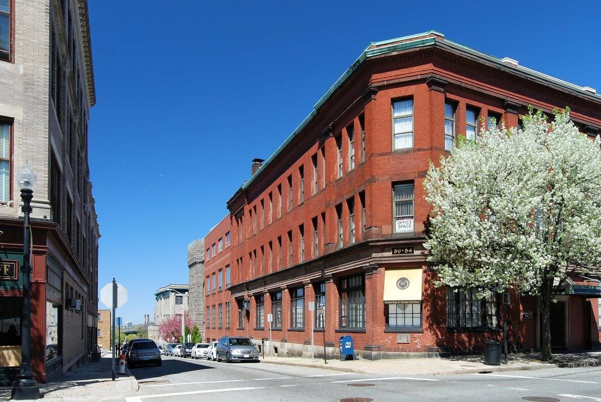
Strategic Assessment of Fall River, MA
Multiple tactical vulnerabilities. Population density, target proximity, or disaster risk are likely compounding. A retreat property and exit planning is required.
What does the Strategic Assessment tell us?
Our Strategic Assessment grades tactical survivability of an area. Major population centers, military targets, fallout zones, natural disasters, and border exposure all drive risk — lower exposure means a more defensible position in a crisis.
This is heavily inspired by Joel Skousen's Strategic Relocation book. Highly recommended you checkout the book ($)What does this tell us?
Our Strategic Assessment grades tactical survivability of an area. Major population centers, military targets, fallout zones, natural disasters, and border exposure all drive risk — lower exposure means a more defensible position in a crisis.
This is heavily inspired by Joel Skousen's Strategic Relocation book. Highly recommended you checkout the book ($)Strategic Pillars

Key Distances
Regional Safe Places
Below is our recommended "safe zones" in Massachusetts and the surrounding area based on our strategic heuristics. For most people, it's unrealistic to live in a “safe zone” full-time due to work, family or other personal reasons. They tend to be more rural. However, many of these areas are perfect for second homes and retreat properties that double as a vacation home or even a short-term rental.


Important Note: For informational purposes only. This does not mean nothing bad ever happens in the green zones. Please use common sense. This is based on public data and modeled with AI. We tried to take a conservative approach but mistakes happen. We update this regularly as new information becomes available.
Solar Generator Recommendations
Backup power matters more here than in safer locations. We've picked three solar generators across budgets and capacity tiers — start with the budget unit if you only need a few essentials, or step up if you want to run a fridge and HVAC for days at a time.

Jackery Portable Power Station Explorer 300
Budget OptionPower on the Go: Weighing only 11 lbs, it's convenient to set up and store with book-sized foldable solar panels

BLUETTI Portable Power Station AC180
Designed for both indoor and outdoor scenarios, AC180 is highly capable as it has a robost capacity and continuous output power.

EF ECOFLOW DELTA Pro Ultra Power Station
Upgraded PickEcoFlow DELTA Pro Ultra is a whole-home energy system designed to grow with your family. Integrated with the Smart Home Panel 2, it scales to meet your evolving energy needs — keeping your home powered, intelligent, and secure through every stage of life.
We earn a commission, at no additional cost to you.
Strategic Assessment Analysis
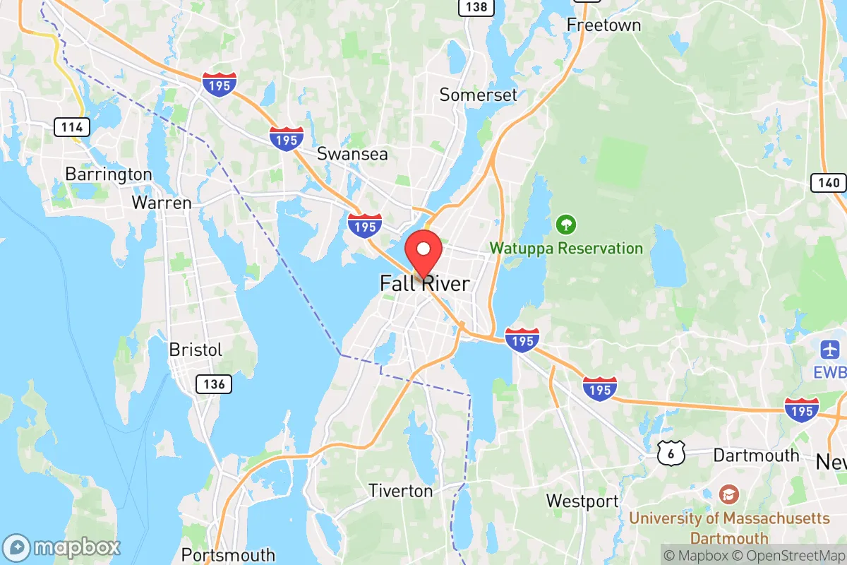
Fall River, Massachusetts, sits in a precarious but potentially strategic pocket of southeastern New England, offering a mix of industrial resilience and geographic chokepoints that matter for anyone thinking long-term about stability. Its location on the Taunton River near Mount Hope Bay gives it access to the Atlantic, but it’s also wedged between the urban sprawl of Providence (15 miles north) and the Cape Cod tourist corridor, with Boston only 50 miles northeast. For a prepper or survivalist, this means you’re close enough to major population centers to monitor threats, but far enough that you’re not in the immediate blast zone of a high-value target—though the proximity to critical infrastructure like the Pilgrim Nuclear Power Station (30 miles east) and the Port of Providence’s fuel terminals (20 miles north) introduces real fallout risks. The city’s history of weathering economic collapse (post-textile decline, 2008 recession) and its working-class grit suggest a population that doesn’t panic easily, but the density of 94,000 people in 38 square miles means you’ll need to plan for congestion and resource competition if things go sideways.
Geographic position and natural advantages for long-term stability
Fall River’s geography is a double-edged sword, but the advantages are real if you know where to look. The city sits on the eastern edge of the Narragansett Bay watershed, with the Taunton River providing a navigable waterway to the Atlantic—useful for fishing, transport, or evacuation by boat if roads clog. The surrounding terrain is mostly low-lying coastal plain, but the city itself is built on a series of hills (e.g., North Main Street rises to 200 feet), offering some natural elevation for line-of-sight observation and defensible positions in a grid-down scenario. The region’s temperate climate means no extreme cold snaps like northern New England, and the growing season (roughly 150 days) is long enough for subsistence gardening, though the soil is sandy and acidic—you’ll need raised beds or imported topsoil. Water is abundant: the Taunton River is tidal but fresh upstream, and the city draws from the North Watuppa Pond, a 1,800-acre reservoir that could sustain a reduced population for months. The real strategic play is the city’s position as a transportation hub: Route 24 runs north-south to Boston, I-195 runs east-west to Providence and Cape Cod, and the rail lines (though mostly freight) offer alternative movement. In a crisis, controlling these corridors gives you leverage, but they also make Fall River a natural chokepoint for refugees fleeing Boston or Providence—plan for that.
Risks, exposures, and proximity to fallout-relevant landmarks
The biggest red flag for a prepper is Fall River’s proximity to high-value targets that could draw kinetic or radiological events. The Pilgrim Nuclear Power Station in Plymouth, 30 miles east, is a decommissioned boiling water reactor that still stores spent fuel on-site—a prime target for sabotage or a natural disaster trigger. The Port of Providence, 20 miles north, handles 10 million tons of cargo annually, including petroleum and chemicals, making it a likely secondary target in a conflict. Boston’s Logan Airport and the naval installations at Newport (40 miles south) add to the risk profile. Fall River itself has industrial sites like the former Brayton Point Power Station (now a offshore wind staging area) and the Route 79 corridor’s chemical storage facilities—any of which could become fallout sources if struck. Civic unrest is a more immediate concern: the city has a poverty rate around 18% and a history of gang activity (e.g., the Latin Kings and MS-13 have a presence), meaning localized violence could spike during a resource shortage. The 2020 civil unrest saw protests in nearby Providence turn into looting, and Fall River’s own police force (around 250 officers) would be stretched thin in a regional emergency. The city’s dense urban core—with narrow streets and aging triple-decker housing—makes it a nightmare for evacuation or defense if order breaks down. You’ll want to be on the outskirts, ideally in the rural zones of Westport or Freetown, where you can monitor the city without being trapped in it.
Practical resilience for a relocator: food, water, energy, and defensibility
For a single individual or family looking to hunker down, Fall River offers a mixed bag of practical resources and vulnerabilities. Water is the strong suit: the city’s municipal supply from the North Watuppa Pond is gravity-fed and has backup generators, but a prolonged grid failure would still strain the system. You’ll want a Berkey filter or similar, plus a plan to draw from the Taunton River (treat for salt and industrial runoff). Food is trickier: the city has a few supermarkets (Stop & Shop, Shaw’s) and a farmers’ market (May-November), but supply chains would snap quickly in a crisis. The surrounding area has small farms (e.g., Westport’s dairy and vegetable operations) and fishing in Mount Hope Bay, but you’ll need to barter or secure access early. Energy is a weak point: the grid is old and vulnerable to storms (Hurricane Sandy knocked out power for days in 2012), and natural gas lines run through the city. Solar is viable (average 200 sunny days per year), but you’ll need battery storage and a backup generator for winter storms. Defensibility is the biggest challenge: the city’s layout is a maze of hills and waterfront, but the dense housing means you can’t secure a perimeter easily. The best bet is a property on the northern or western edges (near the Freetown State Forest) where you have tree cover and fewer neighbors. The city’s police and fire stations are concentrated downtown, so response times in the outskirts will be longer—invest in a good security system and a community network. The local prepper community is small but active (check the Bristol County Preparedness Group on Facebook), and the gun culture is moderate—Massachusetts has strict laws, but you can still own rifles and shotguns with a license. Stock up on ammo and medical supplies before any crisis, because local pharmacies and hardware stores will be stripped fast.
The overall strategic picture for Fall River is one of calculated risk: it’s not a survivalist paradise, but it’s a viable base of operations if you’re willing to work the angles. The city’s industrial backbone and water access give it a resilience that many coastal towns lack, but the proximity to Boston, Providence, and nuclear infrastructure means you’re living in the shadow of potential catastrophe. For a conservative-leaning relocator who values self-reliance and community grit, Fall River offers a real-world test of preparedness—just don’t expect it to be easy. The smart play is to treat it as a staging ground: secure a property on the rural fringe, build relationships with local farmers and fishermen, and keep a bug-out bag ready for a move north to New Hampshire or Maine if the situation deteriorates. The city’s motto is “We’ll Try,” and that’s about right—it’s a place where you can make a stand, but only if you’ve done the work beforehand.
* Values derived from national, state, county, city and local statistics and may differ in a specific area. Last updated: 2026-04-19T06:06:07.000Z
Narrative content on this page is AI-generated and may contain mistakes. Verify any details that matter before acting on them.
ReloMaps may earn a commission from affiliate links at no extra cost to you.