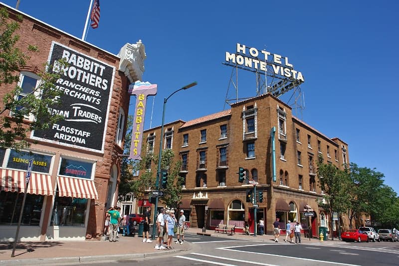
Photo: Wikipedia
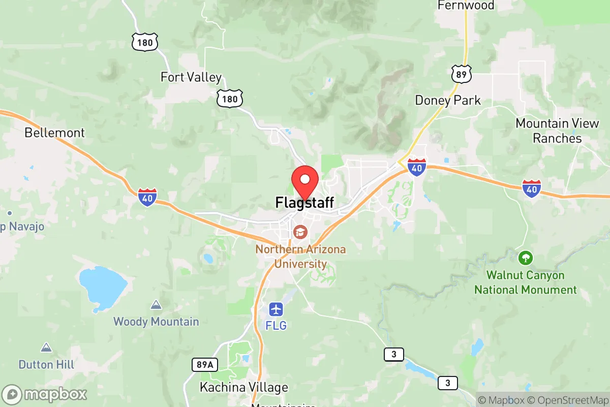
Strategic Assessment of Flagstaff, AZ
Meaningful friction. Expect exposure to either population pressure, blast zones, or natural disaster risk. Consider buying a retreat property.
What does the Strategic Assessment tell us?
Our Strategic Assessment grades tactical survivability of an area. Major population centers, military targets, fallout zones, natural disasters, and border exposure all drive risk — lower exposure means a more defensible position in a crisis.
This is heavily inspired by Joel Skousen's Strategic Relocation book. Highly recommended you checkout the book ($)What does this tell us?
Our Strategic Assessment grades tactical survivability of an area. Major population centers, military targets, fallout zones, natural disasters, and border exposure all drive risk — lower exposure means a more defensible position in a crisis.
This is heavily inspired by Joel Skousen's Strategic Relocation book. Highly recommended you checkout the book ($)Strategic Pillars

Key Distances
Regional Safe Places
Below is our recommended "safe zones" in Arizona and the surrounding area based on our strategic heuristics. For most people, it's unrealistic to live in a “safe zone” full-time due to work, family or other personal reasons. They tend to be more rural. However, many of these areas are perfect for second homes and retreat properties that double as a vacation home or even a short-term rental.
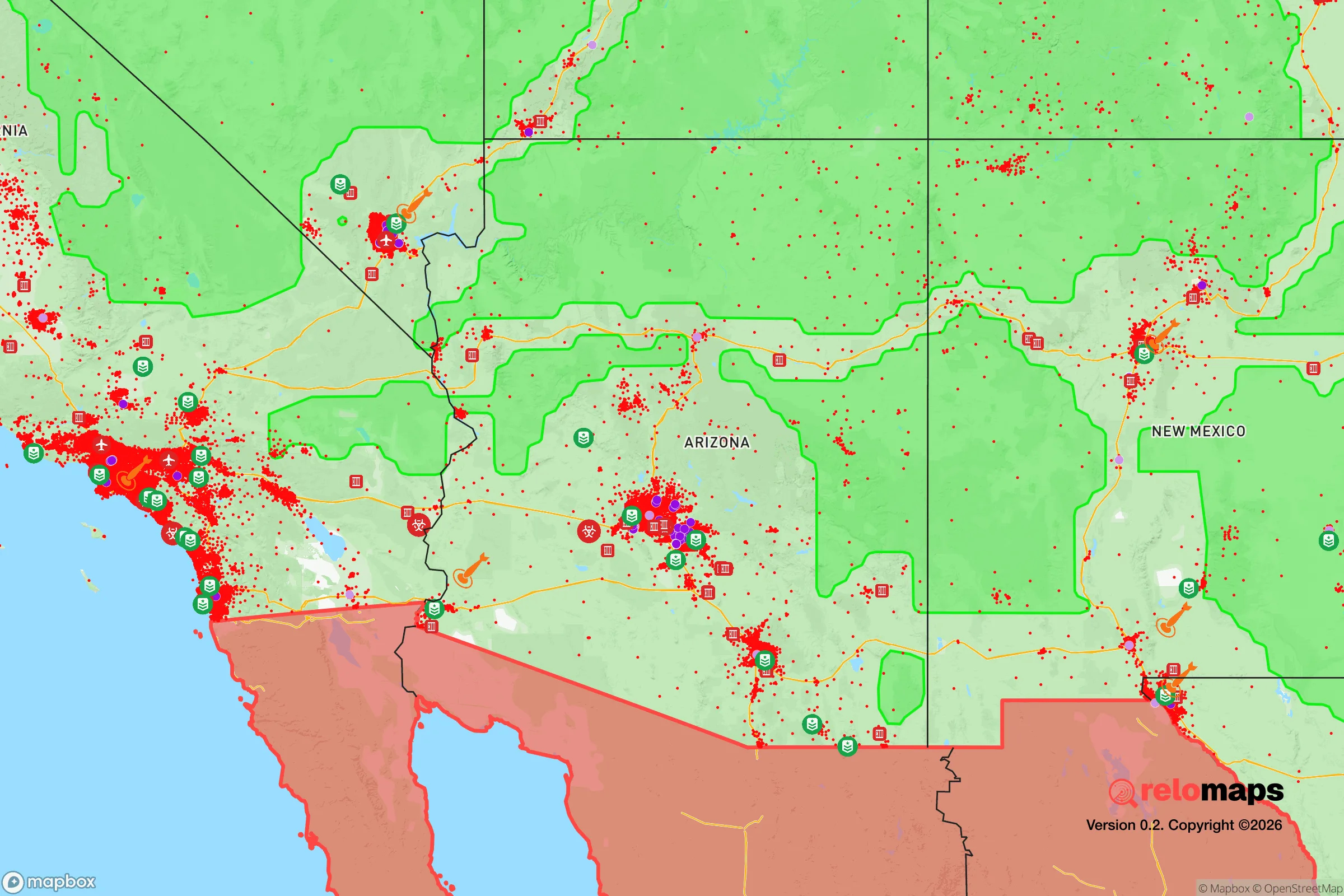
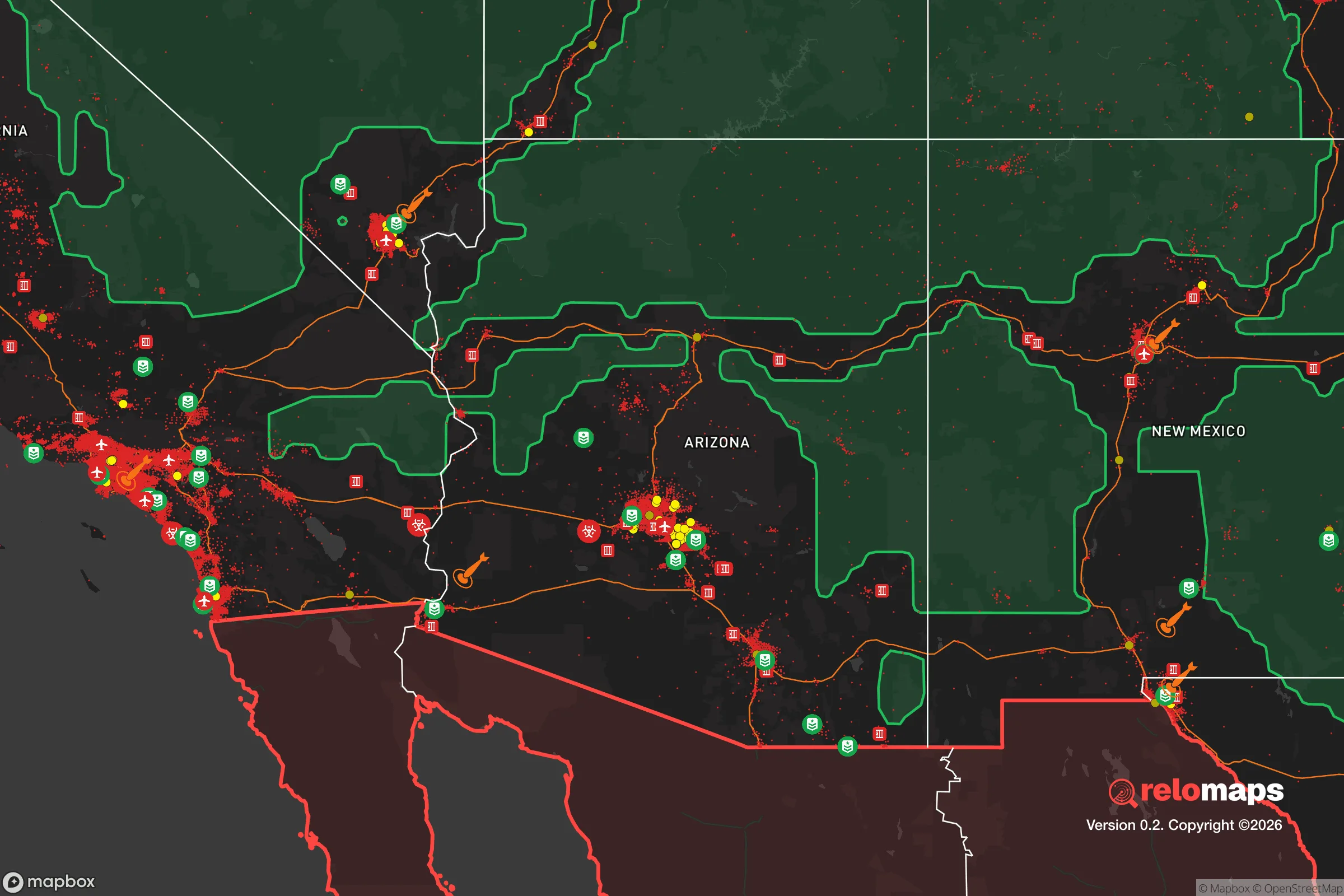
Important Note: For informational purposes only. This does not mean nothing bad ever happens in the green zones. Please use common sense. This is based on public data and modeled with AI. We tried to take a conservative approach but mistakes happen. We update this regularly as new information becomes available.
Solar Generator Recommendations
Backup power matters more here than in safer locations. We've picked three solar generators across budgets and capacity tiers — start with the budget unit if you only need a few essentials, or step up if you want to run a fridge and HVAC for days at a time.

Jackery Portable Power Station Explorer 300
Budget OptionPower on the Go: Weighing only 11 lbs, it's convenient to set up and store with book-sized foldable solar panels

BLUETTI Portable Power Station AC180
Designed for both indoor and outdoor scenarios, AC180 is highly capable as it has a robost capacity and continuous output power.

EF ECOFLOW DELTA Pro Ultra Power Station
Upgraded PickEcoFlow DELTA Pro Ultra is a whole-home energy system designed to grow with your family. Integrated with the Smart Home Panel 2, it scales to meet your evolving energy needs — keeping your home powered, intelligent, and secure through every stage of life.
We earn a commission, at no additional cost to you.
Strategic Assessment Analysis
Flagstaff, Arizona, sits at a unique strategic crossroads: high enough in the San Francisco Peaks to offer natural defensibility and a cooler climate, yet close enough to major transportation corridors to allow resupply or evacuation if needed. For a relocator with a prepper mindset, Flagstaff’s elevation (nearly 7,000 feet) provides a buffer against the worst of the Southwest’s heat and water scarcity, while its position along Interstate 40 and the BNSF railway gives it logistical lifelines that smaller mountain towns lack. However, the same geography that makes it a resilient outpost also places it within a few hours of Phoenix, Las Vegas, and the Grand Canyon—assets and liabilities depending on the scenario.
Geographic position and natural advantages for long-term survival
Flagstaff’s location in the Coconino National Forest, surrounded by the largest contiguous ponderosa pine forest in the world, offers a natural resource base that most of Arizona lacks. Timber for construction or fuel, ample wildlife for hunting, and a reliable snowpack that feeds the Rio de Flag and local aquifers give this area a distinct edge over desert communities. The city sits at the base of the San Francisco Peaks, a dormant volcanic field that provides high ground for observation and communication—critical if cell towers go down. The elevation also means summer temperatures rarely exceed 85°F, reducing heat-related health risks and water evaporation rates. For a relocator, this is a place where you can grow food (short-season crops like potatoes, beans, and hardy greens) and store water without the constant threat of dehydration that plagues lower elevations. The presence of Northern Arizona University and Flagstaff Medical Center adds a layer of institutional stability, though these become targets during unrest.
Risks, exposures, and proximity to fallout-relevant landmarks
Flagstaff’s biggest strategic vulnerability is its proximity to two major population centers: Phoenix (140 miles south) and Las Vegas (250 miles west). In a mass evacuation scenario, I-17 and I-40 would become choke points, and Flagstaff would likely see a surge of refugees from the desert cities. The city also sits within 75 miles of the Grand Canyon, a national landmark that could draw crowds or become a staging area for federal response. More concerning for the prepper: Flagstaff is directly under the flight path for military aircraft from Luke Air Force Base and Davis-Monthan Air Force Base, and the nearby Camp Navajo Army Depot (just west in Bellemont) stores ammunition and explosives—a potential secondary target or hazard. The San Francisco Peaks themselves are a dormant volcanic field; while an eruption is unlikely in a human lifetime, the area does experience minor seismic activity. Wildfire is the most immediate natural threat—the 2022 Pipeline Fire burned over 26,000 acres near the city, and the 2010 Schultz Fire caused catastrophic flooding afterward. For a relocator, defensible space and a fire-resistant home are non-negotiable here.
Practical resilience for a relocator: food, water, energy, and defensibility
Water is Flagstaff’s Achilles’ heel. The city draws from a combination of groundwater wells and the Colorado River via the Central Arizona Project, but the CAP allocation is subject to interstate compacts and drought cuts. The local aquifer is replenished by snowmelt, but multi-year droughts have dropped water tables. A relocator should plan for a private well (depths of 200-600 feet are common) and rainwater catchment—the area gets about 20 inches of precipitation annually, mostly as snow. Food production is possible but limited by a short growing season (May to September) and alkaline soils; raised beds with imported soil and a greenhouse are almost mandatory for serious self-sufficiency. The local farmers’ market and the Flagstaff Food Co-op provide some supply-chain redundancy, but most food is trucked in from Phoenix or California. Energy is more promising: Flagstaff averages over 260 sunny days per year, making solar panels viable even with winter snow (which slides off tilted arrays). Wood stoves are common for heating, and the surrounding forest provides ample fuel—but firewood permits and sustainable harvesting are required. Defensibility is mixed: the city’s layout on a series of hills and valleys offers natural chokepoints, but the sprawl along the I-40 corridor creates multiple entry points. A relocator should prioritize a property on a dead-end road or a ridge with a single access point, ideally outside city limits to avoid municipal collapse scenarios. The Coconino County Sheriff’s Office is well-regarded but thinly stretched—response times in rural areas can exceed 30 minutes.
The overall strategic picture for Flagstaff is one of calculated trade-offs. It offers a rare combination of high elevation, forest resources, and institutional infrastructure that many mountain towns lack, but it is not a remote bunker location. The city’s role as a regional hub means it will attract attention during any large-scale disruption—whether from refugees, federal agencies, or looters. For a relocator willing to invest in off-grid water, fire-hardened construction, and a perimeter security plan, Flagstaff can serve as a viable long-term base. But it requires constant awareness of the vulnerabilities that come with being a “gateway” to the Grand Canyon and a corridor between the Southwest’s major population centers. If the goal is total isolation, look farther north to the White Mountains or the Utah border. If the goal is a defensible position with access to resources and a like-minded community, Flagstaff is one of the better bets in the Southwest—provided you treat it as a strategic outpost, not a sanctuary.
* Values derived from national, state, county, city and local statistics and may differ in a specific area. Last updated: 2026-04-16T00:46:22.000Z
Narrative content on this page is AI-generated and may contain mistakes. Verify any details that matter before acting on them.
ReloMaps may earn a commission from affiliate links at no extra cost to you.